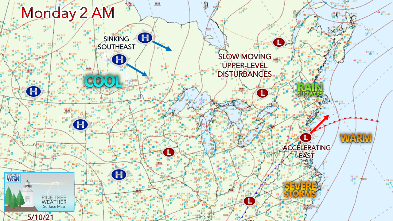
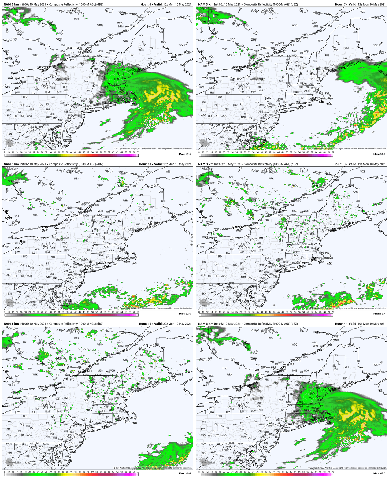
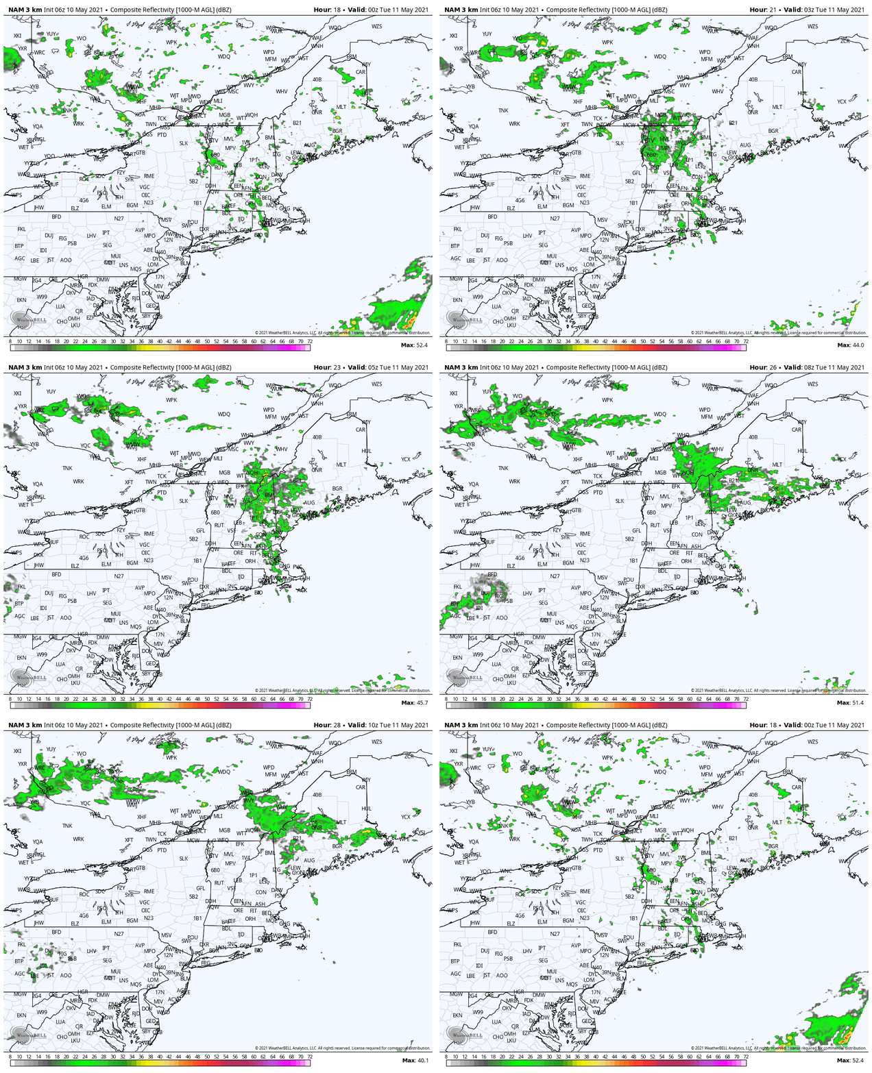
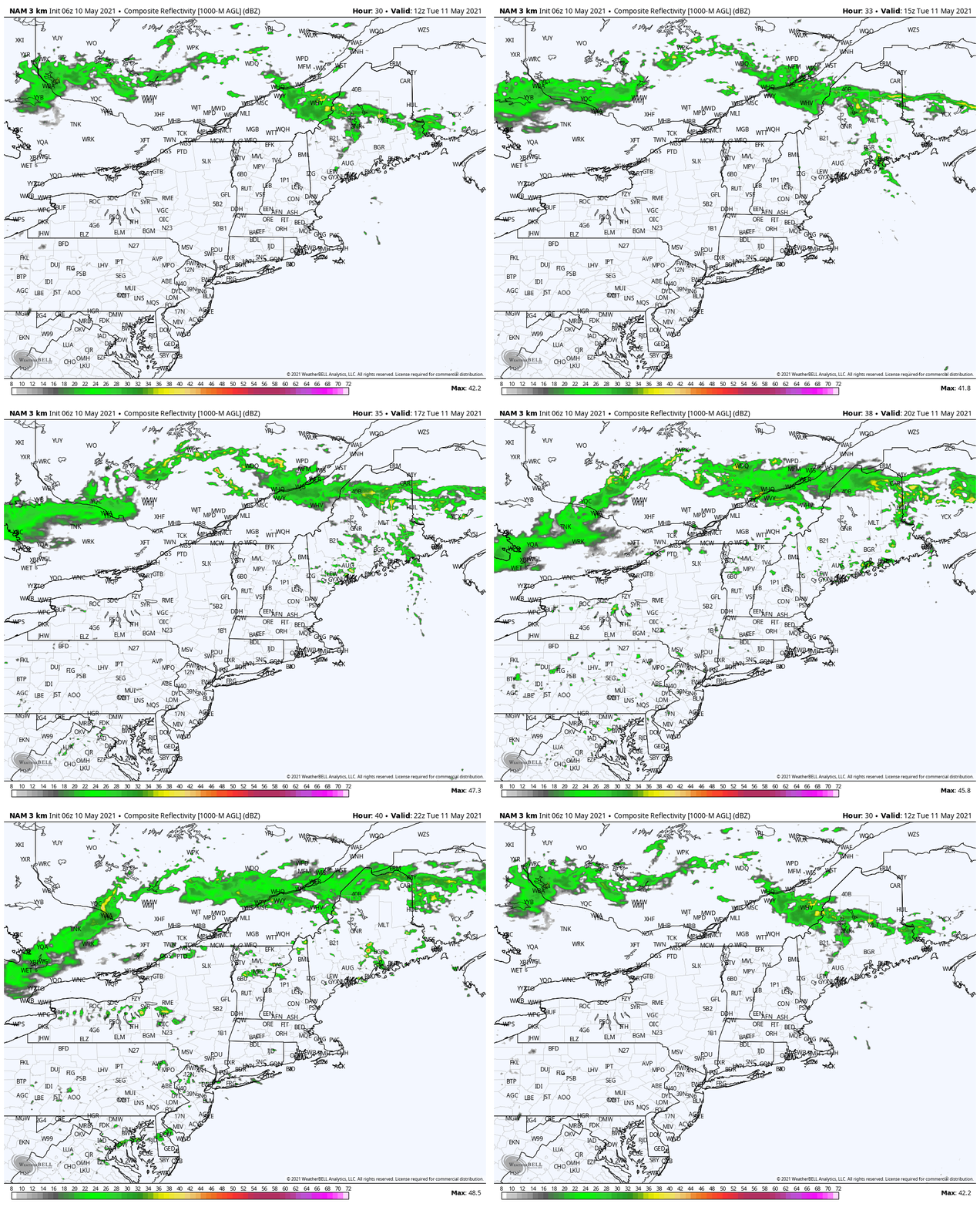
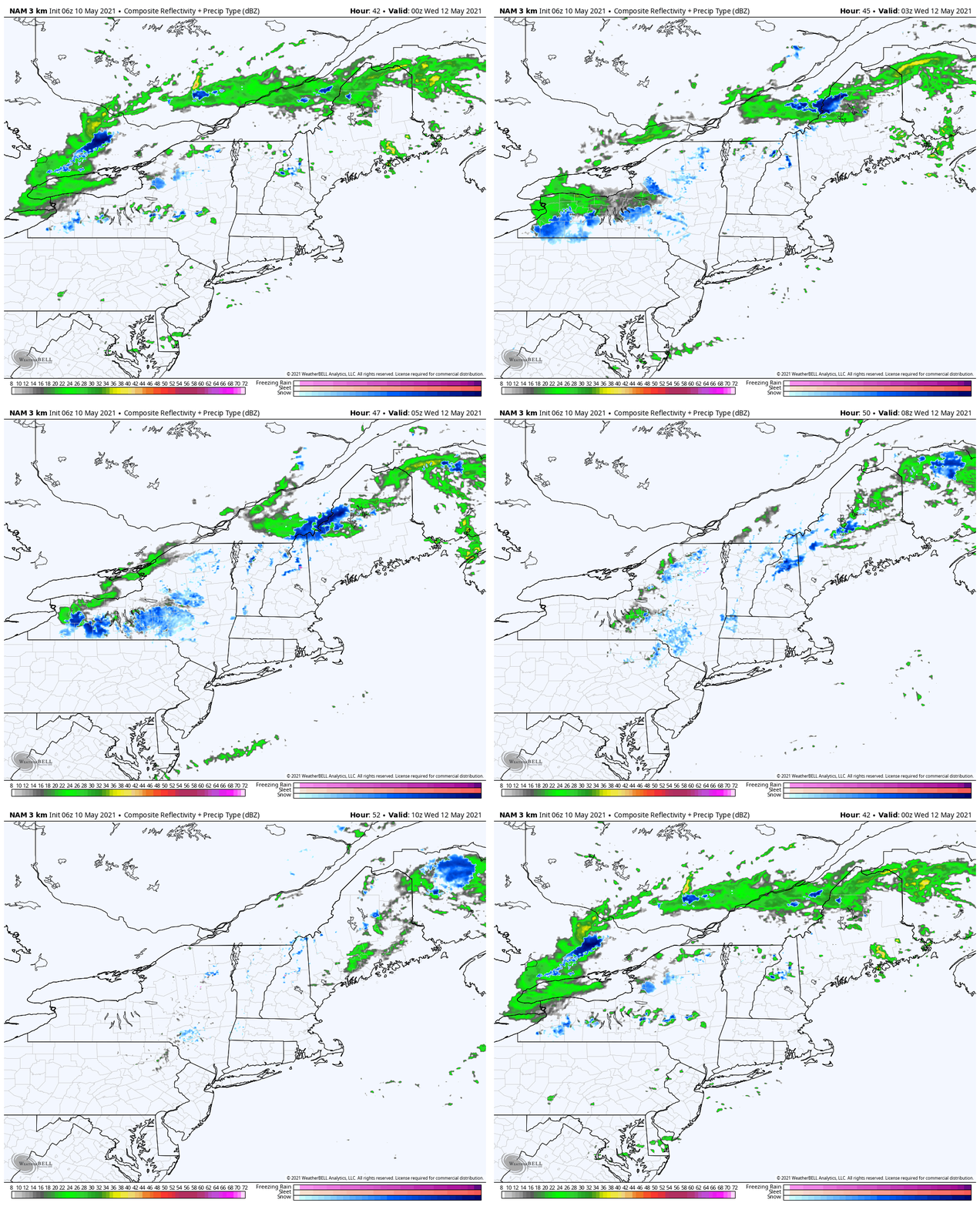
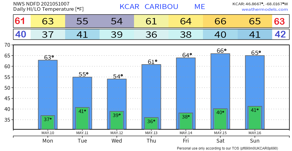
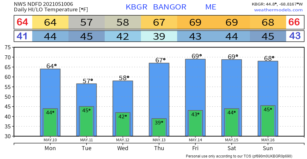
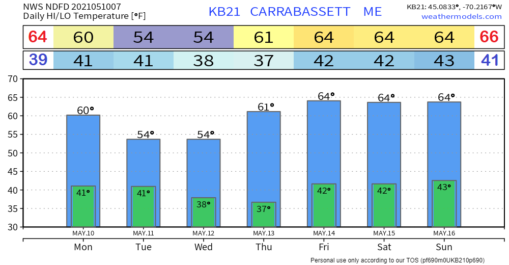
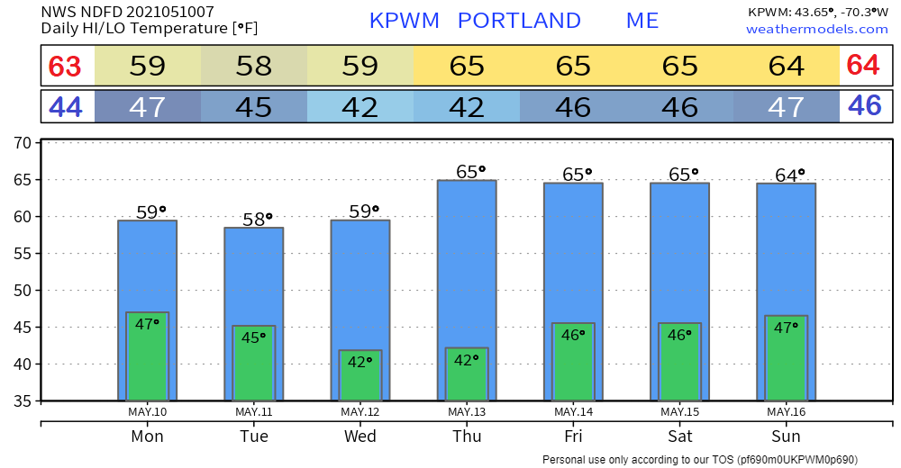
Unsettled for the first half of the weekWhile the first half of May has been a bit on the cool side, the trend towards more seasonable temperatures appears forthcoming as we head towards the end of the month. The atmosphere moves into transition as warm, humid air tries to work northeast, while upper-level disturbances to the northwest keep it suppressed through the week. The result is an unsettled pattern through mid-week, and to start the weekend. Off and on showers through Tuesday morningLow pressure over southern New England races eastward Monday morning. Any steady rain over southern, MidCoast and DownEast areas ends by mid-morning. Slow moving upper-level disturbances swirl through the region in its wake, with widely scattered showers popping up in the afternoon. The disturbances continue to slowly work eastward Monday night into Tuesday, keeping off and on shower activity going. A weak warm front works into the state early Tuesday. Unsettled again for TuesdayThe upper-level disturbances continue to pass through the region on Tuesday. Southern areas appear to stay dry, with showers possible elsewhere. With warmer air nosing in from the southwest and cooler air aloft, if the sun can poke through the clouds, it could trigger an isolated thunderstorm in the afternoon into the early evening. The final snowflakes of winter 2020-21 Tuesday nightA weak cold front slides southeast Tuesday night. There is enough chilly air aloft where snow showers are possible over the western mountains, which could bring some light accumulations to the Jackman area as well as higher elevations. With the passage of this front, I can say with confidence that these are final snowflakes to be seen for winter. For those of you who are awake to see it in the wee hours of Wednesday, you can wave good-bye to the departure of the season past, while you think of your gardens and get serious about planting. Thursday appears to be the pick of the week with sun for most areas. Another round of upper air disturbances enters the region on Friday, keeping the chance for scattered showers in the forecast to wrap up the week and start the weekend. Join the weather community as a storm spotter!Here's a wonderful way to become active in the weather community and help the US National Weather Service Gray ME, broadcast media and forecasters like myself with storm reports. This information is vital during and after an event for forecasting and alerting purposes. I can't tell you how many times I have seen the importance of these reports in the past 9+ years I have been involved. Pine Tree Weather followers have stepped up in the past and participated, and with the readership base continuing to grow, I know there are more out there. This is the spring/summer session which discusses severe weather, what to look for, and how to report it. These sessions run for about 90 minutes. They are fact filled, educational and interesting. You can get the whole family involved from the comfort and safety of home. Once completed, you will get your spotter ID, and will be ready for the season ahead. For those who trained for the winter session, this will complete your full year training. It's important to have both sessions done. The link to register is here ► https://www.weather.gov/gyx/skywarn#fragment-2a If you need more information, please contact Donald Dumont, the Warning Coordinating Meteorologist at NWS Gray via email [email protected] or message me directly. Seven-day temperature outlook through SundayFor most areas, the temperatures appear to be just a smidge above average through the weekend. Southwest interior areas may get into the low 70s on Thursday. Be prepared to receive alerts and stay updated!
For more information in between posts, please follow Pine Tree Weather on Facebook and Twitter.
Thank you for supporting this community-based weather information source which operates by reader supported financial contributions. Stay updated, stay on alert, and stay safe! Thank you as always for your support! - Mike |
Mike Haggett
|

