
Friday Night into Early Morning Saturday: Scattered Storms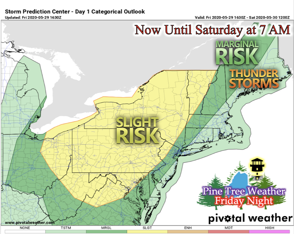 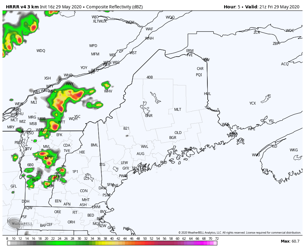 As the low pressure system progresses towards Maine, the Storm Prediction Center has parts of northern and western Maine under "marginal risk" for severe storms. When the cold front pushes through Friday evening, it will bring scattered storms across the state throughout the night and into early Saturday morning hours. After this front has past through, residual showers may be possible during the day only in the morning hours. The GIF above runs from 5 PM Friday evening to 6 AM Saturday morning. Saturday and Saturday Night: Cooler Temperatures and Slight Frost Potential Concern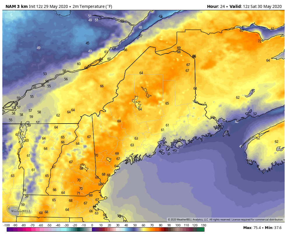 Cooler temperatures will greet Maine after the cold front pushes through. As winds shift from south/southwesterly to north/northwesterly, you can see the push of cooler temperatures into northern Maine Saturday morning and into the afternoon. We see our highest temperatures in southern and southeastern Maine ranging from mid- to upper-70s, with the occasional peak at 80 degrees in some isolated areas. Northern and central northwest Maine sees temperatures in the upper-50s to low-60s as they experience the new northerly winds. The GIF above runs from 7 AM Saturday to 7 PM Saturday. 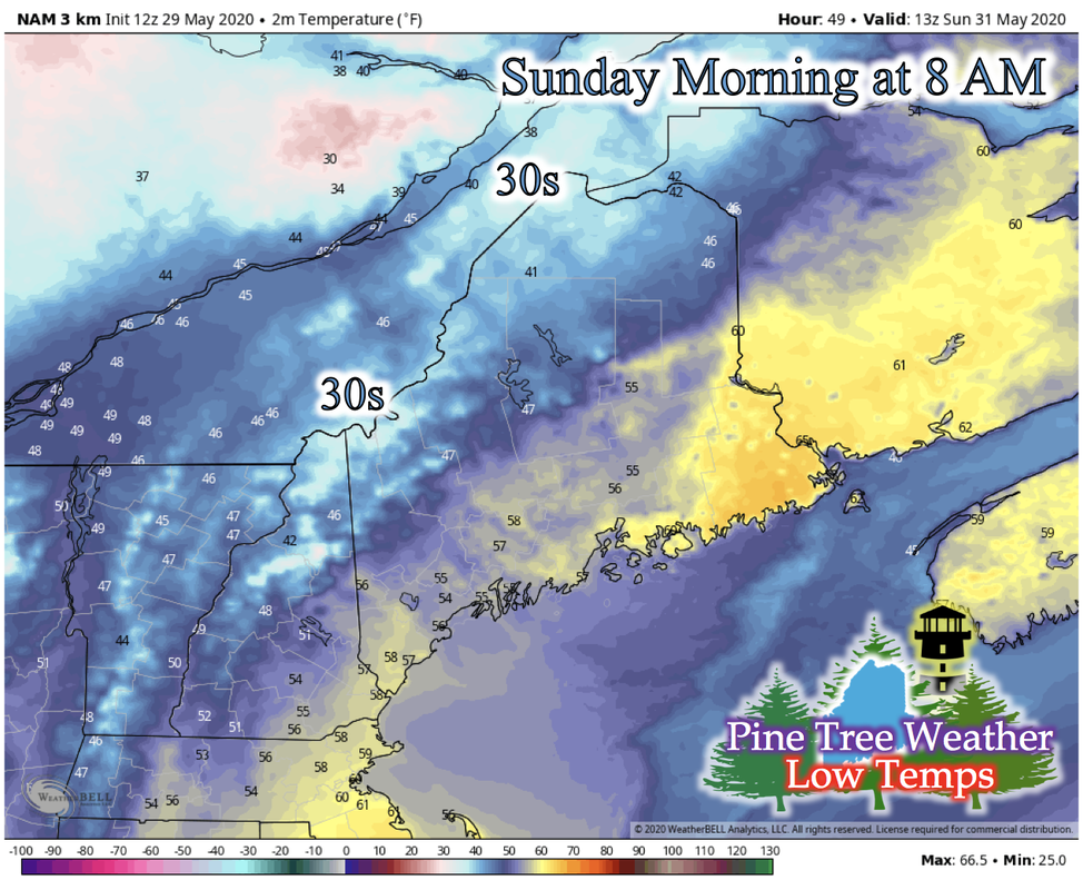 There's slight concern for potential frost on Sunday morning. This risk looks to affect extreme northern Maine and extreme northern west Maine. Northerly winds are helping to decrease the temperature during the night, but cloud cover is helping to keep the heat from the day's sun from escaping into the atmosphere and winds ranging from 5-15 mph are helping to keep the air mixed and keeping it from decreasing. We'll provide more updates on this concern as we head into the weekend. Looking Ahead into Next Week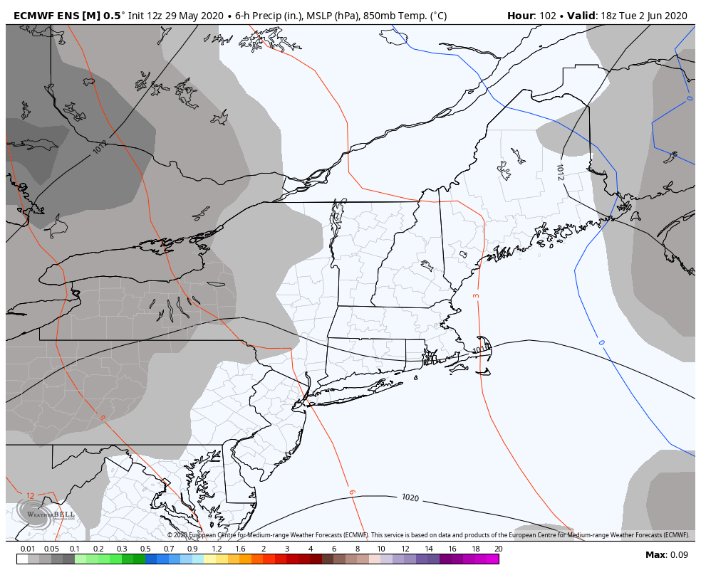 The GIF above runs from 1 PM Tuesday, June 2nd to 1 PM Friday, June 5th. There seems to be another low pressure system on track to move above Maine, bringing potential showers in the middle of next week. Since this is still pretty far out, the logistics of where and how strong these storms are is still up in the air. There is confidence that precipitation will occur, however. 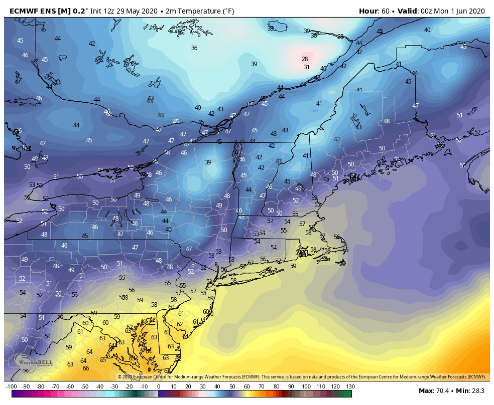 The GIF above runs from 7 AM Monday, June 1st to 7 PM Tuesday, June 2nd. Temperatures continue to decrease due to the northerly winds from the recent system that is passing Maine, giving concern to possible frost on Monday and Tuesday for northern and western Maine. Since this is still a few days out, there will be updates on locations of frost potential and the likelihood of frost happening. Flash Flood Safety Reminder: Turn Around, Don't Drown!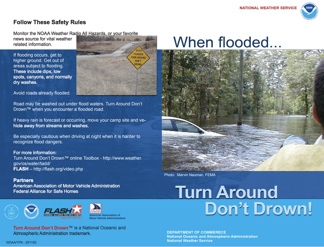 As severe weather season progresses, Maine is not immune to what these severe storms can bring. One of the many dangers is flash flooding, where 1 to 3 inches of rain falls in an hour. If you have to commute via vehicle during a storm, and you see a road flooded, turn around immediately and seek a different route. It only takes 12 inches of water to sweep a car away, and only 6 inches of water to sweep you off your feet if you were to try and wade through it. When you see a flooded road, turn around, don't drown! Stay informed!
For more information, please follow Pine Tree Weather on Facebook and Twitter.
Thank you for supporting this community based weather information source that is funded by your financial contributions. Stay on alert, stay updated, and stay safe! Have a great weekend! - Kaitlyn |

Mike Haggett
|


