Scattered thunderstorms and hottest temperatures of the week on Tuesday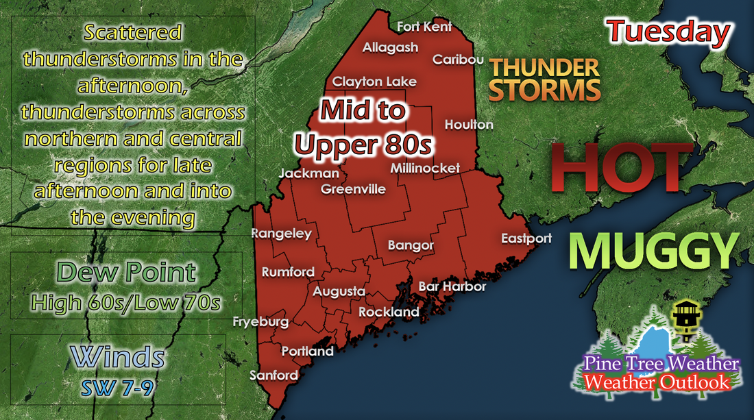 Tomorrow will be the hottest day of this week statewide as the atmosphere readies itself for a cold front on Wednesday. The region in front of a cold front is generally called the warm sector, where the warmest temperatures reside within a low pressure system, accompanied by southerly winds that bring warm and moist air from the south. As expected, dew points will be at their highest for most places across the state: ranging from high 60s to low 70s. Scattered thunderstorms have the possibility to initiate as we head into tomorrow afternoon, and a build-up of more widespread thunderstorms for the northern and central regions initiate in the late afternoon and into the evening as the cold front continues to approach.  The GIF above runs from 7 PM Tuesday to 12 AM Wednesday and shows potential reflectivity by a short-range model. Although these storms may not be as intense as the model predicts (since this model has a history of over-powering storms sometimes), it gives a good general idea of where these storms are likely to initiate. Cold front comes in, bringing scattered thunderstorms across the state for Wednesday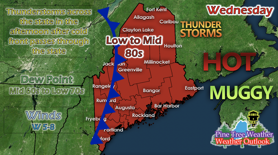 Wednesday's temperatures drop slightly as that cold front passes through, but we won't see a big drop until Thursday. As this cold front passes through, the initiation of scattered thunderstorms across the state in the afternoon is likely. These storms are not expected to be severe (will likely not produce hail, damaging winds, or tornadoes), but brief periods of medium to heavy precipitation, thunder, and lightning are likely. Dew points drop slightly, with more areas in the mid to upper 60s than in the low 70s, and winds shift westerly and ranging from 5 to 8 mph. Rest of the week's temperatures The GIF above runs from Thursday to Saturday and shows the maximum temperatures of each of those days by a short-range model. After that cold front passes through, New England will be under an area of high pressure for the rest of the week. As the state begins to experience a new NW shift in winds on Thursday, temperatures and dew points will drop a little bit as northerly winds bring colder and drier air into the region. It may not be a substantial drop, but it provides some relieve whenever you're outdoors. Heat Safety The summer heat is in full swing, and with it comes some danger to the body if not properly protected. It's important to apply sunscreen regularly when exposed, especially in the afternoon hours, where the sun's strength is at its peak. It's equally important to drink plenty of water to stay hydrated and dress in lightweight and light-colored clothing, with some sort of hat to protect your face. Stay safe in the summertime heat and practice heat safety! Help forecast verification, and stay informed!
For more information, please follow Pine Tree Weather on Facebook and Twitter.
Thank you for supporting this community based weather information source that is funded by your financial contributions. Stay updated, stay on alert, and stay safe! Thank you so much for all of your continued support! This is my Venmo if you'd like to contribute: @Kaitlyn-Lardeo Have a great day! - Kaitlyn |

Mike Haggett
|