Sun and clouds around on Wednesday; chance of showers north and east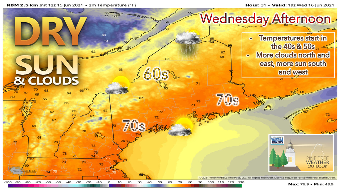 Nicer weather begins to work its way into our region for the day on Wednesday. We'll see this nice weather continue into Thursday and Friday with temperatures remaining seasonable during the next few days. The low-pressure system that brought a cold front through our area Tuesday night will likely continue to sit and spin to the north of the state during the day Wednesday. This will likely bring more clouds and showers to northern parts of the state, especially to places north of Moosehead Lake, during the afternoon on Wednesday. The rest of the state just has the possibility of seeing some clouds throughout the rest of the day. High temperatures will be close to average for a lot of places that see the sunshine tomorrow, with highs expected to reach the lower 70s for southern areas, with 60s expected in places north that hang on to the clouds. A northwesterly wind tomorrow likely makes it all the way to the coastline, which will allow those spots to warm into the lower 70s as well. That wind could gust at times up to 25 mph, but it should die down during the evening and overnight hours. Quiet weather to end the week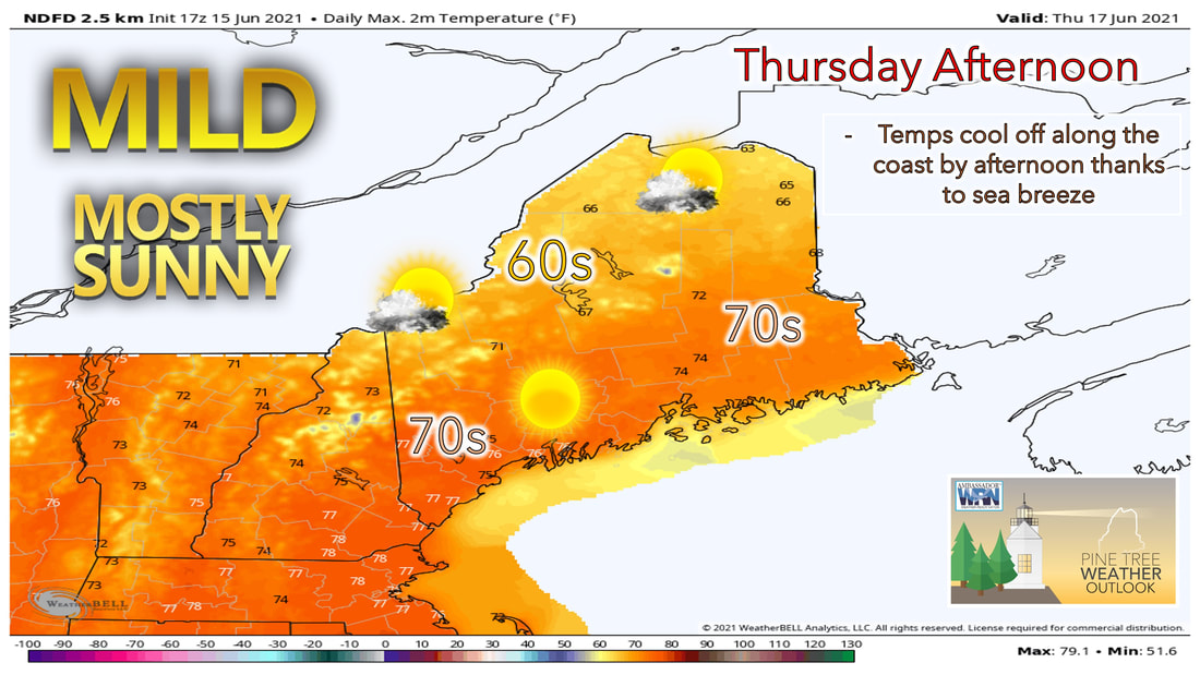 Thursday looks to be a brighter day compared to Wednesday, with more of the state seeing sunshine throughout the day. While the low-pressure system continues to sit to the north of the state, it does appear to weaken and begin to push eastward during the day on Thursday. This will once again result in the northern part of the state being stuck under more clouds during the day, while the southern half of the state sees more sunshine. Temperatures on Thursday will likely be a few degrees warmer than they are today. This is helped by a more westerly wind direction by Thursday. Winds appear to become more southwesterly along the coastline by the afternoon hours Thursday, which could result in cooler temperatures along the coastline by the late afternoon. 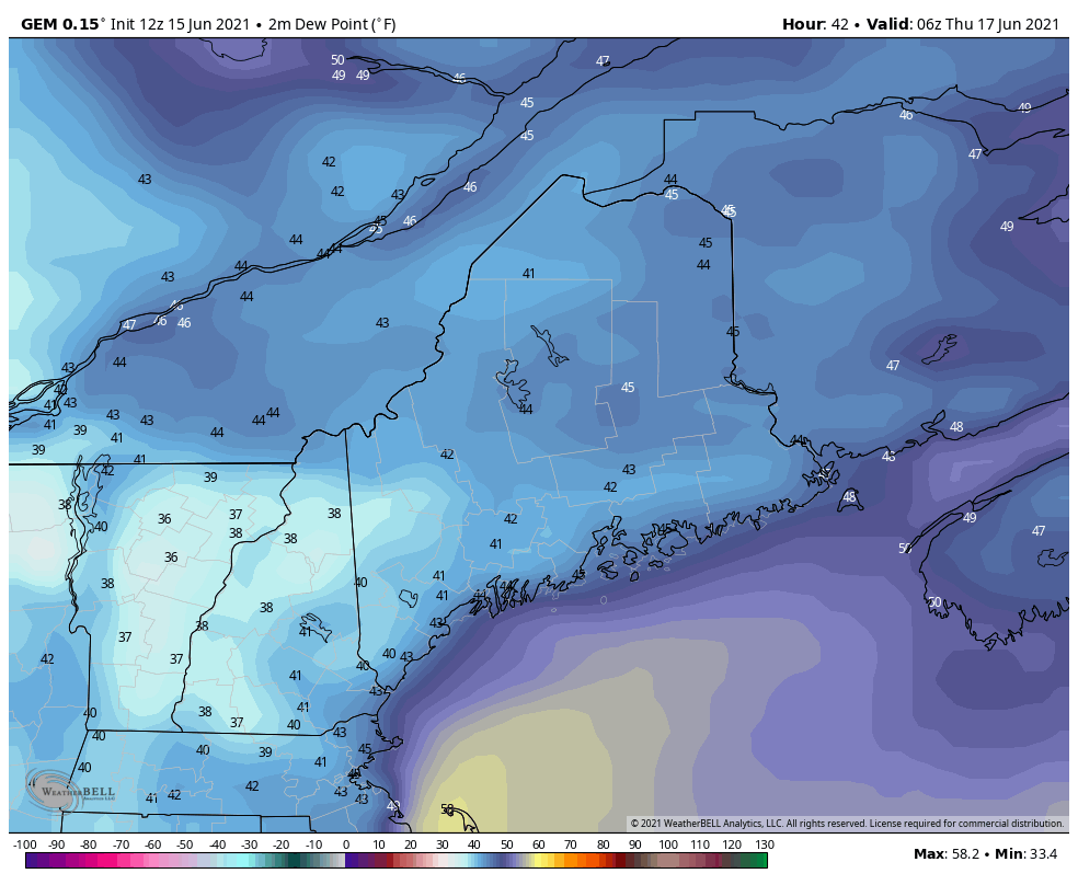 The dry air appears to stay in place throughout the day Thursday and into Friday as well. This relief from the humidity means the next few days will be great opportunities to get outside and enjoy the nice weather. Friday likely remains quiet as a high-pressure system builds to our south. This keeps any rain out of our forecast until the weekend. Winds on Friday likely will be more southwesterly during the day, which will help to bring in warmer air inland, and keep temperatures cooler along the coast. Inland temperatures Friday are expected to climb into the mid to upper 70s across the state. The exception to this will be along the coastline where the sea breeze likely keeps temperatures cooler during the day. Shower chances return by Saturday afternoon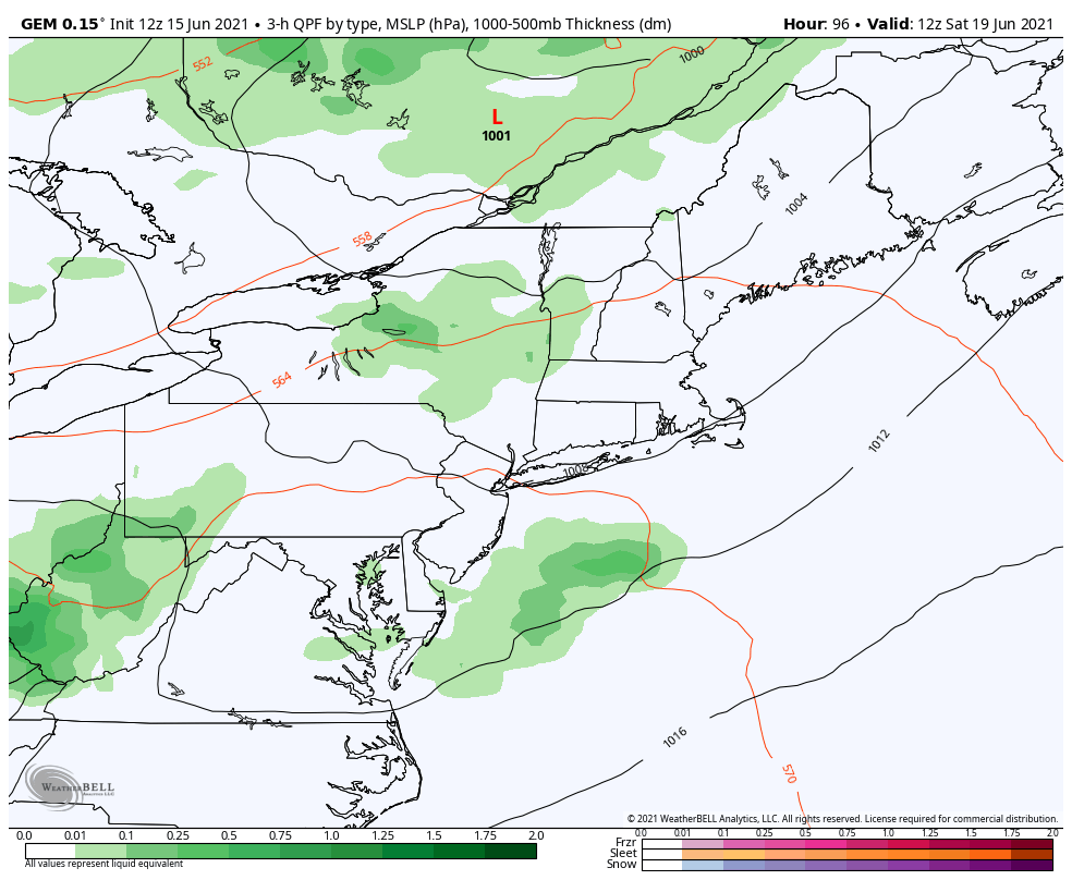 By the time we get to Saturday, another low-pressure system and cold front likely passes through the area during the afternoon. This could spark off the chance for some showers and thunderstorms during the afternoon. The majority of the computer models are on board with bringing this cold front and low pressure system though the area on Saturday, however they are currently disagreeing on the timeframe of the passage of the front. We'll continue to keep an eye on this as we get closer, but as of right now, the best chance of showers appears to be during the afternoon and evening Saturday. 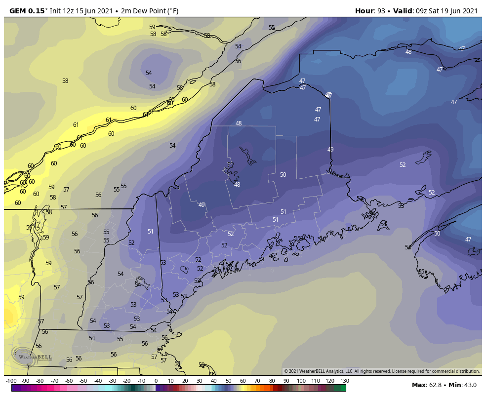 Just because Saturday won't be the best day doesn't mean you should write off the entire weekend. Sunday has the potential of being another nice day. Depending on the timing of the low pressure system and cold front moving though the area, Sunday could end up with some more sunshine during the afternoon as a weak area of high pressure moves overhead. This would result in a mild day with temperatures in the mid 70s with low humidity across the region. Check back with us as we get closer to get more information. Temperature outlook through next FridayOver the next couple of days temperatures across the state remain a few degrees below average. It's not until we get into the weekend and early next week that the trend seems to favor slightly above average temperatures. For people who don't like the extreme heat, it doesn't appear that we have any chance of seeing any in the near future. Low temperatures over the next few days are likely below average with most places seeing low temperatures in the upper 40s and lower 50s. Once again over the weekend we'll see temperatures warm, and low temperatures will be a few degrees above average by the time we get to Sunday. 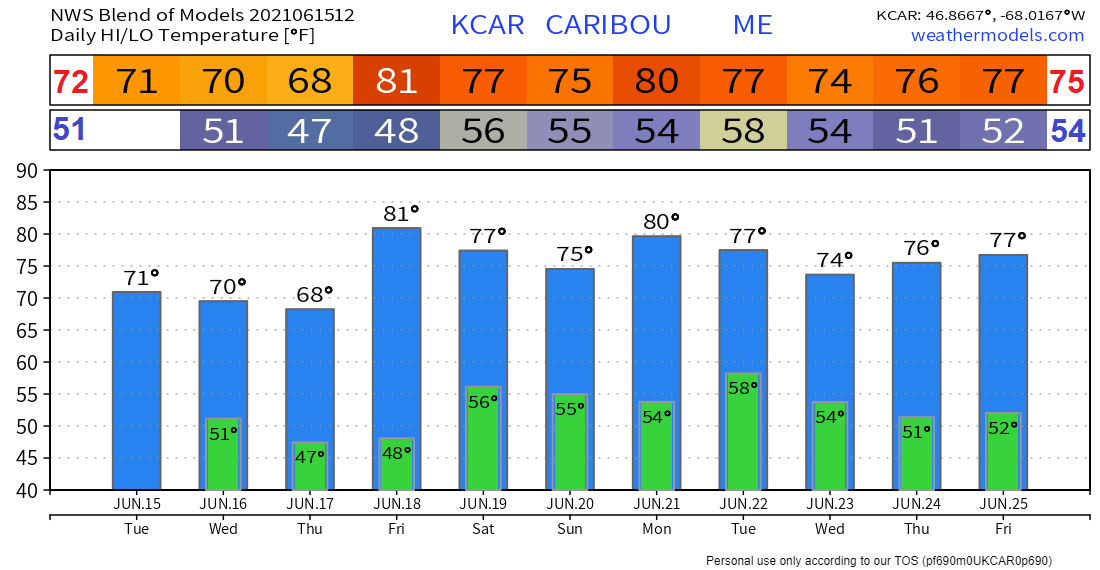 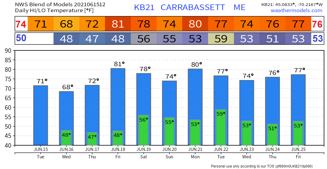 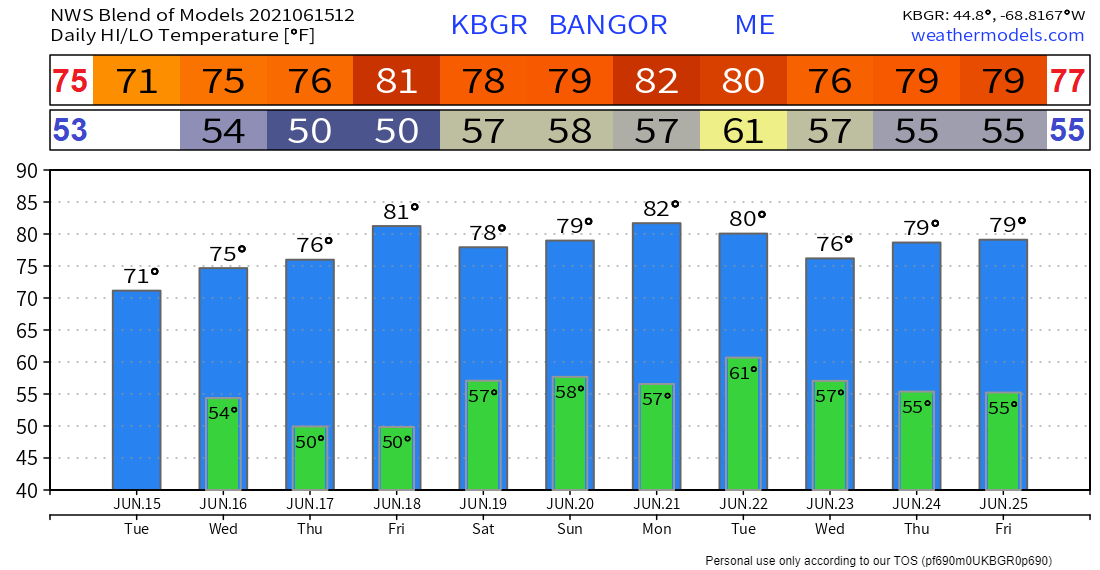 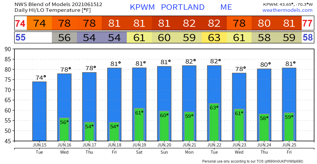 Know Your Limits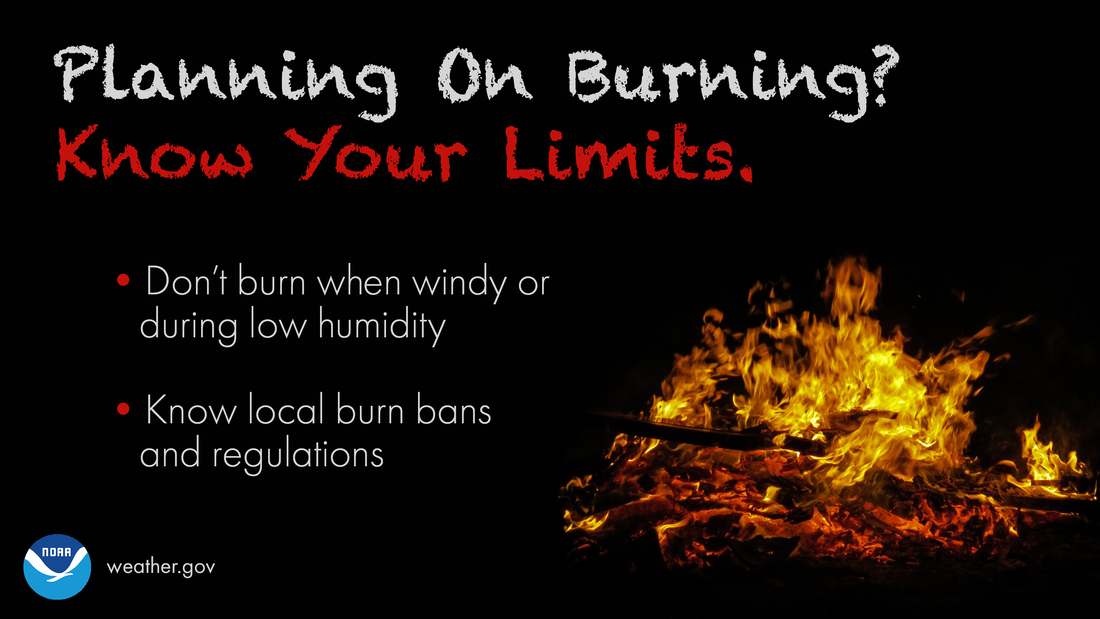 Planning on burning brush? Know your limits. Even if there’s no Red Flag Warning, burning when windy or during low humidity can still be dangerous! weather.gov/safety/wildfire Be prepared to receive alerts and stay updated!
For more information in between posts, please follow Pine Tree Weather on Facebook and Twitter.
Thank you for supporting this community-based weather information source which operates by reader supported financial contributions. Stay updated, stay on alert, and stay safe! |

Mike Haggett
|