Dry and more comfortable air stays around until the end of the week 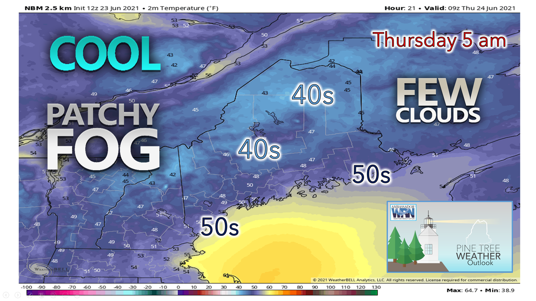 As the gusty winds from this afternoon diminish, conditions will become calmer and pleasant heading into the overnight hours. The ridge of high pressure will be centered over our area tonight with clear skies, light winds, and dry conditions. Expect radiational cooling overnight allowing for lows to drop into the 40s in most cases and perhaps low 50s along the coast. In the northern mountains, a couple of locations may dip into the upper 30s. Some patchy fog is possible, primarily towards the north. Beautiful, comfortable, and seasonable for Thursday 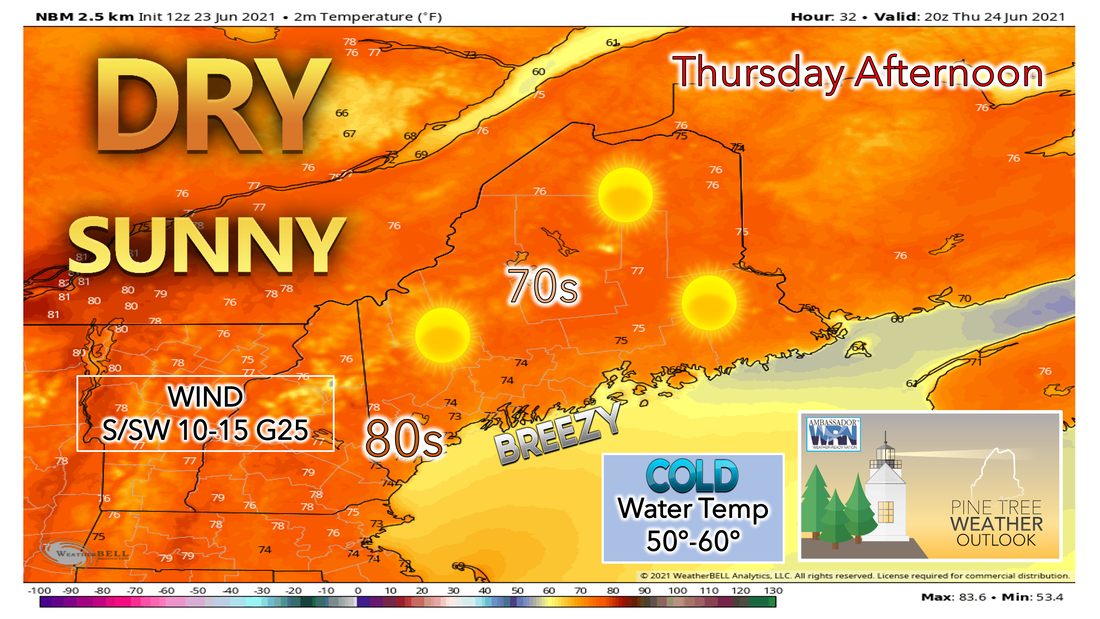 More sunshine will continue Thursday as a strong area of high pressure dominates our region. This will bring a return to a southwesterly flow, bringing slightly warmer air inland and cooler air on the coast from the Gulf of Maine. High temperatures will reach the 70s for most and lower 80s inland during the afternoon hours. Skies will be mostly sunny throughout the entire day. Breezy conditions are expected with winds coming from the south/southwest at 10-15 mph and gusting up to 25 mph. A sea breeze is expected to pick up once again during the evening. Thursday night will be mainly clear with low temperatures a bit milder than Wednesday’s. Humidity and chance of showers or drizzle will increase on Friday and into the weekend 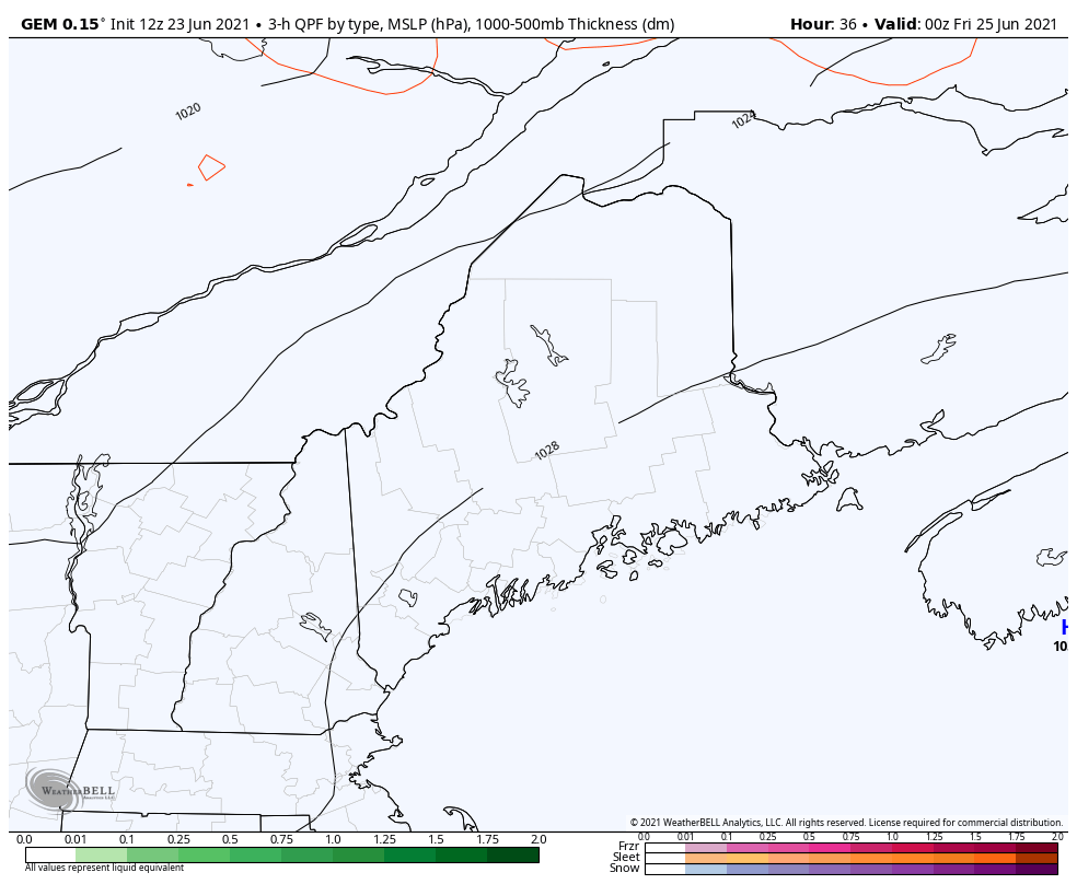 Friday will also be another warm and sunny day with high temperatures a degree or two warmer than Thursday. The humidity will increase Friday and into Friday night. Increased humidity may result in a bit of fog over the waters and along the coast late Friday night. A front will be nearby this weekend but it's looking like we'll be on the warm and humid side of it. The best chance for showers is in the mountains and northern Maine. There is a weak low-pressure system expected to move up the New England coast on Friday, but models are currently not agreeing on amounts or timing. For now, expect clouds to move in during the day and night on Friday as moisture advances off the Eastern Seaboard and rides up the coast. Some thunderstorms will be possible, especially across the north and west, ahead of the cold front on Saturday. Otherwise, most of the day will be partly sunny, warm, and humid. 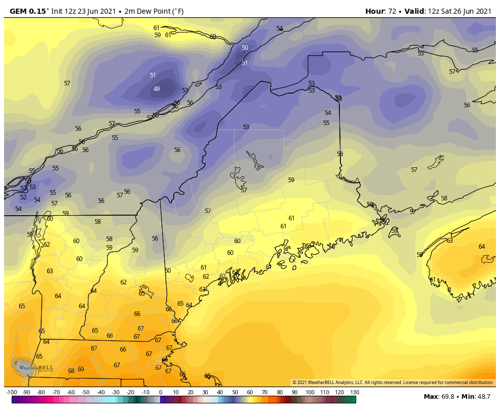 Humidity will steadily increase as we progress through the weekend. Dew points are going to increase Saturday as they reach near 60 degrees. High temperatures on Saturday will be in the upper 70s to mid-80s with partly sunny skies and a slight chance for a passing shower. High humidity will likely result in coastal fog Saturday night into Sunday morning. High pressure continues to dominate and strengthen through early next week. A front will weaken and stall as it crosses through the region Sunday night into Monday due to the very strong high in the southeast. This will cause clouds, warm temperatures, increased humidity, and a chance of showers or thunderstorms each afternoon through Monday. Higher dew points will make it feel muggy once again. Outlook through the weekend 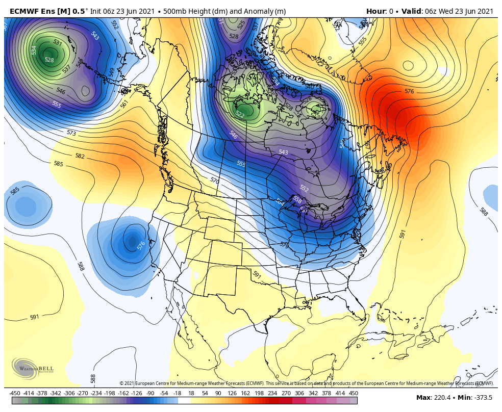 A very strong ridge will form over British Columbia which will fry western Canada and bring a record heatwave out west. Another strong ridge will set up over the east coast and will bring heat along with it. Temperature trends in Maine starting next week will become hot and sticky with 90s possible. Potential omega block is favored to end June keeping temperatures above normal. Temperature outlook through late June The plots below show the trend of the high and low temperatures for Carrabassett, Bangor, Caribou, and Portland over the next week and a half. Summer weather is upon us as we enter this upcoming week. Temperatures will slowly begin to trend upward with increased humidity into the weekend. We will also likely be below average in terms of precipitation as a ridge of high pressure settles over the Northeast US including Maine in the longer range. 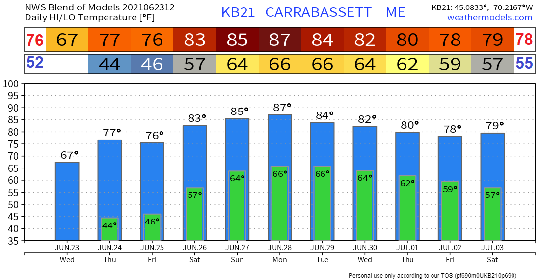 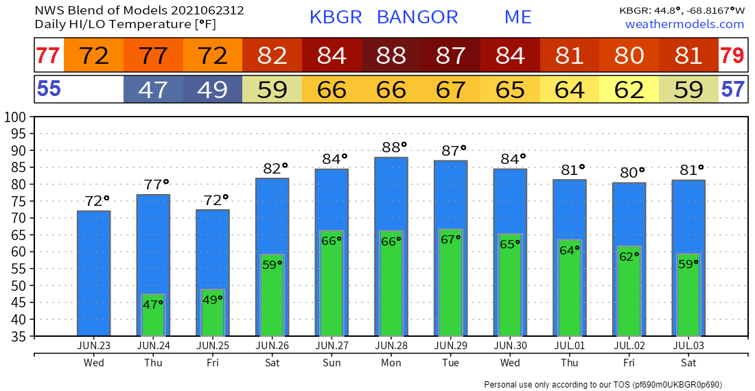 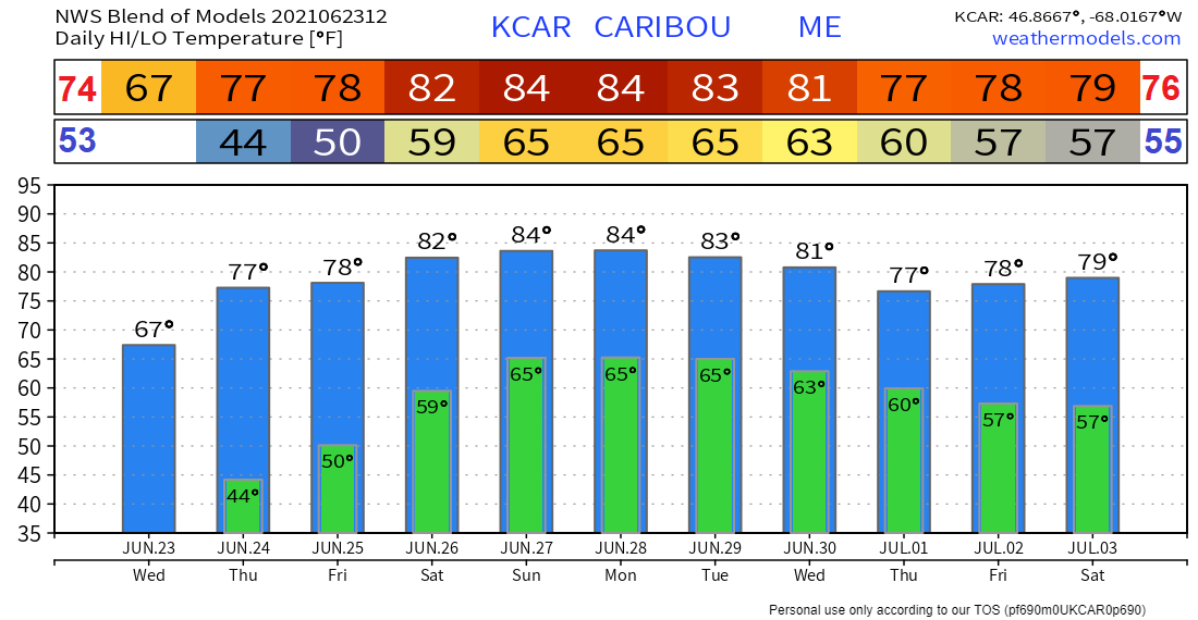 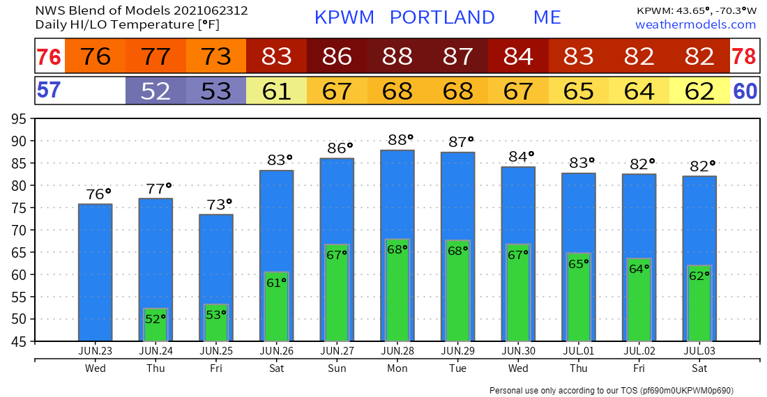 Lightning awareness week: Boating Safety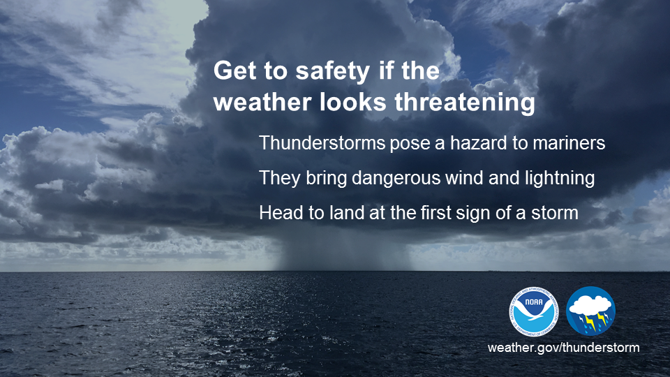 Thunderstorms can be a mariner's worst nightmare. They can develop quickly and can produce strong wind, pounding rain, damaging hail, and deadly lightning. If you see clouds starting to pile up, thunderstorms are likely beginning to develop. Don’t wait until you hear thunder or see lightning. It’s best to head to port or safe shelter at the first sign of a developing storm. weather.gov/safety/safeboating-during Be prepared to receive alerts and stay updated!
For more information in between posts, please follow Pine Tree Weather on Facebook and Twitter.
Thank you for supporting this community-based weather information source which operates by reader supported financial contributions. Stay updated, stay on alert, and stay safe! |

Mike Haggett
|