|
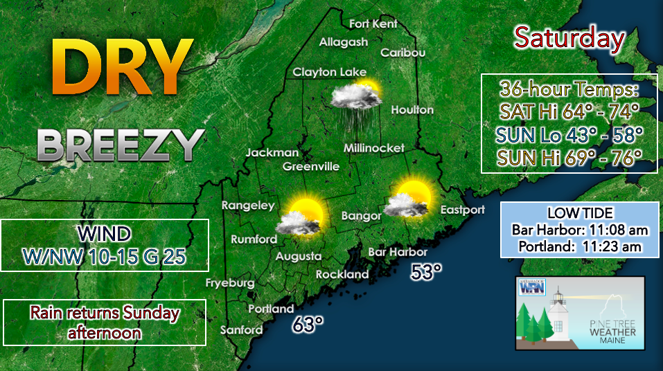
High pressure begins to build on Saturday, bringing mostly clear conditions to the state. There is a chance for some scattered showers across far northern regions this morning as a disturbance tracks over Canada. By the afternoon, most of the state should be dry with lots of sunshine in the south and some lingering clouds for the north. An isolated thunderstorm is possible along the northern border. The breeziness will likely continue on Saturday as the state sits in the path of a strong pressure gradient due a ridge building in from our west and a low spinning out to the Atlantic. Temperatures on Saturday will rival that of early fall rather than mid-summer as a northwest to westerly flow carries in cool, dry air. The northern half of the state will likely only reach the mid to upper 60s for a high, while temperatures in the southern half are expected to rise to the low to mid 70s. Sustained winds of 10-15 mph with gusts upwards of 20 mph will make for a breezy, but otherwise pleasant day. Winds should subside during the evening hours as the pressure gradient weakens. A cool, mostly clear night looks to be in store for Saturday as the high pressure system tracks to the south of Maine. Overnight lows are expected to be in the upper 40s in the north and lower 50s in the south. There is a slight possibility for temperatures to dip into the upper 30s in far north wooded areas. Conditions become unsettled once again on Sunday as an upper-level low approaches from the Great Lakes. Winds are projected to turn southerly, bringing ample moisture to the region. Partly cloudy skies to start will begin to turn overcast with scattered showers arriving during the afternoon. Precipitation will likely become more widespread overnight Sunday as the low-pressure system arrives. A rumble of thunder here and there is possible but models are not suggesting strong convective activity. Clouds and showers likely linger on Monday, however there is some uncertainty regarding the exact track of the low-pressure system. Dry conditions are expected to return on Tuesday with seasonably cool temperatures persisting through the middle of the next work week. Be prepared to receive alerts and stay updated!
For more information in between posts, please follow Pine Tree Weather on Facebook and Twitter.
Thank you for supporting this community-based weather information source which operates by reader supported financial contributions. Stay updated, stay on alert, and stay safe! |
Mike Haggett
|


