
Another warm August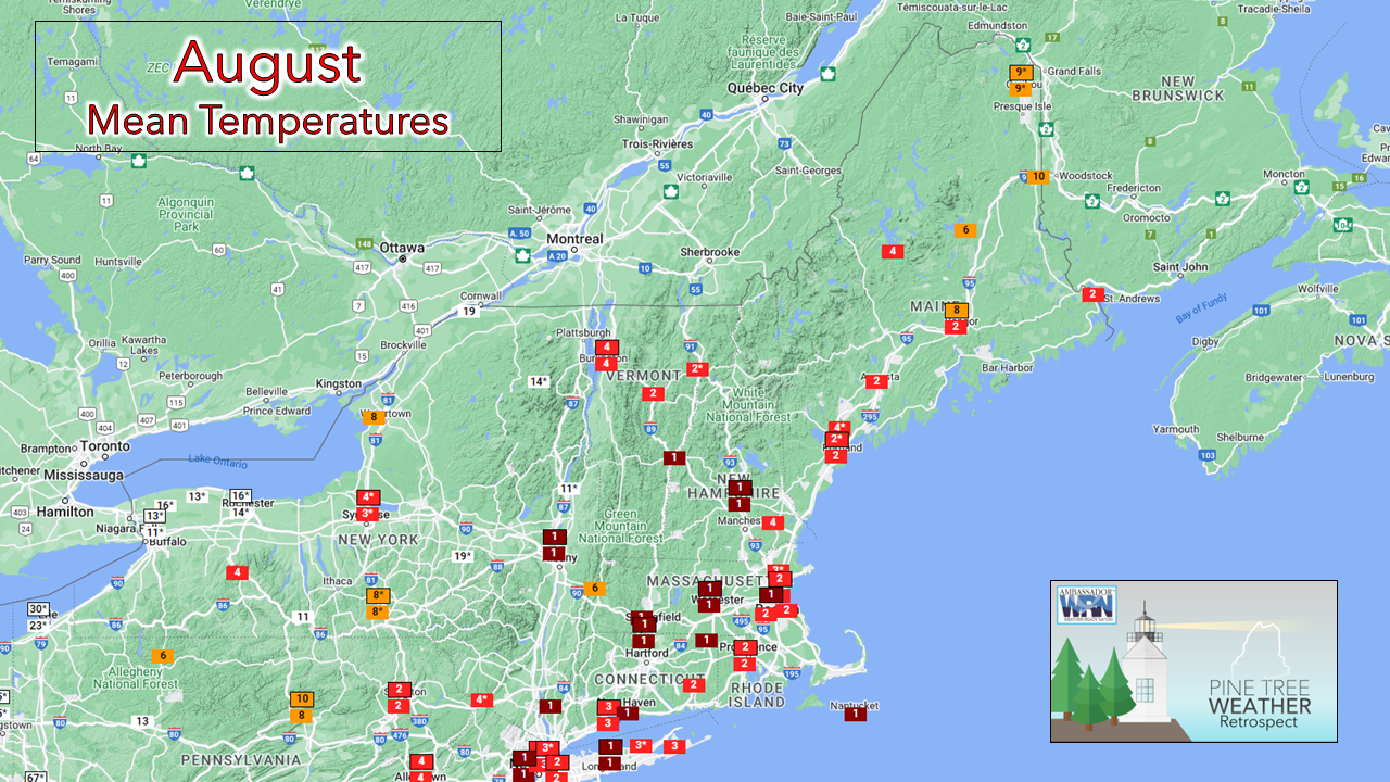 Without too much of a surprise, August 2022 will go into the books being the second warmest month for mean average temperature for Portland, Augusta and Bangor since records began. Only 2018 was warmer. It certainly felt that way. Northern areas are likely to finish in the top ten overall. As for rainfall, the recent accumulations turned a top 10 dry month into the 15th wettest overall for both Portland and Bangor. While the rain has been helpful, it has done little to dent the ongoing drought for the coastal plain overall. An update comes out by 9 AM this morning on that (link on the right side on PC) and I expect little, if any improvement there. Onto SeptemberFor those that have an intense dislike for humidity, the arrival of September couldn't happen fast enough. Like a switch, cooler dew points in the 40s and 50s arrived overnight, and it feels awesome. Football season is here (Go State!), sweater weather is coming, along with fresh apple pie, hot coffee and foliage. This is my time of year. Amen to that. 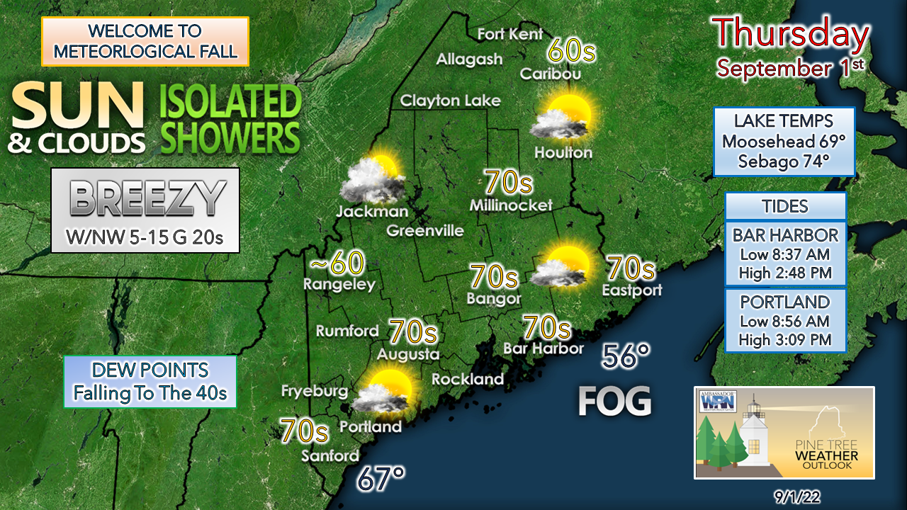 The first day of the month for most will be a pleasant one. Expect temperatures cool for the mountains and sky conditions partly sunny to cloudy there as a weak reinforcing cold front passes through during the day. That may bring a light shower or sprinkle as that passes through. DownEast areas wake up still on the humid side but get relief later in the day as the cold front kicks out the moisture and fog lurking offshore there. Dew points continue to fall as the cool Canadian high moves into the region. With the falling dew points means falling overnight temperatures, and that will be noticed everywhere by Friday morning. Outlook through Labor Day weekend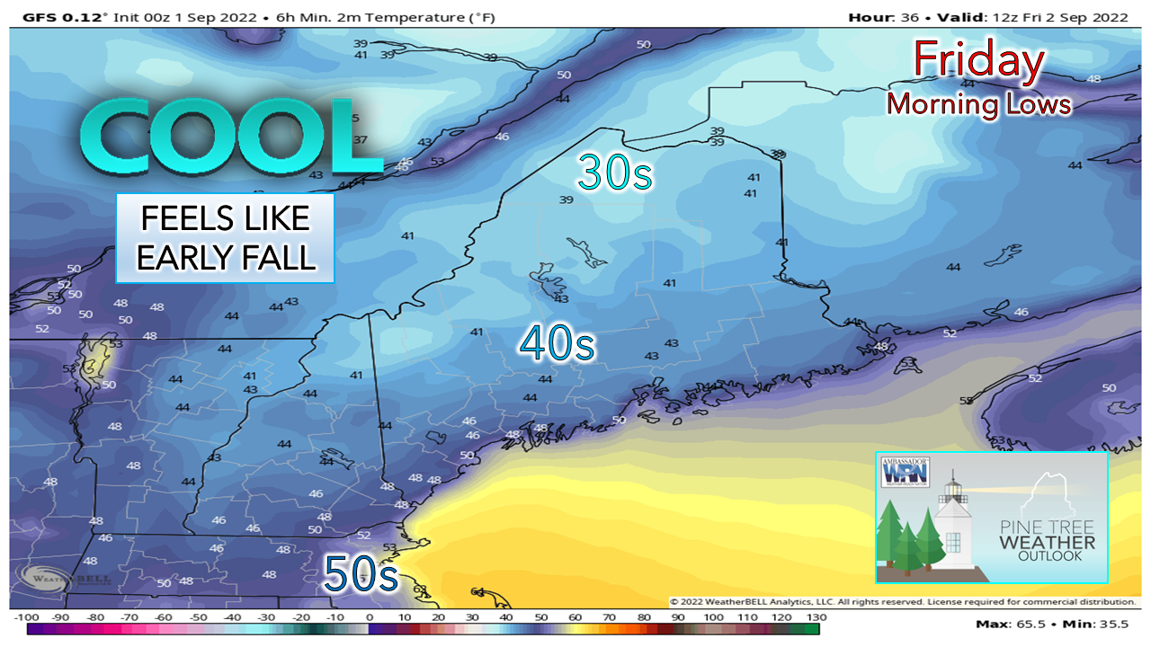 While I don't expect frost, unless Estcourt Station makes me look like a fool, areas in northwestern Aroostook and the protected valleys in the western mountains have a good chance to start Friday in the 30s. Widespread 40s will be the mean low point across much of the region away from the shorelines. We're into the sweater in the morning, t-shirt by noon, sweater in the evening pattern, so plan accordingly. 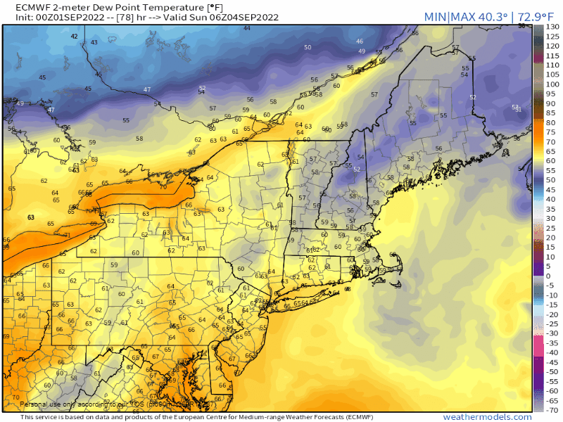 Sunday 2 AM to Monday 8 PM - While the first half of the weekend will be a comfortable one, that changes as high pressure moves offshore Saturday night and a southwest flow brings the humidity back up. Expect dew points to rise into the 60s to near 70° for southern areas as a cold front approaches Sunday afternoon. 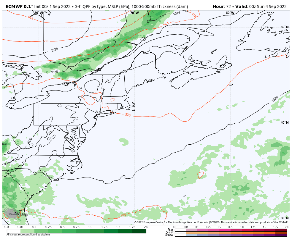 Saturday 11 PM to Monday 8 PM - The mountains and north may see a shower Sunday morning. With the rise of humidity over coastal areas, it sets up a cloud dependent risk for thunderstorms along with scattered showers Sunday afternoon, with the best chance south. As the front passes through, it then stalls out over Southern New England. Where that occurs will dictate what happens on Labor Day and brings questions for southern areas on cloud cover and precipitation chances. Stay tuned for updates on that. 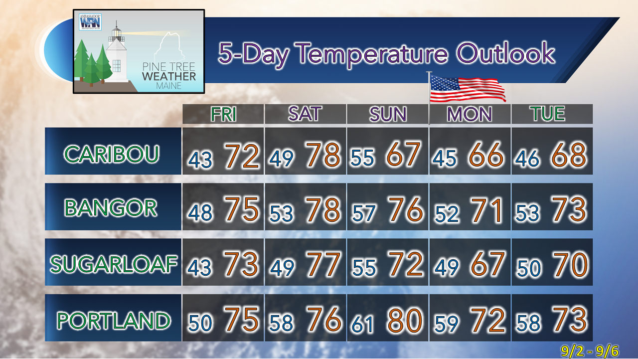 Thank you for supporting this community-based weather information source which operates by financial contributions from people like you. NEXT UPDATE: SATURDAY Stay updated, stay on alert, and stay safe! - Mike NOTE: The forecast information depicted on this platform is for general information purposes only for the public and is not designed or intended for commercial use. For those seeking pinpoint weather information for business operations, you should use a private sector source. For information about where to find commercial forecasters to assist your business, please message me and I will be happy to help you. |

Mike Haggett
|


