
Game on for a Maine landfall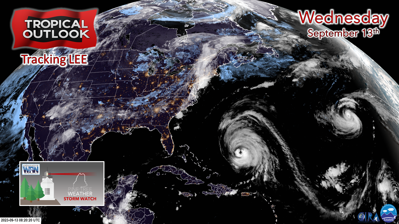 It's time to put preparations for the storm into overdrive. Get what you need for food. Get what you need if the power goes out. Get what you need if roads become blocked due to fallen trees. Fill up the gas tank. Pick up the yard. If you have a boat in the water, secure it or pull it. 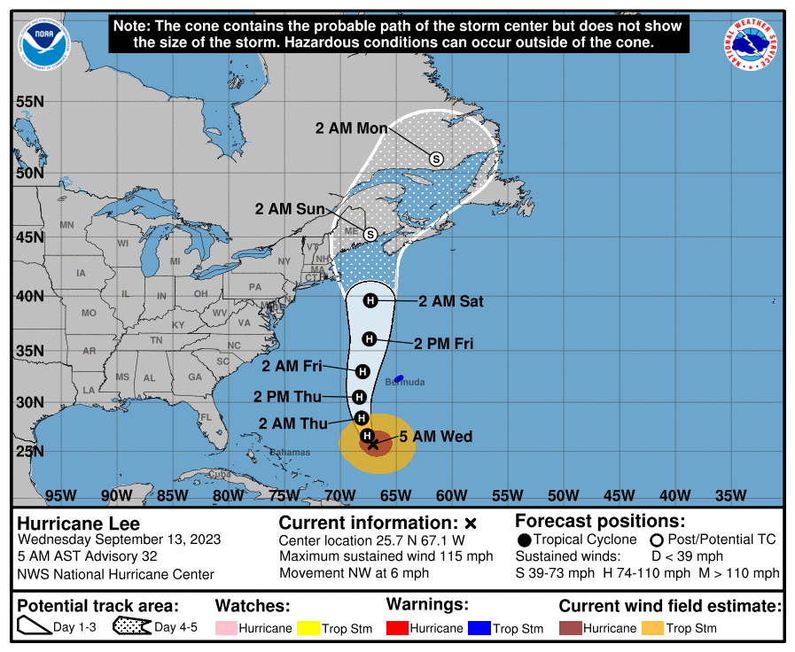 Wednesday 5 AM advisory from the National Hurricane Center has forecast track of Lee making landfall as a tropical storm in far eastern Washington County in the Eastport, Lubec, Machias, Cutler region at roughly 2 AM on Sunday at this point. TIMING: The shorelines are seeing surf begin to build already. The wind increases Friday night and rain arrives on Saturday. Rain is expected to end over southern and western areas early Sunday morning, and for eastern and northern areas by Sunday afternoon. Expect breezy conditions to follow in the storm's departure as clean up and power restoration begins until Sunday night. Track may not be done shifting west yet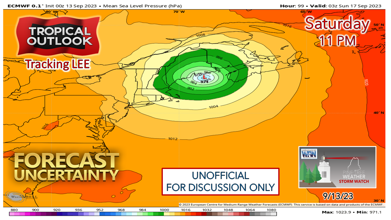 Operational ideas have the storm entering into the Gulf of Maine at around 965-975mb which makes this one a strong tropical storm. As NHC has noted in the 5 AM update, the track has shifted west and may not be done yet. Operational ideas have landfall around Mount Desert Island / Frenchman's Bay / Steuben / Milbridge area, so there may be a jog left before it is over. IMPORTANT TO NOTE that areas on the east side of the storm may have to deal with a higher amount of storm surge. That will be determined as time progresses and the forecast is fine tuned. Early ideas on wind and rain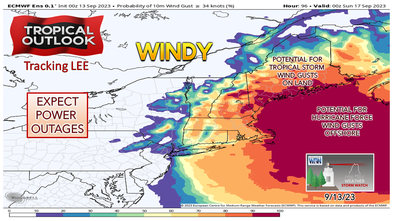 With the westward shift in play, the risk of tropical storm wind gusts covers more territory around the state. I've been saying for days of the threat for power outages. At this point it is not a matter of if, but how many. While this graphic is a snapshot at 8 PM Saturday, the risk of tropical storm wind gusts goes deeper than this, stretching on up into northern areas overnight Saturday. 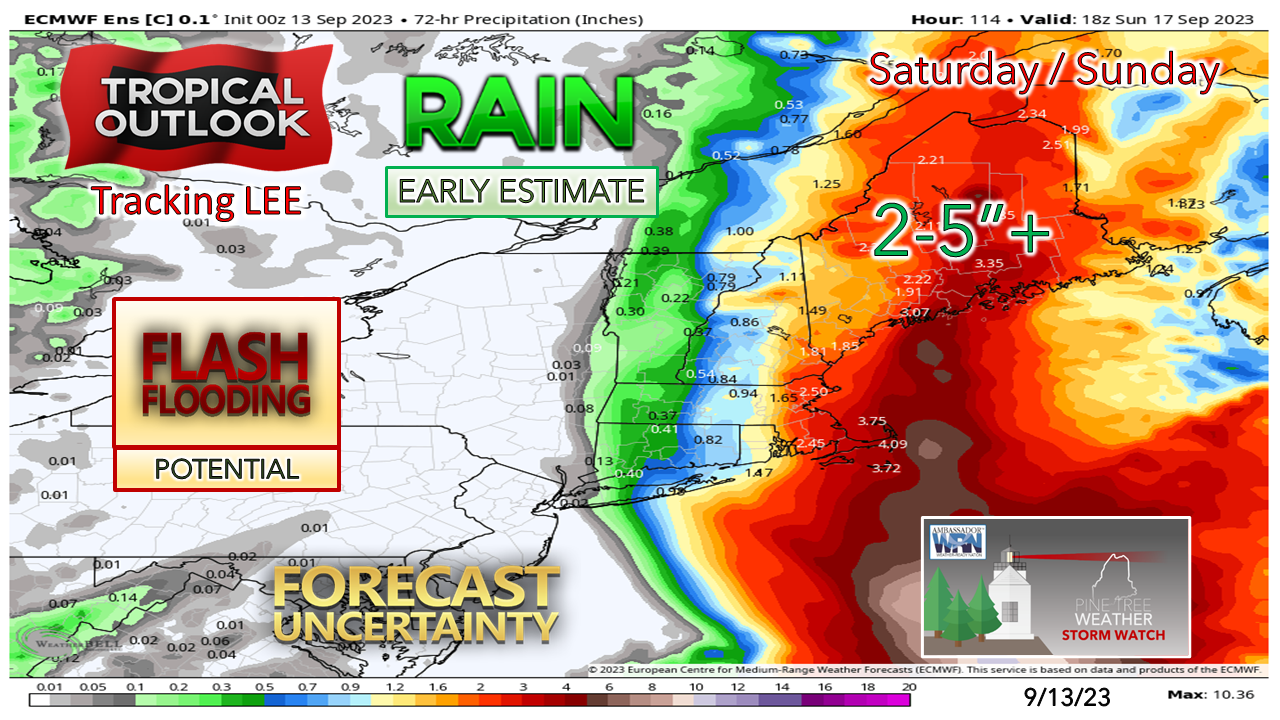 The first call on rainfall is a general 2-5"+ at this point statewide. The northwest quadrant of tropical systems is typically the wettest. I expect areas of flash flooding due to torrential rainfall, with roads and driveways washing out, along with streams and rivers tipping their banks in areas. We've had too much rain this year and the watersheds are maxed out. I've received reports from several of you that have seen areas flooded that they had not seen a flood before. Here we are again, there may be new places still to come. The shorelines are likely to get battered Looking at wind speed from the WaveWatch III model shows the storm track and the eye working through. This appears to be a strong north / northeast wind event until the storm passes and then shifts to the west / southwest on its way into New Brunswick. There is no question eastern areas are going to get hit the hardest. The high tide around midnight Sunday is of concern for storm surge potential for Passamaquoddy Bay southward into Frenchman's Bay. Folks in that area need to pay close attention to the forecast from the National Weather Service and NHC. 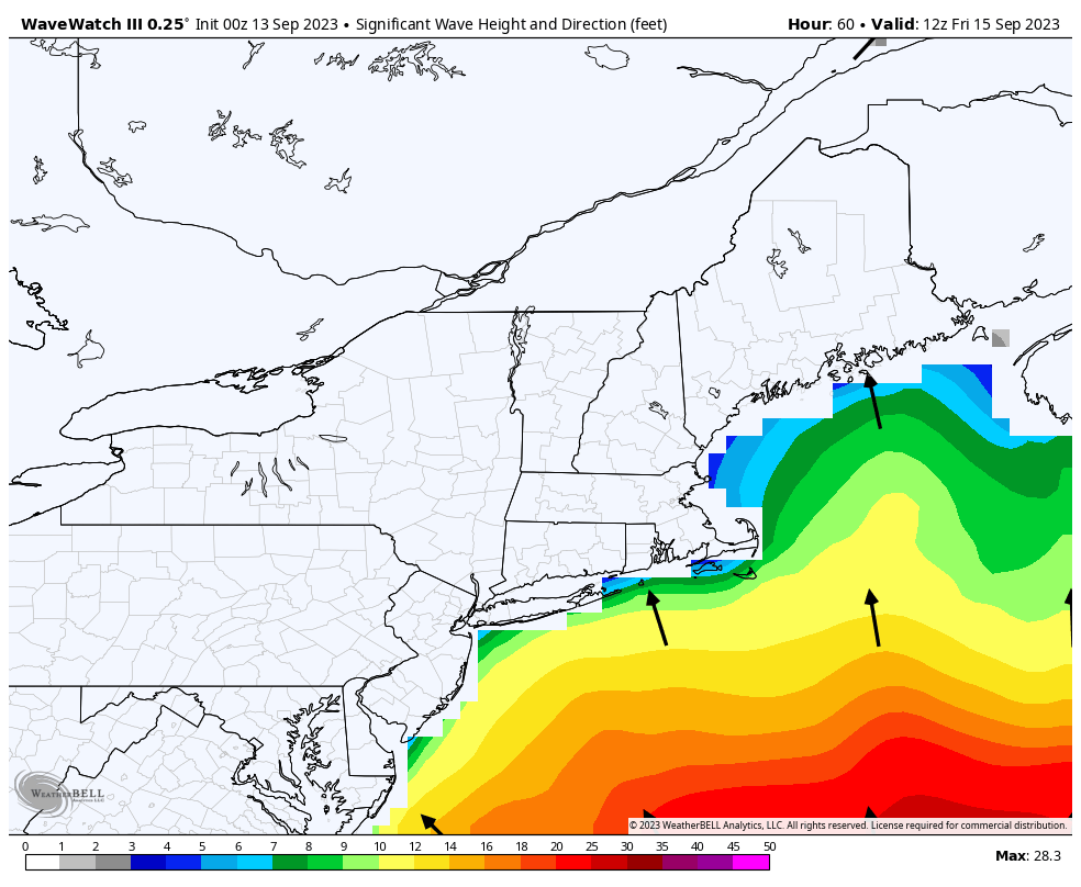 The abuse the shorelines are going to get could be significant. Seas of 10-20'+ for exposed areas and 5-10' for the island protected bays is a reasonable estimate at this point. Three high tide cycles to work through... Midnight & Noon Saturday and Midnight Sunday. There could be some shoreline geography rearranged given the onslaught of high surf, which may seriously damage beaches and potentially property. I also have concerns for potential inundation in low lying areas. My next update will be on Facebook by 5 PM Wednesday. 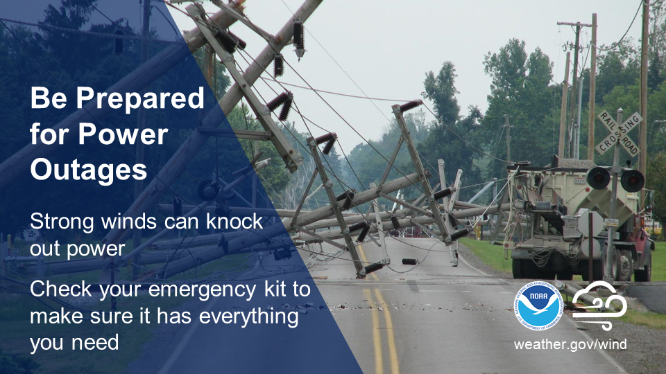 Powerful storms can pack a windy punch. Don’t wait until you’re in the dark! Check your emergency kit now to ensure you have plenty of batteries and other essential supplies on hand. ready.gov/kit Pine Tree Weather is funded from followers like you. I would appreciate your financial support. Click here for how you can contribute. You may not like the weather, but I hope you like what I do, and support my efforts. Thank you! Stay updated, stay on alert, and stay safe! - Mike NOTE: The forecast information depicted on this platform is for general information purposes only for the public and is not designed or intended for commercial use. For those seeking pinpoint weather information for business operations, you should use a private sector source. For information about where to find commercial forecasters to assist your business, please message me and I will be happy to help you. |

Mike Haggett
|


