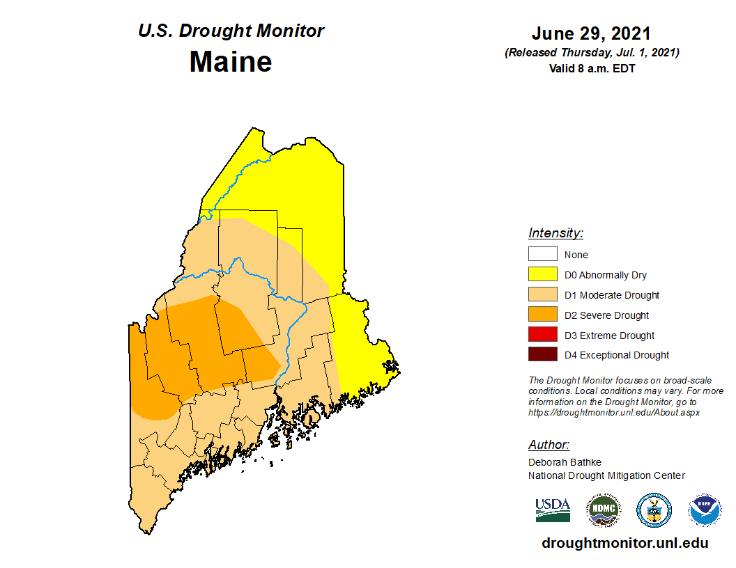
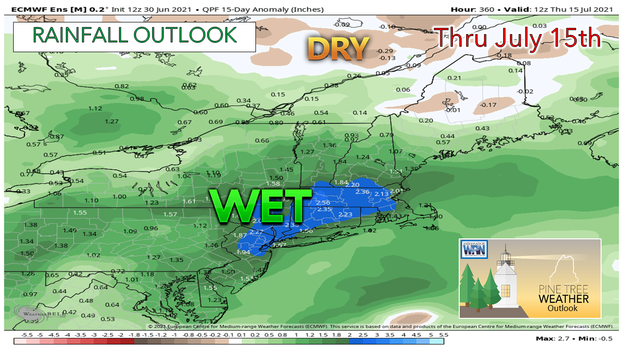
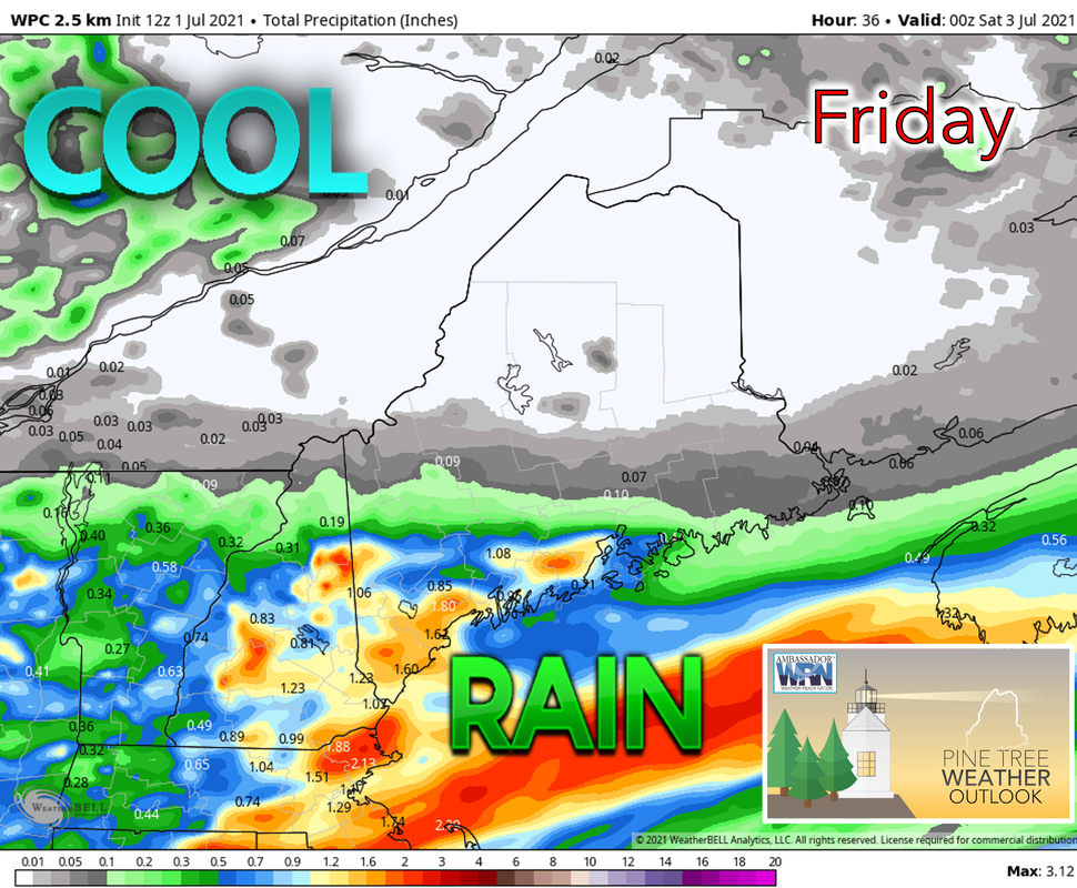
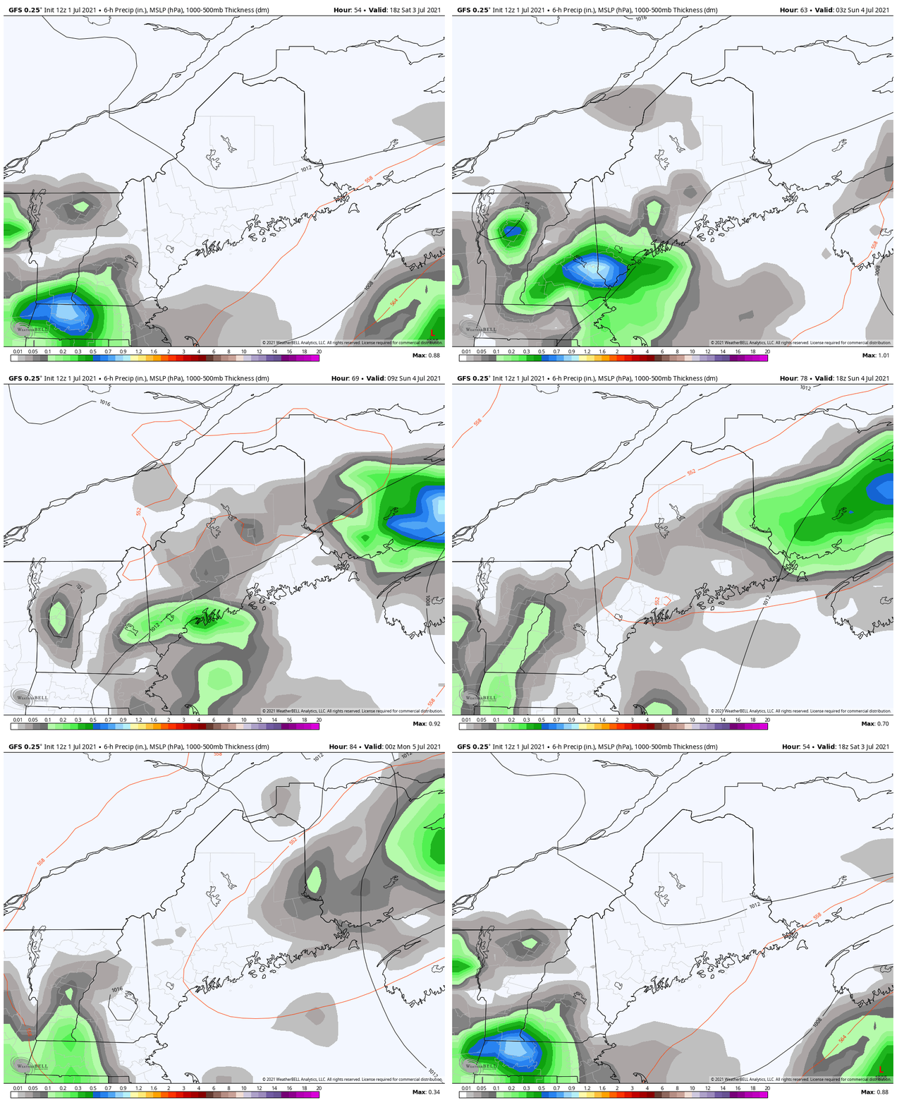
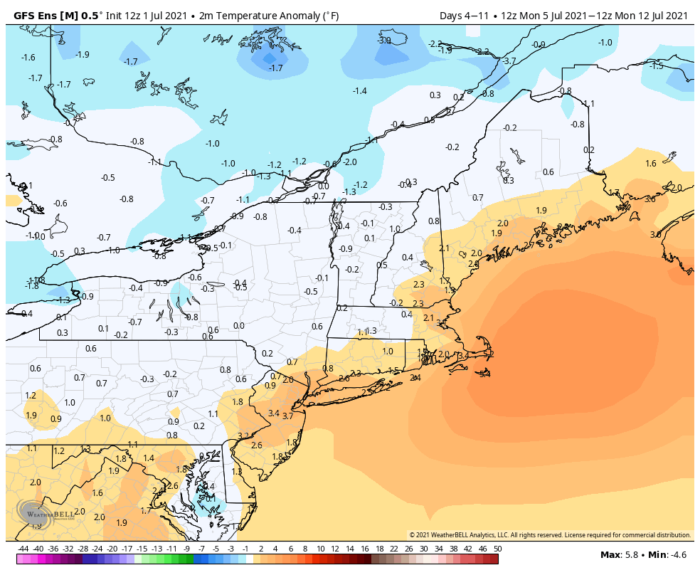
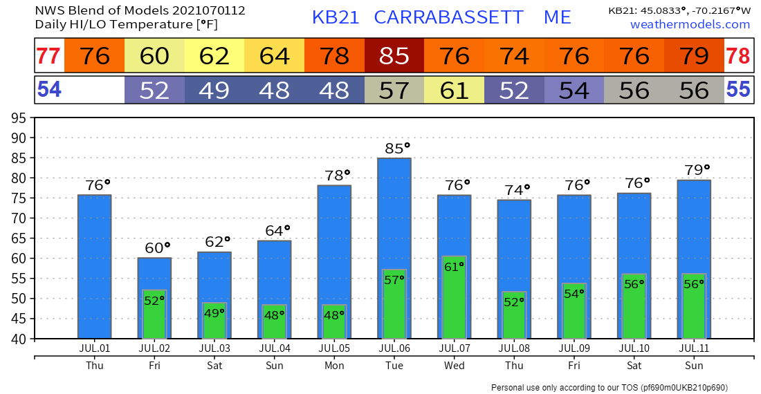
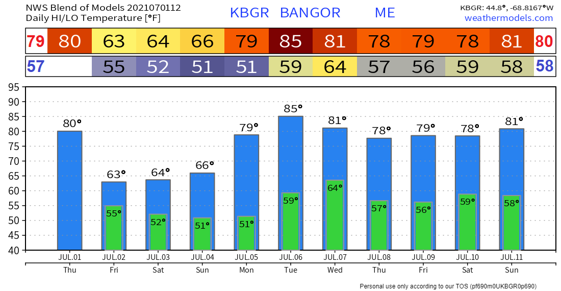
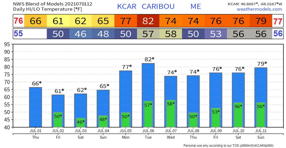
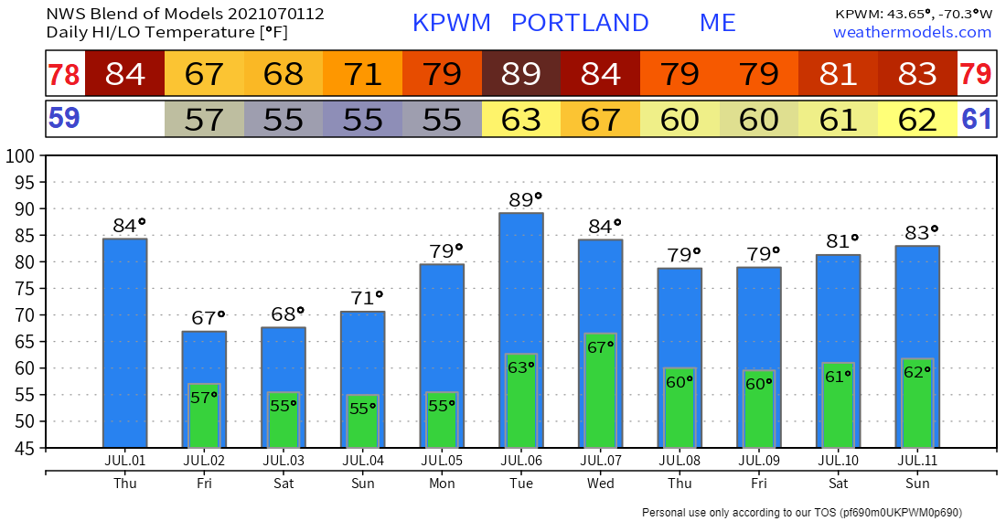
Significant rainfall deficits persistDrought conditions persist across the state with some of the largest departures from normal rainfall present in the SW Coast and Interior regions at nearly 10” in some places. Large deficits are also present along the mid-coast region and in much of central Maine. The County and Allagash regions are a bit better off with rainfall deficits between 1 and 3 inches. Severe drought conditions expandedThe severe drought at level D2, indicated by the orange color on the map, that was originally isolated around the western foothills and Penobscot river valley last week has been extended west by NOAA into the western mountains while the area of moderate drought at level D1, indicated by the light brown color on the map, remains unchanged. The National Weather Service in Gray has recently released a drought statement describing how the hot weather has contributed to increased severity of drought conditions. A recent bulletin released by Maine Emergency Management, which can be found here, details concerns about slow hay growth and dry wells. Drought conditions likely to continue through mid-JulyCurrently, there do not appear to be indications of any major improvement to the present drought situation. The only exception is towards the south where a low pressure system arriving this Friday is likely to bring over an inch of rain primarily along the SW interior and coast as well as the mid-coast. However, in these areas with rainfall deficits nearing 10”, an inch or two will be merely a dent in the drought. A rainy day in the south for FridayAs a low pressure system works its way up the New England coast Thursday night, it will bring rain to the area beginning early Friday morning. Rain will begin in the south before spreading farther north throughout the day. A few areas could see some minor drought relief, although it will be primarily confined to the SW interior and coast as well as the mid-coast region. Northern Maine such as in the County and Allagash regions are likely to stay on the drier side with perhaps only an isolated shower or two. Some fog is also possible in river valleys and along the coast. Temperatures will be on the cool side staying in the upper 50’s to the north and lower 60's towards the south which will provide some relief from the scorching heat earlier in the week. Rain showers and cool temperatures for the holiday weekendAs a 500mb low lingers over the northeast, rain showers will move into Maine in the late afternoon on Saturday, with rain falling primarily in the southern regions in and near the coast. The showers should also persist through the night and into the day on Sunday. Cooler conditions will be present with temperatures staying in the upper 50’s and lower 60's with a better chance for reaching the 60's on Sunday. Skies will be cloudy throughout the weekend although the Allagash and the northern part of The County regions may see a few breaks in the clouds on Saturday. A mostly dry week ahead with warmer temperatures returningThe rainy pattern ends on Monday with dry conditions making a return along with temperatures in the 70’s and 80’s. There is the possibility for some storms on Tuesday as a trough passes through the area but they will likely not bring any drought relief. Temperature outlook through the end of next weekCooler temperatures on Friday and during the weekend before warmer weather returns during the week with some potentially hot weather arriving on Tuesday. Be prepared to receive alerts and stay updated!
For more information in between posts, please follow Pine Tree Weather on Facebook and Twitter.
Thank you for supporting this community-based weather information source which operates by reader supported financial contributions. Stay updated, stay on alert, and stay safe! |
Mike Haggett
|


