Eye to the sky weekend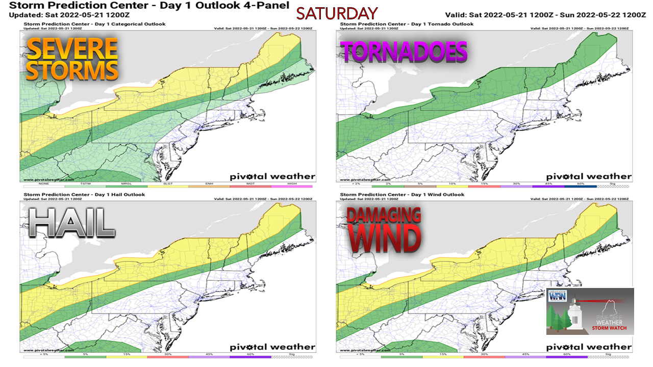 The Storm Prediction Center includes Maine in their Day 1 Outlook for Saturday and Day 2 Outlook for Sunday for severe weather potential for interior areas of the state. 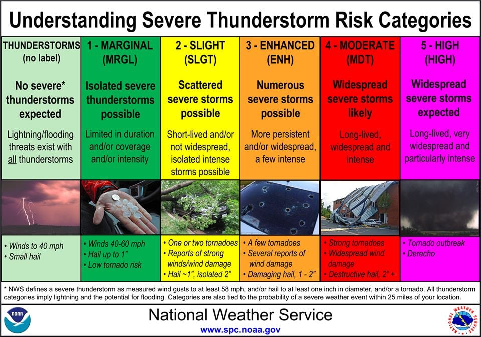 The above graphic provided as a refresher as to what the risk classifications mean. Much of the interior is under Level 2 - Slight Risk for storms over both days. That is where the best case for atmospheric instability exists. It's important to note the dynamics here. The atmospheric set up includes what is known as an elevated mixed layer (EML). You may hear or read of forecasters talking about an "atmospheric cap", or a "capping inversion". What this means in layman's terms is there is dry air aloft. Underneath that dry air is where moisture and instability builds up. Once the EML cap breaks, explosive convection can occur. This is common in the Midwest. It's not exactly rare for Maine, but it is a bit early to see this sort of set up. 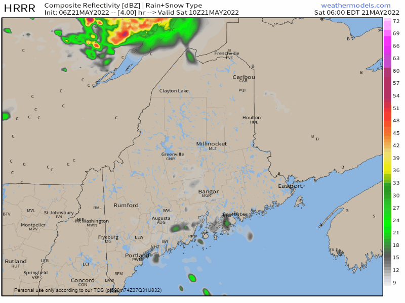 Saturday 6 AM to Sunday Midnight - A weak cold front drops down from east central Quebec during the afternoon which sets up the first round of potential storm activity. Convection allowing short term models (in this case, the featured HRRR) shows the cap losing out and potential strong to severe storms rapidly developing. Given the influx of heat and humidity from the southwest and the EML involved, post-sunset thunder isn't out of the realm of possibility for the mountains and north, but as the front dissipates towards midnight, storms begin to fizzle out heading into the wee hours of Sunday. The main threats include damaging wind and large hail, along with torrential downpours which could cause localized flash flooding, along with frequent lightning. Will there be a severe thunderstorm watch issued? That will be up to the Storm Prediction Center to decide. Make sure you have multiple ways to receive alerts and bulletins from the National Weather Service. 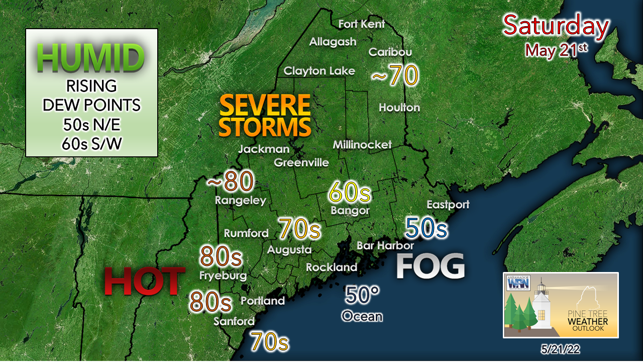 Midcoast and eastern areas can expect to deal with fog and drizzle as a south / southeast flow locks in the stable marine layer. Bangor is on the fringe of the marine layer is a coin flip of sun and 70s or fog and 60s, but I am betting on a cooler outcome there. Western areas have the best chance to make a run into the 80s. The southwest coastal shorelines stay cooler in the 70s, If you are headed for the oceanside beach, expect an incoming tide in the afternoon over the next two days eroding available space. Play it again for Sunday A long wave cold front approaches the region Sunday and increases severe threat volatility. The southwest flow ahead of the front pumps in more moisture and warmth. Since this frontal boundary is stronger, the threat of stronger storms and for them to be more widespread is likely. 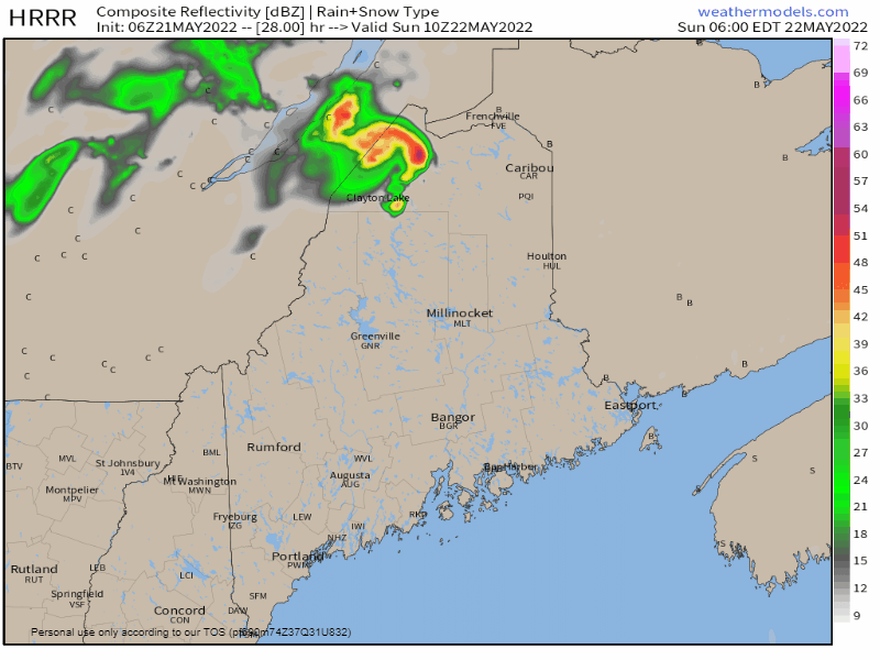 Sunday 6 AM to Monday Midnight - Activity may get going by mid-morning over the north woods pending on timing of the frontal boundary along with daytime heating and the status of the EML. Expect activity to increase heading into the afternoon over the north, south and west. The marine layer over the MidCoast and eastern areas will dictate the outcome there. With a more of a southwest flow, it reduces the area of stable air, keeping it closer to the shorelines. All areas have the chance of at least getting a shower out of this. Interior areas have the best chance for strong to severe storms, but southwestern areas should be on the lookout. While the Storm Prediction Center will have its discretion on if a severe thunderstorm watch will be issued, I think there is a good chance one could be issued for Sunday. The main threats for damaging wind, large hail, torrential downpours which could cause localized flash flooding, along with frequent lightning, with thunder that could be loud. Bottom line, stay on alert, have multiple ways to receive alerts, and take shelter in a safe place immediately if a severe thunderstorm warning is issued for your area. Cold water safety message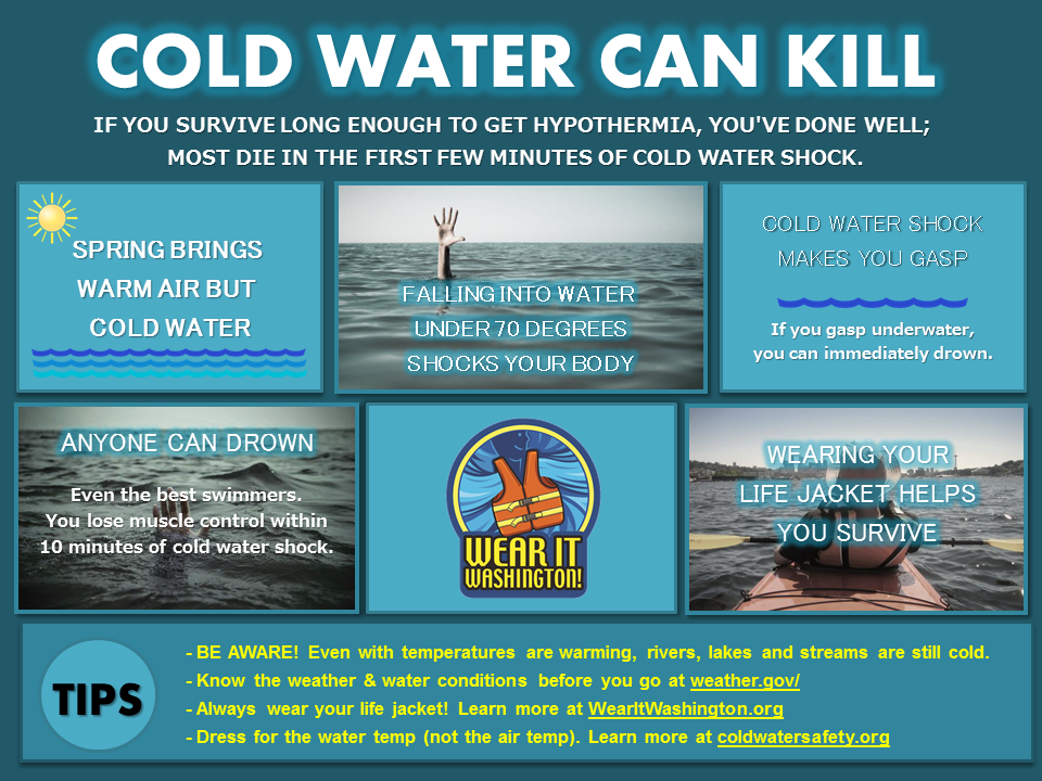 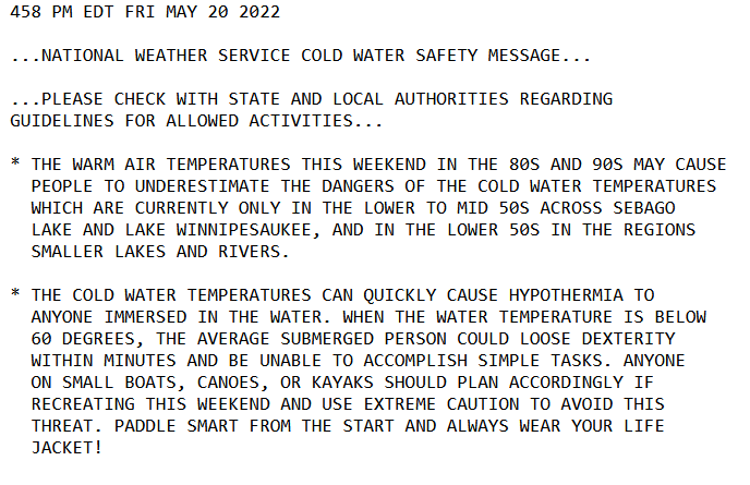 Be prepared to receive alerts and stay updated!
 For more information in between posts, please follow Pine Tree Weather on Facebook and Twitter. Thank you for supporting this community-based weather information source which operates by reader supported financial contributions. Thank you as always for your support! - Mike NOTE: The forecast information depicted on this platform is for general information purposes only for the public and is not designed or intended for commercial use. For those seeking pinpoint weather information for business operations, you should use a private sector source. For information about where to find commercial forecasters to assist your business, please message me and I will be happy to help you.
|

Mike Haggett
|