Thursday: Afternoon severe storm potential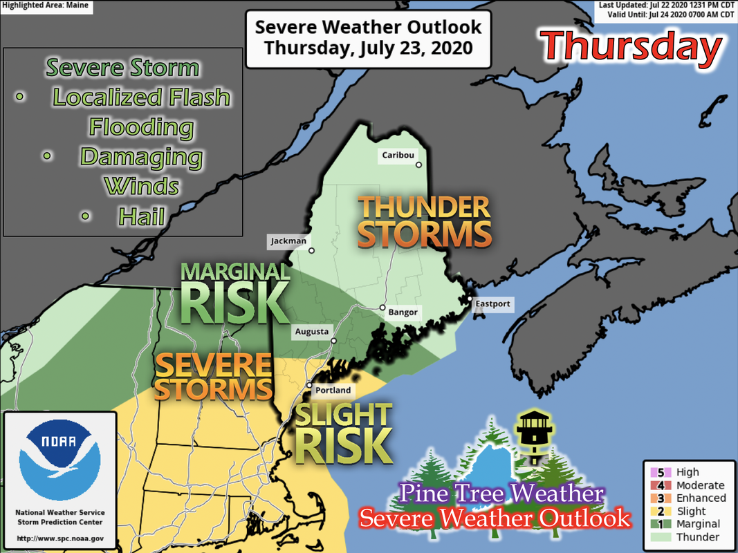 A low pressure system pushes into western Maine Wednesday night into early Thursday morning. Showers are expected statewide, as well as some embedded thunderstorms. For the southern and Portland areas of Maine, severe weather potential exists. Along the backside of the warm front, in the warm sector, increased values of CAPE (energy in the atmosphere) and moisture give increased potential for severe weather in the afternoon. With severe storms comes potential for localized flash flooding, damaging winds, and hail. Frequently check the weather tomorrow for any updates on exact locations and timing of any severe storm threat. 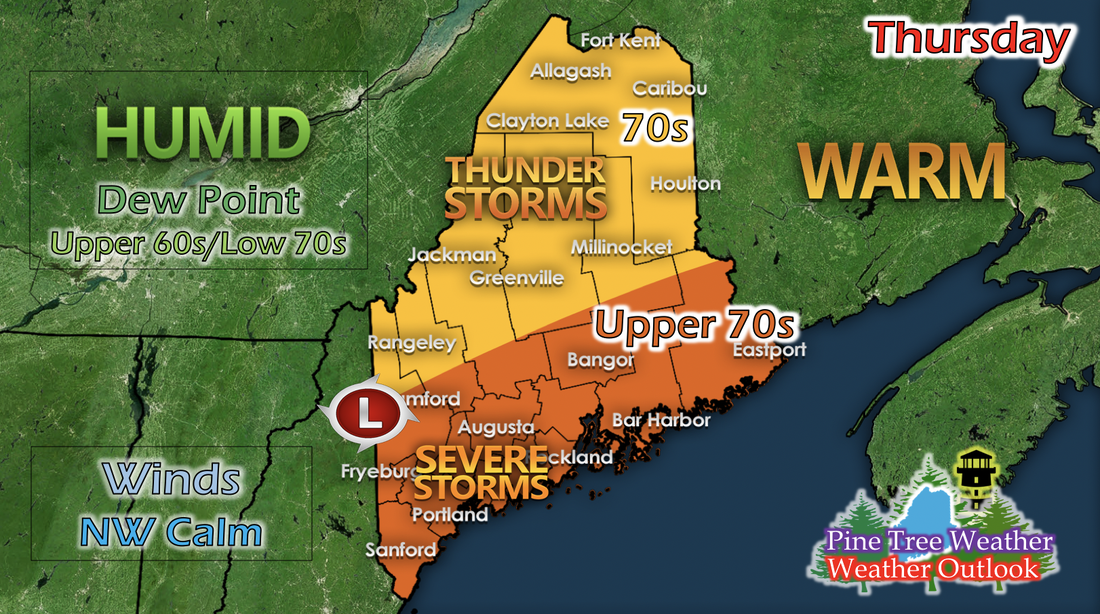 While Thursday will have thunderstorms, rain, and potential severe storms to the south, it will also be warm and humid state wide. Down East, Mid Coast, and the Portland area, as well as Bangor and Augusta, will be in the upper 70s with some areas hitting in the 80s. Elsewhere will be in the 70s. Dew points are in the upper 60s to low 70s statewide, making the air feel very soup-like and humid. This increased moisture will also help fuel the oncoming thunderstorms in the afternoon. Winds will be calm and the general direction is from the northwest. Friday: Mostly sunny, warmer, and more comfortable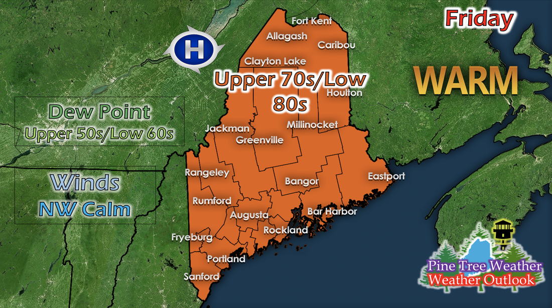 Friday feels much better than Thursday will feel. Dew points drop into the upper 50s to low 60s statewide as the low pressure system moves away from the state. Clouds will also clear up by the afternoon. The low pressure system rode on a shortwave as it passed the state, and a ridge builds west of Maine, helping to increase temperatures and build higher pressure in the New England region. Temperatures statewide are in the upper 70s to low 80s. Winds remain calm and from the general northwest. The weekend's temperatures will be similar to Friday's, but whether or not any precipitation will occur is up in the air. There looks like a hint of rain for the northern portion of Maine on Sunday morning, as a weaker low pressure system comes by, but more information on this weekend will come in a few days. Mid-Week System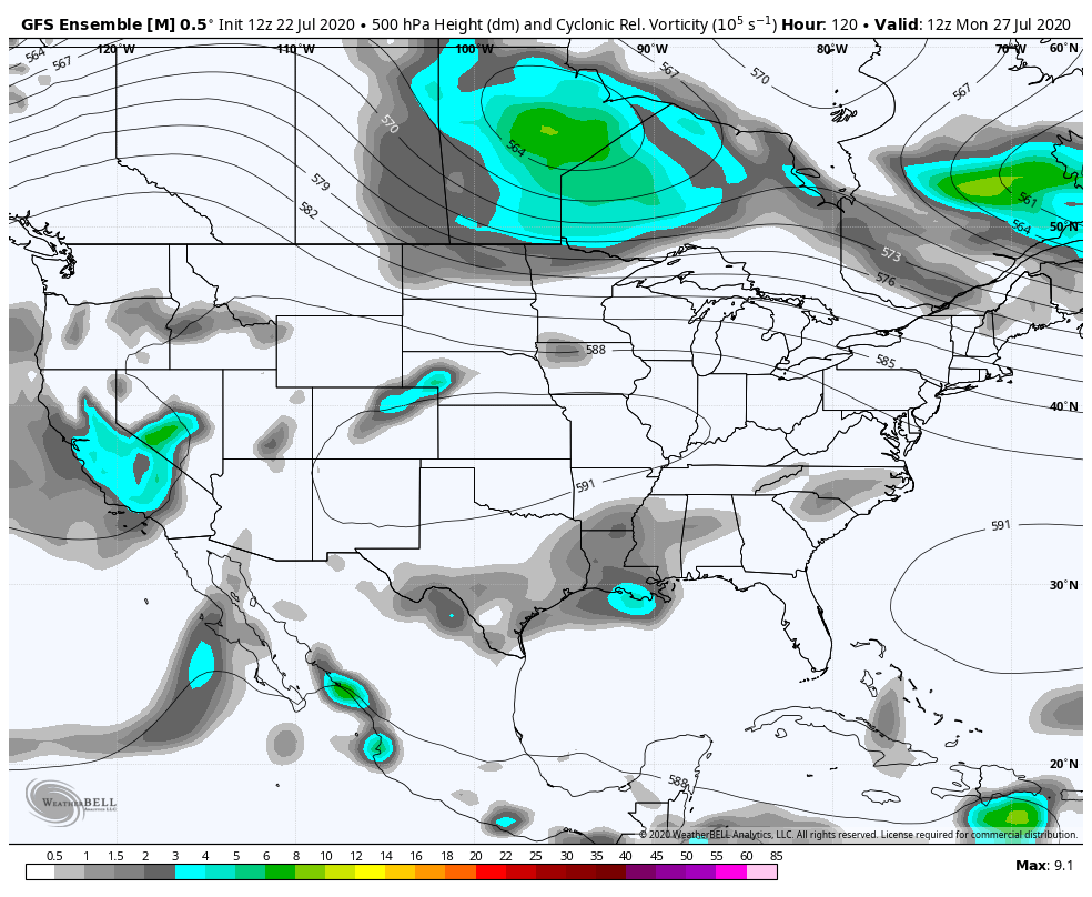 The GIF above runs from 8 AM next Monday to 8 AM next Thursday and shows 500 mb (mid-level in the atmosphere) vorticity. There's strong evidence in the past few model runs of this long-range model of a pretty strong low pressure system diving down into the New England region in the mid-week. It may seem to arrive on Wednesday/Thursday, but these systems typically move a little bit faster than the model runs show. The strong mid-level vorticity signature shown, if it turns out to be true next week, will likely give widespread rains and some strong storms. That is a week away, but this is what forecasters are currently looking at. More information will come next week. Help forecast verification, and stay informed!
For more information, please follow Pine Tree Weather on Facebook and Twitter.
Thank you for supporting this community based weather information source that is funded by your financial contributions. Stay updated, stay on alert, and stay safe! Thank you so much for all of your continued support! This is my Venmo if you'd like to contribute: @Kaitlyn-Lardeo Have a great rest of your week! - Kaitlyn |

Mike Haggett
|