
Storms could pack a punch as cold front moves through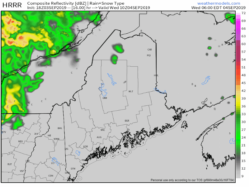 As I mentioned on Facebook this morning, there is the threat for severe weather for the state on Wednesday. There is potential for some rather feisty storms as a cold front works through the region. The main concern here is for damaging wind and downpours. With a strong wind flow from the southwest aloft, there is the risk for a brief isolated tornado given the forecast dynamics. For now, Storm Prediction Center has the entire state under Marginal Risk (very low) for severe storms. That may change by Wednesday morning. Time will tell if a severe thunderstorm watch may come, which that would likely come Wednesday afternoon. Regardless if a formal watch is issued or not, consider this your notification to watch out for these storms. With fall athletics in high gear right now, it's important to remember that when thunder roars to head indoors immediately. 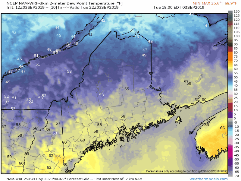 Dew point levels will increase Tuesday night into Wednesday, which will assist in fueling the thunderstorm activity. As quickly as it rises, it goes away, as the dew point temperatures crash overnight Wednesday with the frontal passage and provide that refreshing feeling Thursday morning. Dorian track close enough to watch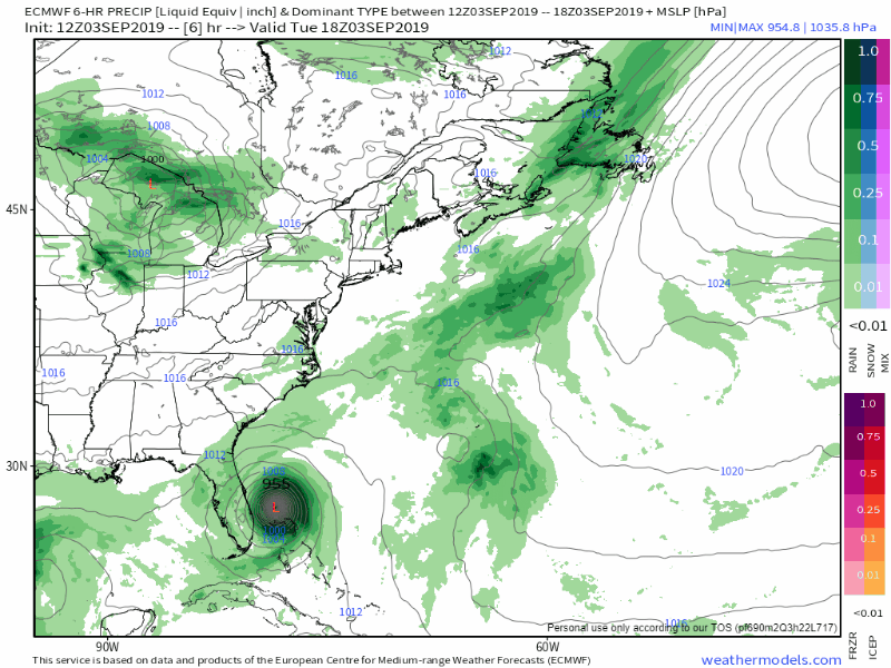 One thing about tropical cyclones as the move into the higher latitudes, is they expand. This model idea shows that extremely well. From this point on, the storm will only gain in size. While in scientific terms the storm is "weakening" as it lowers in strength categories, that absolutely does not reduce the potential threats that go along with it. The threats area widens out in cases like this, which is why this needs to be paid attention to. 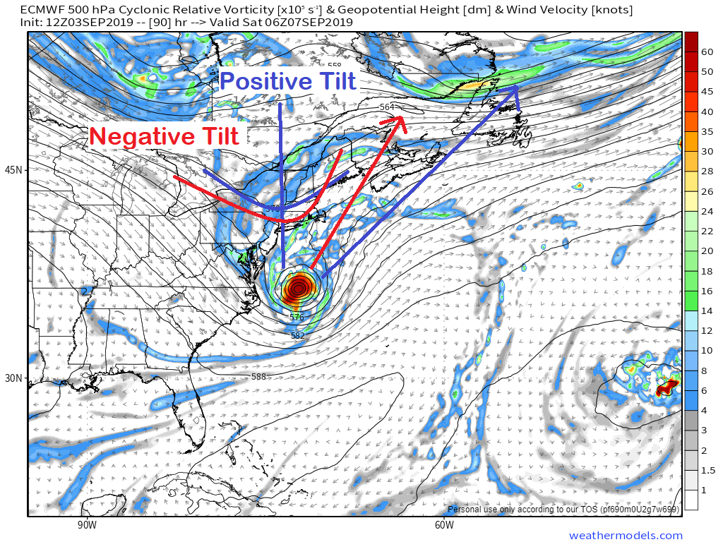 Whether or not Dorian shifts west depends on the tilt of the trough that will drop down from Canada later this week. The more positive the the tilt as what is predicted by models now, the storm stays to the east. If the tilt of the trough becomes negative, like we see with NorEasters, the storm could track more to the west and bring more of a concern to Maine. 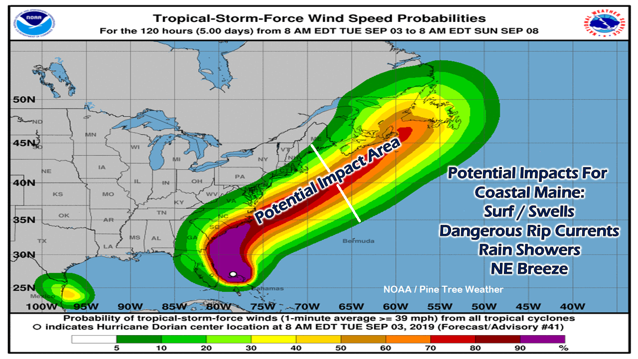 I used this graphical representation last week in a post, and I will do it again here. While the chances for tropical storm force wind speeds are on the low end, the potential track of the storm is close enough to bring at least some effects. While the land effects are minimal for now, the ocean is likely to be a spectacle in regards to surf and swells. With storms like this, the wave action can become rather unpredictable, so it will be wise to do any viewing at a respectable distance. I would not rush to pull boats with this one, so long as where the boat is moored is in a protected area. Boats anchored in open areas, you should use your discretion of whether or not the boat is hooked safely. 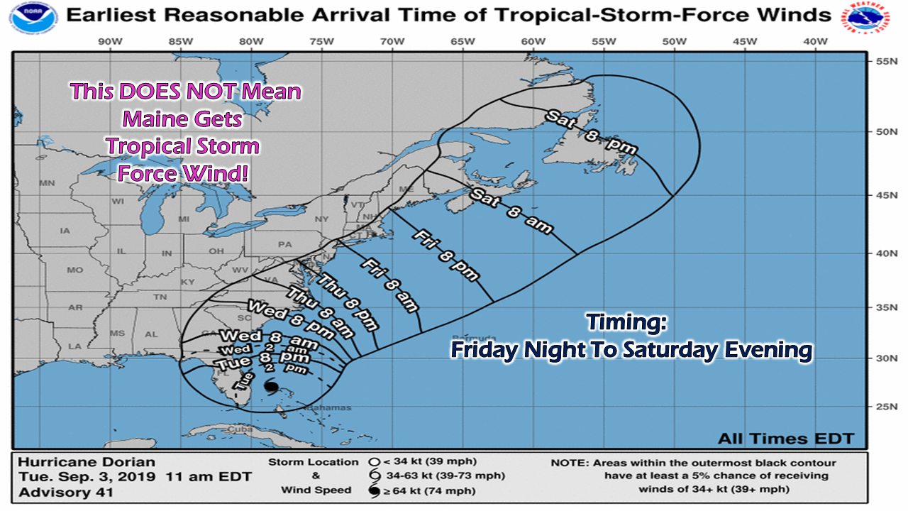 This graphic does a good job of tying the package all together. Southern areas can expect some sort of effects from what is left of Dorian Friday evening, DownEast areas overnight into early Saturday morning. Conditions appear to improve for areas west of Penobscot Bay by around noon or before, and Saturday night for areas along the New Brunswick border. 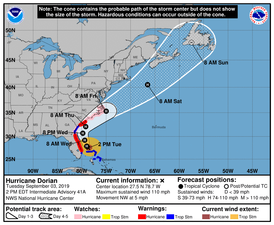 By the time Dorian reaches our latitude, it will look more like a NorEaster, and a powerful one at that. For folks in Nova Scotia and Newfoundland, you'll want to pay very close attention to the Canadian Hurricane Centre for advisories and bulletins from them beginning on Wednesday. For us in the states, the National Hurricane Center is the place for all the latest forecast information.
There is always the potential for a change in track and impacts. Stay updated! ► ► For the latest official forecasts, bulletins and advisories, please check in with the National Weather Service in Gray for western and southern areas, or Caribou for northern and eastern parts of Maine. Please consider supporting Pine Tree Weather ► ► Your financial donations are much appreciated to keep this site funded and for further development. FUNDRAISING FOR 2020 PLEASE SUPPORT! I sincerely appreciate your support not only financially, but also in sharing my efforts with others. For more information from me, please check the Pine Tree Weather Facebook page as well as my Twitter feed. Always stay weather aware! - Mike |

Mike Haggett
|


