
Buckle up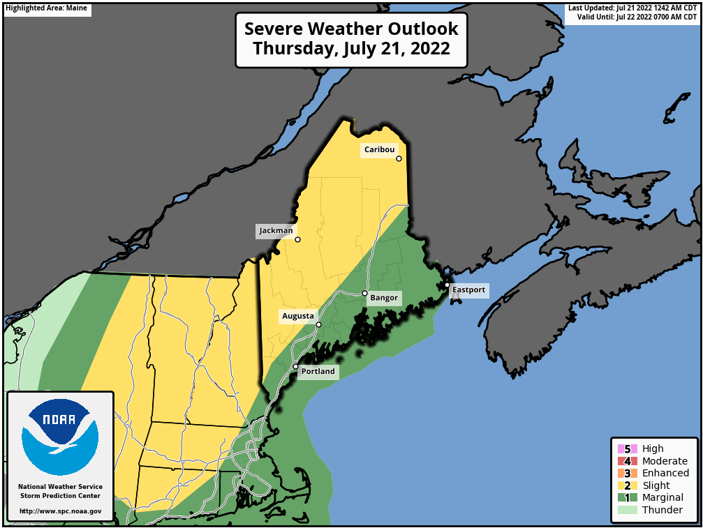 For those over interior parts of the state, it is very important to stay on alert today. This is one of the better set ups for strong to severe storms given the dynamics at play. Storms could develop quickly, become nasty, and potentially life threatening to those caught unaware. Please have MULTIPLE ways to receive alerts and take action when warnings are issued. 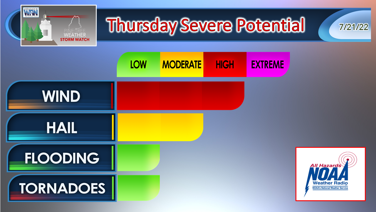 Damaging wind is the main concern with storms as they develop due to steep low-level temperature lapse rates and updrafts. This is also where the hail factor comes in. I suspect hail size to be generally on the smaller scale, but golf ball size hail or larger isn't out of the realm of possibility where supercells form. Localized flash flooding from torrential downpours could reduce visibility and ponding on the roads, may cause rapid rise to streams and brooks, and hydroplaning on the faster roadways. The tornado threat is low. If any form, they are likely to be short lived. Given the tropical nature of the airmass, that threat cannot be ruled out.  Thursday 1 PM to Friday 1 AM - Other than a few showers and perhaps a rumble in the far north in the morning, the main event happens in the afternoon into the early evening. As the front approaches from the west, storms fire along it. The HRRR idea above notes the threat for bow echoes which indicates the potential for damaging wind, small to large hail, and isolated tornadoes. The threat of severe storms diminishes heading into the night as the atmosphere cools. Storms are expected to be strongest over the interior and then weaken as they move toward the coast as the marine layer buoyed by a southerly breeze from the cool ocean diffuses the convection as it enters more stable air. 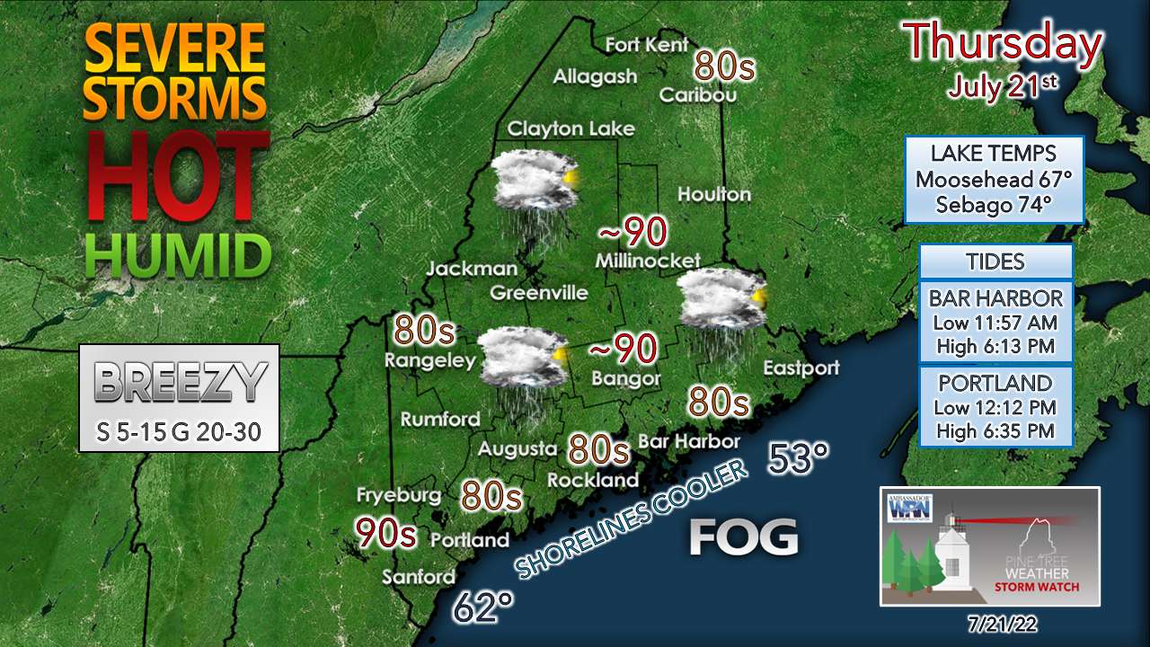 Dew points in the mid-60s to low 70s increases precipitable water values to upwards of 2" which brings a gross, disgusting feel to the skin. It also drives up the heat index into the 90s. While no heat advisory is in effect for Maine as of the time of this post early Thursday, it wouldn't surprise me if the southwest interior gets one. MidCoast and DownEast areas may be dealing with fog given the amount of moisture around and the southerly wind direction. This minimizes the storm threat there and keeps the temperatures down in the 70s. 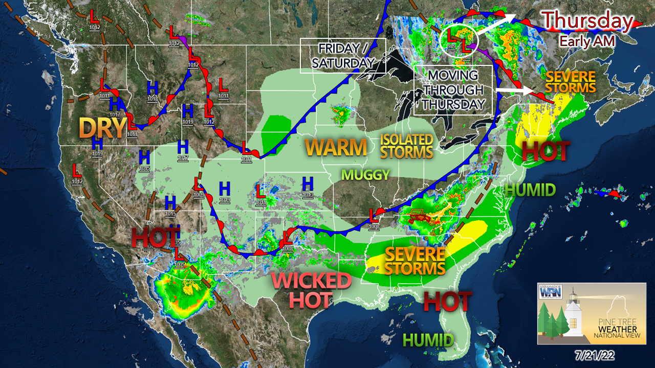 Once the front passes through, a weak area of high pressure enters the region for Friday and Saturday. The dew points drop a few degrees to make it somewhat tolerable, but it remains warm with southwest interior areas seeing high temperatures around 90°, and warm nights in the 60s. Dew points surge once again on Sunday, which could be the hottest and most uncomfortable day of the summer. Expect another round of strong to severe storms to impact parts of the region Sunday afternoon into the evening. Relief from the heat and humidity comes to interior areas Monday, and to the coast by Tuesday. Temperature outlook through Tuesday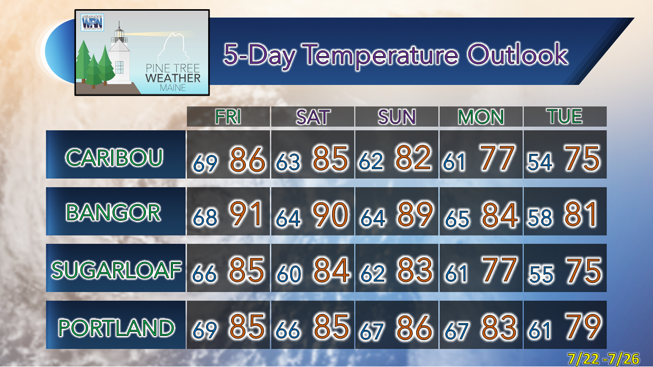 Thank you for supporting this community-based weather information source which operates by financial contributions from people like you. Stay updated, stay on alert, and stay safe! NEXT UPDATE: SATURDAY - Mike NOTE: The forecast information depicted on this platform is for general information purposes only for the public and is not designed or intended for commercial use. For those seeking pinpoint weather information for business operations, you should use a private sector source. For information about where to find commercial forecasters to assist your business, please message me and I will be happy to help you. |

Mike Haggett
|


