Pine Tree Weather
  • DISCUSSIONS
  • DONATE
  • WEATHER WALL
  • MAPS
  • RAIN OUTLOOK
  • SEVERE
  • MARINE
  • CPC OUTLOOK
  • Kennebunk
  • MY BIO
  • PTW IN MEDIA
  • OBSERVING WEATHER
  • INTERNSHIPS
  • INTERN ALUMNI
  • DISCUSSIONS
  • DONATE
  • WEATHER WALL
  • MAPS
  • RAIN OUTLOOK
  • SEVERE
  • MARINE
  • CPC OUTLOOK
  • Kennebunk
  • MY BIO
  • PTW IN MEDIA
  • OBSERVING WEATHER
  • INTERNSHIPS
  • INTERN ALUMNI

Severe storms possible for the region Saturday

7/5/2019

Comments


Eye on the sky day

Picture
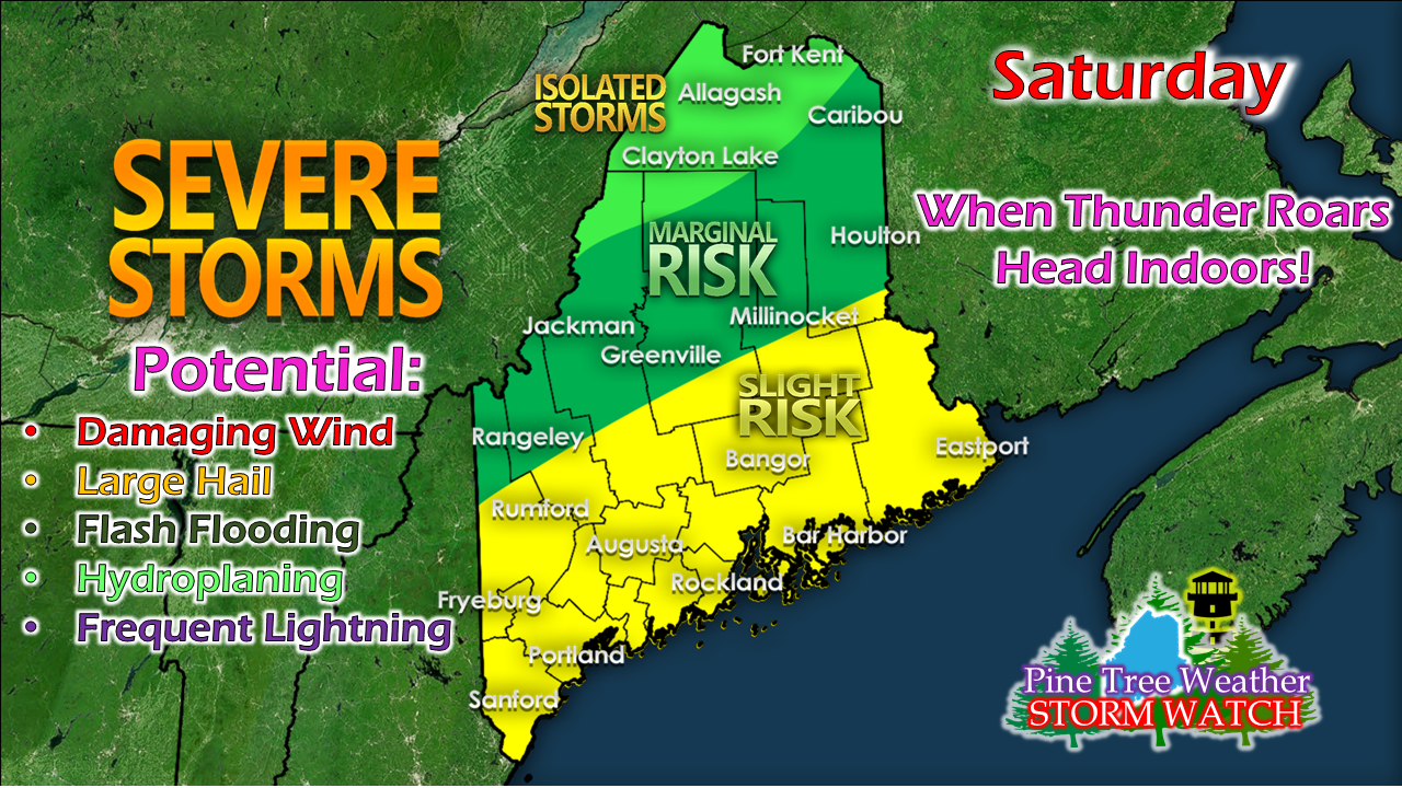
A cold front will pass through the region on Saturday to sweep the heat and humidity out of the region. With the dew point forecast in the 70s for a good chunk of the coastal plain and moisture being pumped in ahead of the front, this presents the best severe storm threat of the summer thus far for the state.
Picture
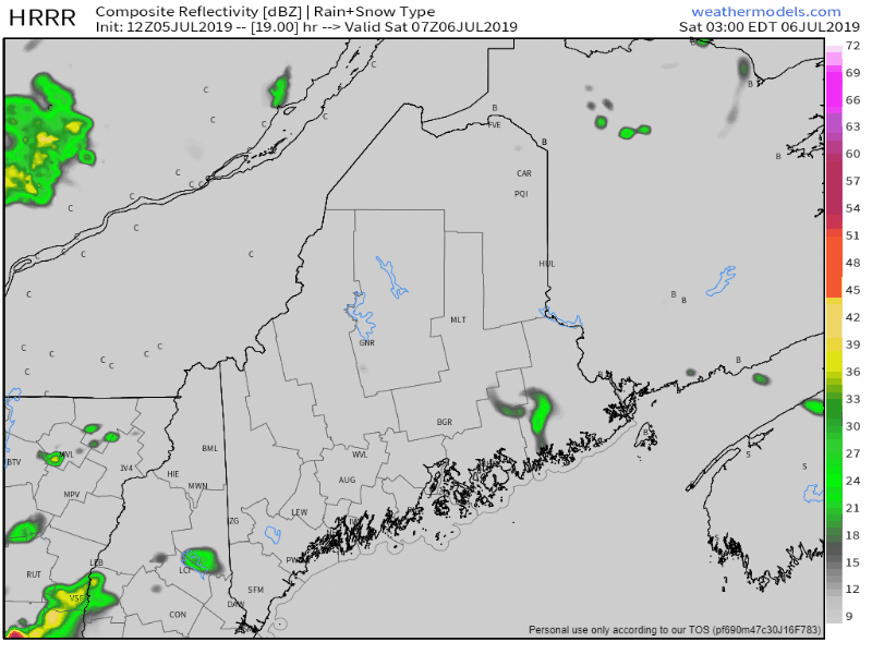
There is the risk for an isolated shower or thunderstorm Saturday morning, but the main event appears to be late morning for the Allagash region and afternoon for the rest of the state.  Damaging wind is the main threat. Given the high humidity level, flash flood potential downpours and hydroplaning on the highways is of concern. Some areas could see 1-2"+ of localized rainfall in a short period of time. With the intrusion of cold air aloft, there is large hail potential with the well organized storms.

The big question as always is if the storms will hold together to reach the shorelines. Given the projected track of the frontal boundary, the coastline has a fair shot at seeing some action.
Picture
Temperatures will be a bit cooler in theory compared to Friday. I say "in theory" as the heat index, factoring in the uncomfortable humidity levels will make it feel like the mid to upper 90s in areas away from the coast. 

If you are headed to the lake or ocean beaches to seek relief from the heat, keep your eyes and ears open for storms, and prepare to take action once the threat for storms occurs. Seek shelter in a safe building, and stay away from windows.

Sugarloaf NOAA Weather Radio transmitter
offline July 8th until fall

Picture
Sugarloaf USA Photo
In much cooler times back in late February, a winter storm which caused hurricane level wind gusts turned the communications tower on top of Sugarloaf Mountain into a pile of scrap metal. The tower relayed cell phone, public safety, NOAA Weather Radio, as well other transmissions. The spire is in the process of being replaced, which will begin on Monday. As a result, the NOAA Weather Radio transmitter will be taken offline until sometime this fall. 

The frequency of this service for the Sugarloaf service area (Oxford, Franklin, Somerset Counties) is 162.450 MHz. The National Weather Service has two other frequencies for use while the tower is replaced. The Mount Washington tower frequency at 162.500 MHz is the first one to try. The other is the Greenville tower frequency at 162.425 MHz. Most recently produced NOAA Weather Radios and public safety radio scanners are  equipped to receive transmission from any available NOAA frequency via their internal scan mode, so manual adjustments are not needed. For older models, they may have to be manually entered. If for some reason neither of the two alternate frequencies work, you can always check the National Weather Service Gray website for forecast information and severe weather bulletins. 

There should be no interruption of FIPS code alerts, so long as your radio can receive a signal from either the Mount Washington or Greenville towers.

Stay on top of the forecast to get a rough idea of when severe weather may occur in order to prepare accordingly if away from both radio and cell phone / web related sources. 

Outlook through midweek

Sunday morning may see some early morning fog in places that get heavy rain the night before, but that should burn off by mid-morning. The region appears precipitation free until later in the week as a cold front arrives Thursday and may not clear until Friday. Humidity levels stay down until Wednesday. Temperatures through the period will range in the 70s north and mountains, 80s for much of the coastal plain for highs and 50s for most areas for overnight lows. 

​► ► For the latest official forecasts, bulletins and advisories, please check in with the National Weather Service in Gray for western and southern areas, or Caribou for northern and eastern parts of Maine.

Please consider supporting Pine Tree Weather ► ► Your financial donations are much appreciated to keep this site funded and for further development. 

I sincerely appreciate your support not only financially, but also in sharing my efforts with others.

For more information from me, please check the Pine Tree Weather Facebook page as well as my Twitter feed. 

Always stay weather aware! 

​- Mike

Comments
    Picture

    Mike Haggett
    Kennebunk, ME

    Weather-Ready Nation
    Ambassador

    Certified Weather
    Forecaster
    Penn State '21

    American Meteorological Society

    National Weather Association
    ​
    ​SKYWARN-CWOP

    Matthew 19:26


    DONATE

    Picture
    Picture
    Picture
    Picture
    Picture

    Picture

    Picture

    Picture

    Picture

    Picture

    Picture

    Picture

    Picture

    Picture

    Picture

    Picture

    Picture


    Archives

    April 2025
    March 2025
    February 2025
    January 2025
    December 2024
    November 2024
    October 2024
    September 2024
    August 2024
    July 2024
    June 2024
    May 2024
    April 2024
    March 2024
    February 2024
    January 2024
    December 2023
    November 2023
    October 2023
    September 2023
    August 2023
    July 2023
    June 2023
    May 2023
    April 2023
    March 2023
    February 2023
    January 2023
    December 2022
    November 2022
    October 2022
    September 2022
    August 2022
    July 2022
    June 2022
    May 2022
    April 2022
    March 2022
    February 2022
    January 2022
    December 2021
    November 2021
    October 2021
    September 2021
    August 2021
    July 2021
    June 2021
    May 2021
    April 2021
    March 2021
    February 2021
    January 2021
    December 2020
    November 2020
    October 2020
    September 2020
    August 2020
    July 2020
    June 2020
    May 2020
    April 2020
    March 2020
    February 2020
    January 2020
    December 2019
    November 2019
    October 2019
    September 2019
    August 2019
    July 2019
    June 2019
    May 2019
    April 2019
    March 2019
    February 2019
    January 2019
    December 2018
    November 2018
    October 2018
    September 2018
    August 2018
    July 2018
    June 2018
    May 2018
    April 2018
    March 2018
    February 2018
    January 2018
    December 2017
    November 2017
    October 2017

Proudly powered by Weebly