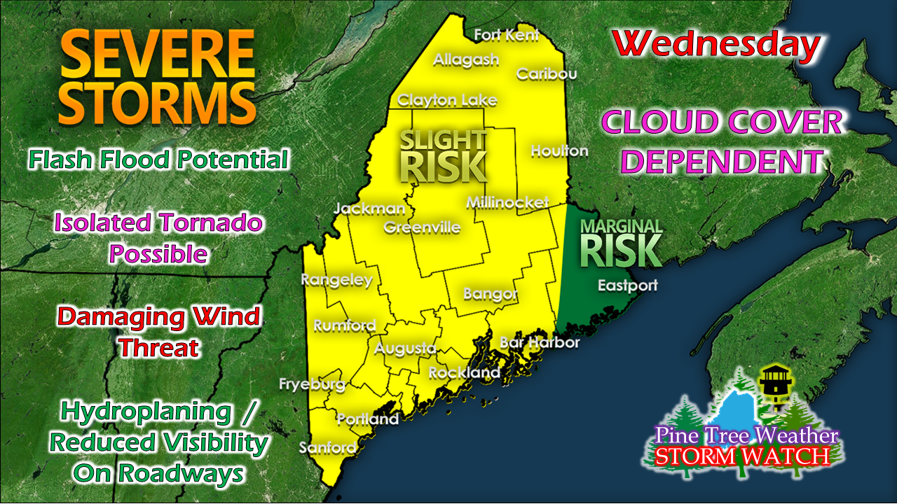
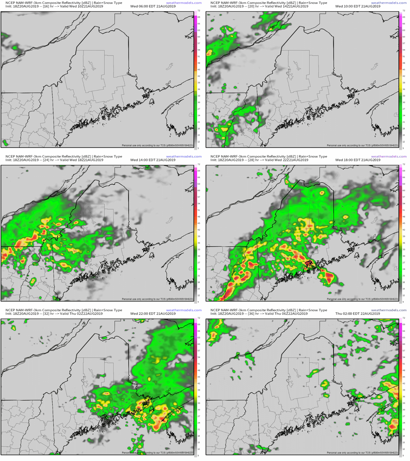
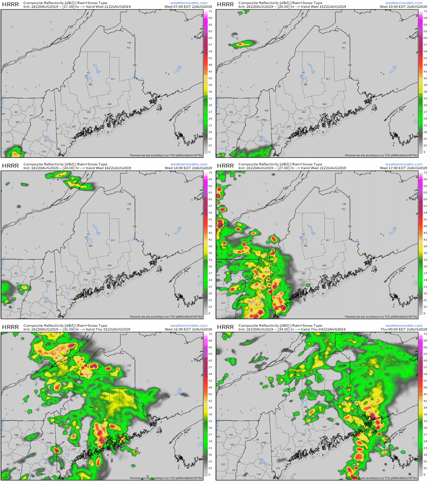
Welcome to the new followersAs with any weather of any significance, I end up with new followers on my social media outlets of Facebook and Twitter. I appreciate you coming along. My hope is that you find the information I provide useful. I am not here to reinvent the wheel of forecasting, what I try to do is give you more information that what is provided to you via smartphone apps and media outlets. I am entering my 9th year of forecasting. I'd like to think I have learned a few things over the years, but there are always challenges, and its always changing. Thanks again for coming along. If you are finding Pine Tree Weather via Facebook, make sure your page notifications are turned on in order to get the latest information from me. This is Maine. The forecast can change quickly. Just give it 5 minutes. So yes, there is a severe storm threatThe map here is that of the Storm Prediction Center's Day 2 Outlook that highlights much of the state in the SLIGHT risk category. A warm front will move into southern New England Wednesday. Humidity and dew points will rise. It will get muggy in areas. The humidity level in your region will be the first clue that something could happen. The other part, is cloud cover. Two schools of thought on how this plays outTwo things to consider here. A few isolated showers and perhaps a weak thunderstorm is possible Wednesday morning. With warm, humid air overrunning cooler, drier air, that is likely to set up some cloud cover. Wind out of the southwest has impacts on the coastal plain east of Portland as cooler, moist air is drawn off the ocean. That scenario could also create cloud cover. How this day will play out depends on both variables, clouds, and wind off the water. The NAM model here depicts just that. Showers and storms tend to be stronger over interior areas, and less impactful east of Portland. There is still the possibility for heavy showers for the coast, and thunder also. The HRRR model idea is thinking what cloud cover forms with the morning showers over southern areas will quickly dissipate and set the the idea of strong to severe storms over much of the state. Those storms would weaken into the evening as daytime heating escapes and the atmosphere cools down. Still, with warm meeting cold, a rumble of thunder is possible for eastern areas Wednesday evening.
Wednesday will certainly be an eye-to-the-sky day for Maine. Where there is sun and humidity, there is a threat for severe storms. If clouds get the upper hand in your area, you can expect some light to heavy showers, and a few rumbles of thunder. I will update on Facebook Wednesday morning. Remember... when thunder roars, head indoors! ► ► For the latest official forecasts, bulletins and advisories, please check in with the National Weather Service in Gray for western and southern areas, or Caribou for northern and eastern parts of Maine. Please consider supporting Pine Tree Weather ► ► Your financial donations are much appreciated to keep this site funded and for further development. FUNDRAISING FOR 2020 BEGINS SOON! I sincerely appreciate your support not only financially, but also in sharing my efforts with others. For more information from me, please check the Pine Tree Weather Facebook page as well as my Twitter feed. Always stay weather aware! |
Mike Haggett
|


