Warm start, thunderstorms containing heavy downpours and gusty winds Wednesday evening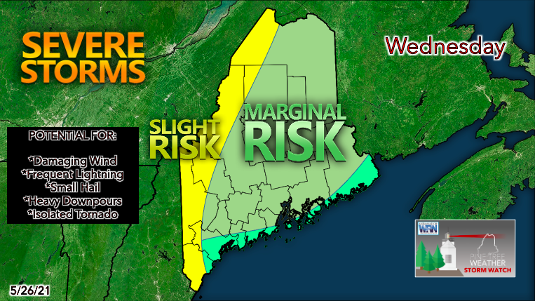 A cold front will pass through Maine on Wednesday afternoon, bringing the potential for strong storms during the evening. A southwesterly flow will carry warm, moist air over much of Maine on Wednesday morning. As the front moves through in the afternoon, the moist air mass will be lifted upwards, creating an unstable environment with lots of convection. Steep lapse rates and strong wind shear set the stage for a busy evening. Storms will be quick-moving, but they could produce high wind gusts, heavy rain, and small hail. Always look out for the chance of an isolated tornado, especially in far western Maine. 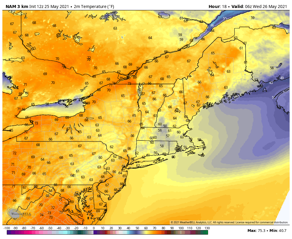 Wednesday will feel like a summer day, with daytime highs reaching the mid to upper 80s across the interior. Northern areas will be in the upper 70s to low 80s. With dew points rising well into the 60s, expect humid, muggy conditions. Coupled with the chance of strong storms, Wednesday won't be the best day for outdoor activities. 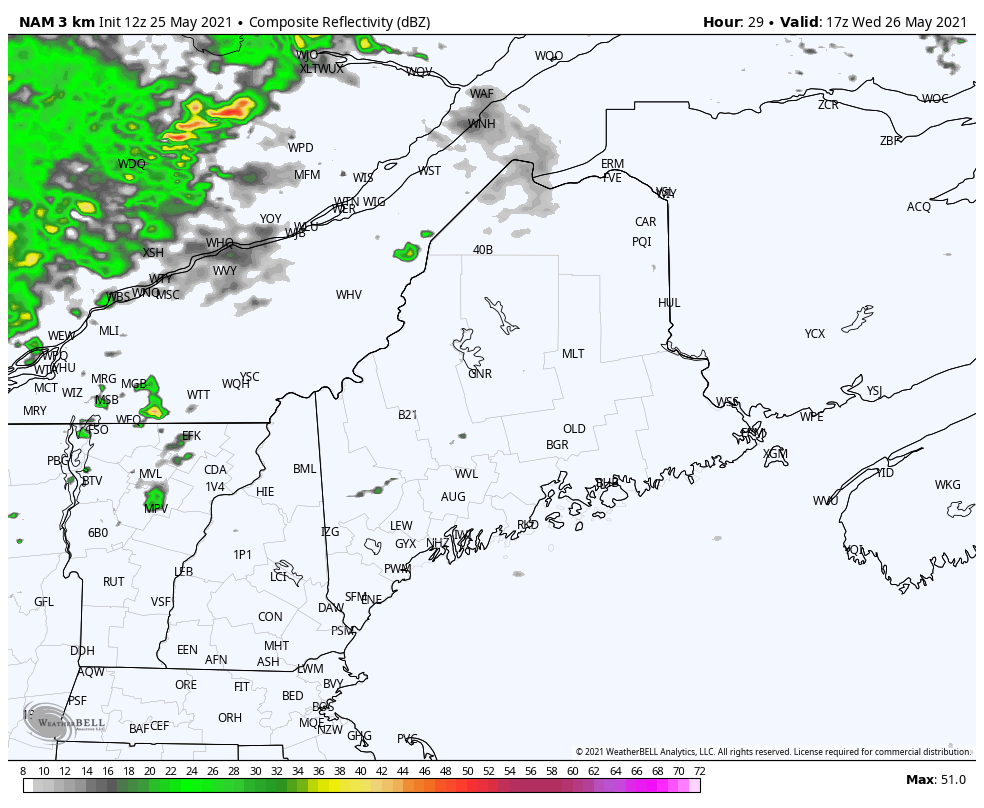 This composite radar model shows the first round of storms arriving around 4pm on Wednesday. Throughout the rest of the late afternoon and evening, storms will continue to roll through much of Maine. Things should begin to settle down early Thursday morning once the cold front moves off the Atlantic coast. Cooler on Thursday, dry conditions remain as high pressure builds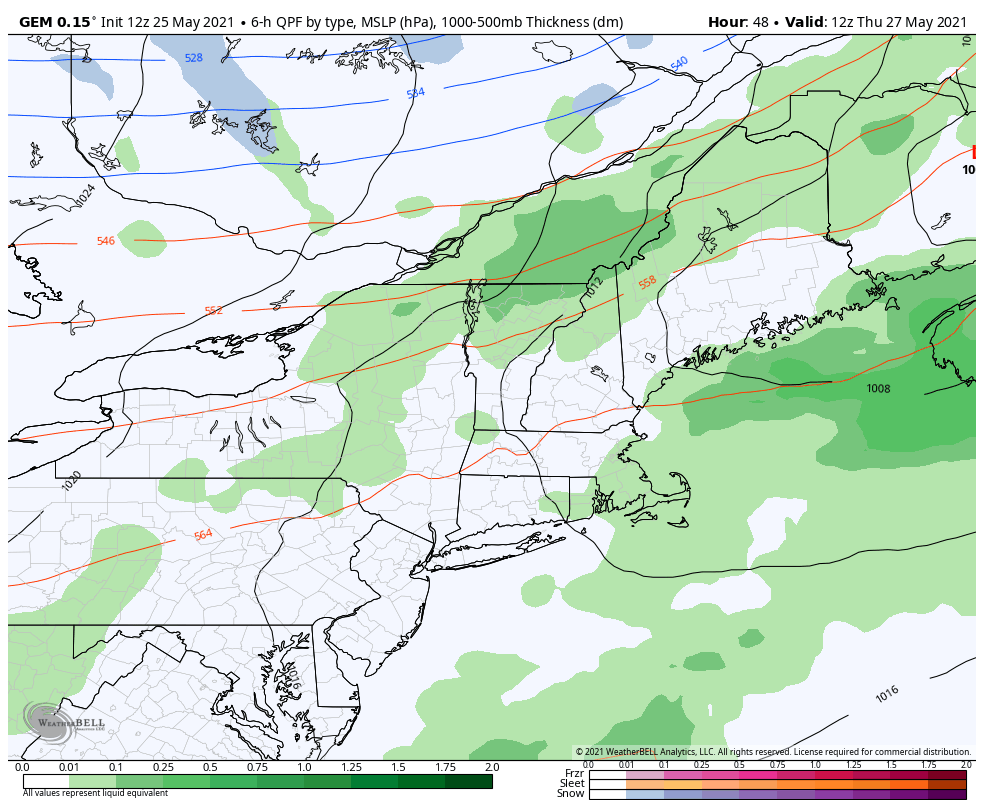 If you do not enjoy hot weather, Thursday will bring relief. The front that will pass through on Wednesday will leave temperatures much cooler. Northern areas may only reach 60F while areas further south will be in the upper 60s to lower 70s. Frost will be a concern on Thursday night and throughout the rest of the week as lows will dip into the upper 30s in the northern half of the state. High pressure will build back up, preventing more rain. 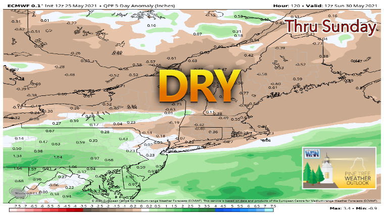 Unfortunately, the rain on Wednesday will not bring much relief to areas experiencing drought. Sinking air associated with high pressure will keep conditions dry through the rest of the work week and into Memorial Day weekend. An area of low pressure will pass to the south on Friday and Saturday, leading to some light showers and sprinkles in southern Maine, but nothing of profound impact. We will have to wait and see if next week brings potential for more significant precipitation. Below are the high/low temperature graphs for Carrabassett, Bangor, Caribou, and Portland. Wednesday is very warm, and milder temperatures return for the rest of the week. 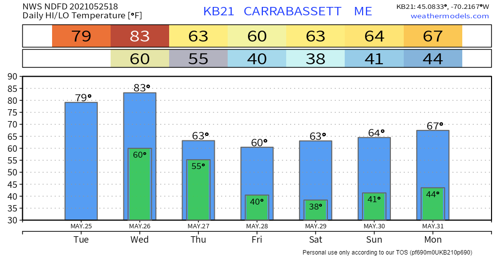 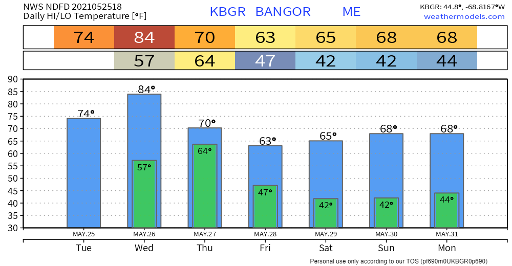 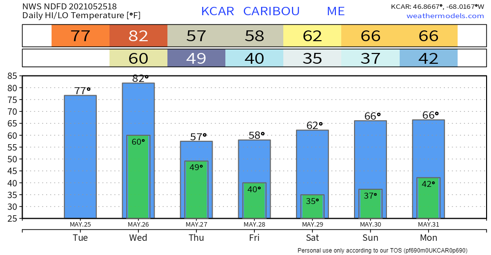 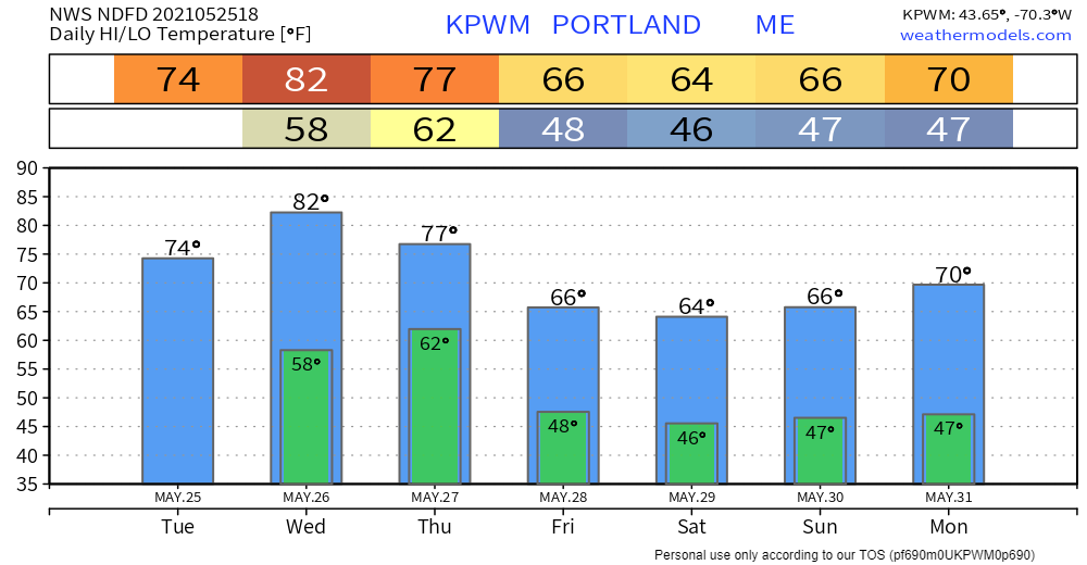 Join the weather community as a storm spotter!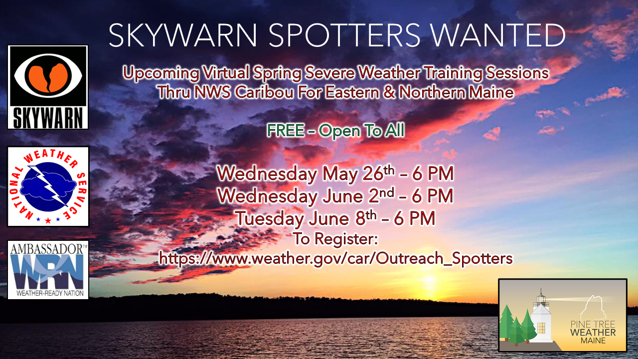 Here's a wonderful way to become active in the weather community and help the broadcast media and forecasters like myself with storm reports. This information is vital during and after an event for forecasting and alerting purposes. I can't tell you how many times I have seen the importance of these reports in the past 9+ years I have been involved. Pine Tree Weather followers have stepped up in the past and participated, and with the readership base continuing to grow, I know there are more out there. This is the spring/summer session which discusses severe weather, what to look for, and how to report it. These sessions run for about 90 minutes. They are fact filled, educational and interesting. You can get the whole family involved from the comfort and safety of home. Once completed, you will get your spotter ID, and will be ready for the season ahead. For those who trained for the winter session, this will complete your full year training. It's important to have both sessions done. The link to register is here ► https://www.weather.gov/car/Outreach_Spotters Be prepared to receive alerts and stay updated!BE PREPARED WITH A NOAA Weather Radio. For $20-$40, it could provide vital information to you when you need it. The weather bands are standard on most public safety scanners, and newer scanner models. Weather radios can be programmed for auto alert. Click here for more information.
For more information in between posts, please follow Pine Tree Weather on Facebook and Twitter.
Thank you for supporting this community-based weather information source which operates by reader supported financial contributions. Stay updated, stay on alert, and stay safe! |

Mike Haggett
|