Slight risk of thunderstorms Wednesday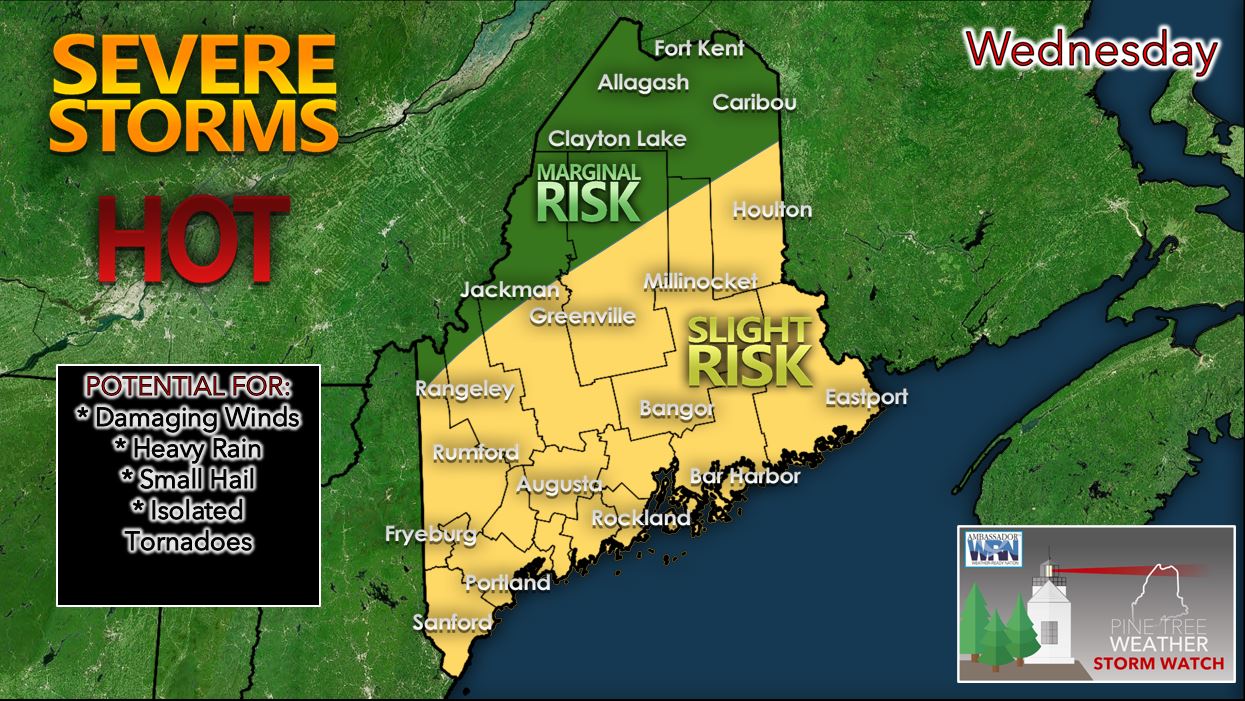 A cold front dropping down from Canada on Wednesday should help to provide the necessary additional instability needed for some severe thunderstorms across the state. Much of the state should be in the warm sector out ahead of that cold front which should allow for ample low-level warming, atmospheric energy (CAPE), and moderate atmospheric shear. These are all necessary ingredients for severe weather; therefore, NOAA's Storm Prediction Center has put much of the state in a slight risk of severe weather. The north and northwestern parts of the state currently are placed in a marginal risk area for severe weather. The main threats tomorrow with the severe thunderstorms that do develop should be damaging winds, heavy rain, and small hail. However, given the moderate amounts of projected 0-6 km shear, an isolated tornado or two cannot be ruled out. 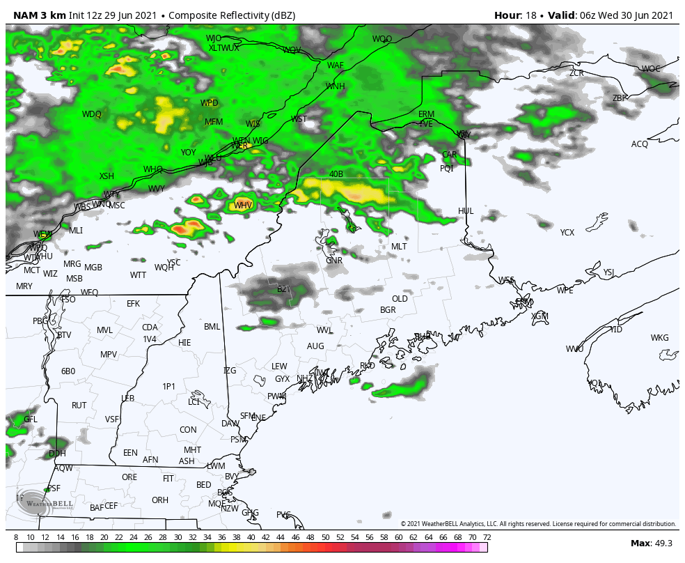 After an area of showers and light rain moves through primarily the northern half of the state Wednesday morning, we should then see the daytime heating ensue with severe thunderstorms possible statewide as we head into Wednesday afternoon and evening. High temperatures on Wednesday should be slightly cooler but still well above average. Expect high temperatures to reach the upper 80's to lower 90's for the Midcoast and Downeast Maine. Temperatures in the 70's and 80's are expected across the northern portions of the state. Wednesday night expect some leftover showers with patchy fog possible in the areas that see partial clearing. More seasonable with rain showers expected Thursday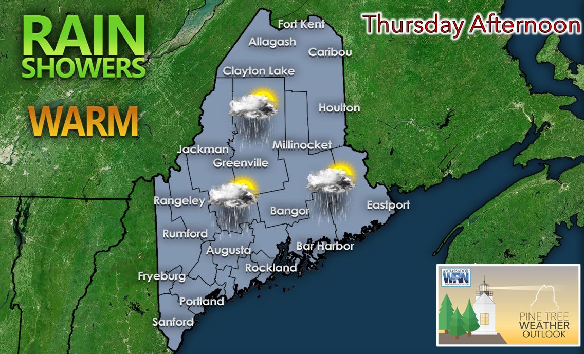 The cold front on Thursday should stall offshore keeping us unsettled with more seasonable temperatures expected. Expect a mix of sun and clouds with showers across much of the state on Thursday with high temperatures primarily in the 70's and 80's expected. Despite the more seasonable temperatures, conditions will still be humid across much of the state providing little relief. Thursday night into Friday we could see another round of showers and steadier rain possible mainly across southern Maine. Previewing the holiday weekend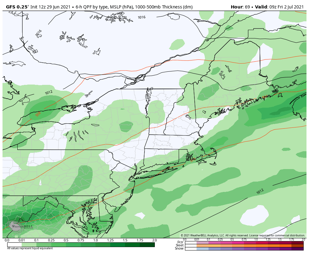 This weekend we remain in an unsettled weather pattern due to an approaching upper level trough from the Great Lakes that should become cut off while approaching New England. This should allow a series of disturbances to track just offshore and move off to the northeast. Therefore, there will be a chance for showers each day especially for southern Maine and for many of the coastal communities. However, the holiday weekend should not be a complete washout by any means! We will be seasonably cool throughout the weekend statewide as well with lower dewpoints expected making conditions feel more comfortable. You can expect temperatures statewide for each day this holiday weekend to be primarily in the 60's and 70's. Monday looks to be the nicest day of the holiday weekend at this time with a mix of sun and clouds and highs in the 70's! Temperature outlook through the holiday weekend The plots below show the projected daily high and low temperatures over the next 10 days for Carrabassett, Bangor, Caribou, and Portland. After yet another heat wave that has occurred across many portions of the state early this week, we will see temperatures start to drop down to more seasonable levels heading into the Fourth of July weekend. Thursday and Friday should see more seasonable temperatures with a chance of rain especially for coastal locations. A series of disturbances will traverse the state into the holiday weekend resulting in ample cloud cover and the chance for showers across much of the state which should keep temperatures below average for this time of year. Temperatures look to be seasonable to slightly above average heading into the early part of next week. 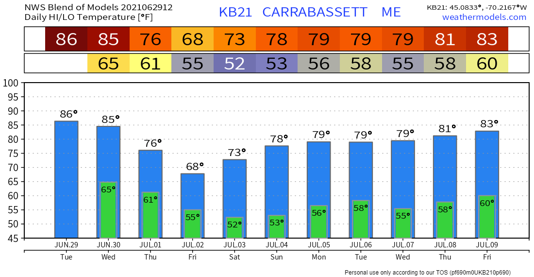 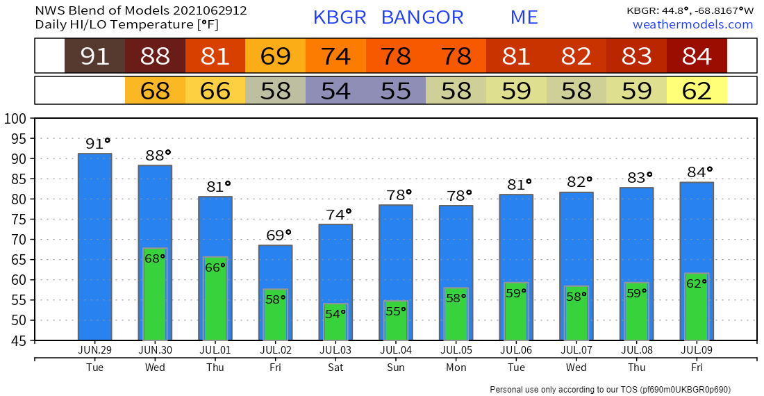 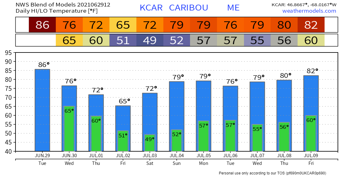 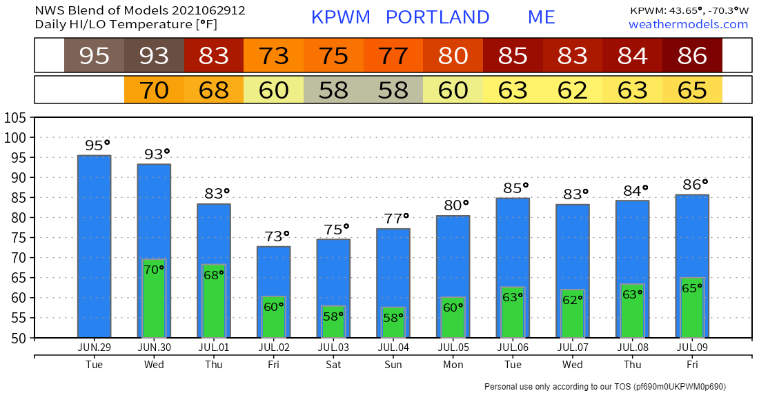 Practicing heat safety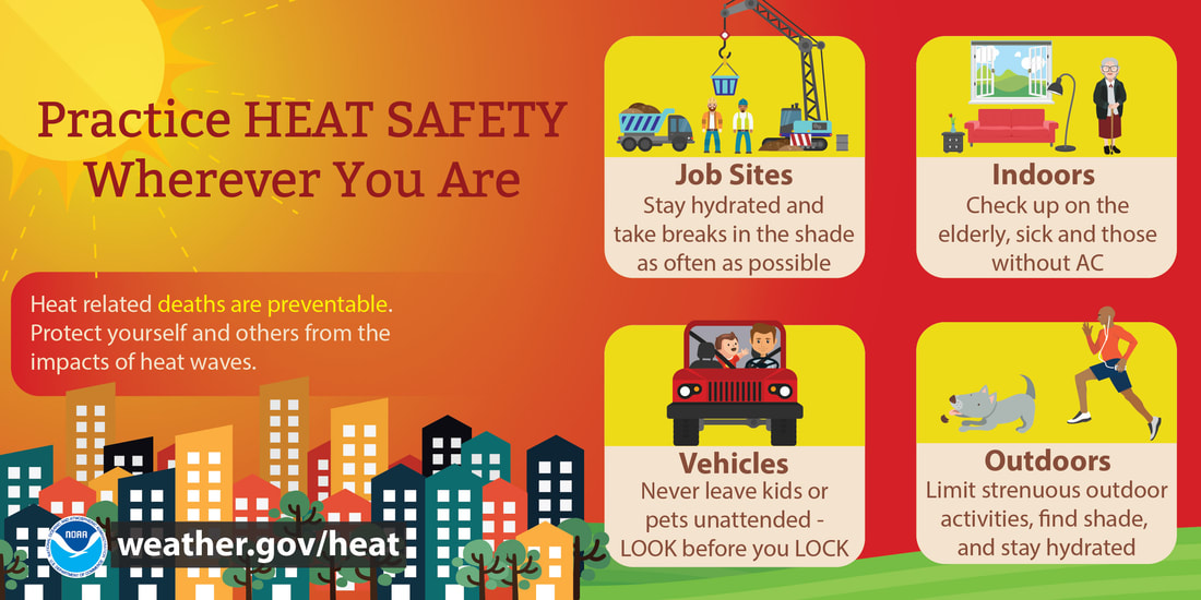 Heat is one of the leading weather-related killers in the United States, resulting in hundreds of fatalities each year. Heat can be very taxing on the body; check out the heat related illnesses that can occur with even a short period of exposure. Everyone can be vulnerable to heat, but some more so than others. www.weather.gov/safety/heat Be prepared to receive alerts and stay updated!
For more information in between posts, please follow Pine Tree Weather on Facebook and Twitter.
Thank you for supporting this community-based weather information source which operates by reader supported financial contributions. Stay updated, stay on alert, and stay safe! |

Mike Haggett
|