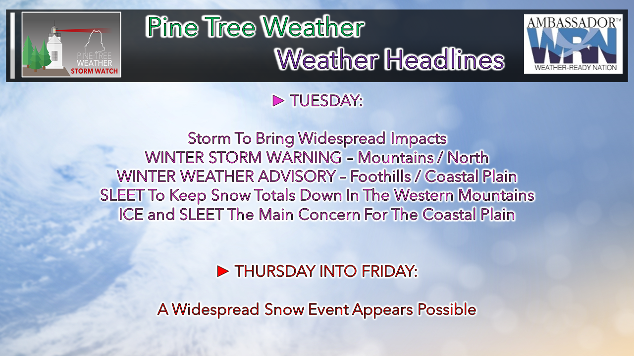
 Storm track has moved in a bit closer to the shorelines, and consequently that changes the outcome for this event. Sleet and ice is likely to cut down on snow totals, and make the roads, parking lots and walkways a skating rink in areas. Falls from slippery ice is the number one reason why folks end up in the emergency room at the hospital during the winter months. Do be careful and use extreme caution. This is an mPING event day... we need your reports! Details after the forecast. Storm to be a quick hitter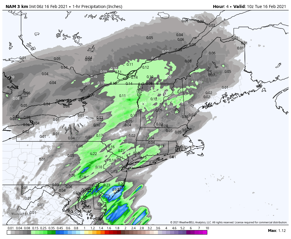 For southern areas, this bulk of precipitation is over by early afternoon. Eastern areas see it taper down by early evening. For the north and mountains it appears to be closer to midnight before the steady precipitation ends. It appears that all four precipitation food groups are in play here. 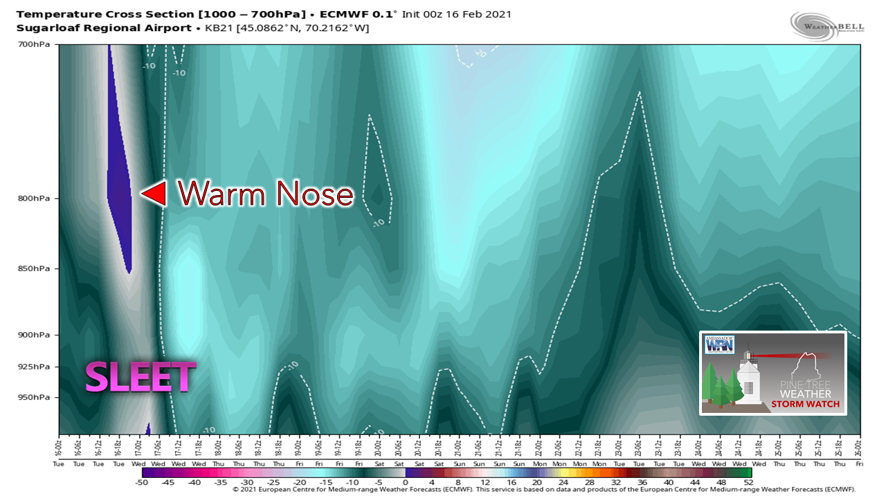 Looking at the atmospheric thermal profile forecast from the European model shows the warm nose working in between 5,000 - 10,000 feet, which changes precipitation type there. Sleet appears to cut down on the snow totals over the western mountains, but the good news is that the bulk of the precipitation remains frozen for the ski hills. 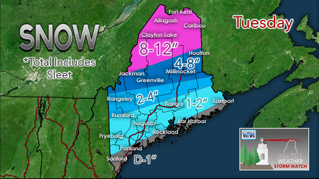 With the inland shift of the warm nose, the amount of frozen precipitation changes. Far northern areas have the best chance to stay mainly snow. 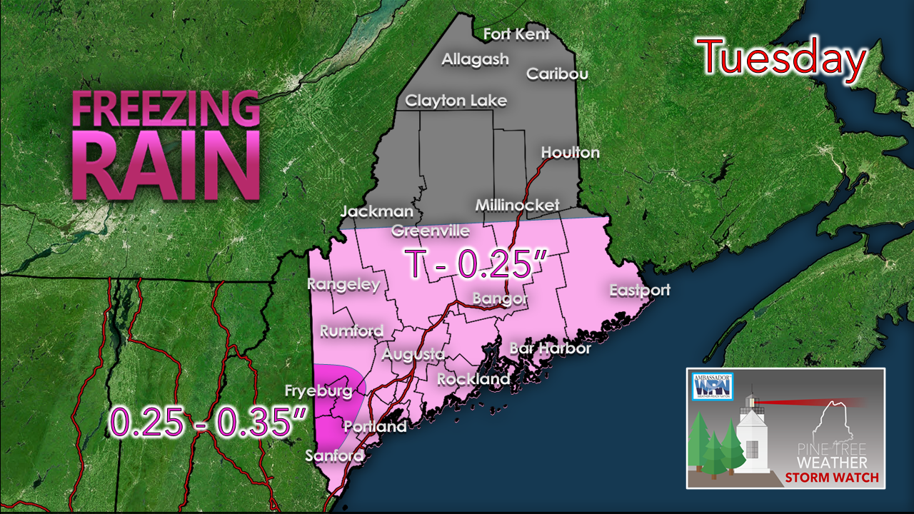 Best chance for the most ice would be for the southwest interior, with potentially trace ice as far north as Moosehead and East Grand Lake. Important to note for the southwest coastal areas: a coastal warm front appears to meander back and forth during the day which would move temperatures above and below freezing. This may tease you into thinking it is safe to venture out. Be advised that temperature and conditions are likely to vary within short distances. Also important for all areas is that once the bulk of precipitation is over, pockets of drizzle and/or freezing drizzle could form. Until the cold front pushes through tonight, the risk of icing continues. 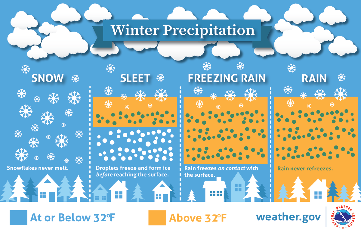 A colder shift on the storm late week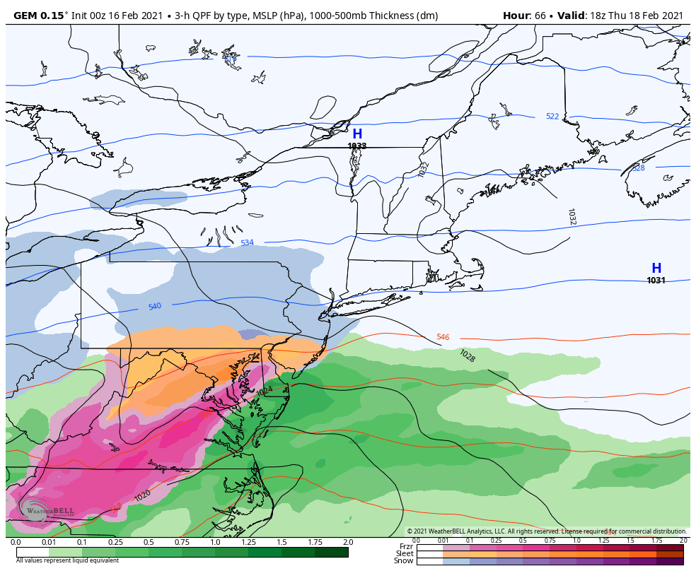 What was looking like a mixed bag event has turned cooler. Deterministic models like the one shown here shows the potential track passing just slightly north of the benchmark 40° N / 70° W point. Ensemble ideas are heavily favoring a closer track to the coast, however, so at this point it is not a slam dunk that this stays all snow. I'll get into this one after our current storm passes through.  mPINGers needed for this storm!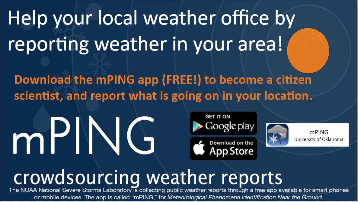 Check out mPING (Meteorological Phenomena Identification Near the Ground) project. Weird name, cool app! You can report the type of precipitation you see where you are. No need to measure! Use the free mobile app to send reports anonymously. Reports are automatically recorded into a database, which improves weather computer models. The information is even used by road maintenance operations and the aviation industry to diagnose areas of icing. mping.nssl.noaa.gov Freezing Rain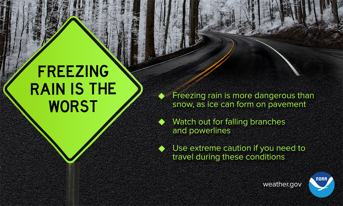 Compared to a typical snowstorm, freezing rain is much more hazardous — especially on the road. While both are dangerous, it’s far easier to lose control of your vehicle on icy pavement, not to mention the increased risk of falling branches and powerlines. Bottom line: do not drive if there is, or recently was, freezing rain. weather.gov/safety/winter Be prepared to receive alerts and stay updated!
For more information in between posts, please follow Pine Tree Weather on Facebook and Twitter.
Thank you for supporting this community based weather information source which operates by reader supported financial contributions. Stay updated, stay on alert, and stay safe! Thank you as always for your support! - Mike |

Mike Haggett
|