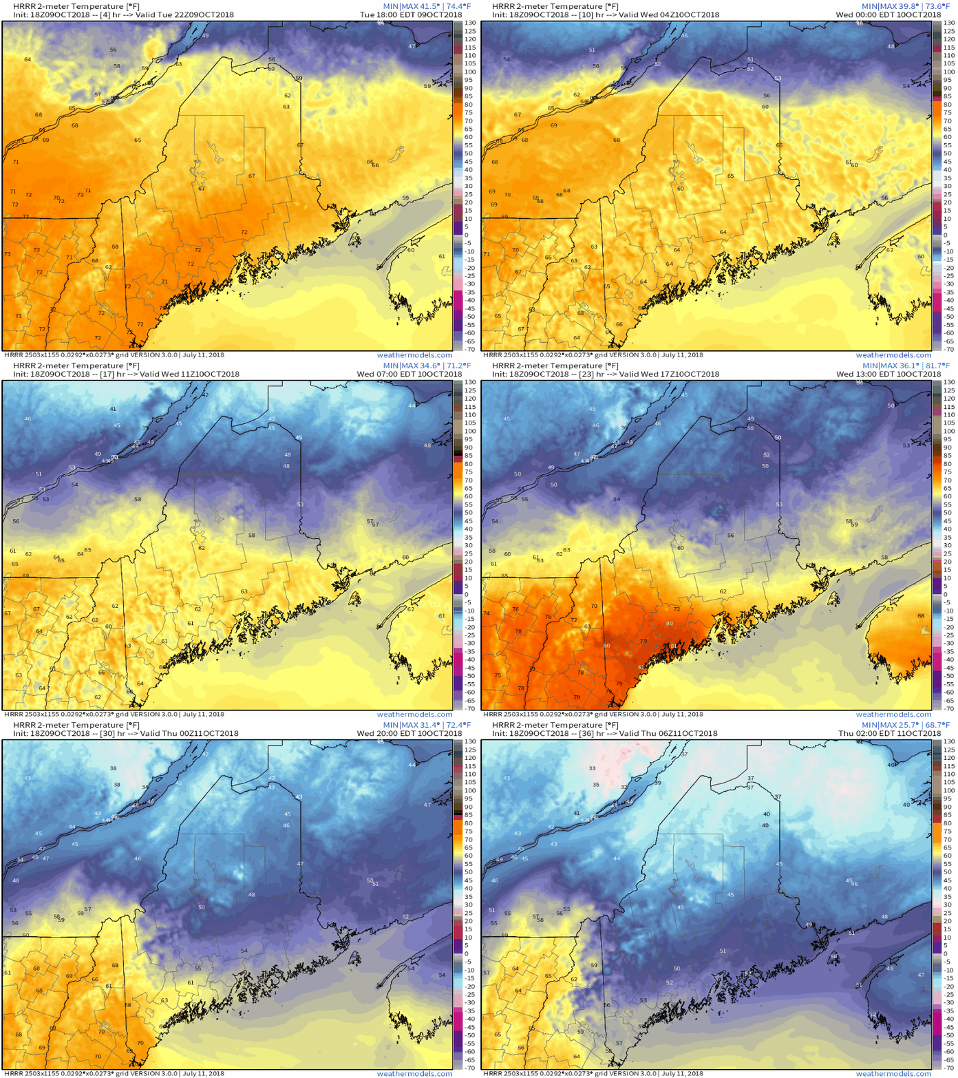
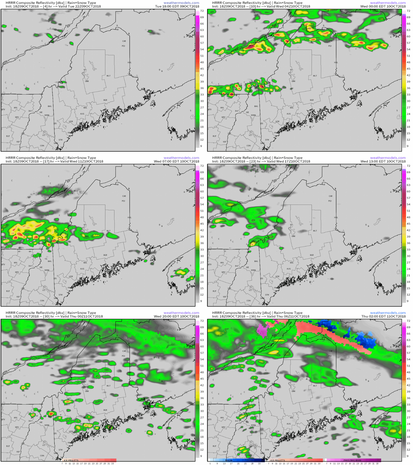
Enjoy the foliage while we have itMany places in the north country hit peak foliage for the Columbus Day Weekend, and the rest of the state is following rather quickly. While southern areas may get one more taste of "Indian Summer" on Wednesday, northern and western areas are likely done with anything close to 70° until next spring. As I mentioned in an earlier post here today, a stormy period is ahead. Temperatures gradually crash through WednesdayThese types of cold fronts are typical in spring and fall around these parts. Wednesday will be a classic day where Frenchville / Fort Kent will struggle to get to 50° while Fryeburg / Portland south will be headed to the beach. Temperatures gradually drop over northern, western and eastern areas through the day, and for southern areas, into the evening. It will be temperature whiplash for southern areas especially between Wednesday afternoon and Thursday morning. Some scattered showers for the day... even some sleet.As the front sags south, it won't come gracefully. I suspect there will be a few thunderstorms in the mix for western and eastern areas in the afternoon as the boundary filters downward. I can't rule out a potential isolated strong to severe storm in the midst of it given the sharp temperature difference. Whether or not southern areas get any of mother natures fireworks depends on the progress of the front, which knowing how cold air tends to be slow in moving may quell the threat. Regardless, there is a chance, so be on alert in case something develops. As temperatures drop, folks in the Saint John River Valley may get a touch of sleet and/or snow as we head into Thursday morning, pending on how quickly the mid to low levels of the atmosphere cool off. While this may come as a bit of a shock, we're about on time for some amount of wintry precipitation being measured in the roof top region. Your support is appreciated!Thanks to the generous contributions of several followers with their checks and Patreon support, I have been able to pay to keep the website going for another year. I am still short on paying the bills for the weather data and graphics that I use to make this as professional an operation as I can. My yearly budget is $3,300 and I am at about $2,200 in funds raised so far. I would love to reach my yearly goal before the holidays kick into high gear. Since you folks have blessed me with your financial support, I would like to pay part of it forward to some folks in need. I can do that with your help. I have faith that the goal will be reached with your support. Please message me on Facebook or Twitter about sending a check, or you can set up a MONTHLY donation on my Patreon page. Thank you!
For the latest official forecasts, bulletins and advisories, please check in with the National Weather Service in Gray for western and southern areas, or Caribou for northern and eastern parts of Maine. For more information from me, please follow the Pine Tree Weather Facebook page and my Twitter feed. Always stay weather aware! - Mike |
Mike Haggett
|


