
Ocean storm slowly moves eastThe storm that has lurked offshore of southern New England since Wednesday will slowly begin to move eastward Friday and clear the region Saturday afternoon. A weak cold front slides through the state Saturday night. Sunday is the pick of the weekend with sun and warmer temperatures. 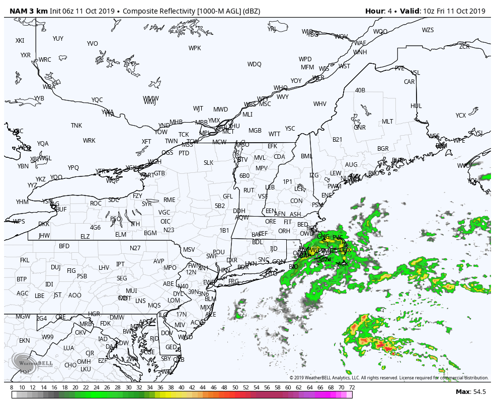 The coastal plain runs the risk for showers Friday. Showers expand over the rest of the state Friday night. By Saturday morning, western and southern areas dry out. It will be Saturday evening by the time the bulk of shower activity leaves eastern and northern areas. The western mountains may pick up a shower or two overnight Saturday into early Sunday from the weak cold front. 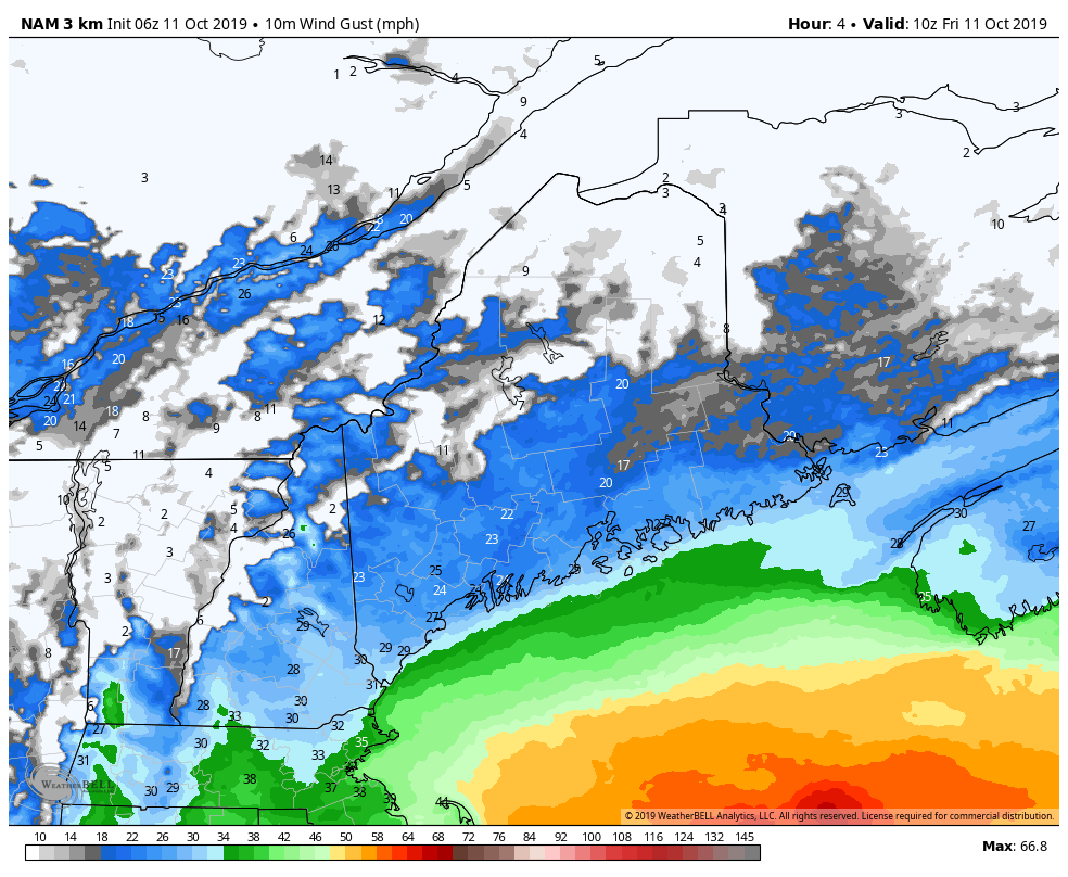 A gusty wind along the coast continue in the 15-25 mph range, with 30+ mph possible along the shorelines. As the storm moves east, the wind slowly diminishes, settling down by Saturday evening. 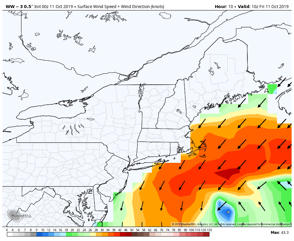 High surf and rip current advisories remain in effect until 6 PM Friday for the southwest coast, 6 AM Saturday for DownEast areas. A coastal flood statement has been issued for the shorelines south of Portland for splash-over and minor beach erosion through 1 PM Friday. The ocean waves slowly recede Friday night and Saturday, then settles by Sunday morning. Temperatures cool until SundayTemperatures for Friday will run mainly in the mid to upper 50s statewide with a few places reaching 60. Overnight lows into Saturday morning will mainly be in the 40s, with 30s possible in the mountains up into the Allagash. Saturday will be a chilly one, with 40s and 50s the high point statewide. Sunday starts off in the 40s, with 50s the high for the mountains, north and DownEast and 60s for southwestern areas. Phasing event could bring a strong storm midweek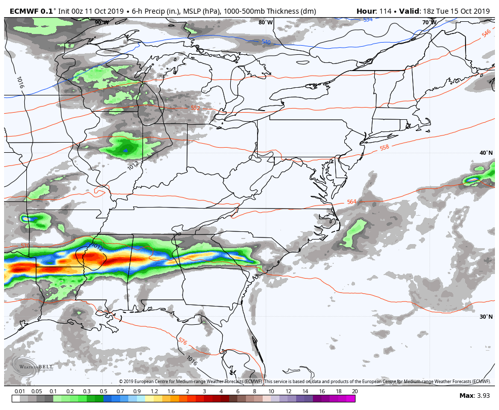 After a couple of mainly dry days to start the week, the northern jet stream sinks and the southern jet stream rises and as the two come together, a strong storm is likely to develop. The question at this point is where the phasing of the two streams occurs. At the very least, there is a reason to believe that the area will get some rain and at least a breeze out of this Wednesday into Thursday. With the energy associated with the two streams coming close to the proximity of Maine, this is definitely a storm to stay updated on as it could develop into a potent one. Stay tuned for updates! Taking a break over the weekendI am going to pause for a bit after this six day stretch and get caught up on some rest and spend time with the family. I may drop a quick update in on Facebook or here, if warranted.
I encourage you to explore the website with all of the new pages and features that I have added over the past week. ► ► For the latest official forecasts, bulletins and advisories, please check in with the National Weather Service in Gray for western and southern areas, or Caribou for northern and eastern parts of Maine. ► ► DONATION DRIVE UPDATE - $920 shortfall for the year ahead! You can help keep Pine Tree Weather going with a donation of any amount now through VENMO @PineTreeWeather, a monthly donation on Patreon or messaging me on Facebook or Twitter to send a check in the mail. Thank you for your support! For more information from me, please check the Pine Tree Weather Facebook page as well as my Twitter feed. Always stay weather aware! - Mike |

Mike Haggett
|


