
The Beauty of Summer in Maine Cape Porpoise, Kennebunkport, Maine All in all the Fourth of July weekend was a good one. One day of oppressive humidity on Saturday reminded us of where we are in the calendar year. Looking ahead a bit, the third week of July could be roaster, which is typical. Having grown up in Yarmouth, Clam Festival weekend is typically a steamy affair, and this year appears no different. While it will be warm and bit uncomfortable at times, rain amounts appear close to normal over the next couple of weeks. Now that the lakes and a good portion of the ocean are at a comfortable temperature for a dip, I suspect the beach spots will fill up quickly in the coming days. Pattern through the weekend As far as Maine is concerned, a frontal boundary approaches the region on Thursday and will slowly move through the area on Friday. High pressure will nose in briefly on Saturday. A cold front will cut across the northern 2/3rds of the state on Sunday. Folks with interest in the central coast region of the Gulf of Mexico will need to watch potential tropical storm Barry forming by around Thursday. There is potential for this to develop into a hurricane. The major concern with this systemr is flooding from 1-2 feet of rain over parts of Louisiana and Mississippi. For more on that, please check in with the National Hurricane Center for the latest.  Back to our region, a southwest flow ahead of the cold front will pump moisture and humidity levels up starting late Wednesday. Thursday will be a muggy day for western and southern areas, with showers and thunderstorms possible during the day. Eastern and northern areas squeak out one more dry day for the most part, with late day showers arriving DownEast by late afternoon. Friday, everyone has a good chance for rain. Thunderstorms are a concern for southern and eastern areas primarily through early to late afternoon, cloud cover dependent. By Friday night, showers and storms end over southern areas. Western, eastern and northern areas may see showers continue into early Saturday morning. The aforementioned cold front dips down from Central Quebec Saturday night and brings showers to the north for Sunday, with scattered showers to western areas, and chance for scattered showers and an isolated thunderstorm for eastern areas through the day.  The loop of forecast dew point temperatures shows potential for some 70°+ for the region on Friday. It appears we'll get a bit of a break early Saturday, but as the cold front approaches the north, a southwesterly flow will bring back the muggy conditions Saturday afternoon. Western and southern areas see more comfortable conditions Sunday, whereas northern and eastern areas appear to have muggy conditions associated with the passing front through Sunday evening. 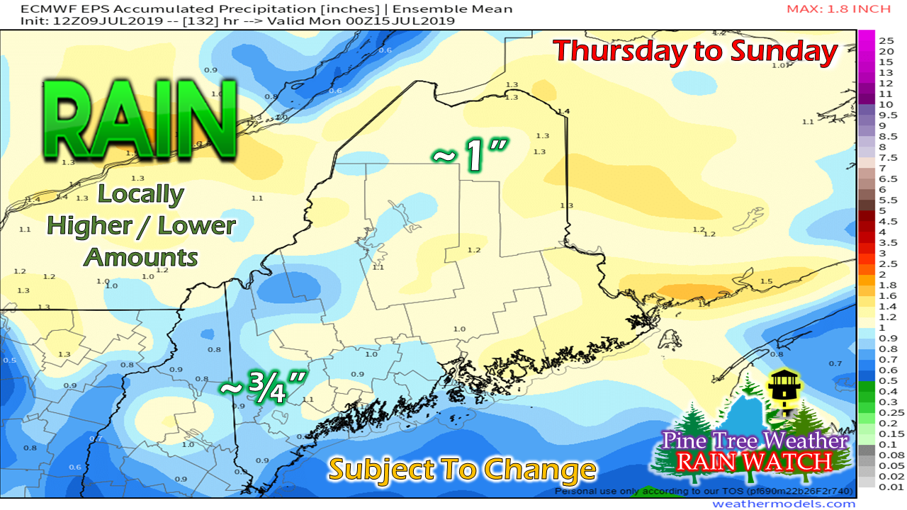 It's a fair bet at this point that northern and eastern areas will receive the most rainfall from the two frontal boundaries through Sunday. Southern areas get most of their rainfall Thursday into Friday, and for the western mountains Thursday through early Saturday. Sugarloaf Region NOAA Weather Radio Offline Until FallThe NOAA Weather Radio frequency Sugarloaf Mountain service area (Oxford, Franklin, Somerset Counties) is 162.450 MHz. The National Weather Service has two other frequencies for use while the tower is replaced. The Mount Washington tower frequency at 162.500 MHz is the first one to try. The other is the Greenville tower frequency at 162.425 MHz. Most recently produced NOAA Weather Radios and public safety radio scanners are equipped to receive transmission from any available NOAA frequency via their internal scan mode, so manual adjustments are not needed. For older models, they may have to be manually entered. If for some reason neither of the two alternate frequencies work, you can always check the National Weather Service Gray website for forecast information and severe weather bulletins. Regional outlook through the weekend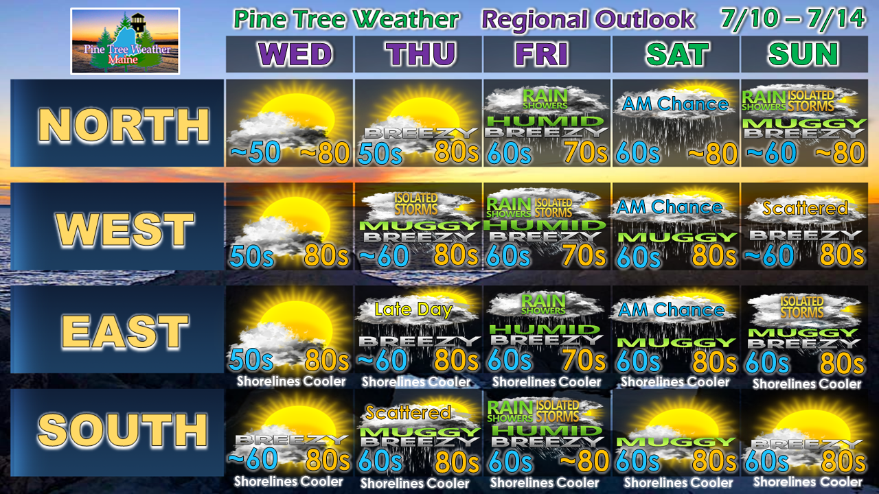 Wednesday features a mix of clouds and smoke from the wildfires over eastern Alberta and western Manitoba. A weak front passes through that may touch off a brief sprinkle over western areas. Temperatures will generally be a few degrees above normal through the five day period, with the exception of Friday where the daily highs will be a bit below normal for most.
► ► For the latest official forecasts, bulletins and advisories, please check in with the National Weather Service in Gray for western and southern areas, or Caribou for northern and eastern parts of Maine. Please consider supporting Pine Tree Weather ► ► Your financial donations are much appreciated to keep this site funded and for further development. I sincerely appreciate your support not only financially, but also in sharing my efforts with others. For more information from me, please check the Pine Tree Weather Facebook page as well as my Twitter feed. Always stay weather aware! - Mike |

Mike Haggett
|


