A few boomers possible with the frontal passage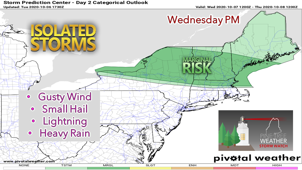 This cold front on the way could bring some isolated storms which could bring a punch in areas. For those working outside or engaging in athletics, it would be wise to have a couple ways to be notified for any storm which may become severe. 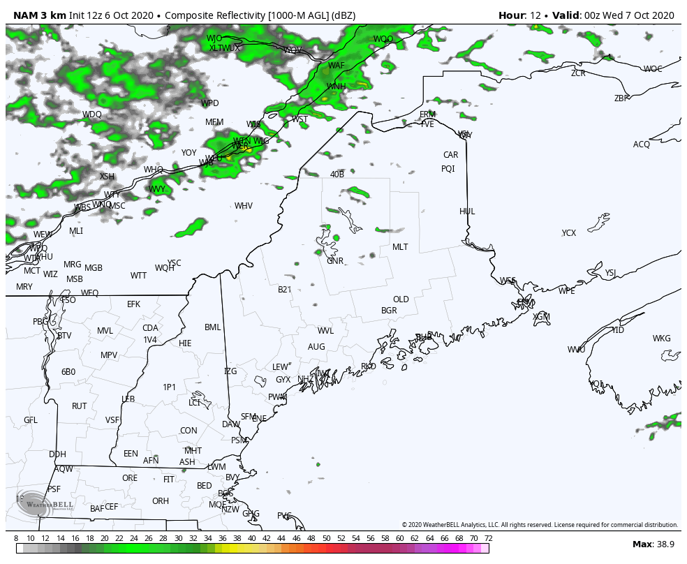 Scattered showers overspread the region Tuesday night and become more numerous towards midday and into the afternoon. The best chance for thunderstorms appears in the afternoon. The threat appears to end by around sunset. Showers in the north end in the overnight hours heading into Thursday. 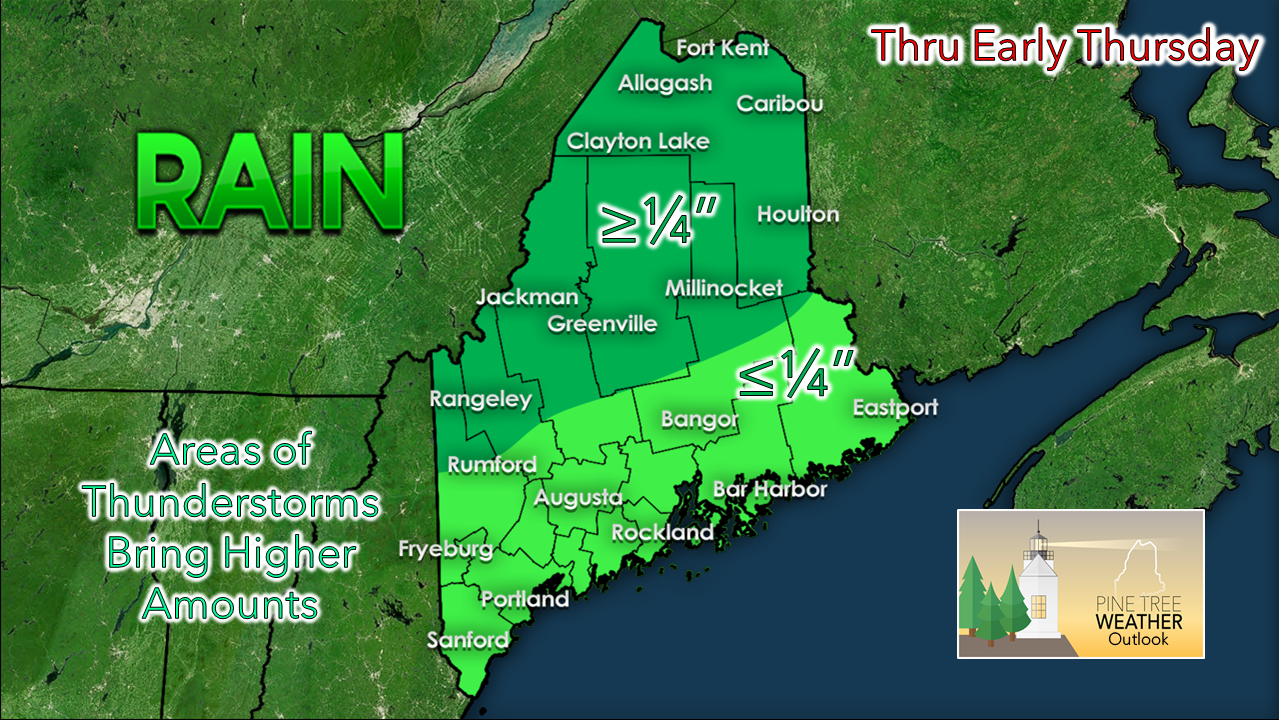 No real drought relief with this event. Isolated areas in southern and eastern areas may benefit with localized potluck amounts from any storms. Some areas in the south and east may not get much of anything out of this.  Hello there, windchill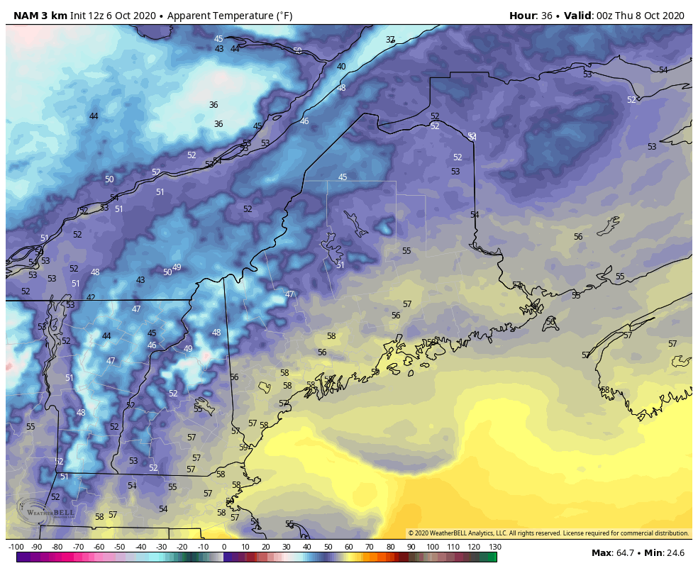 After the front passes through late Wednesday, the wind shifts to the northwest. That will usher in the coldest air of the fall season thus far. Wind chill values in the 20s and 30s for the mountains and northern areas appear likely thanks to wind speeds in the 15-25 mph range with gusts near 40 mph early Thursday morning. The wind slowly diminishes during Thursday into Thursday night. As the wind settles, temperatures drop Thursday night. Coastal areas that have not seen a freeze as of yet may see it Friday morning. Cover your mums! Next chance for showers: Saturday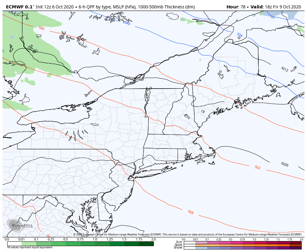 Saturday could be a classic fall day with 20°+ difference in temperature between the far north and south as a cold front stalls across the state. Northern areas may see a few flakes at the onset Saturday morning before changing to all rain. Southern areas appear to stay dry for most of the daylight hours. Temperatures may only top out to around 50° for the rooftop of The County, and may reach the low 70s for York County. I don't expect much rain to come from this event. The next chance for rain after this could be the middle to late part of next week. No relief from remnants of Delta is expected. Temperature outlook through Monday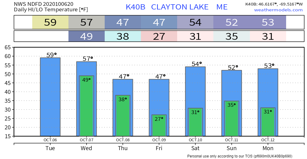 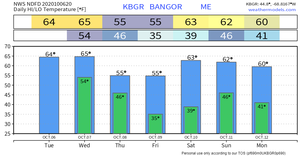 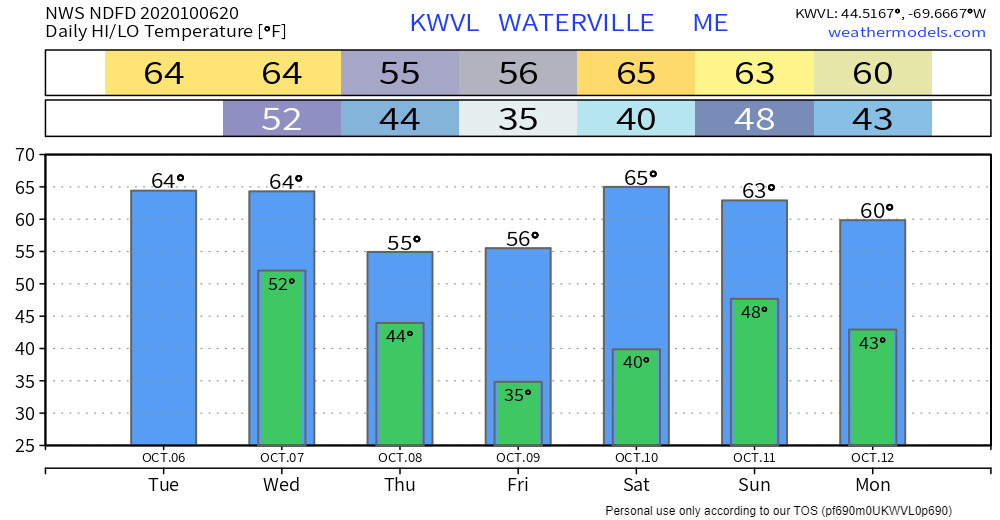 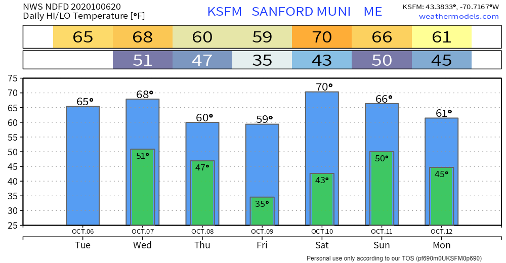 If you see a flash, make a dash to safe shelterA partnership between NOAA and the Deaf and Hard of Hearing community has yielded a fresh safety campaign slogan to protect more people from lightning strikes this season. “See a Flash, Dash Inside!” At the first sight of lightning, take shelter immediately. noaa.gov/stories/see-flash-dash-inside-new-lightning-safety-slogan-rolls-out Be prepared to receive alerts and stay updated!
For more information, please follow Pine Tree Weather on Facebook and Twitter.
** FUNDING NEEDED FOR 2021 ** Thank you for supporting this community based weather information source that is funded by your financial contributions. Stay updated, stay on alert, and stay safe! - Mike |

Mike Haggett
|