
Northern areas to get beneficial rainfall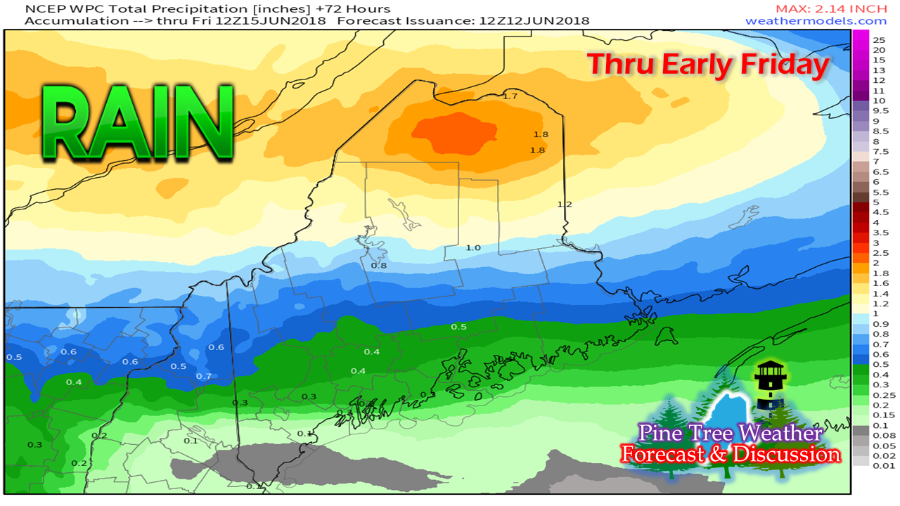 The Crown of Maine will get a decent rainfall Wednesday and Thursday as a frontal boundary becomes quasi-stationary over the state. Western and eastern areas are expected to see some shower activity which will bring some rain of benefit. As for southern areas, it will amount to "pot luck" showers and thunderstorms to determine whether or not the crops, flowers and lawns will need a watering. Isolated thunderstorms possible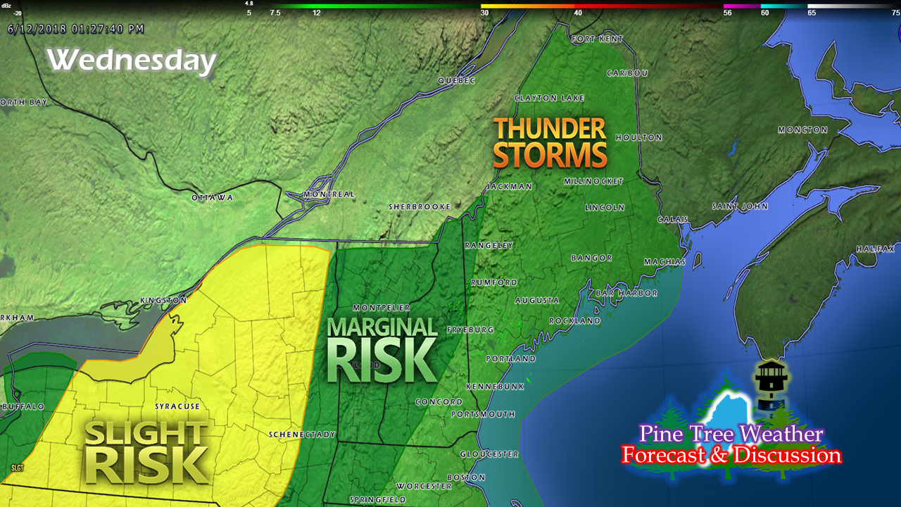 The Storm Prediction Center outlook for Wednesday indicates the potential for strong to severe weather over much of New York, with the threat diminishing further to the east. The best chance for areas of Maine to experience isolated storms will be Wednesday night into the wee hours of Thursday as the warm front moves to the northeast. The best chance for storms is likely over the southern two thirds of the state, with northern areas staying on the cooler, less humid side of the front. Showers and storms to arrive in afternoon Outside of a brief shower possible for the far north Wednesday morning, showers and storms hold off until the afternoon for northern, western and southern areas, and evening for eastern areas. As I mentioned in the update yesterday, cold air is fooling guidance as usual, which has slowed the approach of the trailing cold front from Quebec. This has thrown off timing for precipitation development, and this model idea may also be a bit off, just so you are aware. The odds will increase as the day turns into night. I will post an update in the morning on the timing of this on the Pine Tree Weather Facebook page, with more updates on Twitter as the day unfolds. Outlook for the weekend and into next week After the front clears out of the area early Friday, less humid and comfortable temperatures (indicated by the red) to start the weekend is on tap. High pressure shifts offshore Saturday night. A southwest flow develops ahead of another front that approaches the region from Quebec on Sunday. Northern and western areas may see a showers in the afternoon on Sunday. The very warm, humid air arrives for Monday (indicated by the brown) as the front works to pass through as the day unfolds, bringing a risk for showers and thunderstorms statewide. Dry air and seasonable temperatures return for the middle part of the week. Regional Outlook through Sunday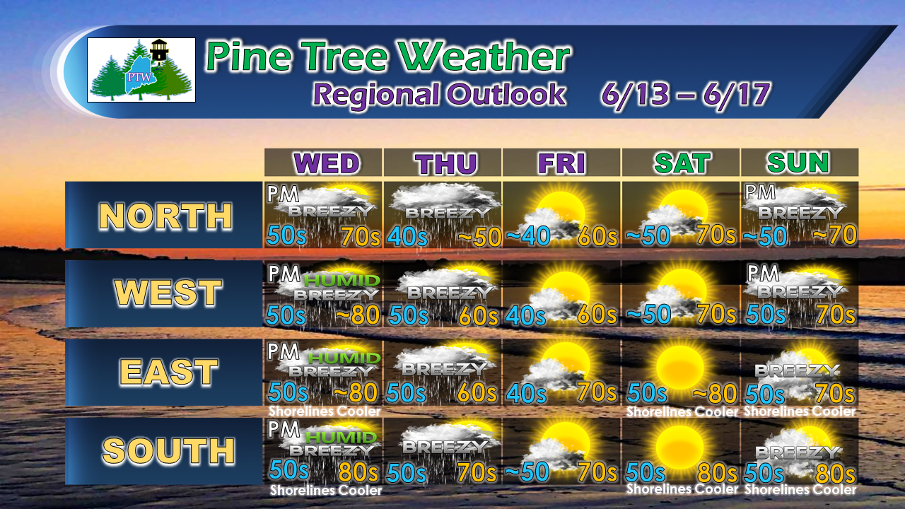 Showers and breezy conditions are likely for Wednesday and Thursday, and possible for Sunday. Folks in the far north may need to cover up plants Thursday evening in the protected valleys as frost may be possible. A sea breeze along the shorelines keeps the beaches on the cool side for Wednesday and over the weekend.  As always, stay in touch with the National Weather Service Gray for western and southern areas, and Caribou for eastern and northern areas for official forecasts, bulletins and advisories.
Thank you as always for your shares, follows, likes, retweets and reviews! - Mike |

Mike Haggett
|


