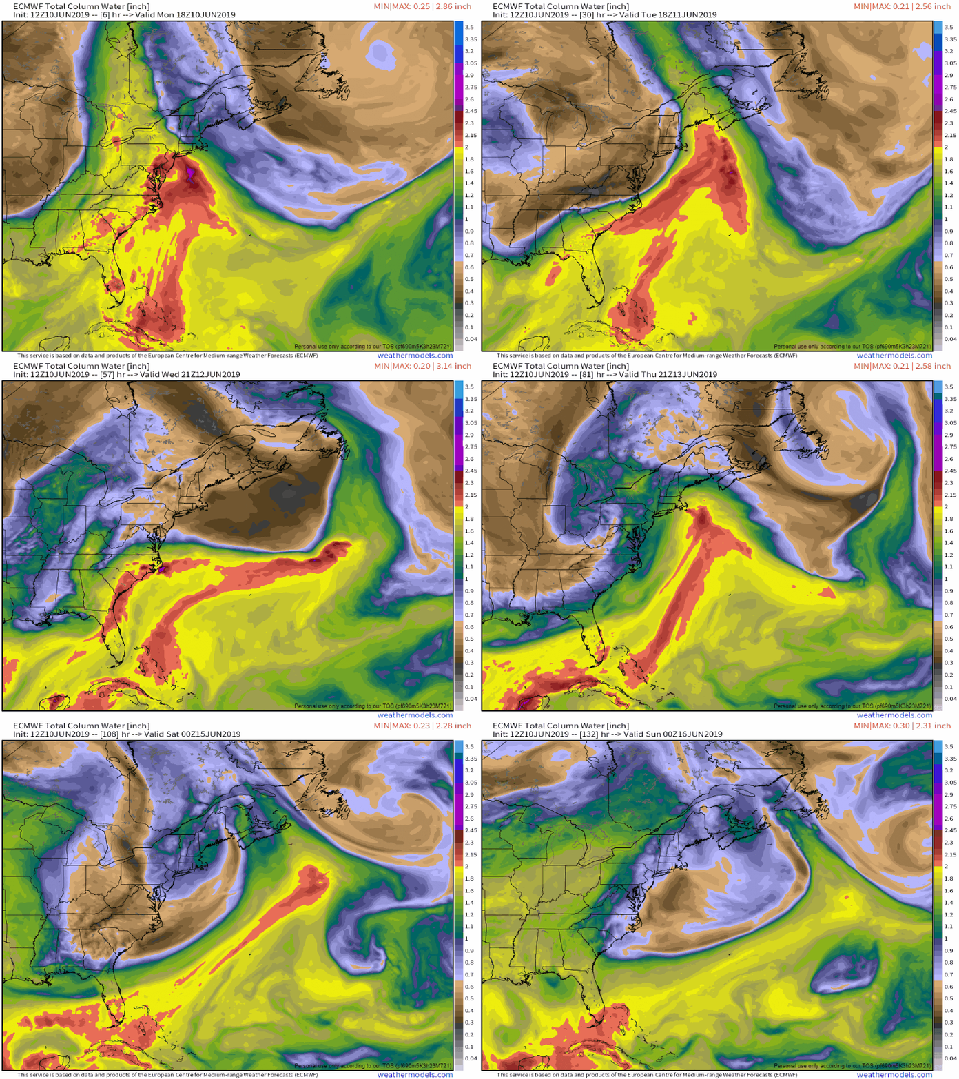
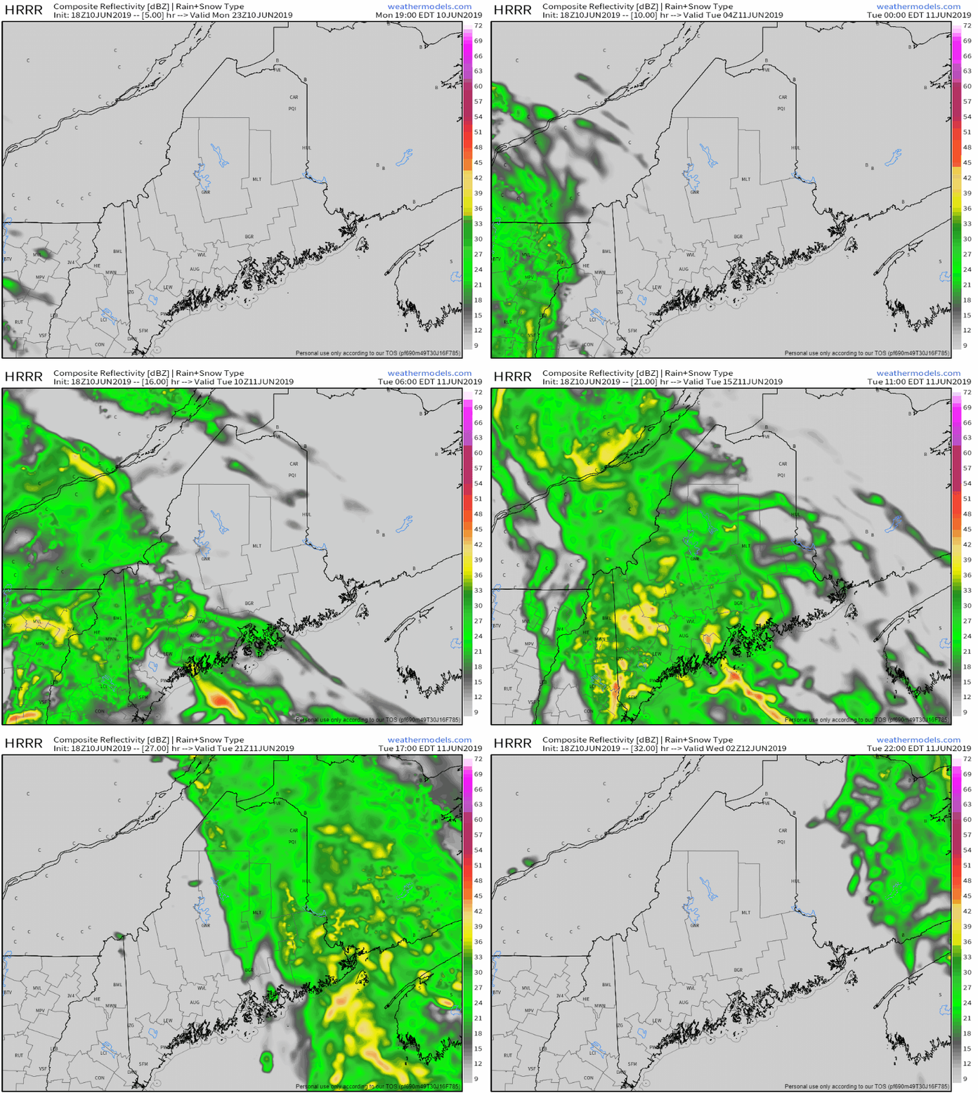
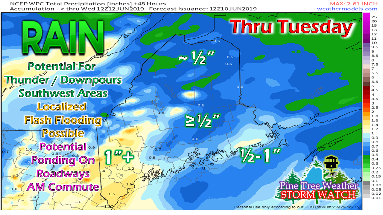
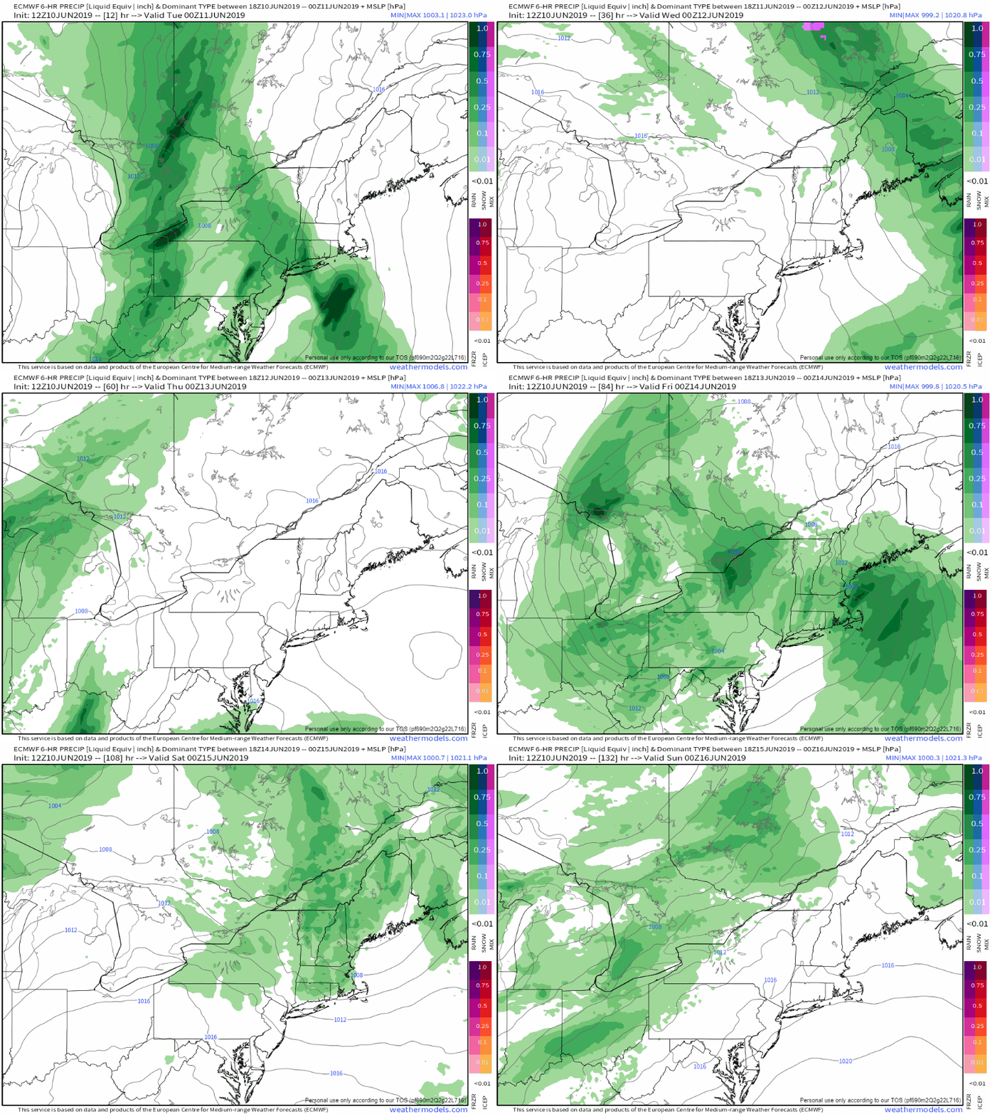
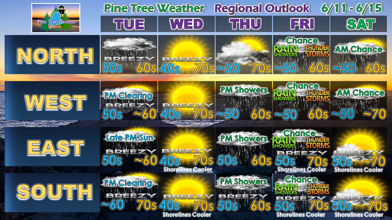
Humidity inching northwardMoisture from the tropics will be noticeable around the region Tuesday morning in the form of rising dew points and potential for downpours. This round again will be short lived as a dry, cool Canadian high precedes Tuesdays showers and will hang in there until Thursday. Another stream of moist air will try to work into coastal areas Thursday afternoon, and bring the potential for showers in the afternoon. The warm, humid air is beginning to knock on our doorstep as we head toward summer solstice in ten days. Rain could be heavy at times in southern areas TuesdayI can't call it a "Body Shop Special" since this is a rain event, but I would be cautious with the morning commute on Tuesday. With the tropical moisture in place, downpours, rumbles of thunder and localized flash flooding are all possible over western and southern areas Tuesday morning. This is a quick moving system, with western and southern areas clearing out Tuesday afternoon, eastern areas by mid to late afternoon, and northern areas may catch a sunset if the clouds clear off in time. The higher elevations and southern areas could see an inch plus of rain from this event. DownEast areas may come close to that in spots. Northern areas may see the least amount of liquid from this event, at just around ½" by the time this wraps up Tuesday evening. Showers return to end out the weekAs the Tuesday front departs, high pressure moves in Wednesday and will help dry things out with cooler than normal temperatures and low humidity. A warm front heads in from the southwest Thursday, which may bring some showers to southern, western and eastern areas in the afternoon. Showers and thunderstorms remain a possibility into Friday as a cold front approaches. A few leftover showers may linger over western and northern areas to start on Saturday. Regional outlook through Saturday► ► For the latest official forecasts, bulletins and advisories, please check in with the National Weather Service in Gray for western and southern areas, or Caribou for northern and eastern parts of Maine.
Please consider supporting Pine Tree Weather ► ► Your financial donations are much appreciated to keep this site funded and for further development. I sincerely appreciate your support not only financially, but also in sharing my efforts with others. For more information from me, please check the Pine Tree Weather Facebook page as well as my Twitter feed. Always stay weather aware! - Mike |
Mike Haggett
|

