
Time to think about hurricane season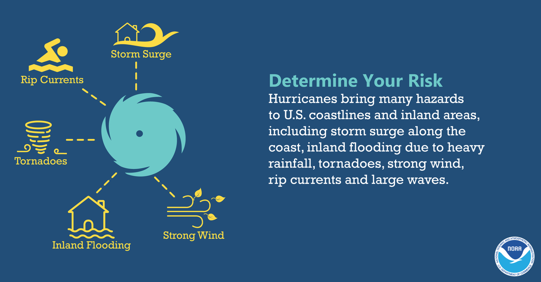 I haven't touched on the subject much since the tropics have been very quiet, but with the 31st anniversary of Hurricane Bob making landfall in Maine approaching soon, it's time to talk about it. It's been a few years since we've had anything of tropical significance affect the region. That said, we do get our share of wet and windy storms in the fall. With pleasant weather on the way for the weekend, it may be time to do some survey work around the yard. We see images at times where homes are crushed by falling trees whether in severe thunderstorms or tropical events. Flooding and trees do the most damage in bad storms, whether tropically based, or not. My family and I lived for 17 years in Poland at a house that was surrounded by trees that needed annual pruning or removal. I started trimming in the spring and chipped away at it through the summer and fall. I walk around my present neighborhood in Kennebunk and think about the possibilities of damage that could occur to property. Some folks are better at keeping up with tree maintenance than others. In addition to looking over the outside, there is checking on the storm supply kits (food, water, batteries), making sure the generator is tuned up and ready to go, and making sure the insurance on your property is where it needs to be to cover any damage. The time to prepare for storms is well in advance. While there is no threat to be concerned about at this point, the fall season usually brings a couple of gnarly storms before winter hits. No preparation will be done in vain. When the storm comes, you can have some peace of mind knowing you are prepared, and your property is ready as well. 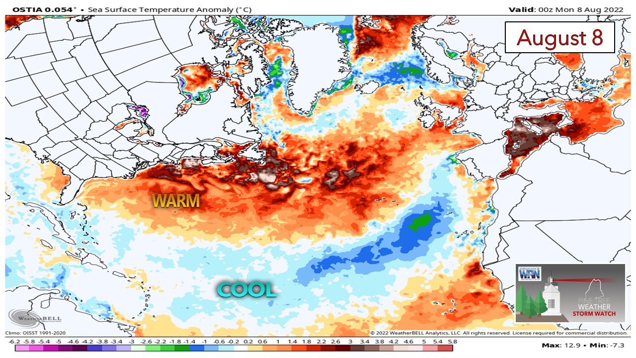 Looking at the current sea surface anomalous temperatures shows the northeast corridor well above normal, and that has been the theme for quite a few years now. With a Bermuda High set up, anything tropical that comes up the coast could keep a fair amount of intensity as a result of the warmer water. I think back to the October Gale of 2017 that smoked the region with high wind. That storm was fueled by warmer water, and that was a synoptic event. Storms feed off warmth no matter what type they are. The current cool temperatures across much of central Atlantic is one feature that has kept the tropics quiet.  Wind shear is another problem. There is very little room for storms to try to organize, let alone sustain themselves. I am no expert on tropical forecasting by any stretch, but I pay attention to those that do. The ideas I am seeing indicate a potential uptick in activity later in August, which is climatologically correct with peak of the season in mid-September. Time will tell if the shear calms down and water temperatures warm enough to ignite tropical trouble. Stay tuned, and prepare ahead. Showers along with isolated storms around Tuesday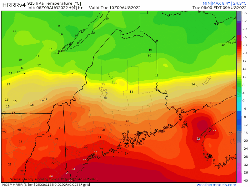 Tuesday 6 AM to 9 PM - Let's play follow the boundary here. This is low level atmospheric temperatures at roughly 2,000-foot altimeter and as can be seen, the warm air aloft is expected to sink to the south. This is important to note for potential storms over western, southern and MidCoast areas through early evening. 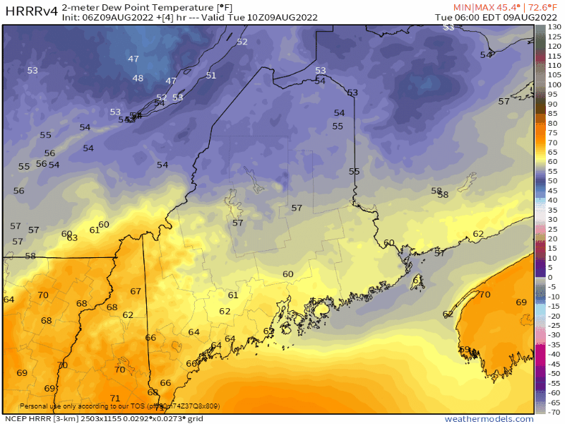 Tuesday 6 AM to Wednesday 6 PM - The other piece in this is the dew point levels. While most southern areas received a bit of a break from the humidity thanks to the back door cold front that passed through the region Monday afternoon, the quasi-stationary front is still hanging around and may move back into the north before retreating later in the day. If that does happen dew points elevate again as this model idea presents, and that adds fuel to isolated storm activity for the coastal plain and the foothills. By Wednesday morning, most areas will feel awesome with the reduced humidity, but expect that to tick back up heading into Thursday. 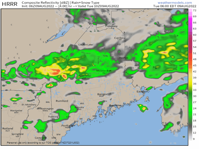 Tuesday 6 AM to Wednesday Midnight - Steady rain ends over the north by midday, with low-level clouds being the dominate feature there, although some peeks of sun may come out later in the day. The model idea notices storm potential for southern areas in the afternoon. Cloud cover may reduce the threat, but if the sun gets out, look out. Main threats for strong to severe storms are for torrential rain and gusty wind, and perhaps some hail. 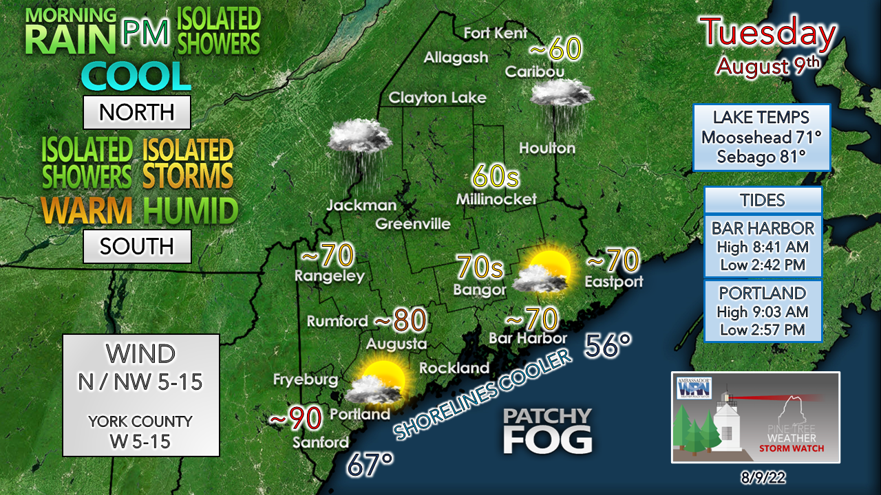 Cool and comfy to the north while southern areas feel the swampy heat again. This could be day 6 of the heatwave for York County if the sun gets out long enough to drive temperatures to 90° plus. Pending on how far north the warm front goes will dictate whether forecast highs bust on the top or bottom end. Wednesday looks to be on the cloudy side thanks to an easterly flow north of the front, with a risk of light shower activity for the mountains and foothills through the day. Temperatures appear a bit below normal for a change, which after this heat blast brings welcome relief. Cold front passage on Thursday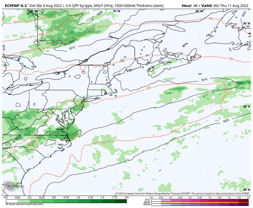 Wednesday 8 PM to Friday 8 AM - Humidity ticks upward once again as a sharp cold front works into the region. While moisture starved, there is a chance for showers and storms as it passes through Thursday afternoon. Expect a breezy and cool day on Friday as dew points drop into the low 50s bringing a refreshing blast of air in. The wind settles on Saturday with a nice weekend ahead. 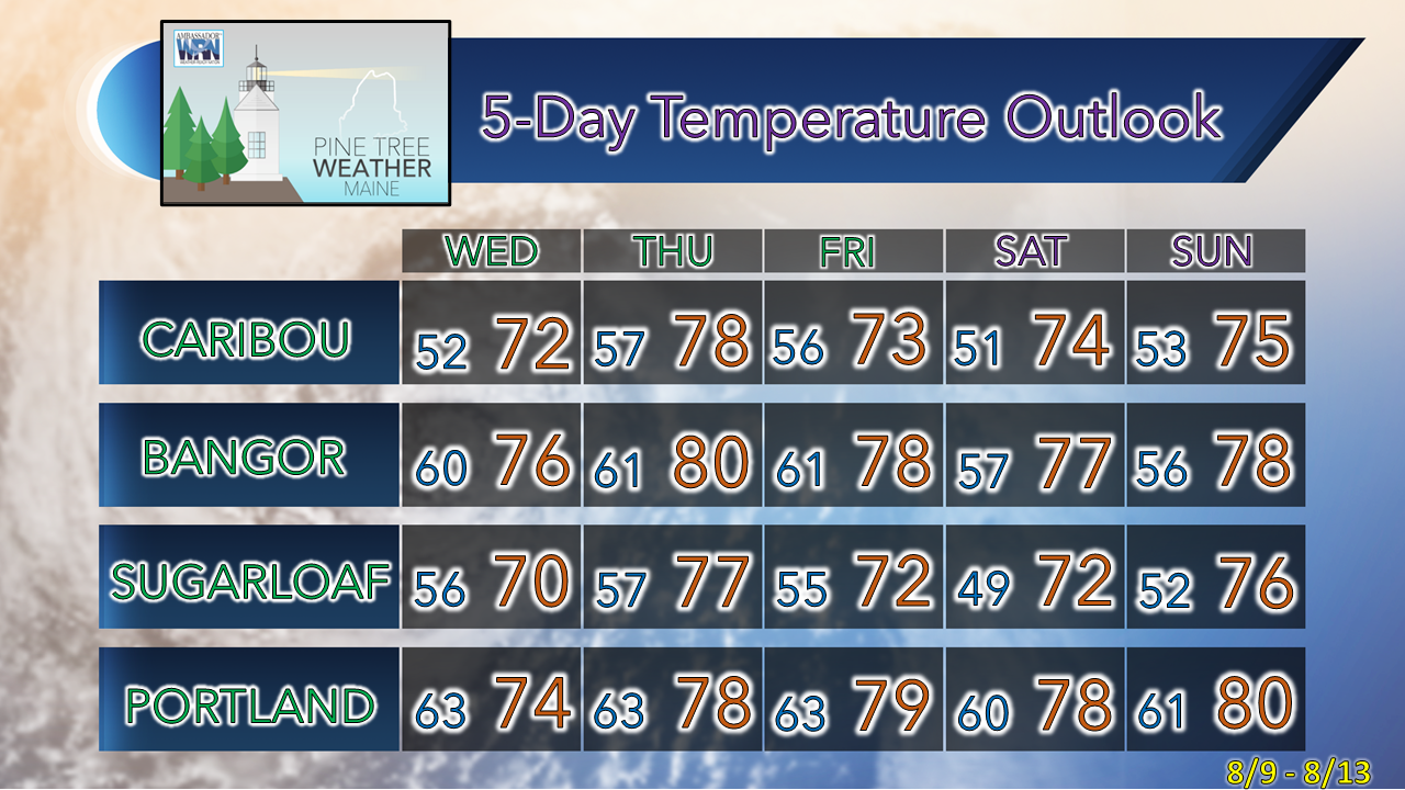 Thank you for supporting this community-based weather information source which operates by financial contributions from people like you. Stay updated, stay on alert, and stay safe! NEXT UPDATE: THURSDAY - Mike NOTE: The forecast information depicted on this platform is for general information purposes only for the public and is not designed or intended for commercial use. For those seeking pinpoint weather information for business operations, you should use a private sector source. For information about where to find commercial forecasters to assist your business, please message me and I will be happy to help you. |

Mike Haggett
|


