
Cold front advances southeast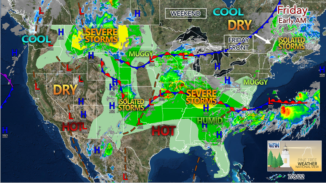 There is one hurdle to get through before the weekend and it is the cold front passing through on Friday. Once that clears out, the weekend appears dry with sun, a bit on the cool side, comfortable humidity levels and a bit breezy. After that, the air conditioners are likely to find use as heat and dew points rise heading into the middle part of the week. Isolated showers and storms around Friday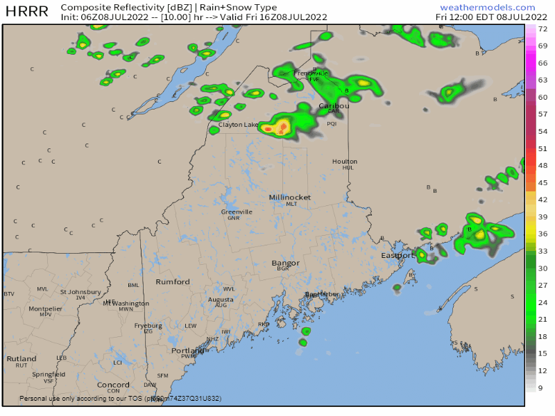 Friday Noon to Saturday Midnight - As I mentioned here Thursday, this isn't the best of set ups for storms, but the convection allowing models (CAMs) like the HRRR featured here aren't ruling out the potential. It's their design to show hints of possibility. There is a fair amount of dry air around aloft, which does two things. For one, it limits storm development. Second, where storms manage to get organized, comes the risk of gusty wind. There could be some low capped hailers that could form depending on how much convective energy becomes available. Dew point temperatures will tick upwards as the front approaches which may provide enough of a spark for isolated strong to severe storms to develop. 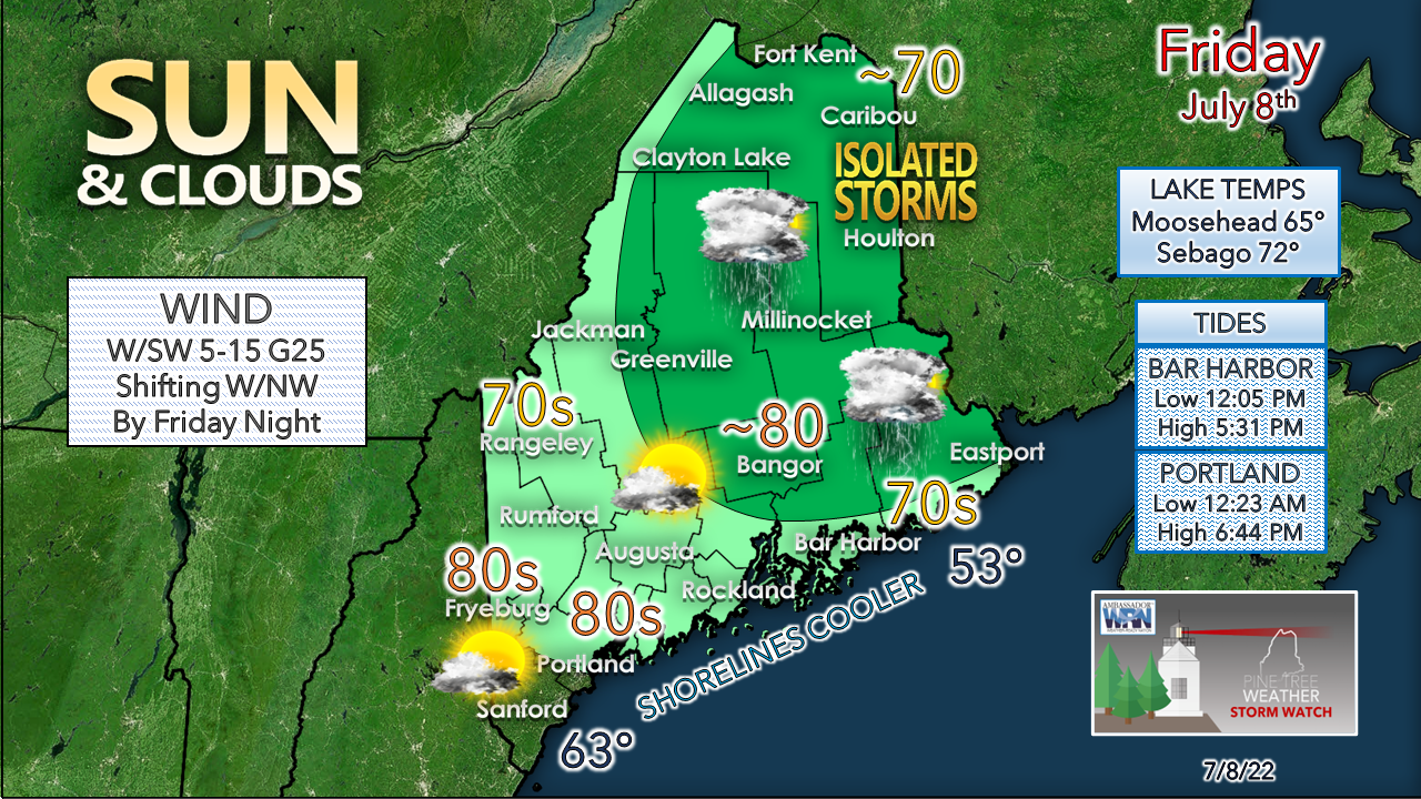 The best chance for storms is over the darker green area highlighting northern and eastern areas. The western mountains may see a couple storms as well. A pop-up garden-variety rain shower is also possible for areas north of York County through early evening. Expect wind speeds to increase through the day, and breezy conditions to continue into Saturday. Drought conditions continue to amplify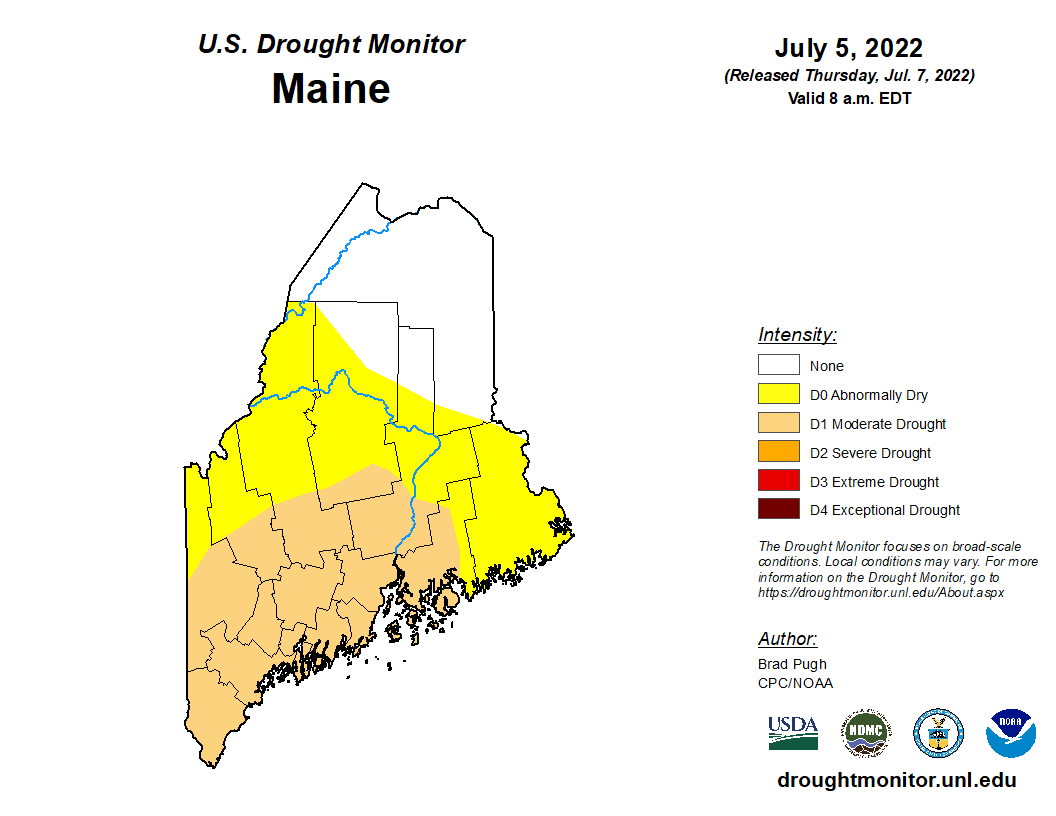 As I mentioned in Thursday's update, we are in potluck shower season, typical for this time of year. Folks who depend on groundwater resources should be in full conservation mode. The National Weather Service Gray office issued a Drought Information Statement Thursday afternoon which is the long form version of what I have previously discussed. Expect dry conditions to continue into the near future. Rain and storm chances increase next week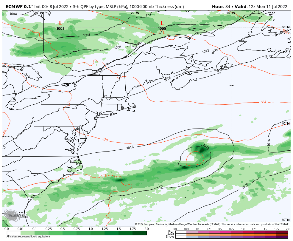 Monday 8 AM to Wednesday 8 PM - If there may be a sign of remote hope some rain of benefit, it may come in the middle to late part of next week. Warm and humid air associated with a ridge from the south is expected to move into the northeast. An upper-low sinks over the southeastern part of the country and becomes cut-off, which holds the warm ridge over the region. A cold front approaching from the northwest tries to squeeze the heat and humidity out but may end up getting stuck and become stationary to the north. The sum total of this is the chance for showers and thunderstorms in the forecast from Tuesday onward. Folks camping out should be mindful of this potential. With the rise in humidity and heat with cold air trying to force itself in aloft along the stationary front, it could produce storms with locally heavy amounts of rain, among other potential impacts. It would be wise to stay updated on the forecast and have multiple ways to receive alerts if you are planning time in the deep woods. Temperature outlook through WednesdayThe normal high and low for Caribou for July 8th is 77° and 56°. For Portland, 79° and 61°. Temperatures are expected to be on the cool side until the start of next week before rising above normal heading into the middle part of the week. Balmy nights are approaching. 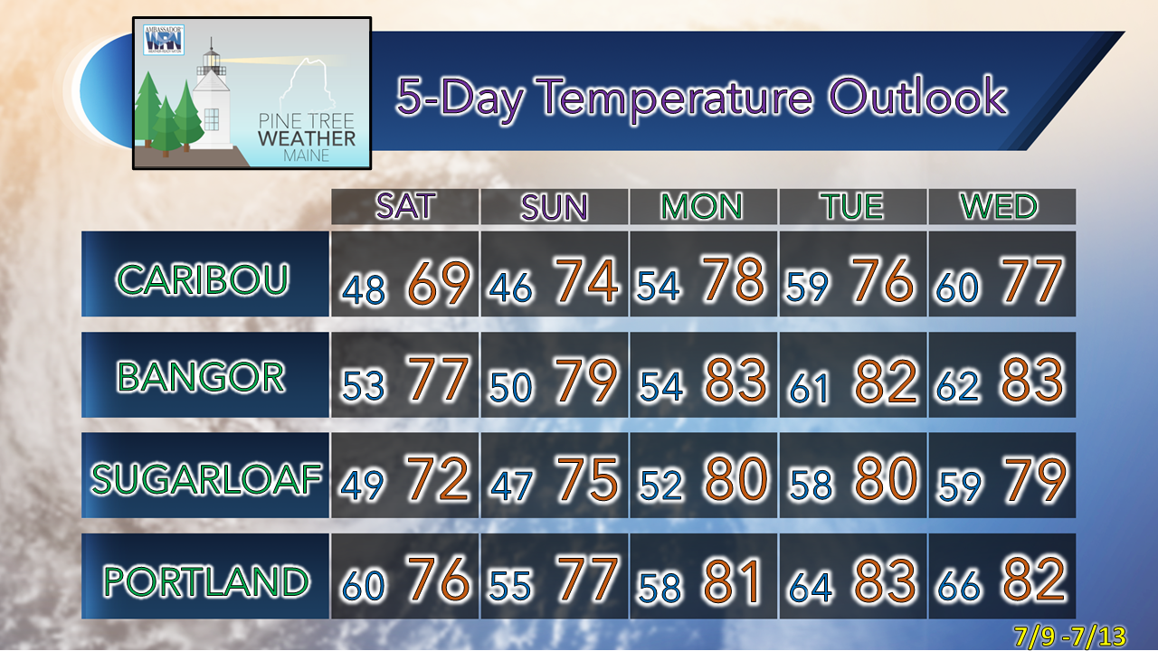 Thank you for supporting this community-based weather information source which operates by financial contributions from people like you. Stay updated, stay on alert, and stay safe! - Mike NOTE: The forecast information depicted on this platform is for general information purposes only for the public and is not designed or intended for commercial use. For those seeking pinpoint weather information for business operations, you should use a private sector source. For information about where to find commercial forecasters to assist your business, please message me and I will be happy to help you. |

Mike Haggett
|


