
Say goodbye to the heat... for now A hat tip to my next door neighbor Jan for allowing me to take a photo of her incredible tiger lilies. These are as bright as the weekend will be. After they get a bit of a drink from rains Thursday night through Friday afternoon, I suspect many of her buds will pop over the weekend. Enjoy what rain we get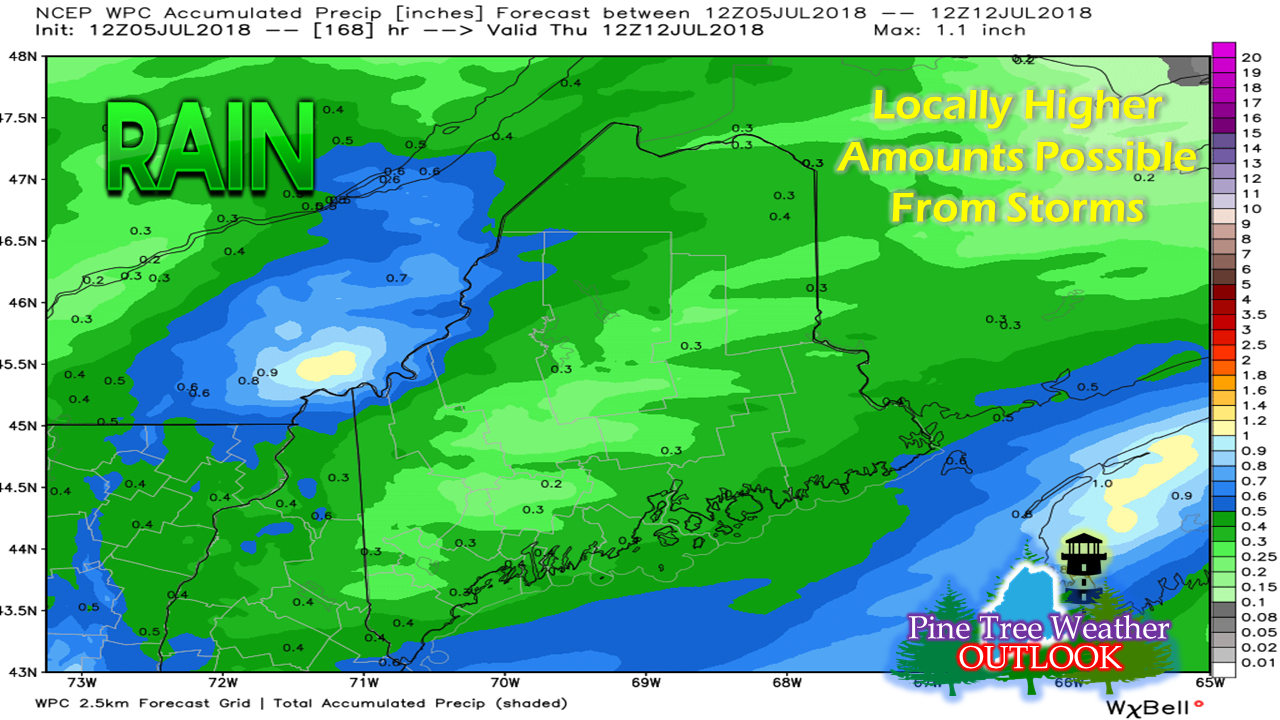 Looking at the fine print on this Weather Prediction Center rainfall outlook graphic indicates this idea is through next Thursday morning. I could have used a shorter run through Friday night, but opted to show this one. What rain you see predicted here all comes Thursday night into Friday. After that, dry times are back on the horizon well into next week. Some rain could come in the form of severe storms Folks in the northern and western areas should be aware that there is a chance of a mesoscale convective system (MCS) to work through the region overnight Thursday into early Friday. These MCS systems are difficult to predict. We had one bust on us earlier this week. Guidance was more bullish on that one. Guidance isn't as robust on this one. Storm Prediction Center has been discussing it in their Day 1 Outlook (time sensitive). Gusty winds, downpours, frequent lightning, and hail are all possible. There is a chance for an brief tornado, but that idea appears remote. The atmosphere is super rich with humidity. Localized flash flooding has some potential also. Important to note: If the sun is out in your region Friday mid-morning, expect to see some thunderstorms activity. While towns lit off their fireworks to celebrate the Fourth over the past couple of days, Mother Nature may supply some of her own. Stay on alert! Humidity exits Friday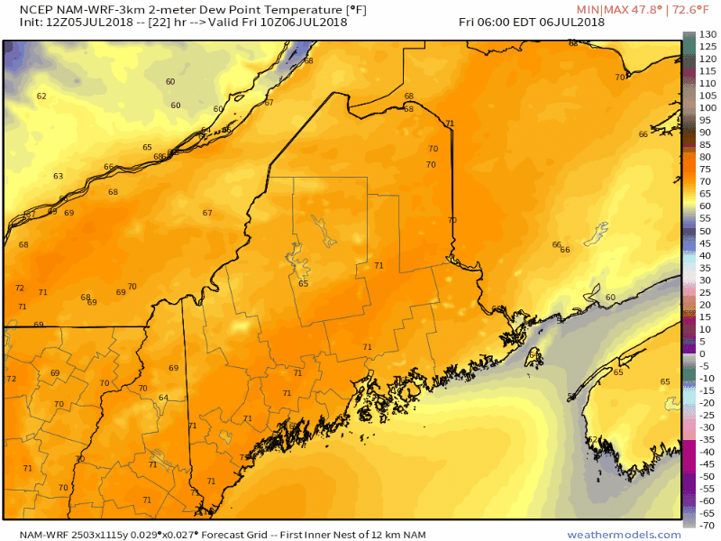 For those that love the hot and sticky weather, they will be saddened by its departure. The front accelerates through the state Friday afternoon, and by Friday evening, the dew points crash. A gusty northwest wind pushes the humidity out to sea. The wind slowly settles overnight Friday, with cool temperatures to start Saturday. The humidity appears to tick back up for southern and eastern areas Tuesday, but not near the levels the region has dealt with this week. Regional outlook through Tuesday Northern and western areas get a couple of cool mornings Saturday and Sunday, with some areas starting off in the mid to upper 40s. Temperatures slowly begin to rise as the weekend progresses into next week. It could be next weekend for any widespread rain comes, and it's too far out to know for sure just yet.
On Friday, please check my Facebook page for synopsis and follow on Twitter for real time updates as the front passes through. My next full update here will be on Monday. With the potential for severe storms, please check in with the National Weather Service in Caribou for eastern and northern Maine or Gray for western and southern areas for the latest bulletins, advisories and official forecast information. Thanks as always for your support! - Mike |

Mike Haggett
|


