The summer goes out with a bang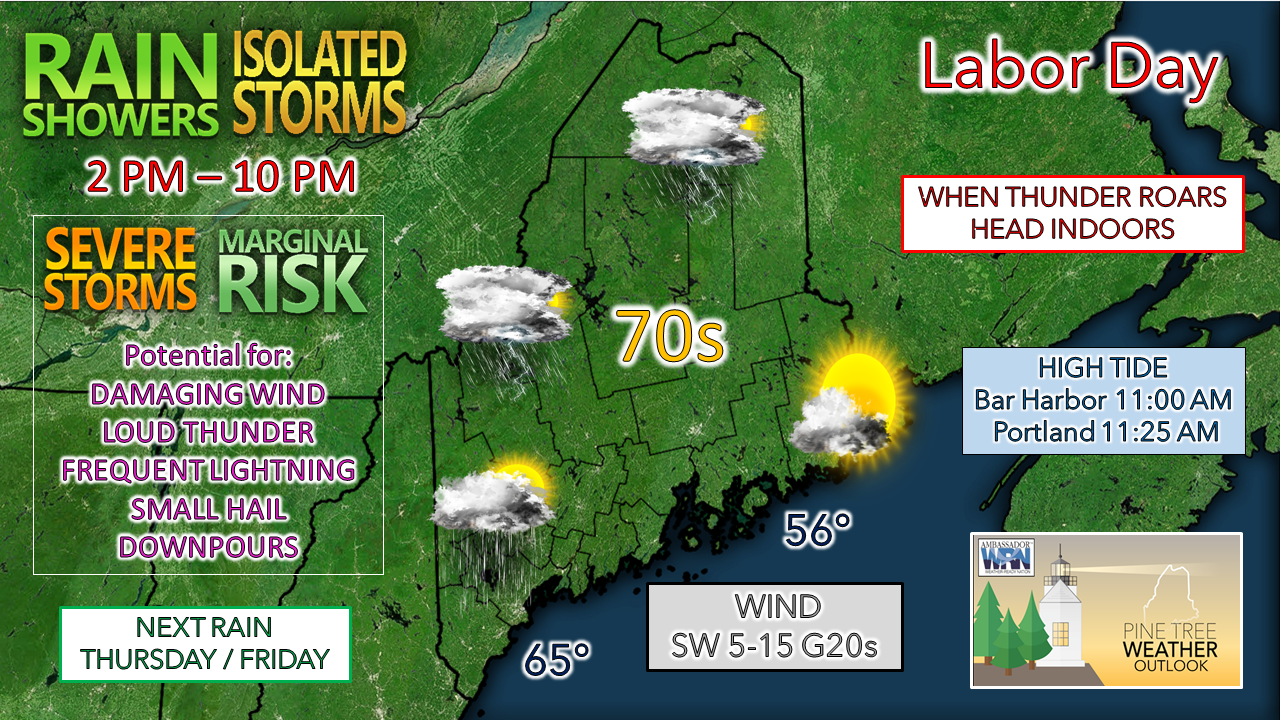 Showers crossing the region this morning end from west to east in a rather prompt fashion, with precipitation ended over far eastern areas by around 9 AM. In the areas that received rain may see fog, which should dissipate as drier air works into the region. Most areas see sun for a time around noon, which for anyone planning a holiday barbeque would be the driest time to have the cookout. An amplified shortwave passes through the region this afternoon, and with it comes the threat for showers and storms. <storm> has amplified the concern for isolated severe storms associated with the shortwave. While there is not a whole lot of convective energy (CAPE) around, when the sun heats the surface there will be enough created to trigger storms. This time of year, we see much lower freezing levels in the atmosphere. In the situation like today where the freezing level is around 10,000 feet, this sets up steep temperature lapse rates that could create loud thunderstorms which could contain damaging wind, frequent lightning, small hail and downpours. The further north and west, the greater the chance for storms. The further south and east, the less of a chance. The main threat period for storms is from 2 to 8 PM, with storms dying off as the air becomes more stable toward sunset. Northern areas may see showers continue into late evening, ending by around midnight. As you are out and about for the day, please have multiple ways of receiving weather alerts with a reliable smartphone app, a NOAA Weather Radio, and/or local terrestrial radio stations. Please stay in touch with the latest from NWS Gray for southern and western Maine and NWS Caribou for northern and eastern areas. Tuesday is shaping up to be a decent day, a bit on the breezy side. Northern and mountain areas will deal with clouds, with an isolated chance of a shower for the far north. Sun rules the day for the coastal plain. Temperatures start off in the 50s statewide and reach the mid to upper 60s for the north and mountains and low to mid-70s for much of the coastal plain. Far southern areas may flirt with 80°. West / northwest winds range from 5-15 mph with gusts in the 20s. Our next chance for rain comes in the Wednesday night to Friday timeframe with details to be ironed out. It will be this frontal boundary that kicks Larry to the northeast. Long wave swells arrive from Hurricane Larry to the region on Tuesday and will gain with frequency and height through late week. This sets up concerns for rip currents, and potential for splash-over and minor beach erosion Friday into Saturday. The storm is on track to stay well to the east. For more on that, please check with the National Hurricane Center.  Thunderstorms can escalate quickly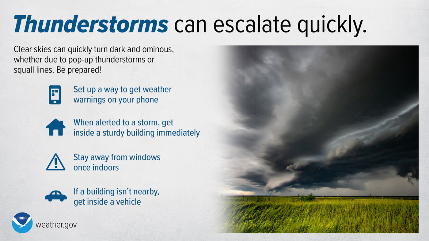 Thunderstorms and squall lines can quickly turn clear skies dark. Stay Weather-Ready by having a way to get weather alerts on your phone and stay safe by immediately going inside when the skies turn threatening. weather.gov/safety/thunderstorm Be prepared to receive alerts and stay updated!
For more information in between posts, please follow Pine Tree Weather on Facebook and Twitter.
Thank you for supporting this community-based weather information source which operates by reader supported financial contributions. Stay updated, stay on alert, and stay safe! - Mike |

Mike Haggett
|