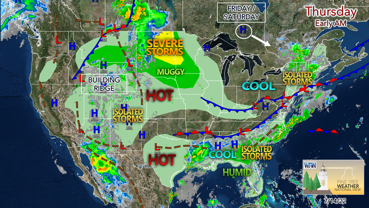
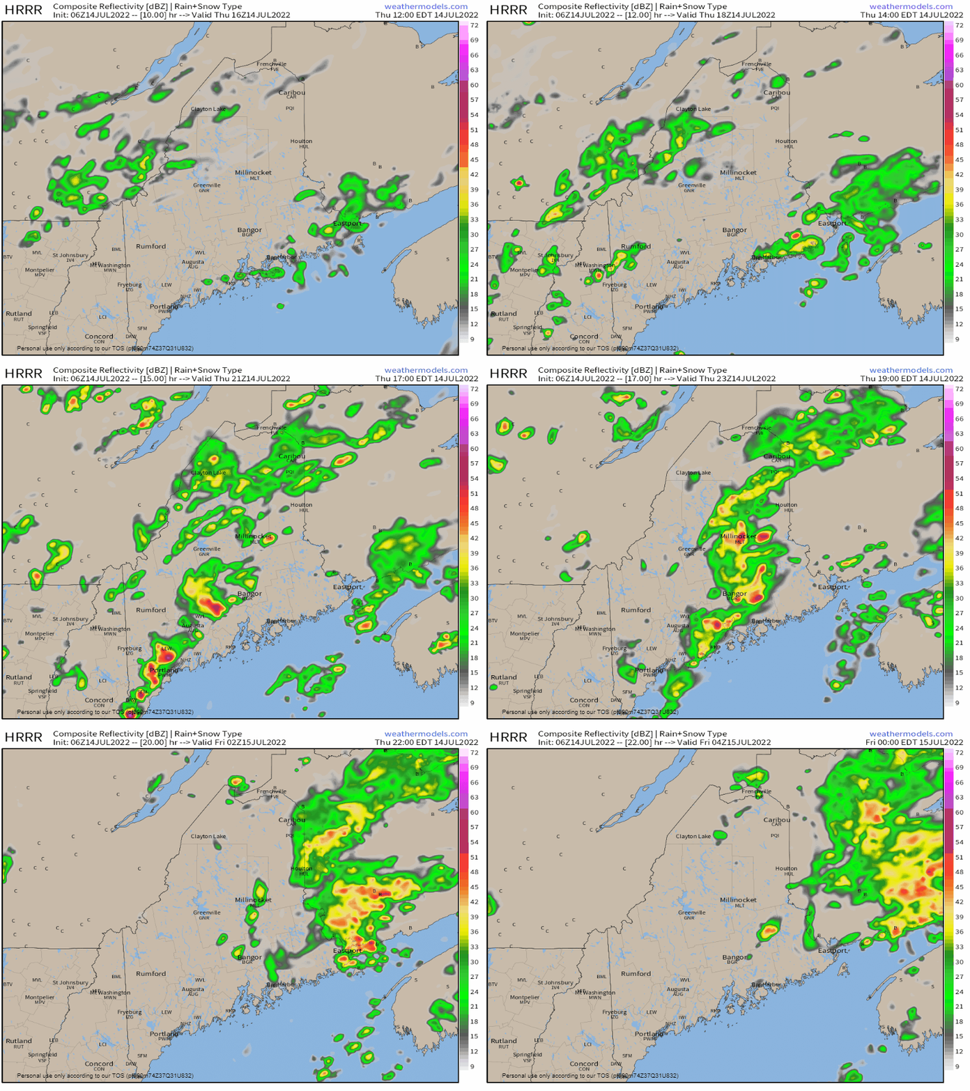
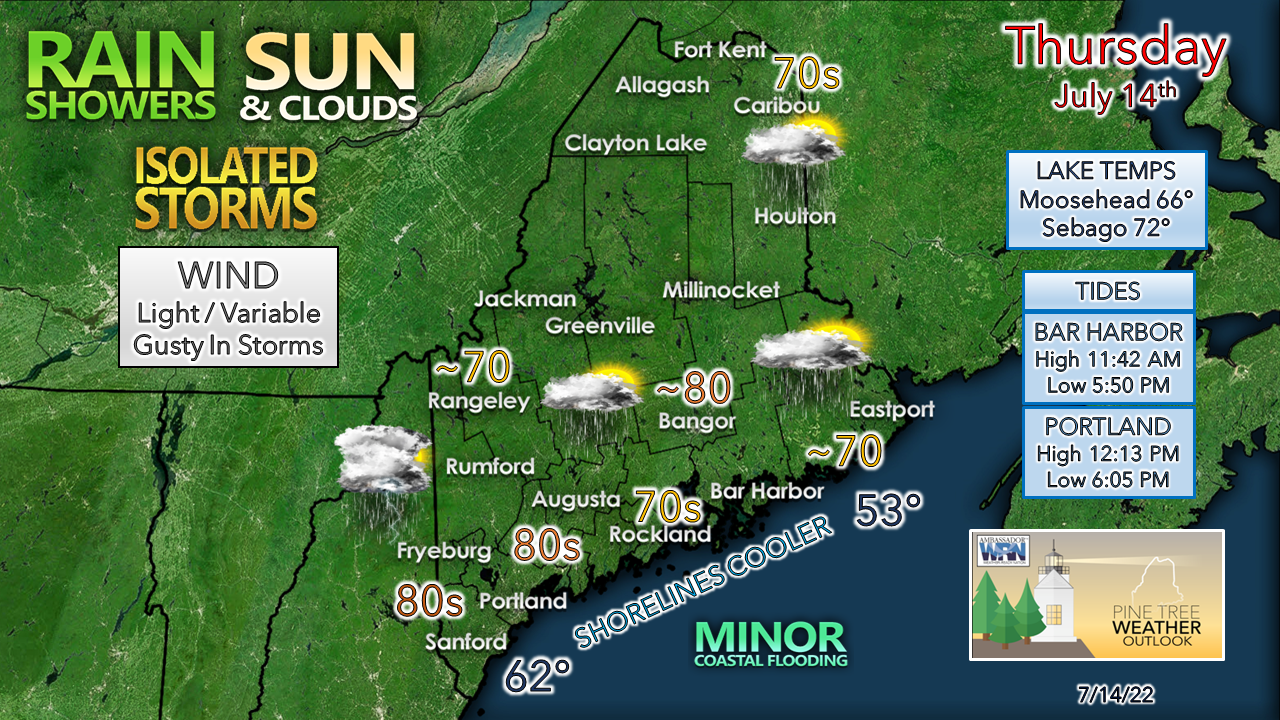
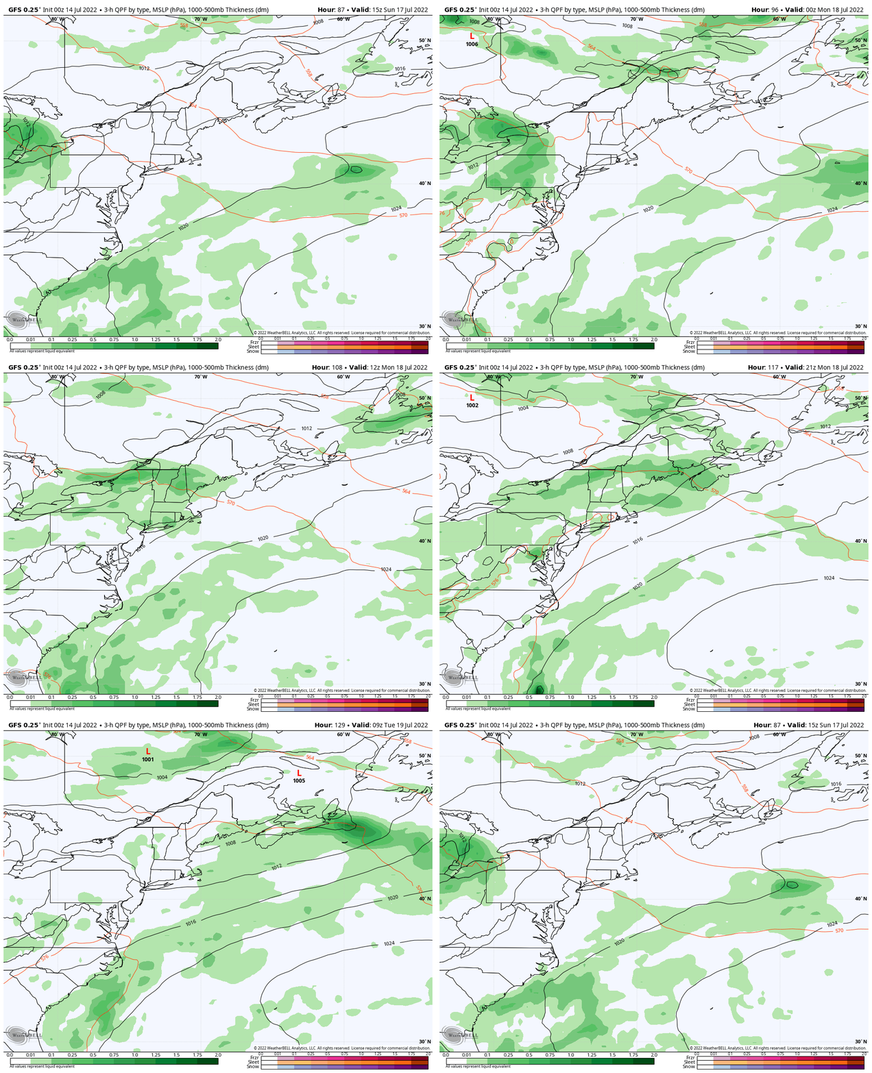
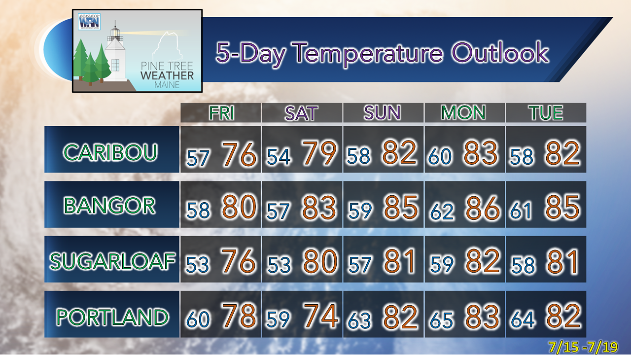
Low pressure moves through the regionBeggars can't be choosy so we'll take what rain we can get, when we can get it. The latest drought monitor should be posted Thursday morning by 9 AM and I expect conditions may be indicated as a level worse is some areas. Since the cut off for precipitation reports was at 8 AM Tuesday, the areas that received rain from the showers and storms that afternoon won't be reflected in the report. After Thursday's chance for showers and storms, the next chance for rain comes Monday. Thursday Noon to Friday Midnight - The southern half of the state can expect some scattered showers around. The cloud debris left from those plays a role in the risk for storms in the afternoon. Expect dew points to increase with the moisture around the area of low pressure. If the sun gets out, look out. Storms could contain gusty wind which could reach severe levels, along with downpours, and hail possible. If the HRRR idea presented here is correct with timing, the evening commute may be impacted in the more populated regions. If the sun gets out, temperatures are likely to spike up into the 80s over the southwest interior. If it doesn't, 70s are likely the high mark of the day. Shorelines may see some minor flooding with the high tide around noon. For those heading to the ocean beaches in the afternoon, please stay mindful of the storm threat through early evening. Next chance for rain comes early next weekSunday 10 AM to Tuesday 10 AM - Friday and Saturday appear mainly dry with comfortable dew points. A ridge to the south and west nudges northward on Sunday, which will begin to slowly raise humidity levels. Far northern areas may get a shower on Sunday, but other than that, the weekend appears dry for rest of the region. Model ideas become scattered as to how and when shortwave disturbance interacts with the dynamics of the atmosphere on Monday. I am guardedly optimistic that this could turn into a decent widespread rain event with showers and thunderstorms around. Fingers crossed and prayers being sent for that. I will update this on Sunday. Folks camping out next week should stay mindful of the daily risk of showers and storms as the humidity rises along with the heat. Temperature outlook through TuesdayThank you for supporting this community-based weather information source which operates by financial contributions from people like you. Stay updated, stay on alert, and stay safe! NEXT UPDATE: SUNDAY - Mike NOTE: The forecast information depicted on this platform is for general information purposes only for the public and is not designed or intended for commercial use. For those seeking pinpoint weather information for business operations, you should use a private sector source. For information about where to find commercial forecasters to assist your business, please message me and I will be happy to help you. |
Mike Haggett
|

