
Another round of heat & humidity The pattern for the week appears to be off and on unsettled overall for the state. Two key factors at play here: the strong ridge that will bring the heat and humidity from time to time; weak frontal boundaries pushing through southern Quebec which will push the ridge south temporarily. A stronger cold front arrives late week, which will bring high pressure in for the weekend. We may see another round of heat and humidity as we head into the middle part of next week. Showers and storms for some Labor Day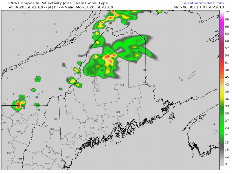 Showers and with a chance of a few rumbles working through northern Maine this morning is the first wave of activity thanks to a weak upper level disturbance with a warm front. A weak cold front will push to the southeast which may bring some strong storms with an isolated severe risk as we head towards the evening. Whether or not northern areas get thunder will be dependent on cloud cover. While this futurecast radar loop idea indicates the south may escape with little to no impact, there is a chance for a storm to sprout given the convective energy around The main potential with these storms will be lightning, gusty winds, heavy rain and perhaps some hail. For those planning on grilling to wrap up the weekend, be prepared for potential showers and storms. It will be a warm one, with many areas in the 80s with some low 90s possible for interior York County. Dew points rise into the upper 60s to low 70s for the day. Northern areas appear to see some relief from the humidity overnight into early Tuesday. Western and eastern areas will dry out during the day, and most southern areas by late afternoon. Watching two systems in the tropics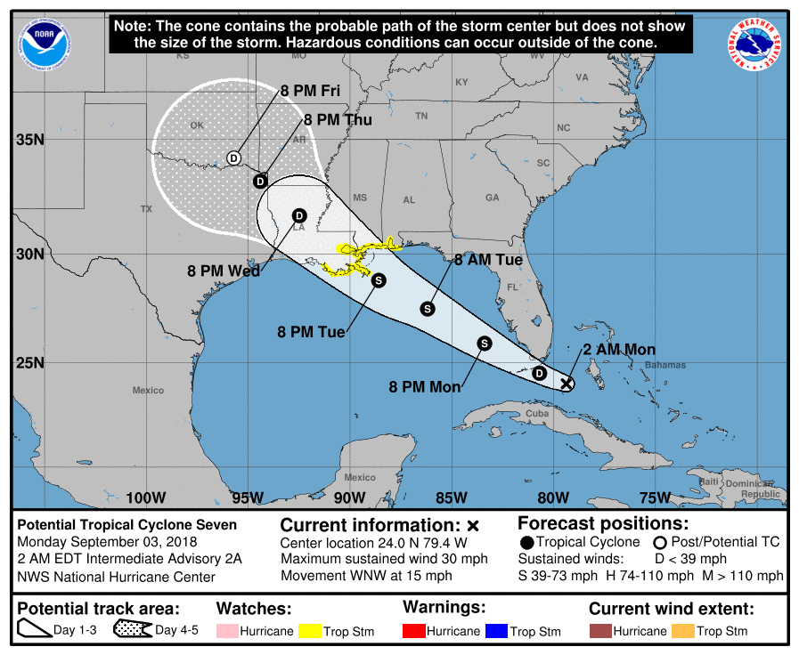 As of the time of this post early Monday, tropical storm and storm surge watches for what is likely to be "Gordon" have been posted for the Alabama/ Florida border to Morgan City, Louisiana. Guidance at this point does not think this storm will intensify too much given the amount of wind shear in the Gulf of Mexico. The main concern with this storm is the potential for flooding rain over the north central Gulf coast, along with some storm surge along the shorelines. 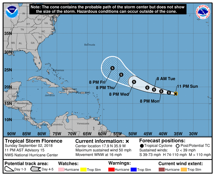 Florence will be one to watch for interests along the eastern seaboard over the next week and beyond. The shear factor appears to inhibit intensification for the short term. As the storm tracks to the northwest later this week, it does appear to reach more favorable conditions for intensification. Operational ideas from the European and Canadian models suggest that the storm could track near Cape Hatteras in the longer term. Those ideas aren't out of the realm of possibility given the Bermuda High influence that has been going on over the western Atlantic since July. For now this storm will tracked and monitored.
For the latest information on the these tropical systems, please check in with the National Hurricane Center. With peak tropical storm season upon us, make sure you are prepared if and when the big one comes. Make a plan and be ready. Keep your eyes and ears open for potential storms today over Maine. Stay in touch with the National Weather Service in Caribou for northern and eastern areas, or Gray for western and southern regions. Enjoy your Labor Day! - Mike |

Mike Haggett
|


