Showers and storms on Wednesday, followed by a break from the humidity for the rest of the week6/23/2020 Isolated storms and a slight cool down for Wednesday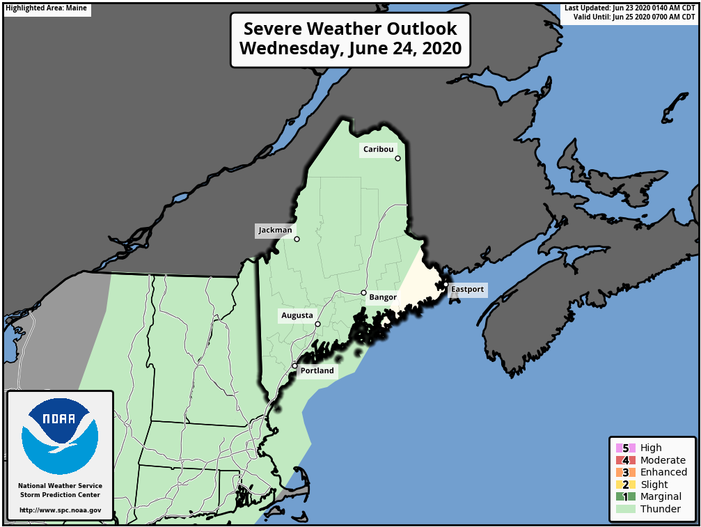 SPC Severe Weather Outlook for Wednesday 6/23 As a cold front moves through the state on Wednesday, expect showers and thunderstorms for the afternoon and into the overnight hours. The SPC has most of Maine, with the exception of Downeast areas, in a general thunderstorm risk. As decent moisture continues to be brought into the region, this may result in some storms producing localized heavy downpours. Gusty winds are also a threat with these storms. 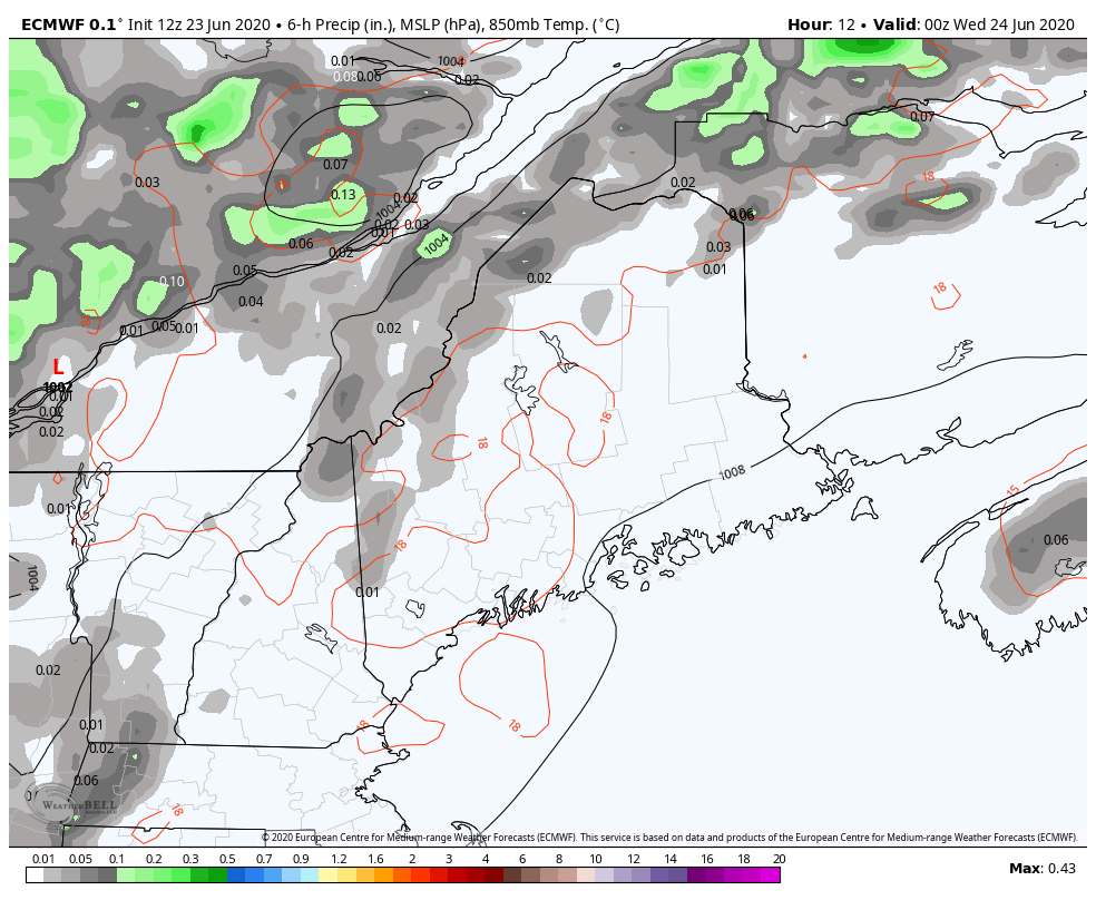 European Model 6 Hour Precipitation Totals Precipitation will move in to the state in the afternoon hours and linger overnight into Thursday morning. Though it's not a lot, this is looking like the most precipitation the state has seen in a while. 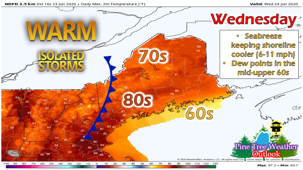 Temperatures will be cooler on Wednesday, with the majority of the state lingering around the low 80s and upper 70s. With a relatively strong seabreeze, the shoreline will only see upper 60s and low 70s, while southwestern areas could see mid 80s. It will be humid outside as well, with dew points in the mid-upper 60s. Overnight, temperatures will drop into the low-mid 60s along the coastal plain and in the eastern regions of the state, and upper 50s in western and mountainous regions. Drier air moves in behind front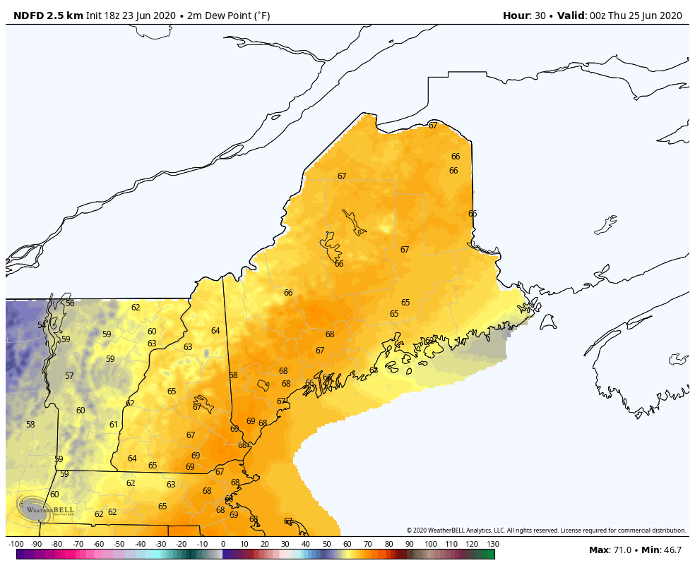 NWS Dewpoint Forecast from Wednesday Night until Saturday Night As the front passes through the rest of the state on Thursday, you can see the drier air moving in. Dew points will drop into the 50s and low 60s for Thursday through Saturday, giving Maine a nice break from the humidity. However, another system approaches on Sunday, which may spike dew points again and bring back fairly muggy conditions. 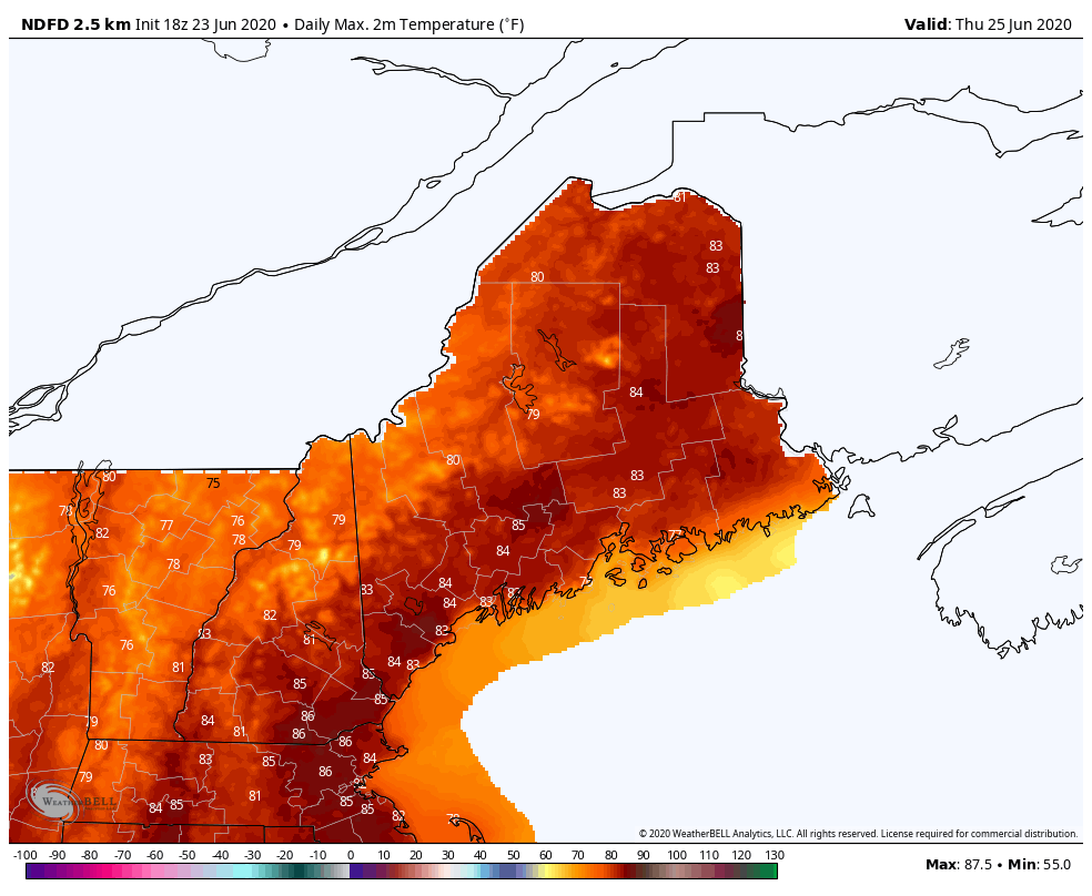 Thursday will be windy with temperatures in the low-mid 80s and winds from the southwest at 9-14 mph. Friday and Saturday cool down a bit, with mainly upper 70s and low 80s. Saharan dust beginning to impact the U.S. this week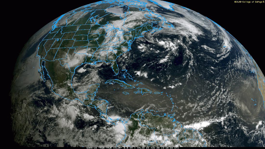 Satellite Loop from 10am to 2pm today As you can see in this satellite GIF from today, dust from the Sahara desert has traveled across the ocean and into the Carribean. 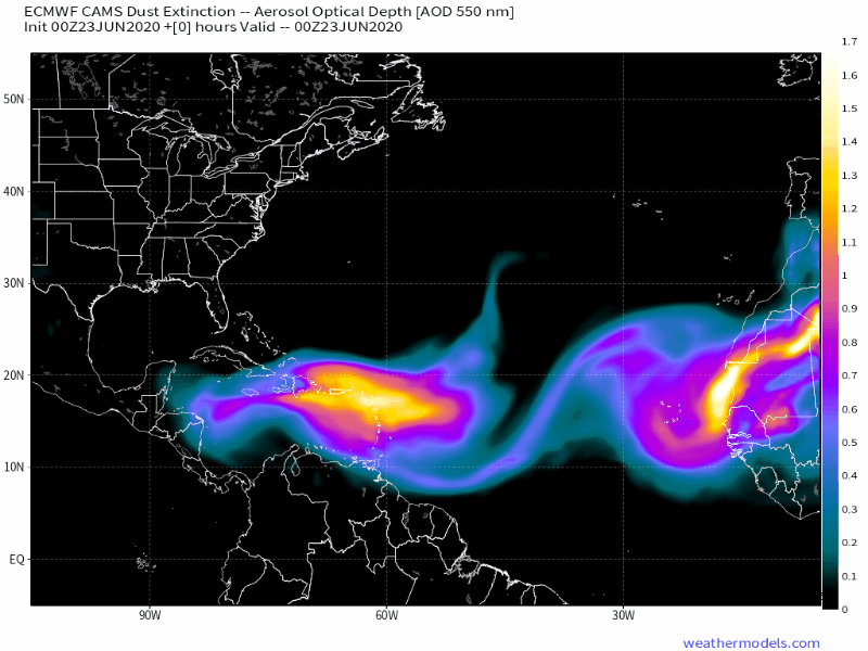 This is a European model forecast GIF of the Saharan dust. Now that it has made its way into the Carribean, it will spread into the Gulf of Mexico by Thursday. From there, it could get wrapped up in a cyclone and spread up to the Mid-Atlantic and Southeastern regions of the U.S by Saturday. Though dust can make skies hazy, it can also lead to some fantastic sunrises and sunsets. Lightning Safety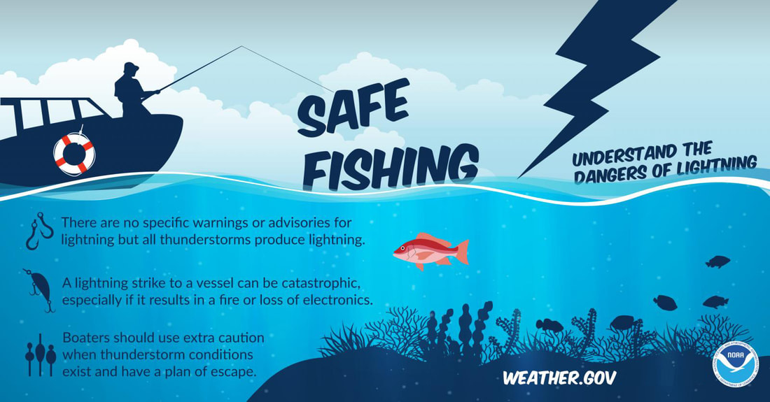 It's lightning safety week! ALWAYS remember to practice lightning safety, especially when enjoying a day outside and/or by the water. Though the odds of being struck by lightning are small, that doesn't mean it can't strike objects that may cause injury. Stay alert on the latest weather updates, especially if you'll be spending the day outside/on the water. Help forecast verification, and stay informed!
For more information, please follow Pine Tree Weather on Facebook and Twitter.
Thank you for supporting this community based weather information source that is funded by your financial contributions. Stay updated, stay on alert, and stay safe! Make it a great week :) - Alex |

Mike Haggett
|