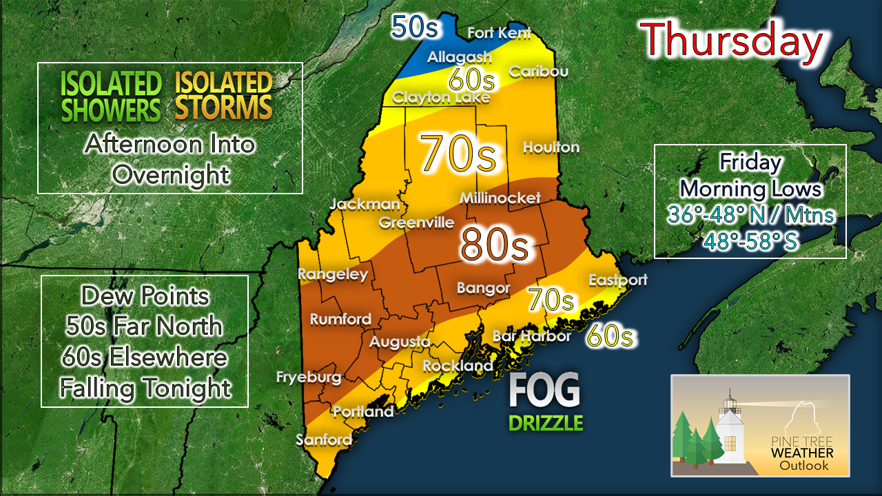
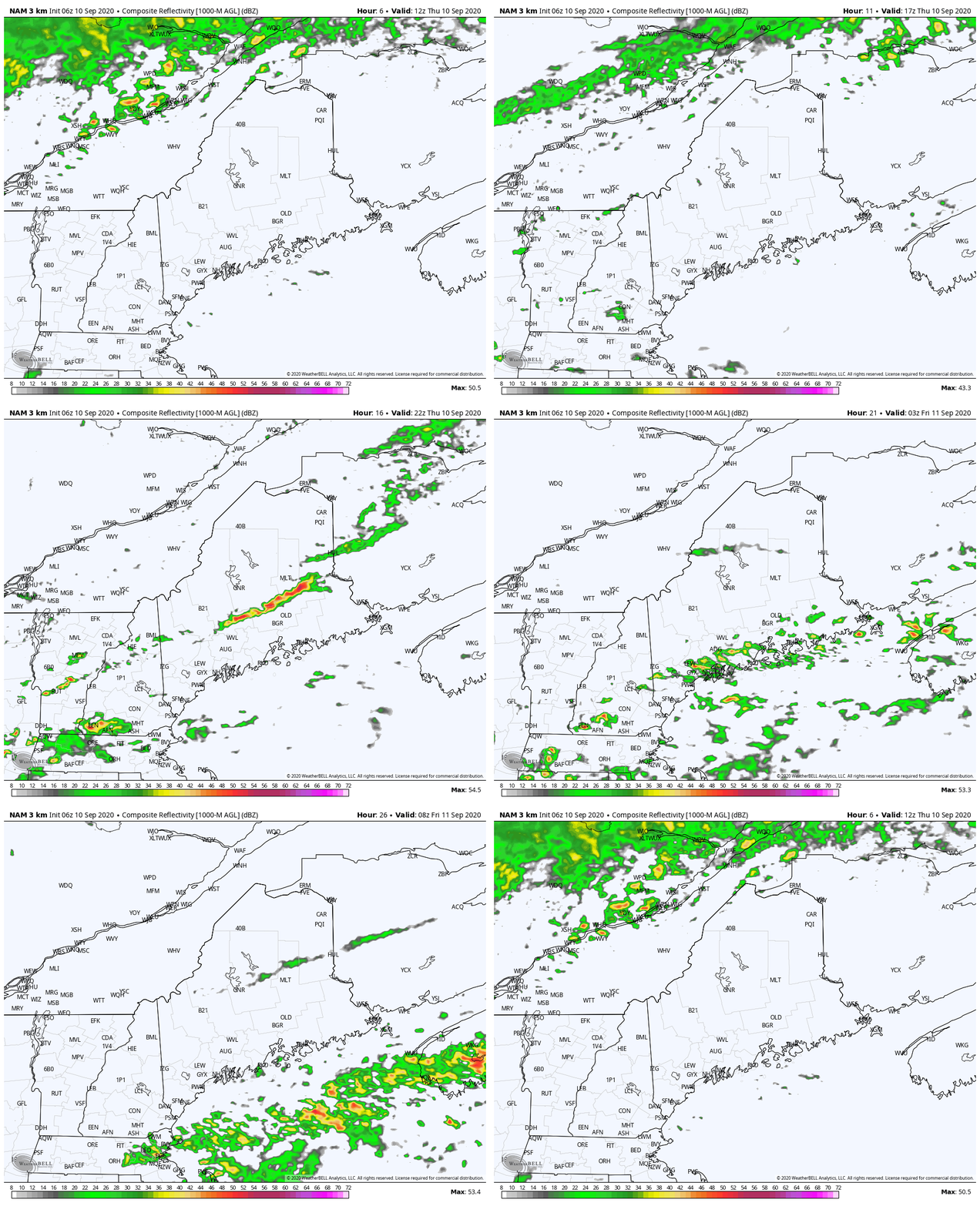
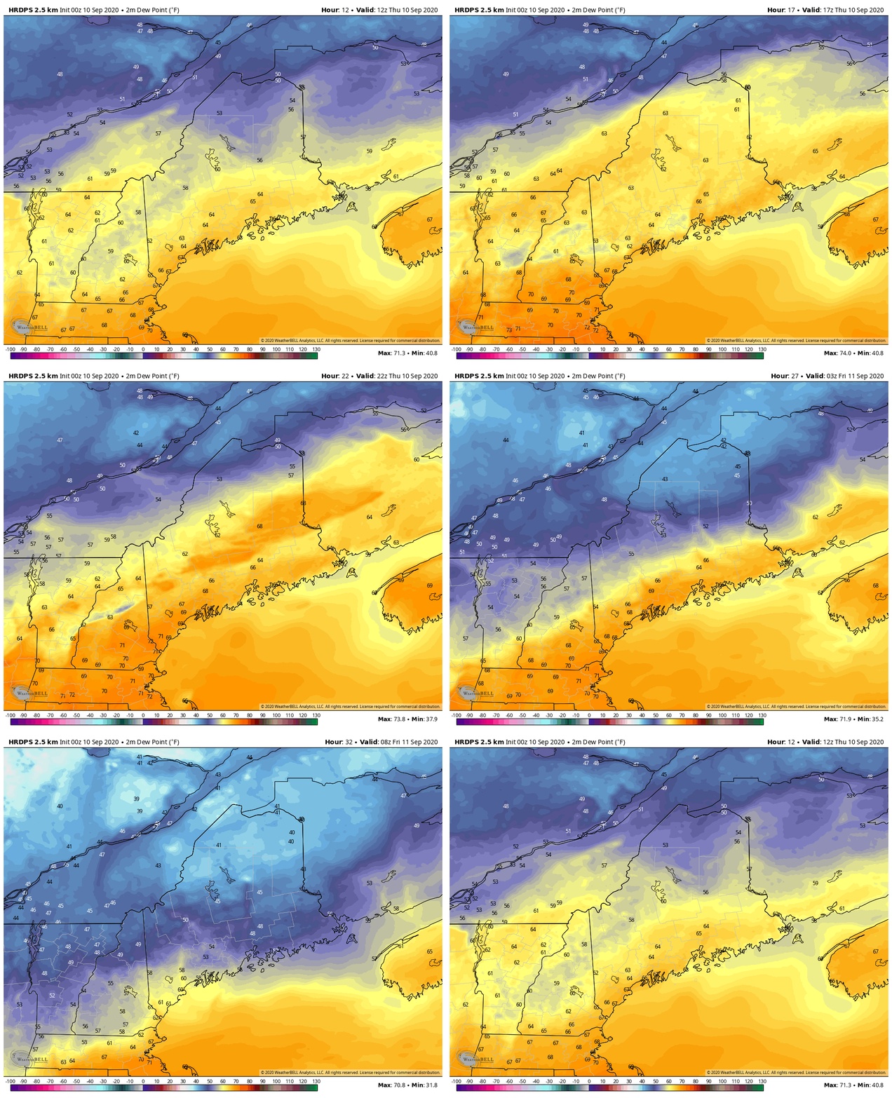
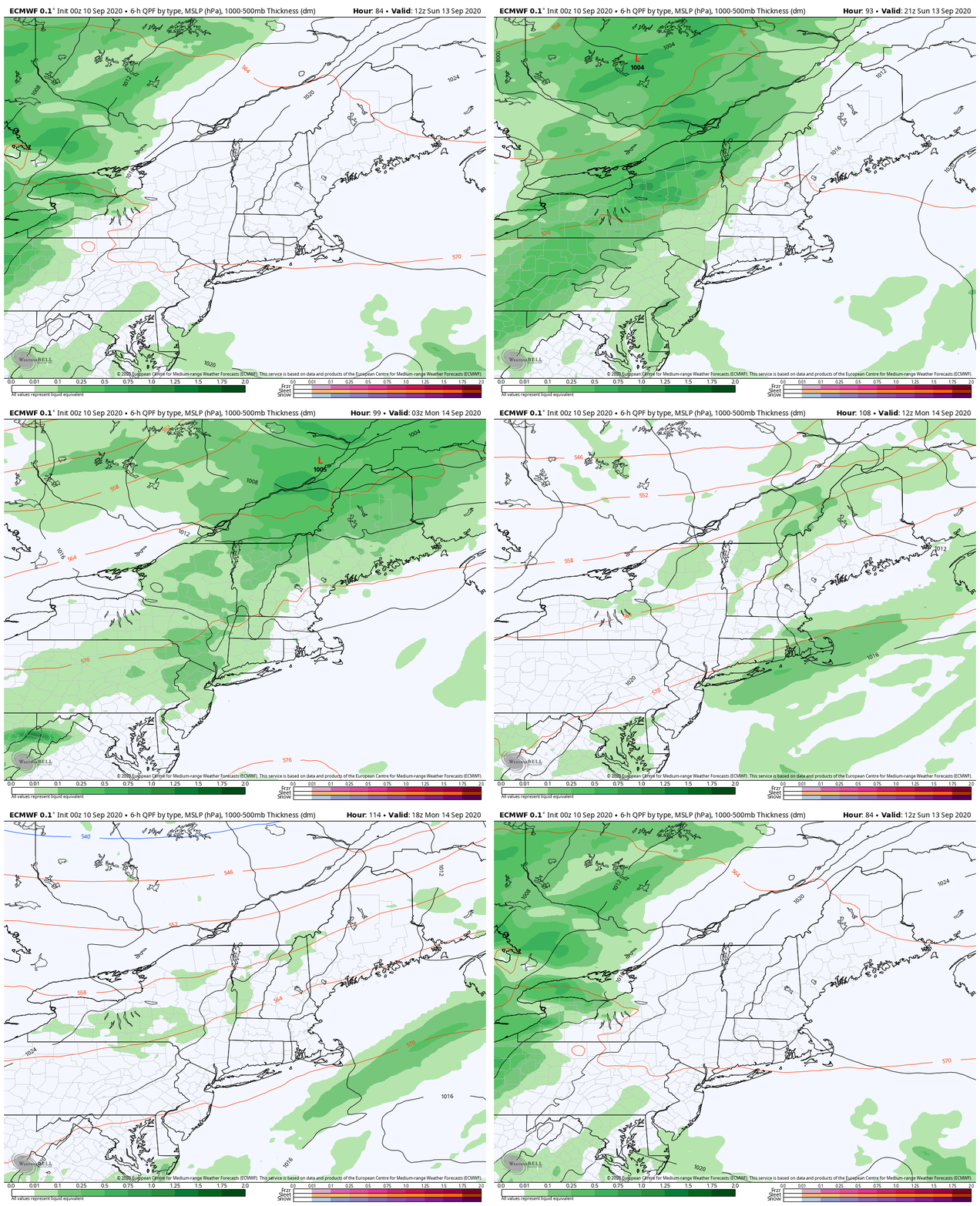
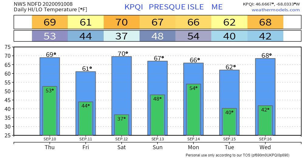
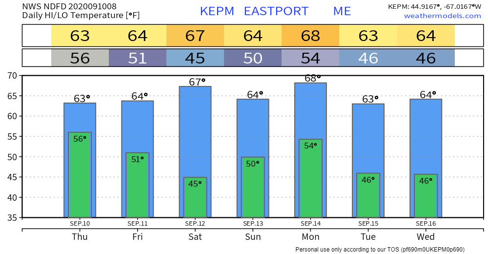
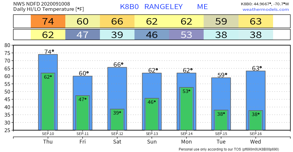
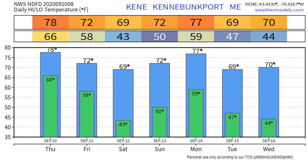
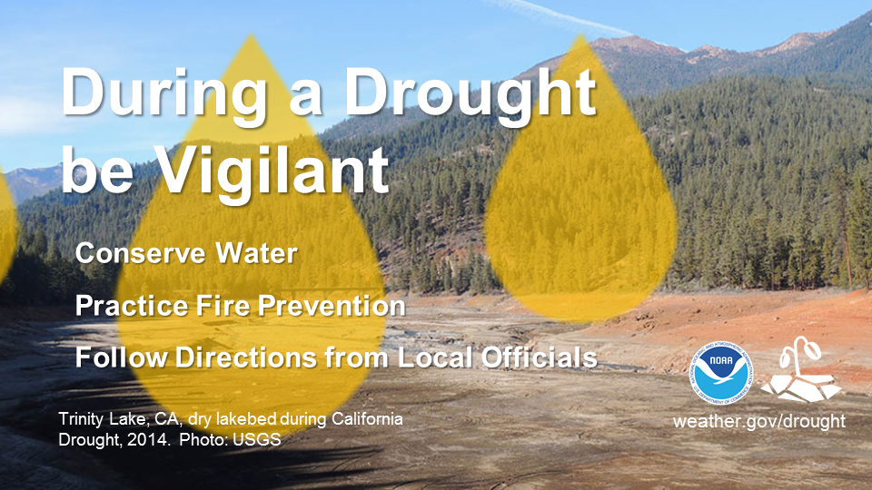
One more day of humidityThe stationary front that has meandered over the state since Tuesday is on track to turn into a cold front and pass through the region Thursday afternoon and be offshore by Thursday night. Coastal areas east of Portland could once again be dealing with stubborn fog for the day prior to the arrival of the front. For interior areas, expect it to get warm with sticky conditions with varying amounts of sun. Outside of a spot shower for the rooftop and areas of drizzle with the fog along the coast, much of the state stays dry through the morning. The front begins to move southeast through the region this afternoon. Rain showers and storms appear to be isolated in nature. Moisture along the front weakens as it approaches the coast. With the humidity and heat from the day, there is a risk for thunderstorms. The severe threat is very low. Any storms that form could contain gusty winds, hail and a quick downpour. Shower activity appears to end by roughly midnight Friday as the last of the showers and storms leave the shorelines and head into the Gulf of Maine. As the front passes through, the humidity drops. Dew points in the 50s and 60s crash into the 30s, 40s and 50s by Friday morning. The sticky conditions may return briefly Sunday. Weekend updateFriday will be dry but a bit on the cool side for this point in September. Saturday appears pleasant, and a bit warmer. Sunday's outlook has improved. Most areas appear to avoid shower activity until the afternoon into the evening. Like Thursday, showers appear mainly scattered with light accumulation of rainfall. No drought busting storms are expected anytime soon. Temperature outlook around the stateThe north and the western mountains should stay updated on potential frost Friday night into Saturday, and possibly Tuesday and Wednesday mornings next week. The overall trend through midweek is generally below normal temperatures. Sweater weather evenings have arrived. The drought for Maine continuesDuring a drought, be vigilant. Conserve water by taking shorter showers and not washing your car. Practice fire prevention by properly disposing of cigarette butts and not setting off fireworks. Follow any additional directions from local officials. For more information about drought safety, visit weather.gov/drought Be prepared to receive alerts and stay updated!
For more information, please follow Pine Tree Weather on Facebook and Twitter.
** FUNDING NEEDED FOR 2021 ** Thank you for supporting this community based weather information source that is funded by your financial contributions. Stay updated, stay on alert, and stay safe! - Mike |
Mike Haggett
|

