Pine Tree Weather
  • DISCUSSIONS
  • DONATE
  • MAPS
  • NWS BRIEFINGS
  • SATRAD
  • MARINE
  • SNOW / ICE OUTLOOK
  • RAIN OUTLOOK
  • CPC OUTLOOK
  • Kennebunk
  • OBSERVING WEATHER
  • Who We Are
  • My Photography
  • DISCUSSIONS
  • DONATE
  • MAPS
  • NWS BRIEFINGS
  • SATRAD
  • MARINE
  • SNOW / ICE OUTLOOK
  • RAIN OUTLOOK
  • CPC OUTLOOK
  • Kennebunk
  • OBSERVING WEATHER
  • Who We Are
  • My Photography

Showers and storms Sunday, wet Monday south

9/4/2022

Comments


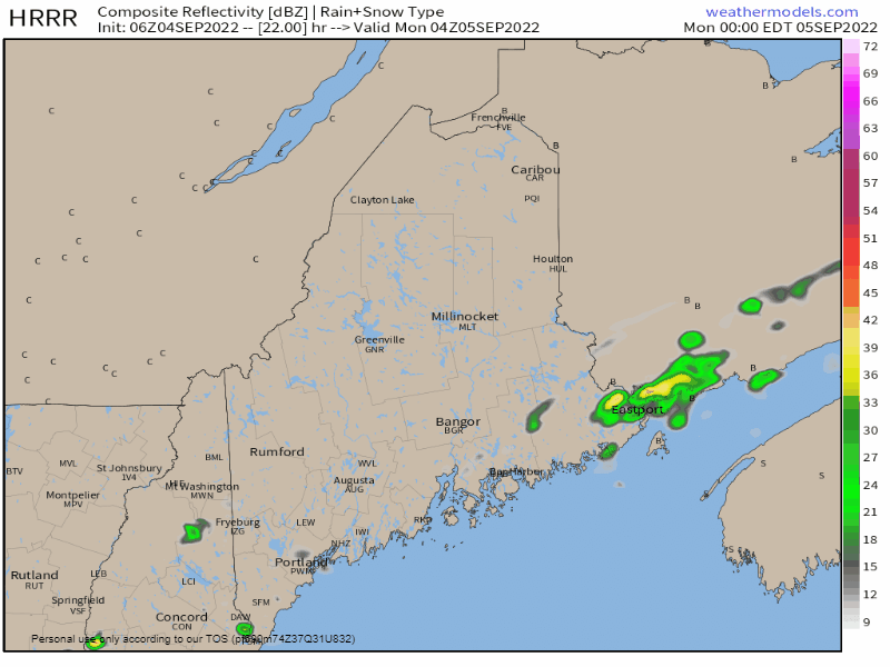
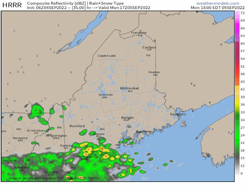
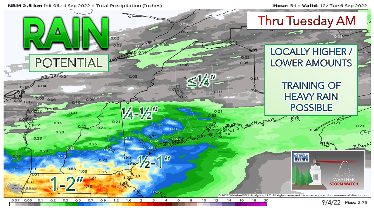
Frontal boundary advances Sunday

Picture
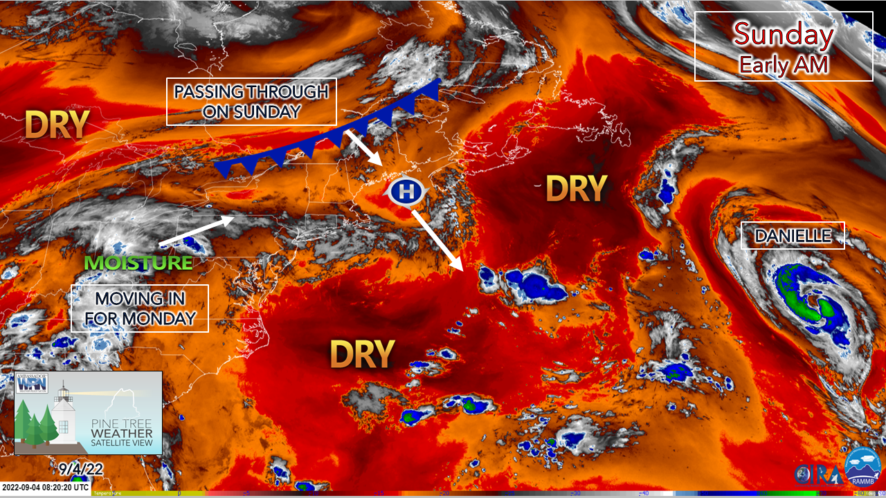
I hope everyone is enjoying the weekend thus far. For those working, I thank you for your service. There is plenty of work going on in the atmosphere around us. Danielle is holding up well, located to the southeast of Newfoundland. High pressure that brought a fantastic day on Saturday has slid to the southeast. A southwest flow develops over the region for Sunday which bumps dew point levels up. A frontal boundary passes through the region and is set to stall to the south for Labor Day and keeps rain in the forecast for southern areas through Tuesday.
Picture
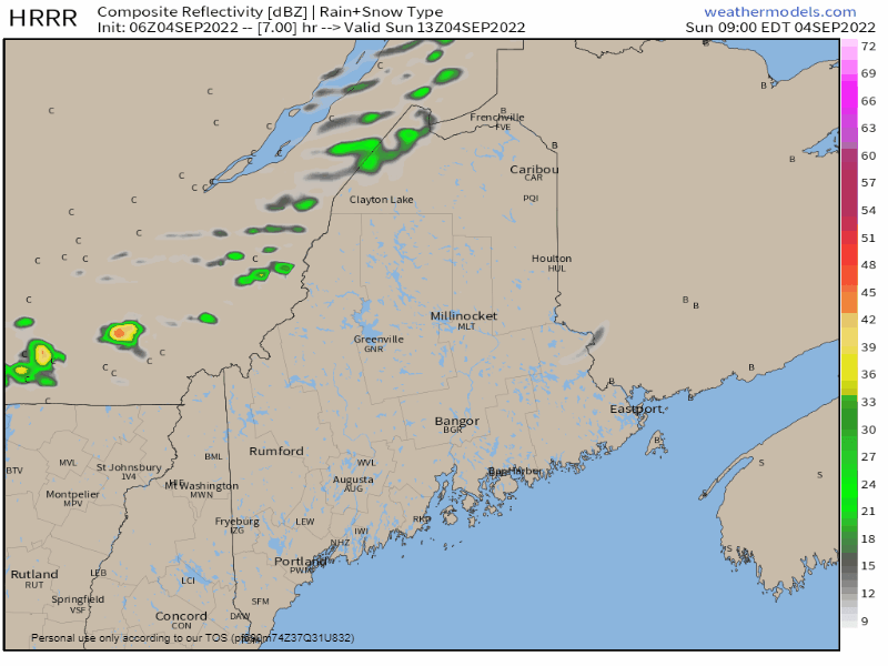
Sunday 9 AM to Monday Midnight - No real changes in thinking I posted here on Saturday about the timing and impacts with the frontal approach. Northern areas have the best chance for an isolated shower through early afternoon, then the coastal plain has its chance Sunday afternoon into the evening. The best chance for thunder is for the western foothills - Waterville - Waldo County south and may interrupt the evening outdoor grilling plans. Storms could produce some gusty wind and a quick downpour. Showers and storms are of the potluck variety and not all areas get wet. 
Picture
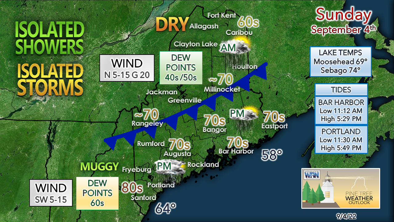
The tale of the day involves the front and will change as the front passes through. The wind will shift from the southwest to the north and could be a bit gusty this afternoon in spots. As the front gets closer to the coastal plain in the afternoon, dew point levels rise and could be on sticky side especially for southwestern areas until the front passes through Sunday night. 

Best rain chances are for southwestern areas
​through Tuesday

Picture
Monday Midnight to Noon - For those with outdoor plans Monday morning for southwestern areas, plan to get it done early. For those traveling to Southern New England, get on the road as early as possible
Picture
Monday Noon to Tuesday Midnight - Rain picks up in velocity and frequency Monday afternoon over southwest and MidCoast areas as disturbances ride along the stalled front to the south. A washout afternoon for Fryeburg to Rockland south appears likely, with scattered showers from Rangeley to Bangor to Eastport. 
Picture
My suspicion that the front may dip a bit further south than model ideas were thinking that were expressed here in Saturday's post may end up that way. The trend to this point continues to move south.  York County makes out the best as a region. Some localized areas of 2-3"+ are possible where training of heavy showers occurs, with the best chance for that also for York County but could also occur as far north as Fryeburg - Rockland. 

Temperature outlook through Friday

After this round of rain passes through, it appears to be a mainly dry rest of the week with temperatures on the rise. The next widespread rain event is not clear as of now. 
Picture

Thank you for supporting this community-based weather information source which operates by financial contributions from people like you. 
​
NEXT UPDATE: MONDAY

Stay updated, stay on alert, and stay safe!

- Mike

​NOTE: The forecast information depicted on this platform is for general information purposes only for the public and is not designed or intended for commercial use. For those seeking pinpoint weather information for business operations, you should use a private sector source. For information about where to find commercial forecasters to assist your business, please message me and I will be happy to help you.

Comments
    Picture

    Mike Haggett
    Kennebunk, ME

    Certified Weather
    Forecaster
    Penn State '21

    American Meteorological Society

    National Weather Association

    Weather-Ready Nation 
    Ambassador
    ​
    ​SKYWARN-CWOP

    Matthew 19:26


    Support
    Pine Tree Weather

    DONATE

    Picture

    Picture

    Picture

    Picture

    Picture

    Picture

    Picture

    Picture

    Picture

    Picture

    Archives

    January 2023
    December 2022
    November 2022
    October 2022
    September 2022
    August 2022
    July 2022
    June 2022
    May 2022
    April 2022
    March 2022
    February 2022
    January 2022
    December 2021
    November 2021
    October 2021
    September 2021
    August 2021
    July 2021
    June 2021
    May 2021
    April 2021
    March 2021
    February 2021
    January 2021
    December 2020
    November 2020
    October 2020
    September 2020
    August 2020
    July 2020
    June 2020
    May 2020
    April 2020
    March 2020
    February 2020
    January 2020
    December 2019
    November 2019
    October 2019
    September 2019
    August 2019
    July 2019
    June 2019
    May 2019
    April 2019
    March 2019
    February 2019
    January 2019
    December 2018
    November 2018
    October 2018
    September 2018
    August 2018
    July 2018
    June 2018
    May 2018
    April 2018
    March 2018
    February 2018
    January 2018
    December 2017
    November 2017
    October 2017

    RSS Feed

Proudly powered by Weebly