
Thursday daytime dry for most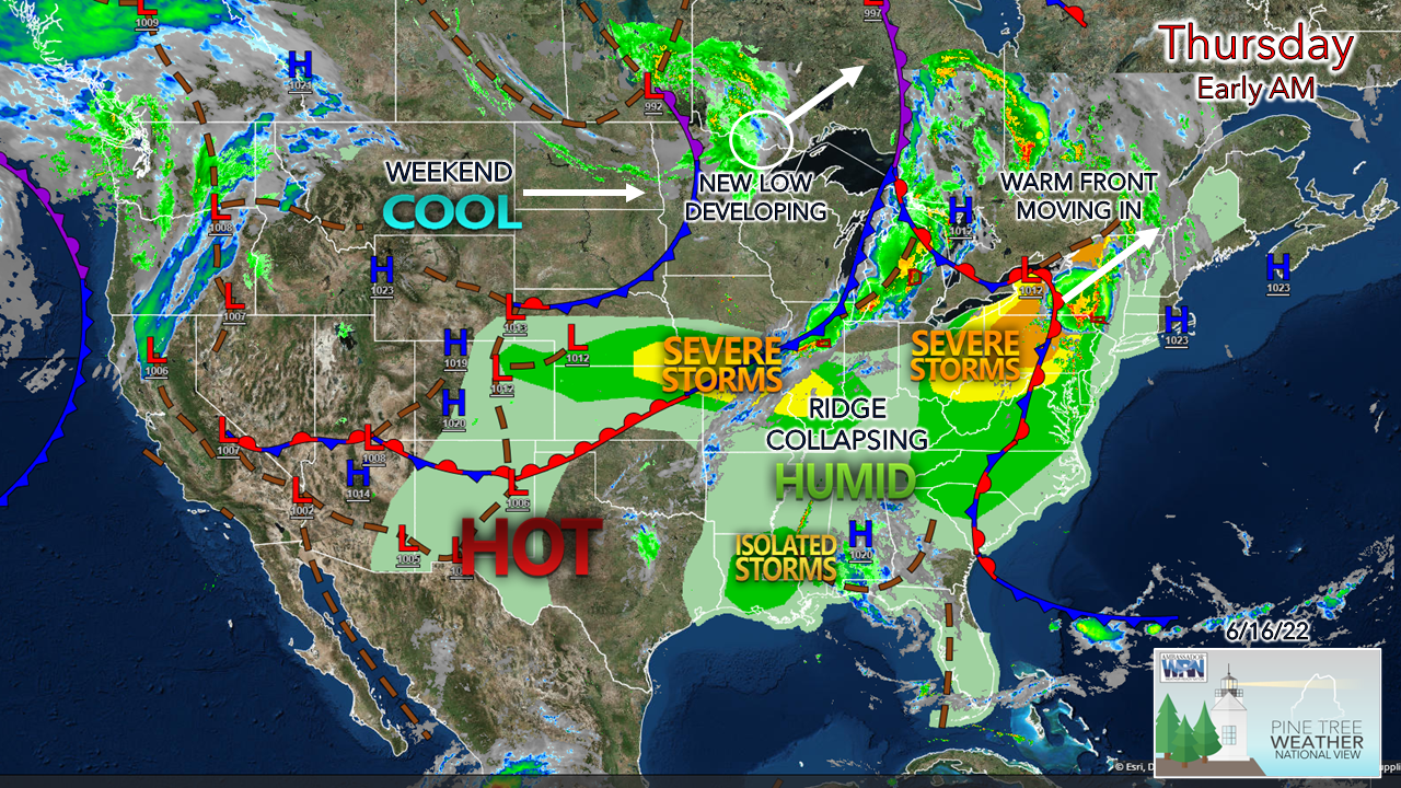 Midwestern areas around the Great Lakes have been hammered with storms over the past couple of days and will get lit up again Thursday. The ridge to the south has begun to get squashed as an upper-level trough across the Plains headed toward the east. The ridge will win in the short term as it pushes a warm front into the region Thursday night, but then gets pushed back to the south as a cold front passes through the region on Friday. The weekend outlook is headed downhill. 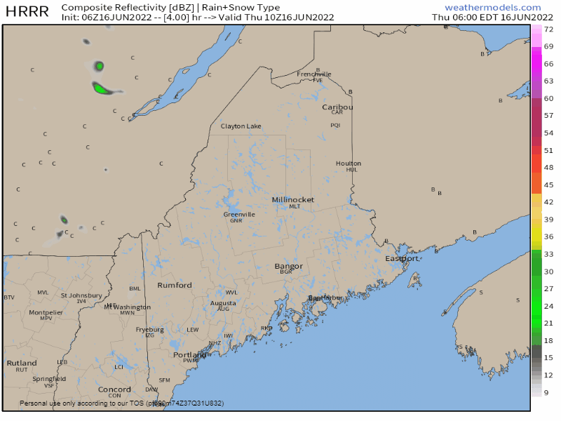 Thursday 6 AM to 6 PM - Given the dry air over the region, I don't expect much accumulation of rainfall as outflow ahead of the approaching warm front sneaks ahead into the area. The clouds may poof up and darken in spots and may produce a light shower or sprinkle, but most of the area misses rainfall through the bulk of the day. 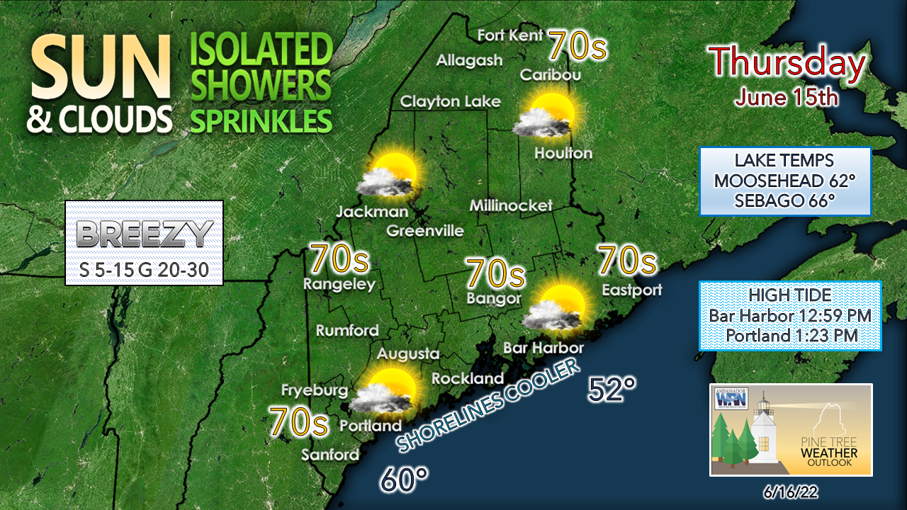 The breeze from the south is expected to crank up again as the warm front approaches and may be stiff enough to blow around any light objects (30 mph) along the coast in the afternoon. The southerly flow also raises humidity levels later in the day. High tides are slowly subsiding from astronomical highs and flood statements have been dropped for now. Showers and rumbles Thursday night into early Friday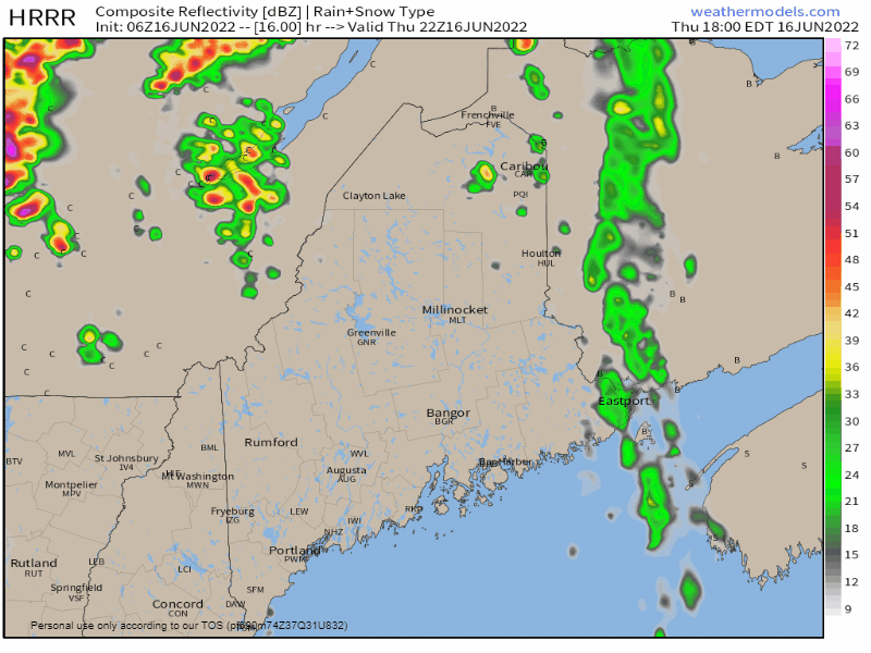 Thursday 6 PM to Friday 6 AM - The warm front moves in from west heading into the evening and brings the risk for showers and rumbles of thunder overnight into early Friday morning. There could be decent light show from the storms in spots and rumbles could wake folks up. Storms could generate localized downpours but appear to stay below severe levels due to lack of heating. Some gusty wind may occur with storms as well. For those camping out, make sure your site is cleaned up, secure any loose objects, and cover anything that you don't want to get wet. Showers and strong to severe storms for Friday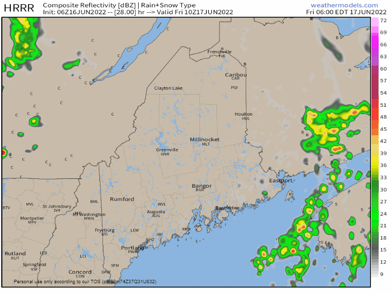 Friday 6 AM to 6 PM - The cold front works through the region during the day and could bring some snarky storms as it passes through. Expect areas of fog in spots Friday morning from the showers and storms in the previous nighttime hours. Expect it to be sticky as well with dew points in the 60s for most locales. As the front approaches, dew points rise and could reach the upper 60s. Storms could produce gusty wind, downpours, frequent lightning, and hail. Stay aware and have multiple ways to receive alerts. After the frontal boundary passes through, widely scattered showers are possible Friday night into early Saturday, along with falling humidity and a breezy northwest wind. Father's Day weekend outlook: damp and cool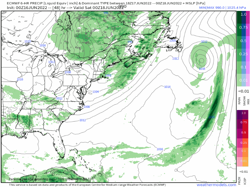 Friday 8 PM to Monday 8 PM - An upper-level low and associated trough settles in over the region through the first of the week. Off and on showers are expected at times on Saturday, with southern areas having the best chance to stay mainly dry for the day. The likelihood of the upper-low setting up a surface low over the Gulf of Maine Saturday night into early Sunday is growing in confidence, which could make Father's Day a showery affair. The upper-low and trough slowly begin to move east on Monday, with shower potential for the west, east and north continuing. 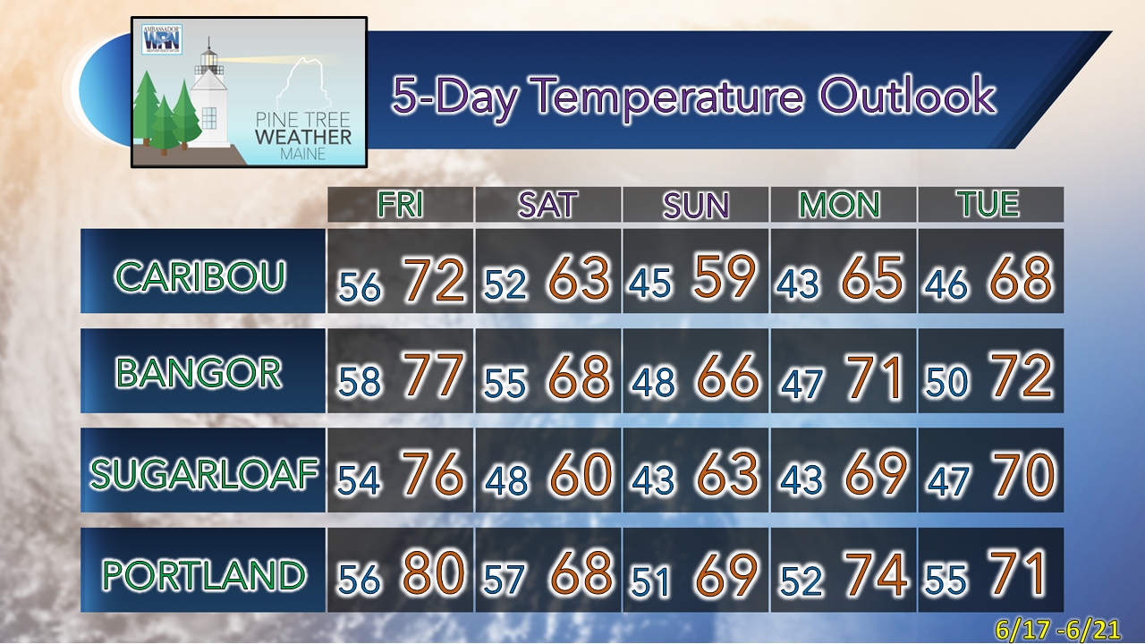 Thank you for supporting this community-based weather information source which operates by financial contributions from people like you. Stay updated, stay on alert, and stay safe! - Mike NOTE: The forecast information depicted on this platform is for general information purposes only for the public and is not designed or intended for commercial use. For those seeking pinpoint weather information for business operations, you should use a private sector source. For information about where to find commercial forecasters to assist your business, please message me and I will be happy to help you. |

Mike Haggett
|


