
Best chance for severe storms south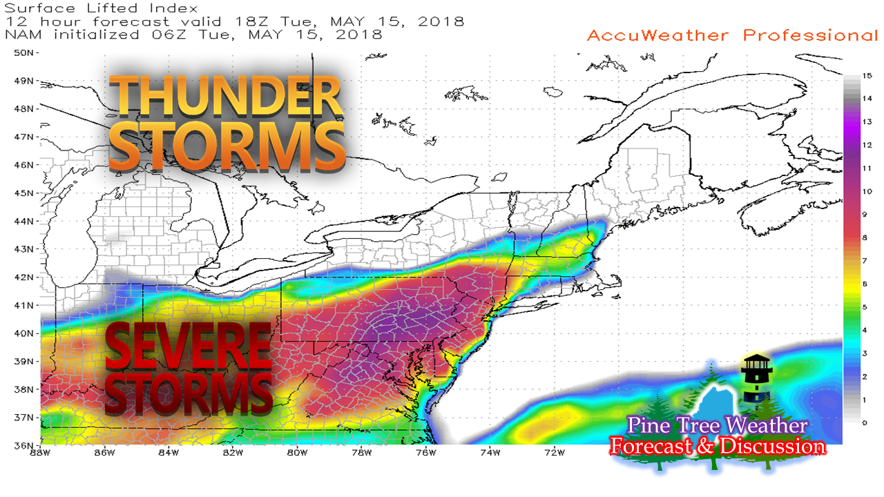 This is shaping up to be one of those days where guidance gives strong hints but actual results may vary. A strong cold front is bearing down on the region. Ahead of it comes the humid air which will advance northeast and bring fuel for thunderstorm activity. How far north the humid air penetrates in conjunction with how much sun will get out after the initial wave skirts through the region midday will tell the tale on late afternoon storm threats. SPC Outlook... subject to change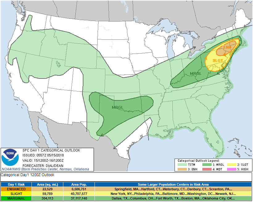 There is no question that the MidAtlantic and southwest New England is likely to have a rough afternoon. There is a very good chance for supercells to develop which would bring frequent lightning, damaging wind, hail, flash flooding and tornado potential. Again, how far north into Maine this creeps is to be determined. The waves...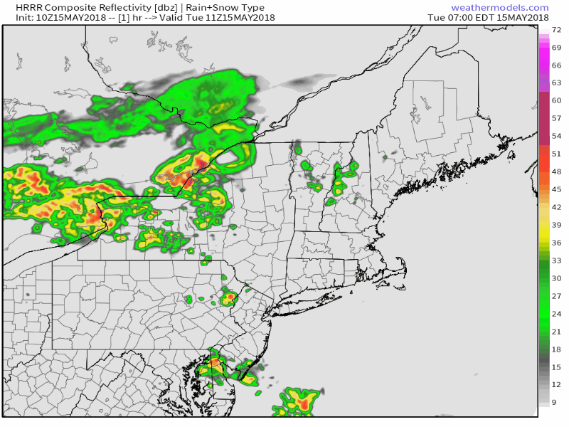 Guidance is more or less in agreement of the first wave pushing through the region early in the afternoon. It also suggests that the sun could peek out in southwest areas roughly in the 2:00 - 5:00 range. This is especially concerning for Southern Oxford, Androscoggin, Cumberland, York, Sagadahoc, Lincoln, Waldo, Knox and Kennebec Counties. If the sun can get out and heat the low levels of the atmosphere up, it will provide fuel to strong to severe storms to develop through early evening when the front moves offshore. Rain dependent on storm formation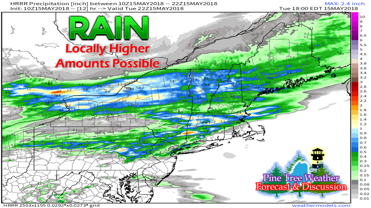 There is a good chance that most of the region sees some rain out of this, which is necessary at this point. Anytime strong to severe storms form, there is always a threat for locally higher amounts of rainfall. There will be a chance for localized flash flooding as a result of very heavy rain and a dry soil combination. While the greatest threat will be for the southwest part of the state, the afternoon sun will dictate how much further north and east that threat may occur. Eye to the sky, put your ears on, and stay informed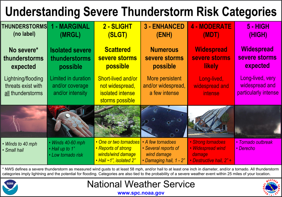 Given the scenario, southern areas could be upgraded from minimal impact to marginal threat as far as Storm Prediction Center's forecast criteria goes. This is one of those days where the forecast could turn into "nowcast" meaning warnings could be issued on an as need basis. Understand that there is a threat here. Conditions can change in a hurry. Don't be fooled to think that severe weather isn't possible. Stay on alert. Stay updated. Take shelter if necessary. When thunder roars, head indoors. Links to watch for the dayStorm Prediction Center Day 1 Outlook (time sensitive)
National Weather Service Gray for western & southern Maine and New Hampshire National Weather Service Caribou for northern & eastern Maine My Twitter feed @WesternMEwx for updates and analysis as needed. - Mike |

Mike Haggett
|


