
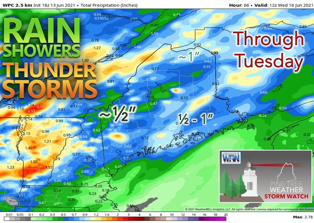
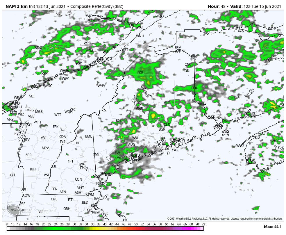
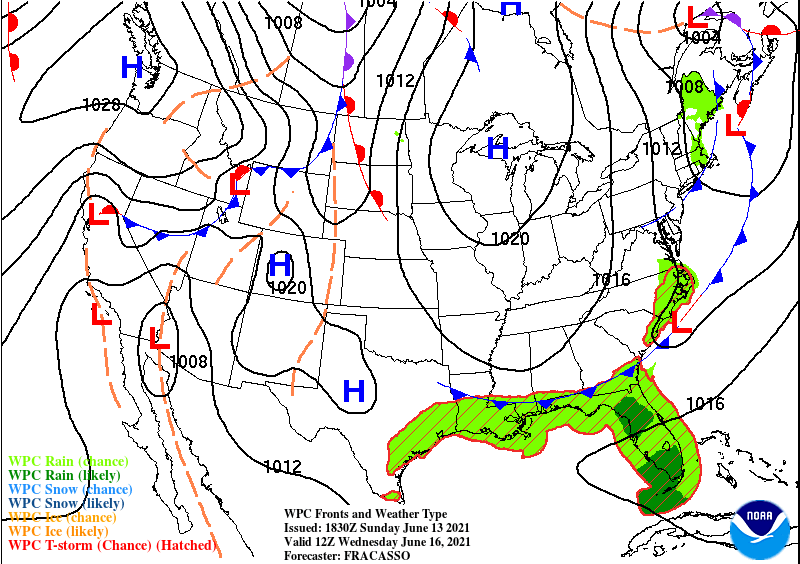
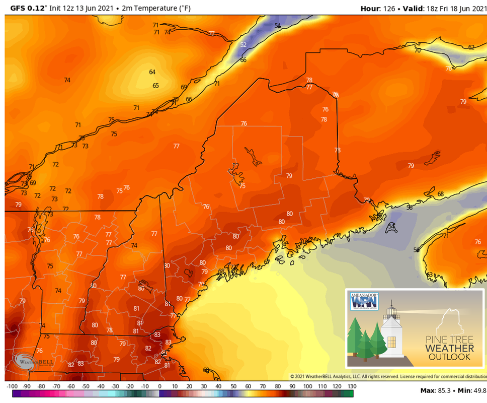
 Most areas should see at least 1/2" of rain with a possibility of over 1" in localized areas from thunderstorms. Showers throughout the day on MondayAs a trough at 500mb sits over the Midwest, repeated pockets of shortwave energy will round the base and pass through the state, resulting in multiple rounds of showers throughout Monday and continuing into Tuesday. Rain showers begin early Monday morning starting in Western Maine before spreading throughout the rest of the state by the end of the day and into the night. A thunderstorm or two is also possible. Mostly cloudy conditions across the region with a few more breaks in the clouds towards the east. As a result, temperatures should reach the lower 70’s in parts of the east, except for along the coast, while remaining in the 60’s towards the west. Breezy with winds 10-15 mph gusting to 30 mph. 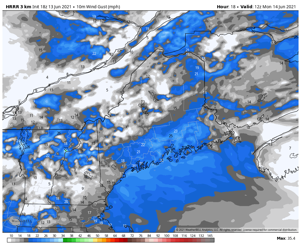 Winds will be quite gusty during the day on Monday, possibly reaching 30mph or more Showers and thunderstorms persist through Tuesday |
| | BE PREPARED WITH A NOAA Weather Radio. For $20-$40, it could provide vital information to you when you need it. The weather bands are standard on most public safety scanners, and newer scanner models. Weather radios can be programmed for auto alert. Click here for more information. |
| ► ► For the latest official forecasts, bulletins, and advisories, please check in with the National Weather Service in Gray for western and southern areas, or Caribou for northern and eastern parts of Maine. | |

Thank you for supporting this community-based weather information source which operates by reader supported financial contributions.
Stay updated, stay on alert, and stay safe!

Mike Haggett
Kennebunk, ME
Weather-Ready Nation
Ambassador
Certified Weather
Forecaster
Penn State '21
American Meteorological Society
National Weather Association
SKYWARN-CWOP
Matthew 19:26
Please
Support
Pine Tree Weather
In 2024


Archives
July 2024
June 2024
May 2024
April 2024
March 2024
February 2024
January 2024
December 2023
November 2023
October 2023
September 2023
August 2023
July 2023
June 2023
May 2023
April 2023
March 2023
February 2023
January 2023
December 2022
November 2022
October 2022
September 2022
August 2022
July 2022
June 2022
May 2022
April 2022
March 2022
February 2022
January 2022
December 2021
November 2021
October 2021
September 2021
August 2021
July 2021
June 2021
May 2021
April 2021
March 2021
February 2021
January 2021
December 2020
November 2020
October 2020
September 2020
August 2020
July 2020
June 2020
May 2020
April 2020
March 2020
February 2020
January 2020
December 2019
November 2019
October 2019
September 2019
August 2019
July 2019
June 2019
May 2019
April 2019
March 2019
February 2019
January 2019
December 2018
November 2018
October 2018
September 2018
August 2018
July 2018
June 2018
May 2018
April 2018
March 2018
February 2018
January 2018
December 2017
November 2017
October 2017