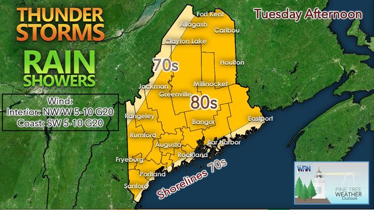
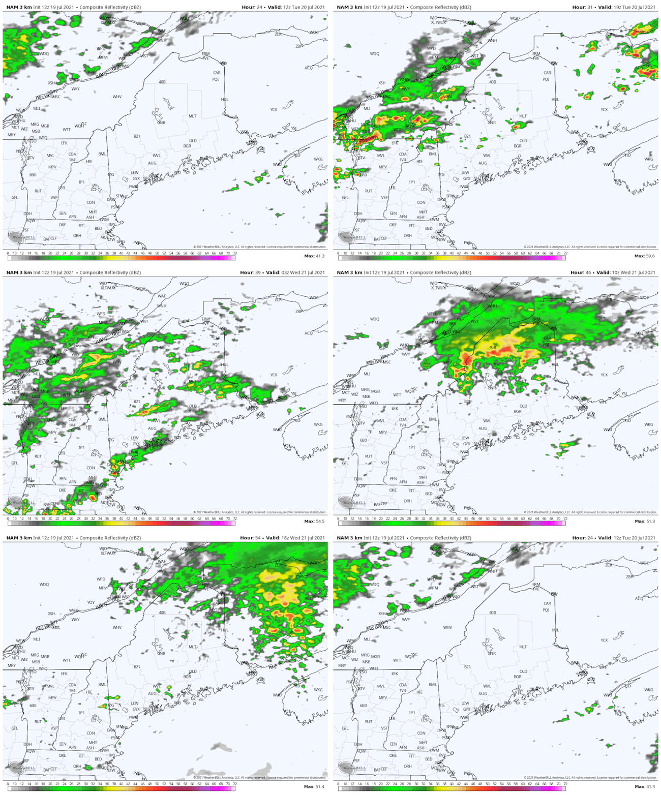
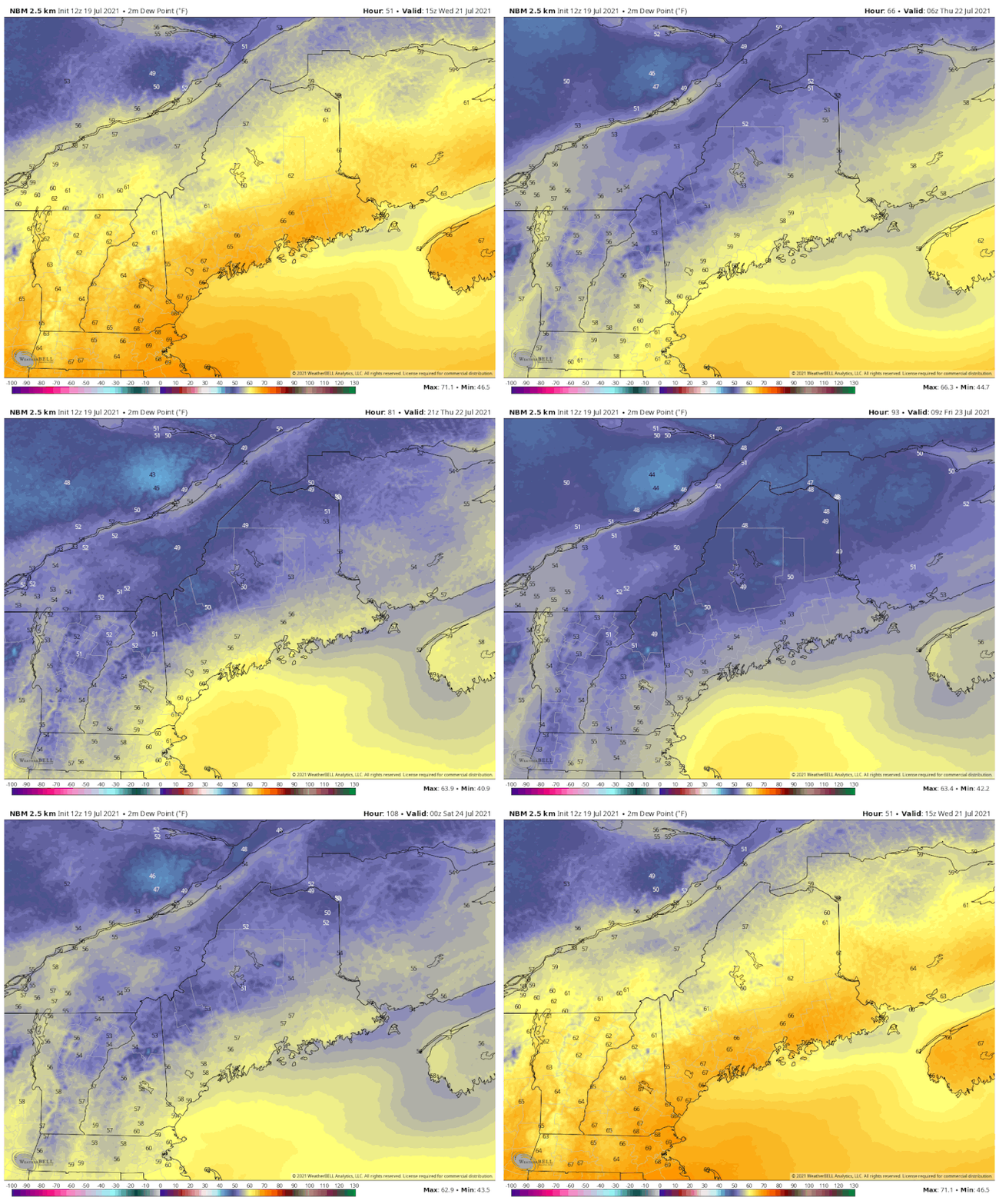
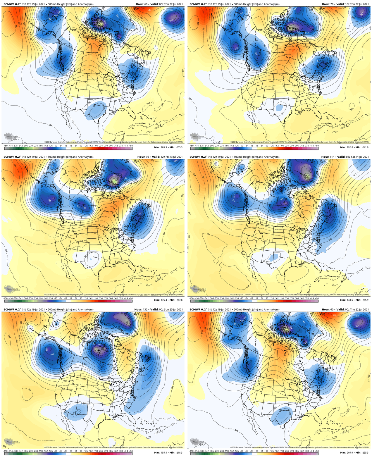
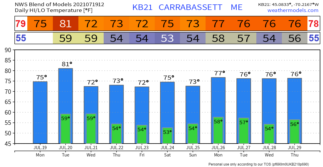
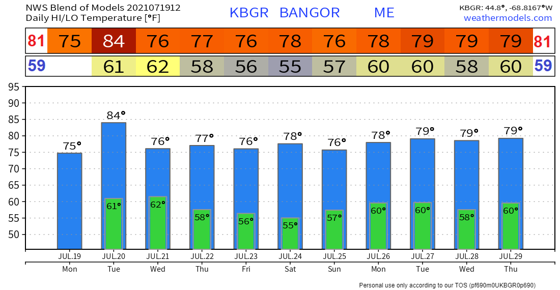
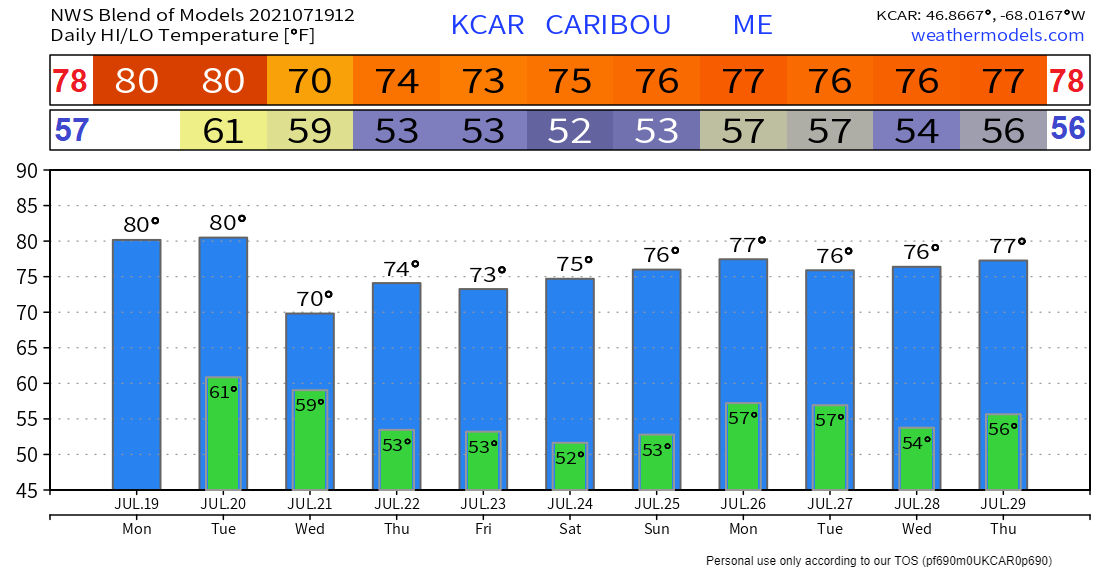
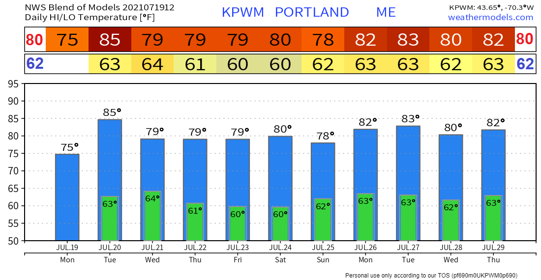
Showers and thunderstorms possible TuesdayEarly Tuesday morning, there could be some areas of dense fog along the Midcoast as well as in the river valleys. For Tuesday afternoon into the evening, there is a risk for showers and thunderstorms across the state. This is associated with a shortwave trough that will approach the area from the west. The thunderstorms are not expected to be severe at this time due to a lack of wind shear; however, some of the stronger storms could produce isolated damaging wind gusts. The showers and thunderstorms should move into the mountains of western Maine by the afternoon and progress across the state from west to east through late evening Tuesday. There is a marginal risk of excessive rainfall for the entirety of the state Tuesday as some of the thunderstorms could produce locally heavy rainfall. High temperatures on Tuesday should be in the lower 80's for most of the state with 70's elsewhere. Renewed chances for showers and storms Wednesday With the loss of daytime heating, any showers and thunderstorms across the region should fall apart Tuesday night. Lows Tuesday night should be in the low to mid 60's for most. For Wednesday afternoon and evening, we can expect a renewed chance for showers and thunderstorms out ahead of a frontal boundary pushing to the southeast through the state. There is once again the risk for a few stronger storms Wednesday as well as a marginal risk of excessive rainfall associated with the thunderstorms. High temperatures Wednesday should be about 10 degrees cooler than they were on Tuesday statewide. Comfortable and pleasant Thursday and FridayThursday should be a mainly quiet and less humid day across the state with partly to mostly sunny skies likely and high temperatures in the upper 60's to lower 70's. Friday should be similar with partly to mostly sunny skies expected and high temperatures in the mid 60's to lower 70's. However, there is a chance for a few showers and perhaps an isolated thunderstorm Friday associated with an upper level low. Long range weather pattern for MaineInto the weekend, we can expect seasonable temperatures and a relatively quiet weekend as a shortwave ridge builds into the region. We look to become more unsettled into the early part of next week as a southerly flow returns bringing more moisture into the region. Temperature outlook through end of July The plots below show the projected daily high/low temperatures over the next ten days for Carrabassett, Bangor, Caribou, and Portland. Additionally, these daily high/low temperatures are compared to the average temperatures for this time of year for each town. Temperatures appear to be seasonable to slightly below average through early next week. CoCoRaHS Maine- volunteers neededHELP WANTED! Ever wanted to take rain or snow measurements? Join CoCoRaHS or Community Collaborative Rain, Hail, and Snow Network. This volunteer network of observers measures precipitation from their backyards. Any age can volunteer. Data is used by NWS meteorologists to help with forecasts. For more information, check out the CoCoRaHS Maine website. Be prepared to receive alerts and stay updated!
For more information in between posts, please follow Pine Tree Weather on Facebook and Twitter.
Thank you for supporting this community-based weather information source which operates by reader supported financial contributions. Stay updated, stay on alert, and stay safe! |
Mike Haggett
|

