
|
I am in the process of doing some cosmetic and functionality updates here with the website and will continue to chip away at it over time. I am working to set myself up to save time while providing you quick access to information beyond the scope of what I have time to do here. All the tabs on the site have been gone through, broken links and images have been fixed. There are plenty of resources to tap into for information beyond the forecast. I hope you will use them when needed to help with your decision-making process, whether a storm is imminent or it's a trip out to the lake or beach. I sincerely appreciate the support of my faithful donors that supply the funding to keep this going and to those who pass my efforts along to others to grow my readership base. A weak disturbance passes through Saturday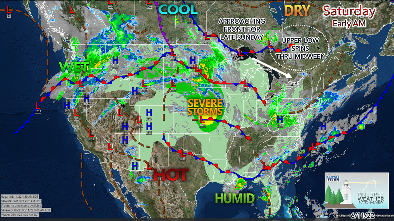 The upper low over eastern Quebec has shifted to the southeast and is pinwheeling disturbances through the region. Popcorn cumulous clouds are expected to develop over the region after a mainly clear start. High level cirrus associated with a frontal boundary offshore may dim the sun a bit over the coastal plain. 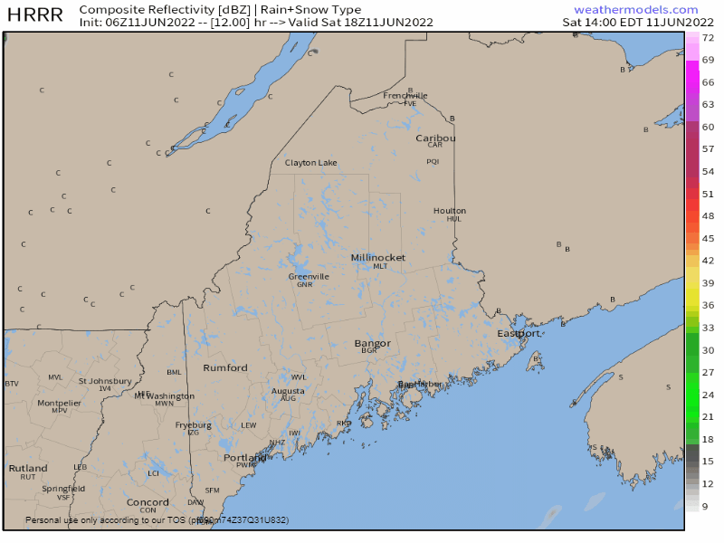 Saturday 2 PM to Sunday Midnight - As the weak disturbance sweeps through, it may touch off a quick pop-up shower or two, but the risk of rainfall is more of a miss than a hit later in the afternoon into the evening. 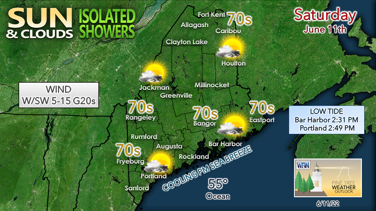 Temperatures make a run at the 70s most everywhere away from the shorelines. With high pressure in control for the day, the sea breeze is expected to kick up and cool the coastal communities and those nearby. Rain holds off until late on Sunday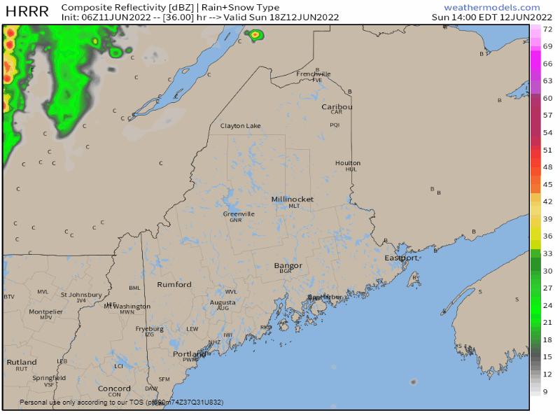 Sunday 2 PM to Monday 2 AM - A cold front approaches the region Sunday and clouds are expected to increase as it moves in. Most of the day stays dry. Outflow ahead of the front may pop an isolated shower toward evening across the region. A thunderstorm is possible over the mountains and Allagash region from late afternoon into early evening. Rain could be heavy at times Sunday night into Monday as the approaching front taps into moisture from the south. Expect areas of fog and rain tapering to showers Monday morning, clearing out from west to east Monday afternoon. Use caution during travel for the commute. 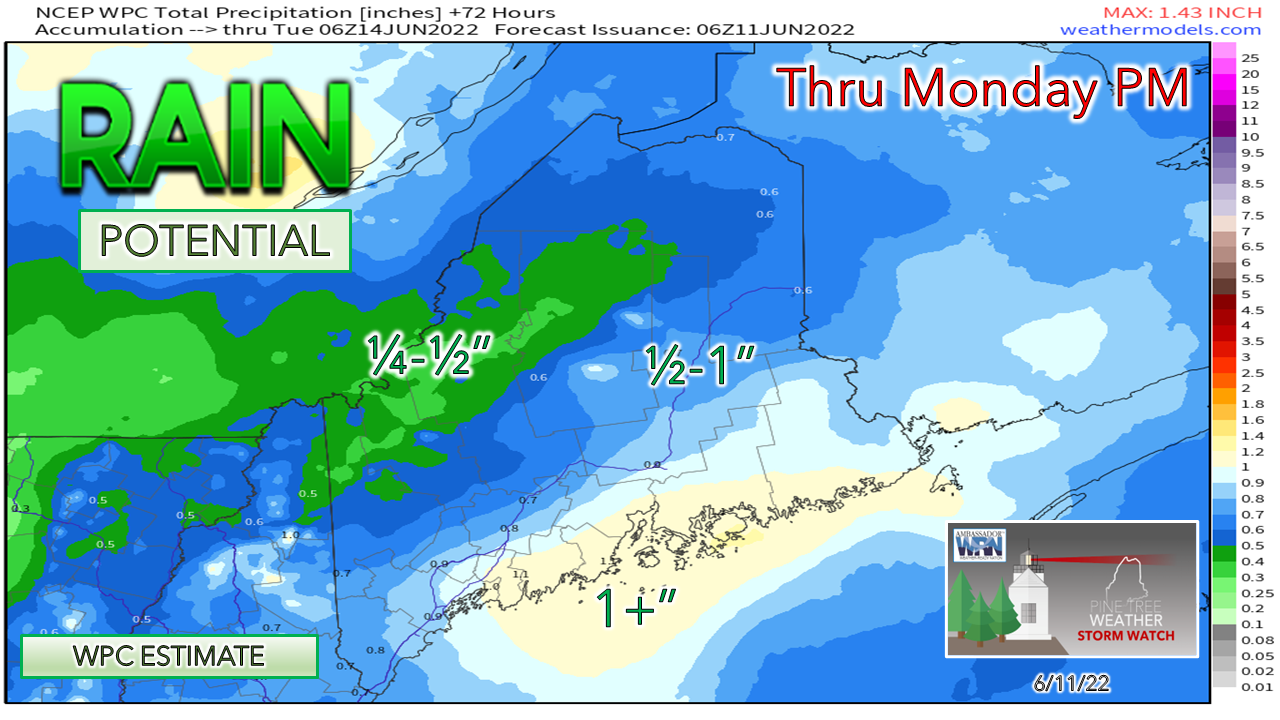 Another decent rainfall is expected for the coastal plain, with lesser amounts expected north of the mountains. Locally higher amounts are expected in any areas of downpours. Temperature outlook through ThursdaySpot shower activity remains a possibility for the mountains and north for Tuesday as the upper low gradually moves to the east. A ridge builds in from the west which brings a bit of warmer weather on the way later in the week. A cold front approaches the region late in the week and brings a chance for showers on Friday. Operational model ideas are widely scattered with ideas for Father Day weekend, expect a better idea on that by midweek. 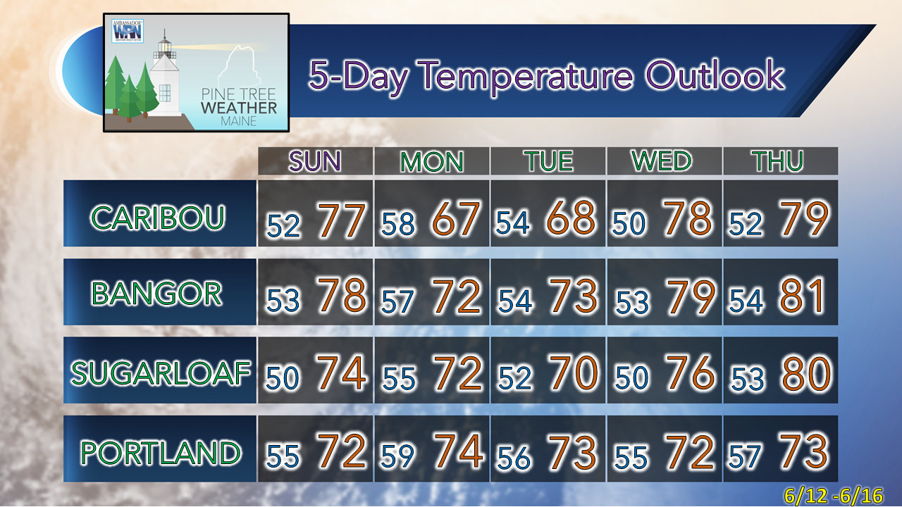 Thank you for supporting this community-based weather information source which operates by financial contributions from people like you. Stay updated, stay on alert, and stay safe! - Mike NOTE: The forecast information depicted on this platform is for general information purposes only for the public and is not designed or intended for commercial use. For those seeking pinpoint weather information for business operations, you should use a private sector source. For information about where to find commercial forecasters to assist your business, please message me and I will be happy to help you.
|

Mike Haggett
|


