
Rain with a chance for a rumble south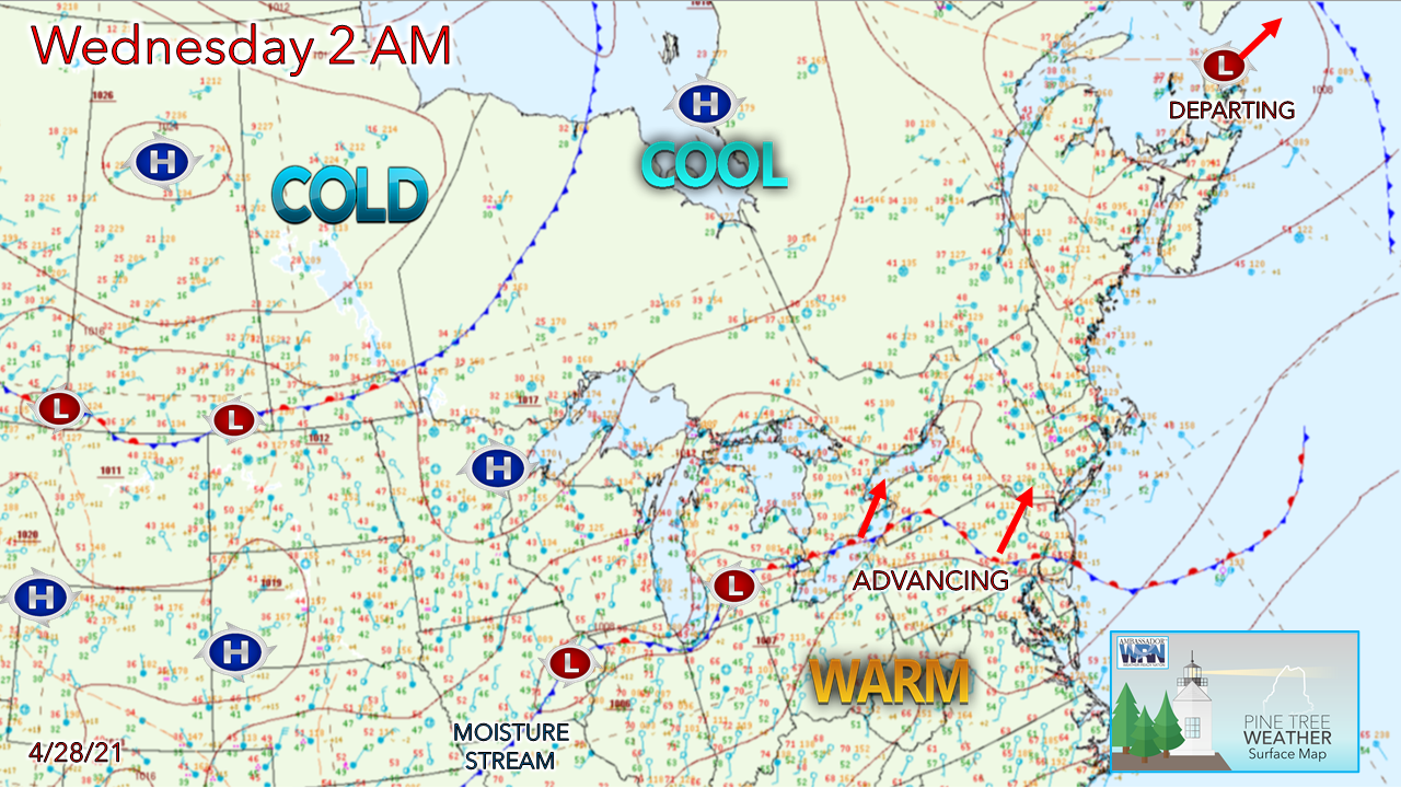 It will be the tale of two Maine's for Wednesday. Northern areas see sun and 60s, where southern areas see showers and 50s. Disturbances crossing over the ridge building in from the southwest bring breaks in precipitation. Off and on showers through Thursday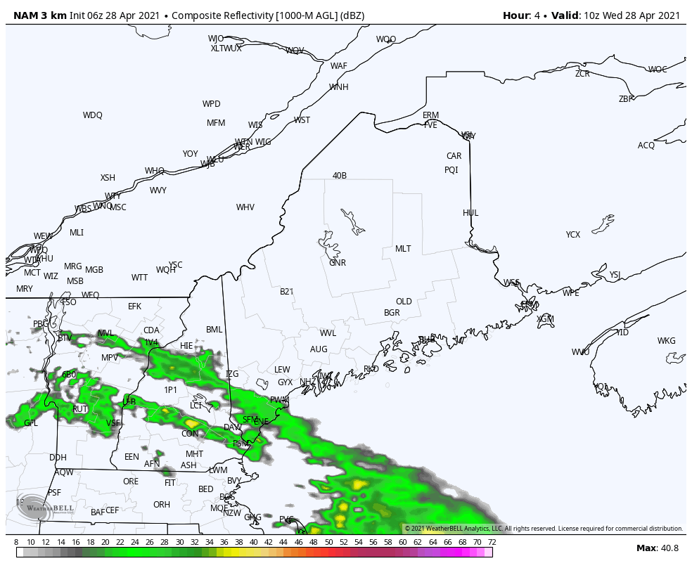 The first wave of shower activity crosses southwestern areas through the early morning hours. After a pause, another wave passes through this afternoon. There is a low chance for a rumble of thunder for far southwestern areas, with a quick downpour and a gust of wind along may accompany it, but the best chance for that is over southwestern New Hampshire. Steady rain over southwestern areas starts off Wednesday evening. 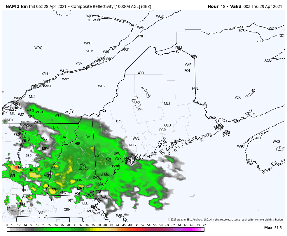 Showers become scattered into the overnight. As the ridge moves further northeast, the rain shield advances with it, bringing the chance for early morning showers into eastern areas into Thursday. 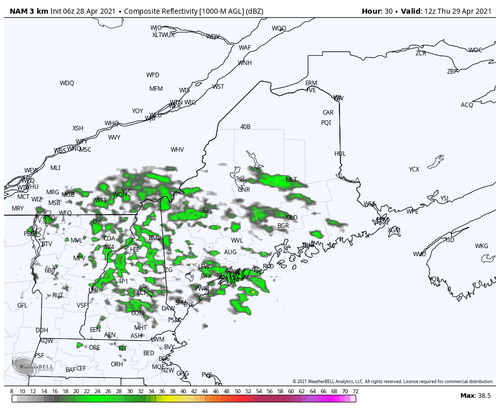 Scattered showers continue through Thursday for all but northern areas. After a pause late Thursday afternoon, the pieces begin to come together for a widespread event Thursday night into Friday. Friday storm brings rain of benefit to most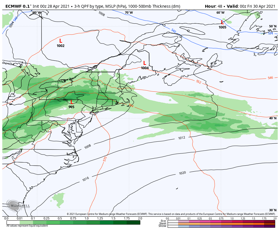 The Friday forecast is a bit tricky for interior areas as a mid-level trough dips into the region late afternoon. With the storm intensifying as it heads into New Brunswick, it could tap into cold air lurking to the north. This could flip rain to wet snow for the higher elevations in the western mountains and north as the storm departs. Expect a breezy day with wind gusts 20-30+ mph. 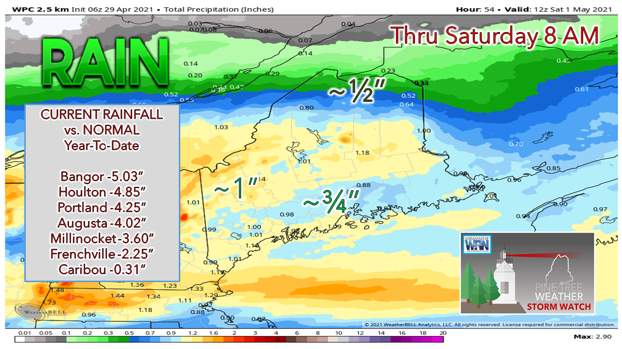 The Weather Prediction Center's idea for rainfall through early Saturday is a fair base point as for what to expect. The Friday storm could overperform for precipitation amounts with earlier phasing. Either way, the region appears to get a decent amount, which is much needed after the dry winter. Spending Time Outdoors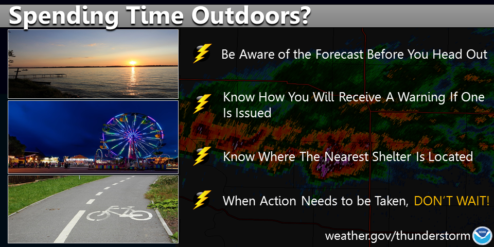 Spending time outdoors? Be on the lookout for thunderstorms! Keep up with the latest NWS forecast before you head out and know how you will receive a thunderstorm warning if one is issued. Identify where the nearest shelter is located, and if the skies turn threatening, seek shelter immediately. weather.gov/safety/thunderstorm Seven-day temperature outlook through TuesdayAfter any lingering showers clear out Saturday morning, the rest of the weekend appears dry. The next system works into the area Sunday night. The first week of May appears warmer than normal, but unsettled with rain chances through the week. 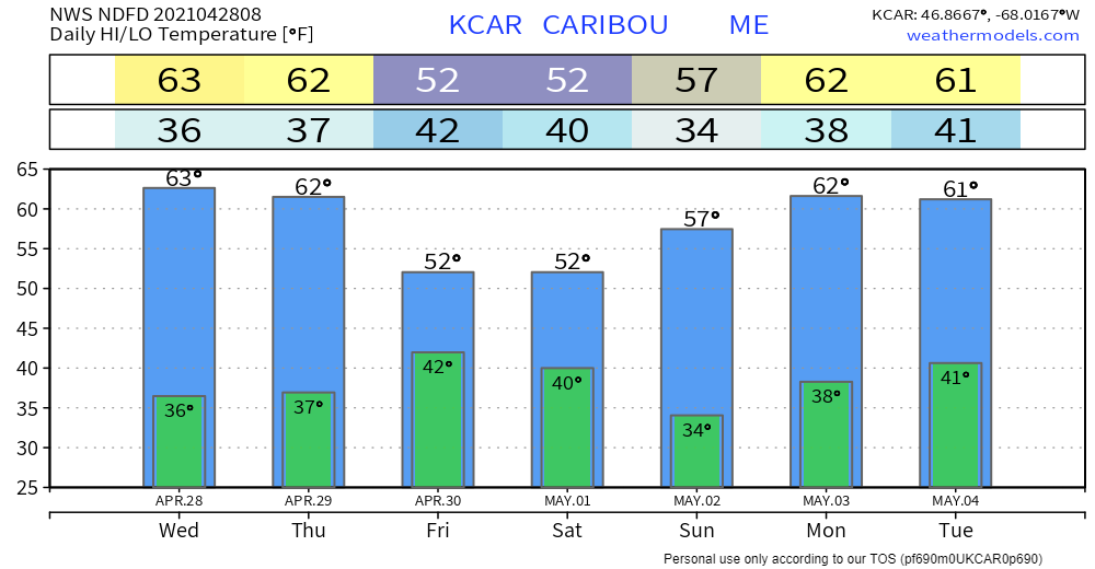 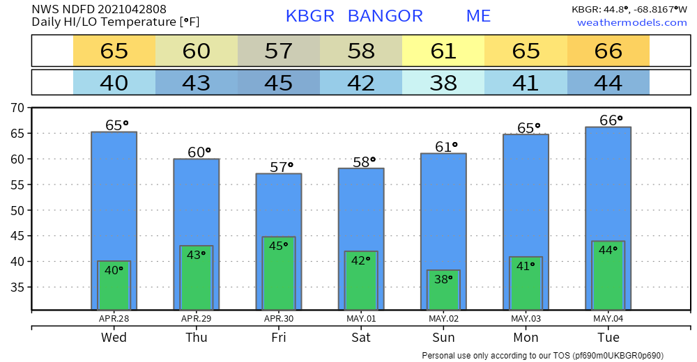 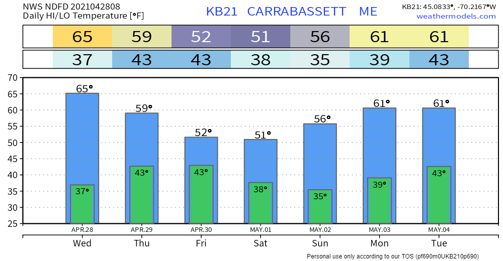 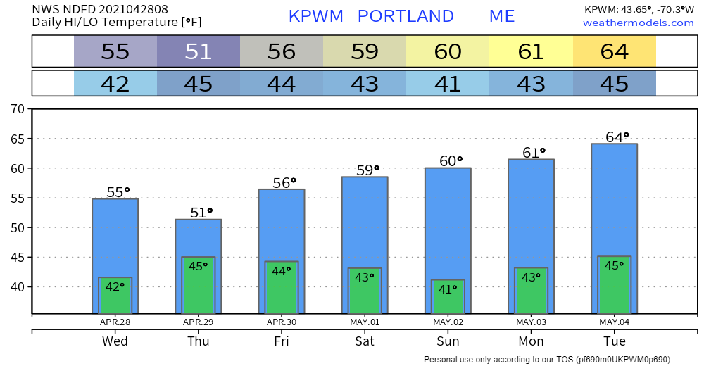 Be prepared to receive alerts and stay updated!
For more information in between posts, please follow Pine Tree Weather on Facebook and Twitter.
Thank you for supporting this community-based weather information source which operates by reader supported financial contributions. Stay updated, stay on alert, and stay safe! Thank you as always for your support! - Mike |

Mike Haggett
|


