Interior areas may get a touch of frost in spots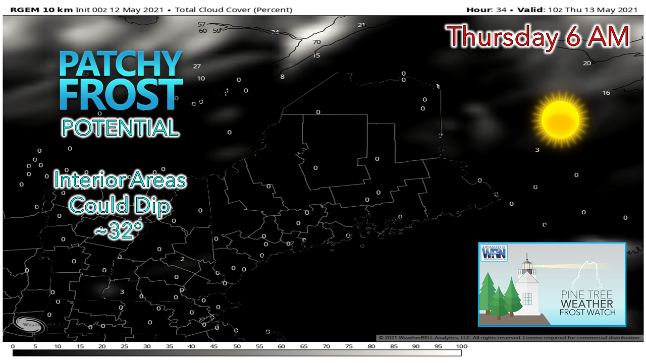 The only real impact item to speak of is the potential for some patchy frost over interior areas. The National Weather Service Gray office has issued a frost advisory for southern Oxford County. Due to timing of annual growing seasons, frost advisories are not issued for much of the state just yet. For those who live in well protected areas over interior areas would be wise to cover up any vegetation of importance as a safety precaution. The wavy pattern continues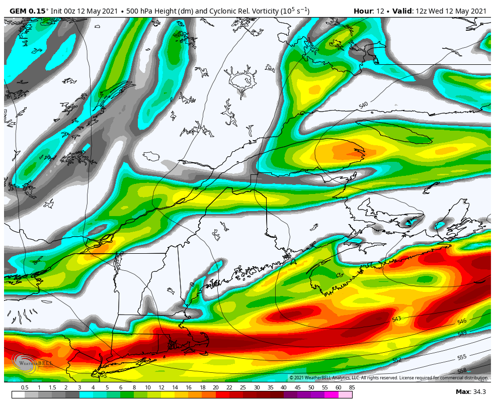 The forecast over the past few days has been on repeat status like a vinyl music record with a scratch on it. The upper-level vorticity loop above from 8 AM Wednesday to 8 PM Sunday shows disturbance after wave working through the region. The air mass aloft is on the cool side and will continue to be for a while. 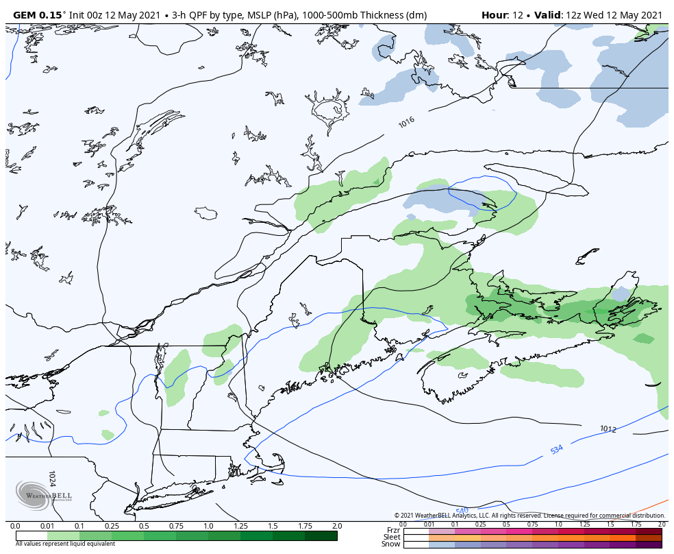 What that translates into is a situation where the sun of the day warms the surface and heat rises into the cooler air. This diurnal heating causes clouds to increase. The vorticity pinwheels across the region, and assists to touch off showers with low capped, weak thunderstorms that bring a quick gust of wind, small hail, and quick shot of heavy rain. Showers and storms are widely scattered and vary by region and time of day. This pattern is expected to continue through Sunday. Friday appears to be only dry day region wide in the next five days. 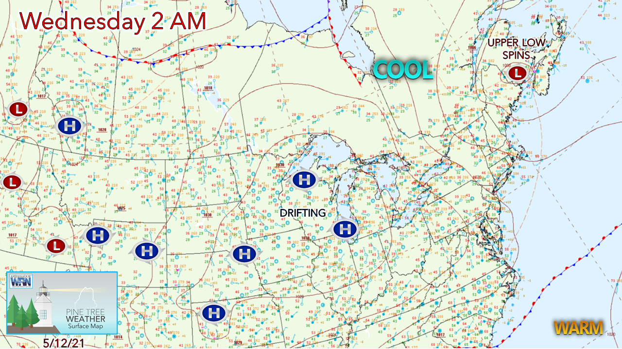 A look at the surface map shows a weak surface low over New Brunswick. With high pressure to the west, this set up brings reinforcing shots of cooler air aloft. A northwesterly breeze generated between the highs and the low keep temperatures slightly below normal for the day. 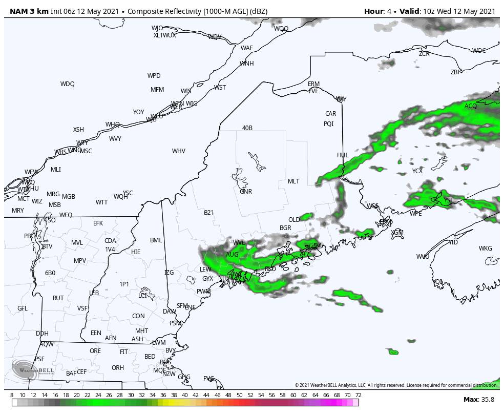 As the heating of the day warms the surface and upper-level energy passes through, a pop up shower is possible through 8 PM Wednesday. Once the sun goes down, showers end, the sky clears, which sets up potential for patchy frost for interior areas Thursday morning. 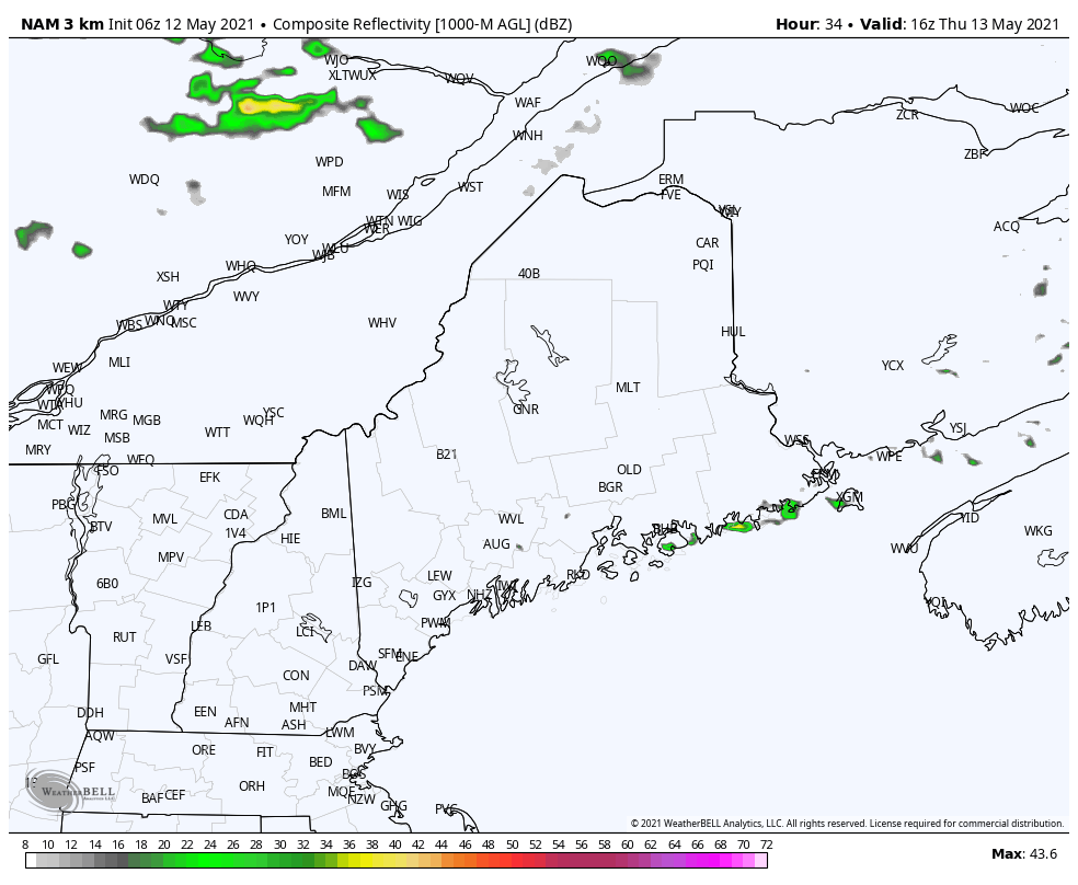 For Thursday, more of the same. A clear sky to start off, the heating of the day creates clouds in the afternoon and showers to break out as another upper-level wave passes through. This loop from noon Thursday to midnight Friday shows the best chance for rain in the north and mountains. Outlook into next week: continued cool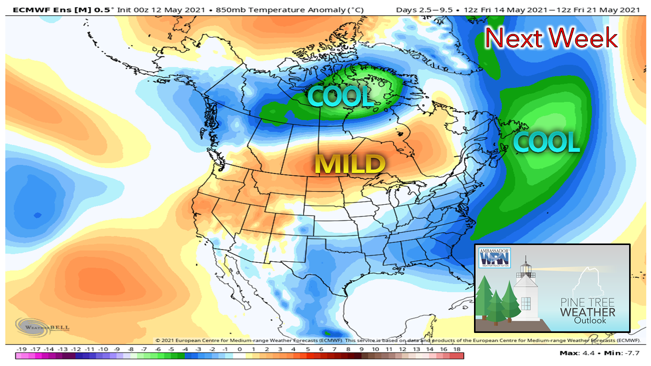 For those who love heat and humidity, you'll have to wait awhile. The pattern remains on the slightly on the cool side overall. There will be chances for parts of the state to take a run at 70° at times in the next week. If anything, it remains comfortable through next week. Temperature outlook through Tuesday 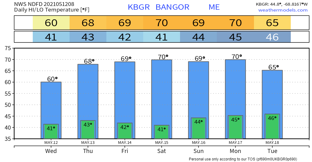 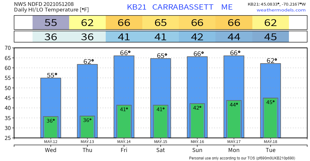 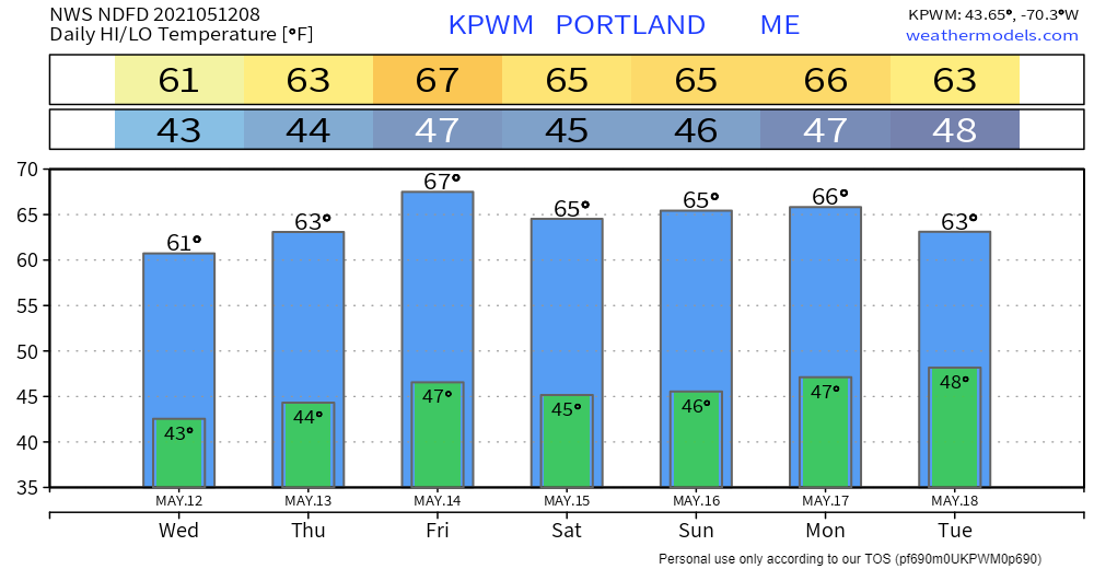 Join the weather community as a storm spotter!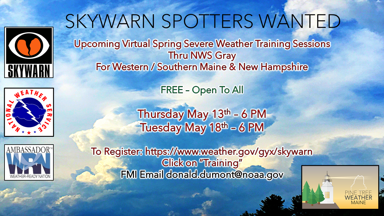 Here's a wonderful way to become active in the weather community and help the US National Weather Service Gray ME, broadcast media and forecasters like myself with storm reports. This information is vital during and after an event for forecasting and alerting purposes. I can't tell you how many times I have seen the importance of these reports in the past 9+ years I have been involved. Pine Tree Weather followers have stepped up in the past and participated, and with the readership base continuing to grow, I know there are more out there. This is the spring/summer session which discusses severe weather, what to look for, and how to report it. These sessions run for about 90 minutes. They are fact filled, educational and interesting. You can get the whole family involved from the comfort and safety of home. Once completed, you will get your spotter ID, and will be ready for the season ahead. For those who trained for the winter session, this will complete your full year training. It's important to have both sessions done. The link to register is here ► https://www.weather.gov/gyx/skywarn#fragment-2a If you need more information, please contact Donald Dumont, the Warning Coordinating Meteorologist at NWS Gray via email [email protected] or message me directly. Be prepared to receive alerts and stay updated!
For more information in between posts, please follow Pine Tree Weather on Facebook and Twitter.
Thank you for supporting this community-based weather information source which operates by reader supported financial contributions. Stay updated, stay on alert, and stay safe! Thank you as always for your support! - Mike |

Mike Haggett
|