
Showers for most, windy for the coast on Monday; uncertainty on ocean storm impacts weekend outlook10/7/2019 A damp, stormy start to the week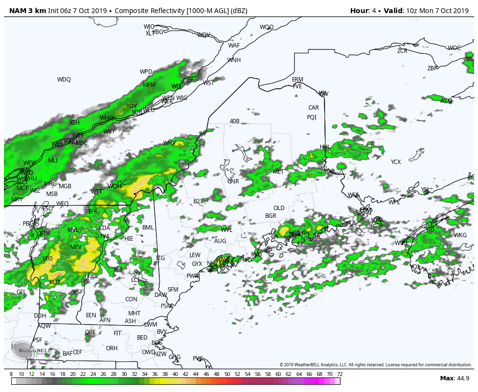 A cold front will pass through the region today. Timing remains on track for showers to become more numerous for the north and mountains through the morning. Outside of spot showers, the main event won't reach the coast until later in the afternoon. Showers end from northwest to southeast overnight, with the the remaining rain departing the coast by around dawn Tuesday.  The main swath of the heaviest rain runs roughly from Fryeburg to Bethel northeast to Houlton and Calais where roughly 1-2" is expected, with lesser amounts north and south. Downpours are possible as the atmosphere will be rather rich with tropical moisture. This may cause ponding on roadways, poor drainage flooding, along with reduced visibility. A rumble of thunder is possible, but severe storms are not expected. 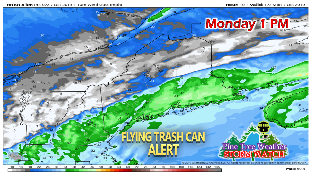 With the slow moving front, a southwesterly breeze is likely to increase out ahead of it and appears to be gusty at times through the afternoon. With potential gusts 30+ mph, leaves, debris and trash / recycling receptacles may be blown around through early evening along the coastal plain. As the front moves offshore, the wind will settle overnight. 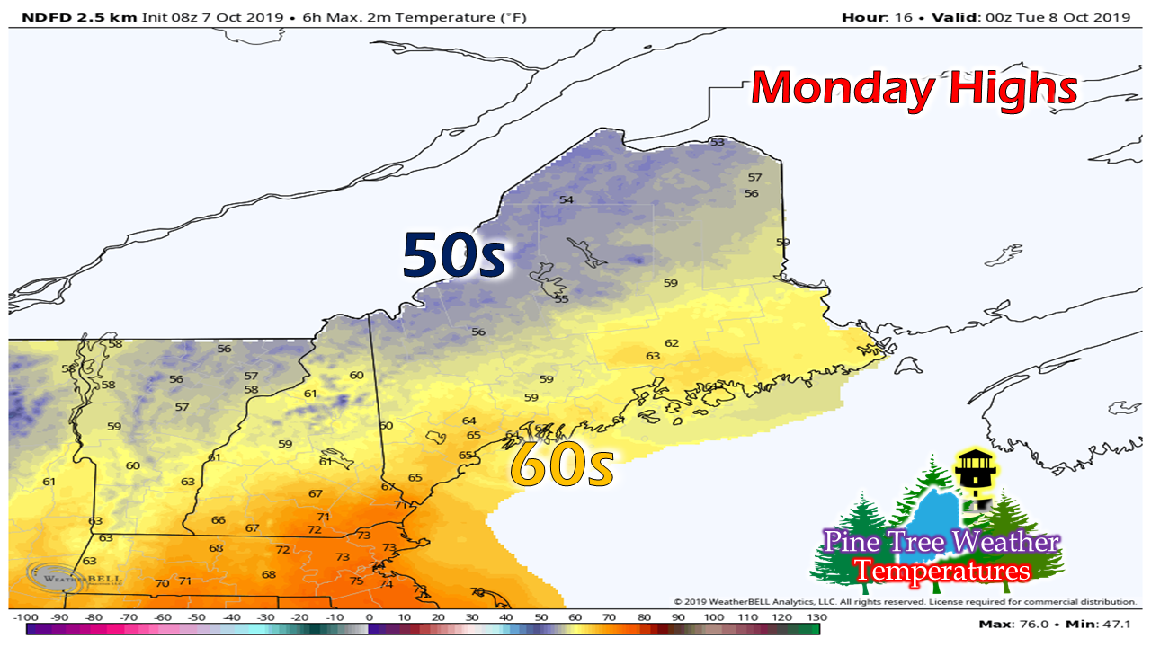 With the tropical moisture around, it will be on the muggy side as dew points will be close to actual temperatures. Humidity levels drop as the front passes to the southeast overnight. Outlook through midweek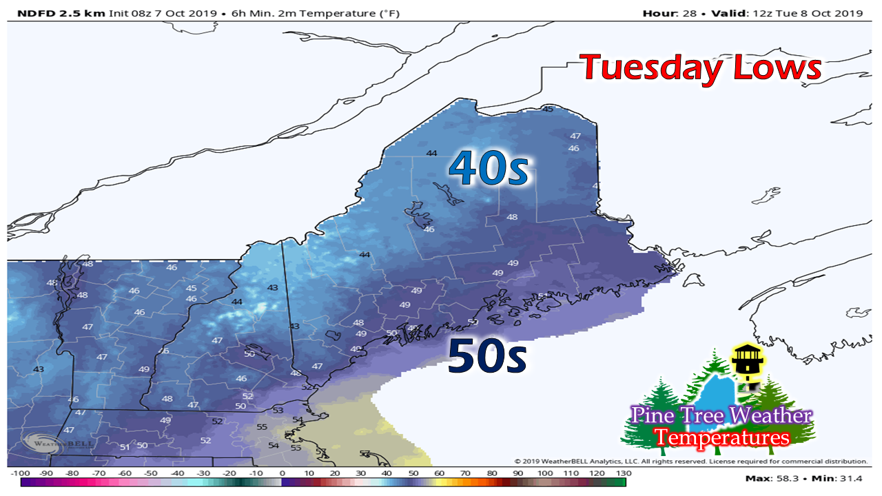 With the frontal passage, temperatures to start on Tuesday will be a bit cooler with 40s and 50s. 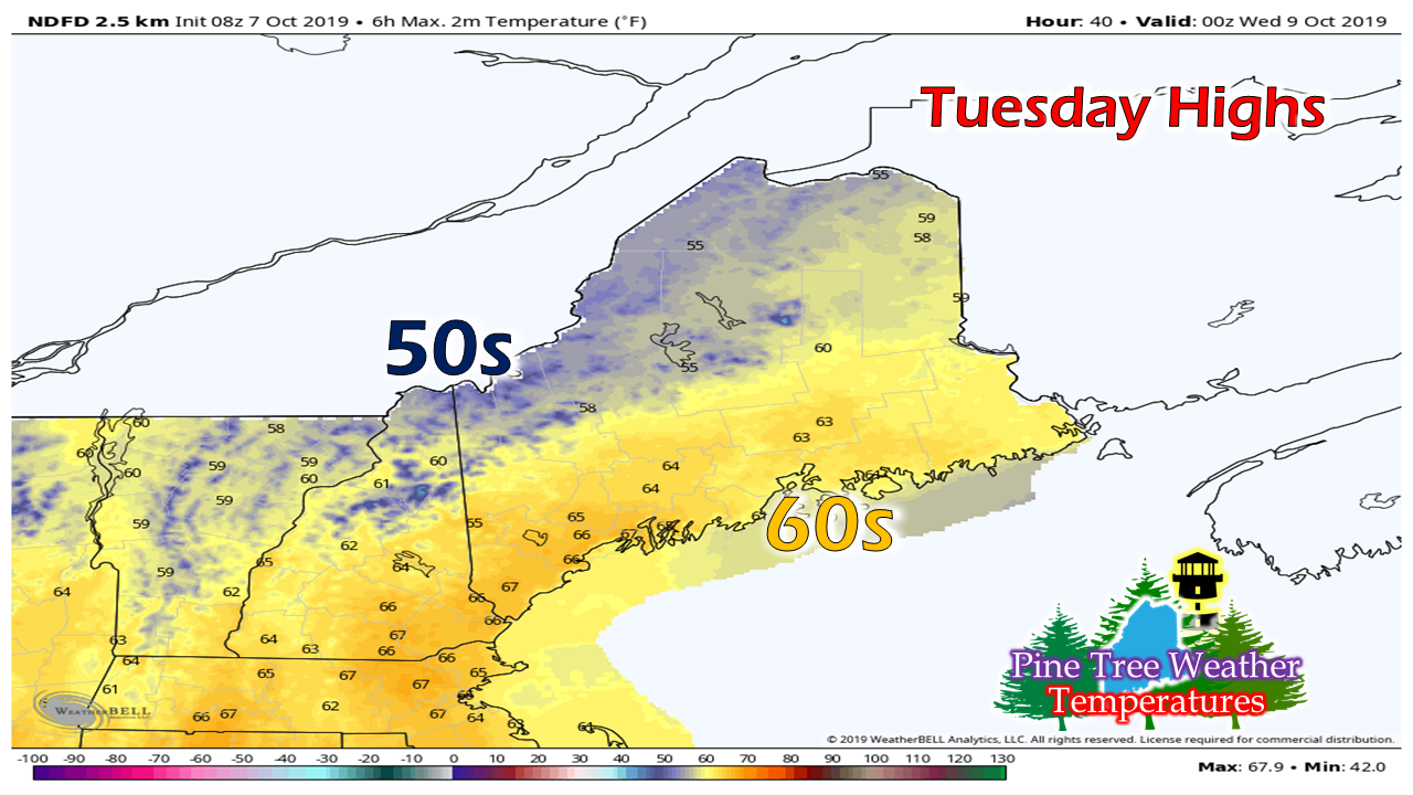 A northwest breeze in the 15-25 mph range kicks up with high pressure moving into the region. This will clear any remaining cloud cover out and drop the dew points into the 40s by afternoon. 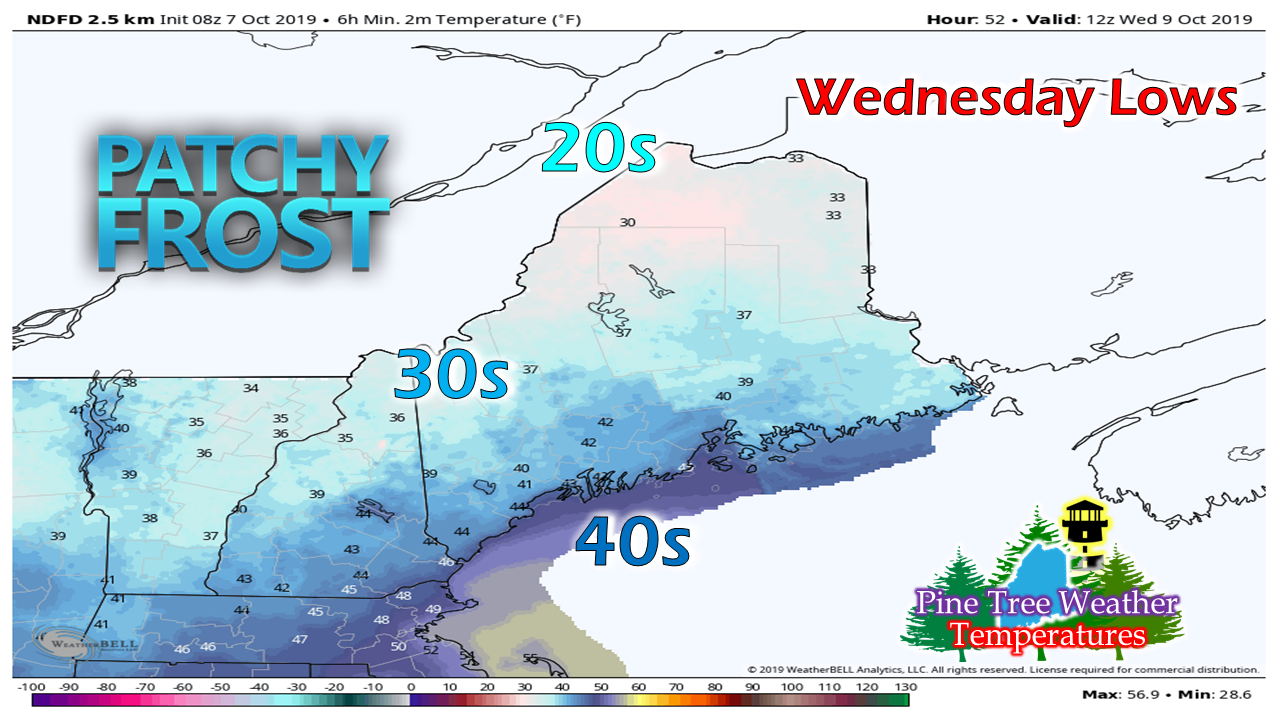 As high pressure settles in, the breeze drops and with a mainly clear sky for most, temperatures tumble. NOTE: Both the Caribou and Gray National Weather Service offices have declared growing season over and will no longer issue frost or freeze related bulletins until spring. For those that are still tending gardens, you'll have to monitor the forecast closely and cover up when necessary. Ocean storm may have weekend impacts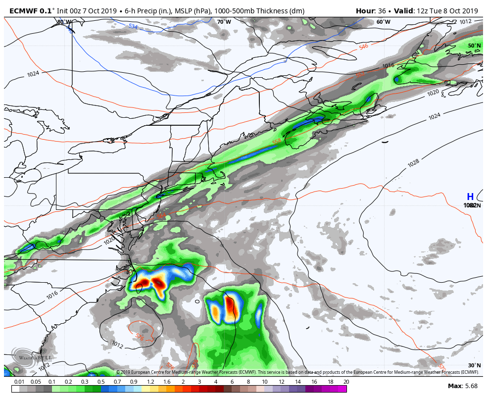 High pressure to the north keeps a brewing ocean storm with an associated upper level area of low pressure to the south of the region through the end of the week. There is still a great deal of uncertainty for any impacts to Maine. As I mentioned in Sunday morning's update, surf for the shorelines continues to be a fair bet at this point. For now, a chance for showers both Saturday and Sunday is the best estimate for now.
Stay tuned for more updates as the week unfolds. ► ► For the latest official forecasts, bulletins and advisories, please check in with the National Weather Service in Gray for western and southern areas, or Caribou for northern and eastern parts of Maine. DONATION DRIVE UPDATE - $1020 shortfall for the year ahead! You can help keep Pine Tree Weather going with a donation of any amount now through VENMO @PineTreeWeather, a monthly donation on Patreon or messaging me on Facebook or Twitter to send a check in the mail. Thank you for your support! For more information from me, please check the Pine Tree Weather Facebook page as well as my Twitter feed. Always stay weather aware! - Mike |

Mike Haggett
|


