
More beneficial rain on the way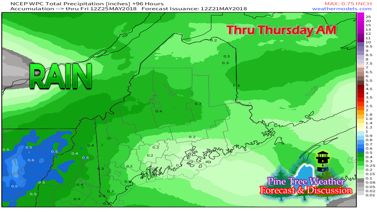 The area was able to get some benefit of shower activity over the weekend, and there is more on the way for Tuesday into Wednesday. As the foliage continues to grow in, the fire threat will gradually diminish toward the weekend, which is good news for campers and hikers that are planning to get out and enjoy the long weekend. Tuesday won't be a total loss as showers should hold off until around noon over south and western areas, and then work northeastward in the afternoon. Northern Maine should see most of the daylight on the dry end with showers reaching there by late afternoon / early evening. Wednesday sees showers slowly tapering from southwest to northeast during the morning, ending roughly late morning to mid-afternoon over northern and eastern areas. Memorial Day Weekend Watch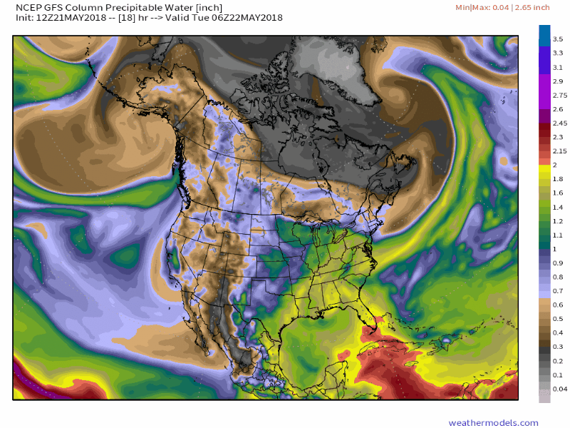 This loop represents humidity in the air over the North American continent through Monday evening. This is shows the pattern extremely well. The browns and grays identify dry air, the other colors represent increased moisture. The loops shows the uptick of humidity with the Tuesday / Wednesday system, followed by drier air for Thursday. Humidity increases Friday into Saturday as showers are expected once again, followed by drier air settling in for Sunday into Monday. This is the GFS model idea for what could happen here. There are discrepancies in model ideas for the second half of the weekend in regards to the movement of the frontal boundary over the region. The European model keeps the moisture and rain threat in the forecast through Monday. Important to note that the European model has done poorly over our region beyond five days. Given that recent performance, I tend to side with the GFS at this point. The GFS has been the better of the two models in the 5-7 day range. We can't take the forecast for second half of the weekend to the bank yet, but I like the chances that Sunday and Monday will be decent weather days. 5-Day Outlook for the north country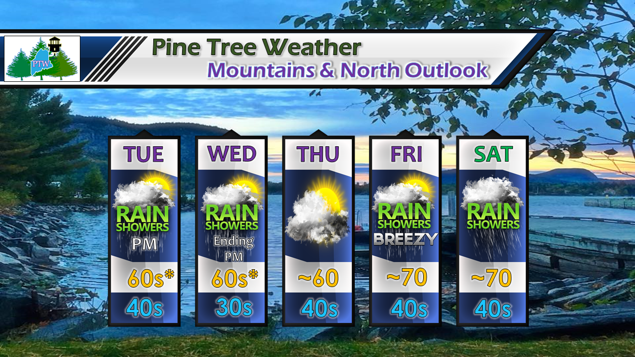 High temperatures for Tuesday and Wednesday will be dependent on where one is in the north. Tuesday will be warmer for the Crown since showers won't arrive until later, and the mercury could climb there into the low 70s. For Wednesday, it's the opposite, with cooler temperatures north and warmer temperatures over the western mountains. A weak disturbance brings more clouds than sun for Thursday, then showers return to start the holiday weekend. 5-Day Outlook for the coastal plain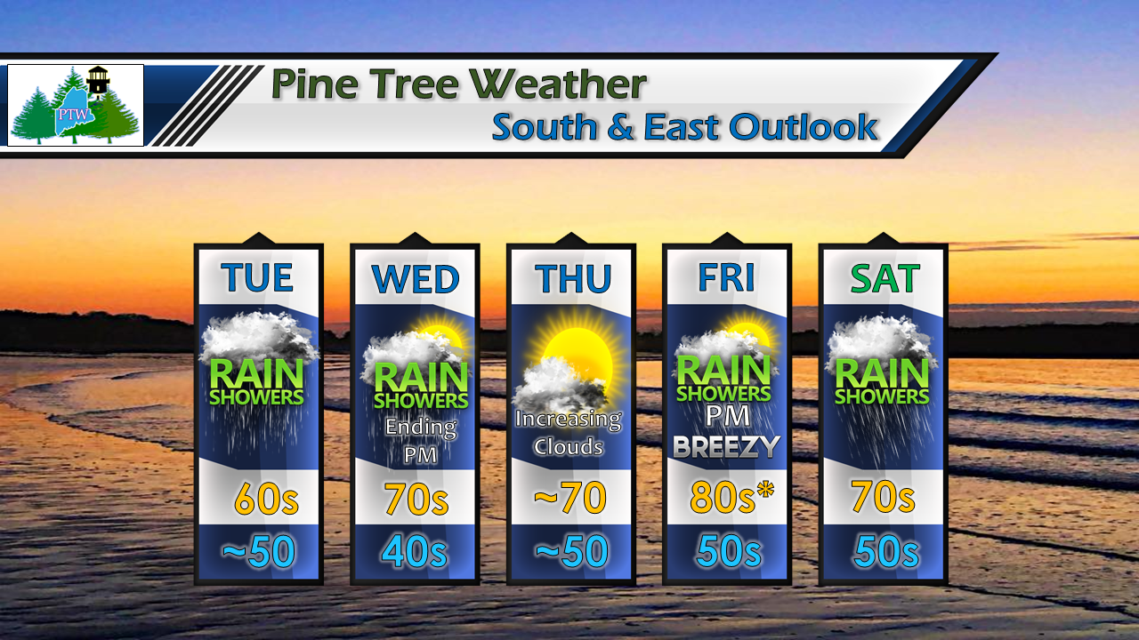 With showers ending Wednesday morning, temperatures should tick up the 70s much of the region, with far eastern areas staying cooler in the upper 60s. Friday will feel like summer with 80s possible for much of the southwest interior, cooler DownEast. I expect humidity will also build Friday as a warm front approaches from the southwest.
Official forecasts from NWS Gray for western and southern Maine and NWS Caribou for eastern and northern Maine. Thanks as always for your support! - Mike |

Mike Haggett
|


