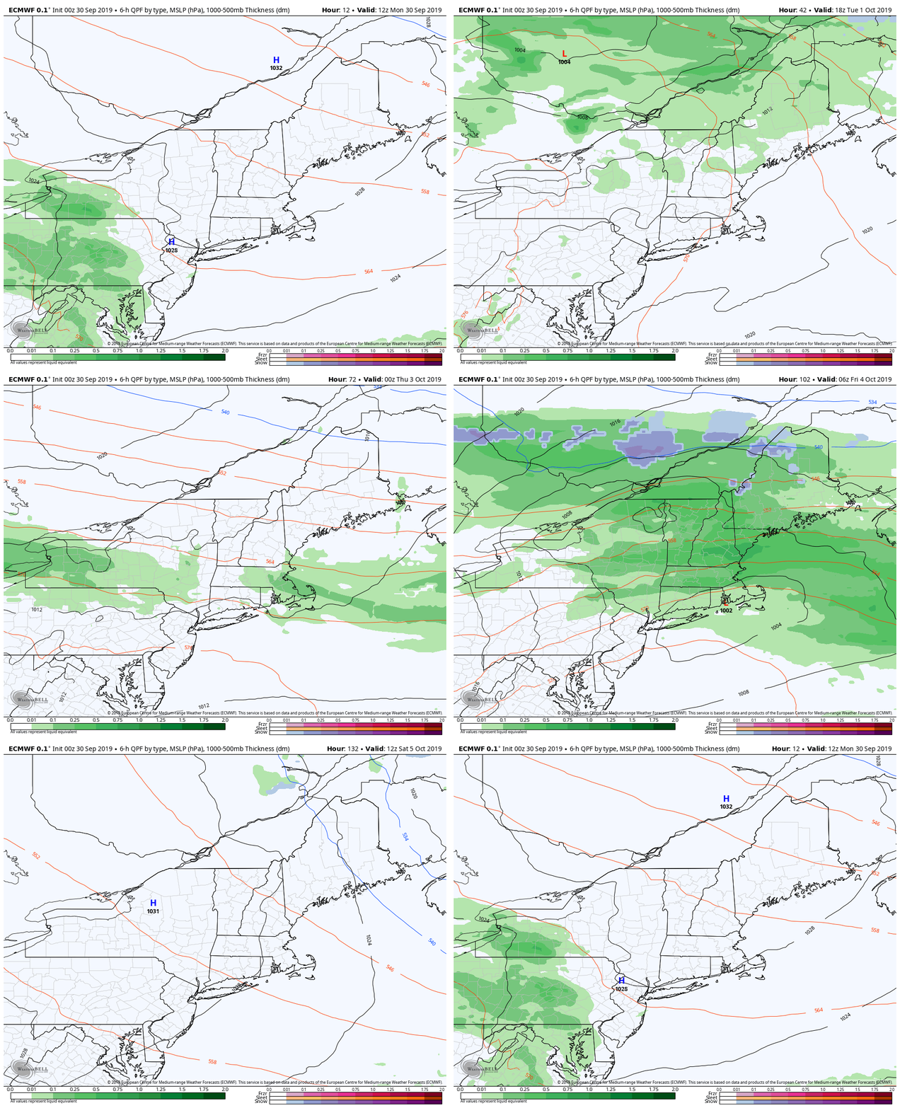
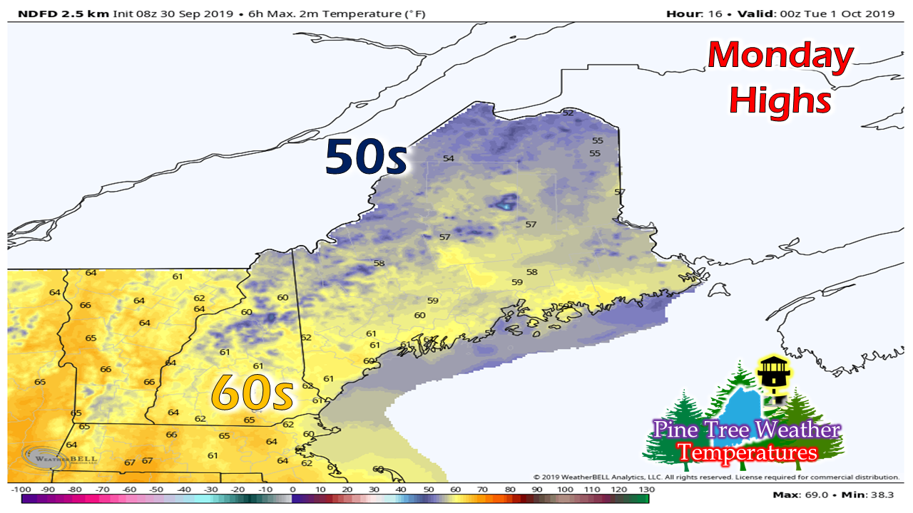
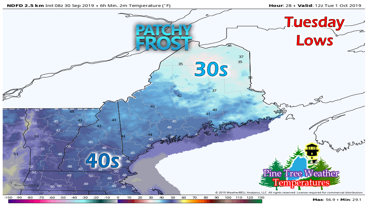
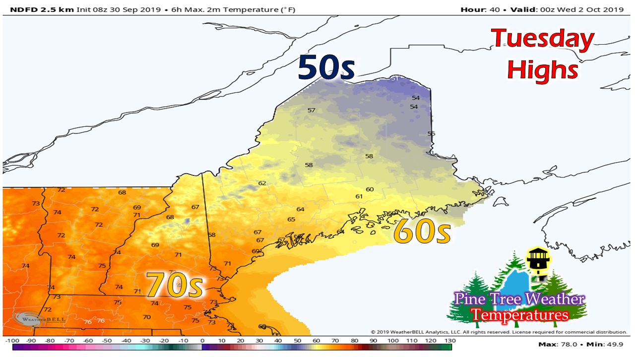
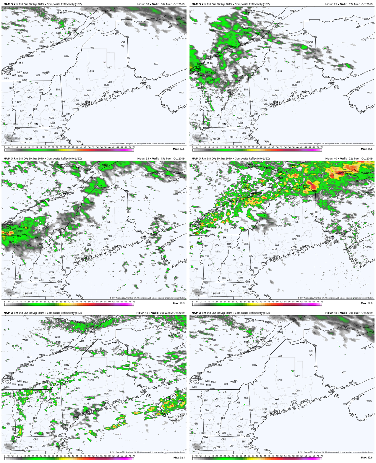
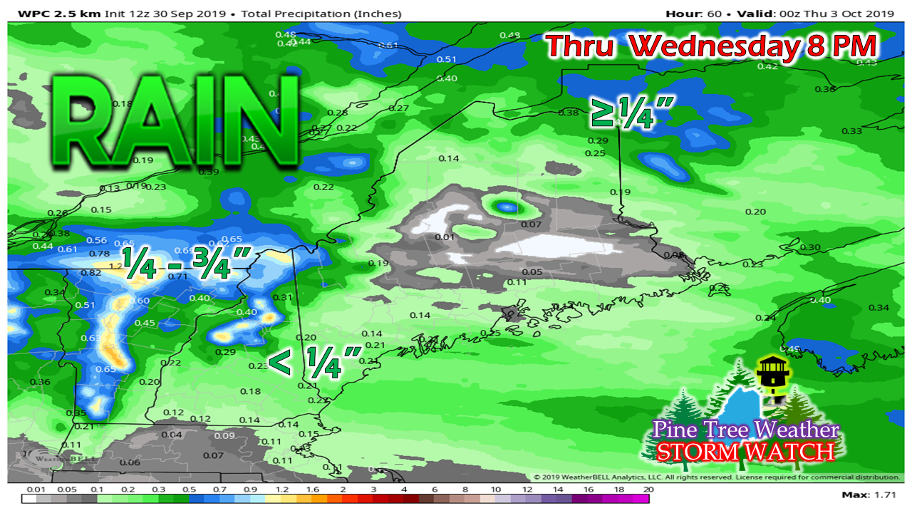
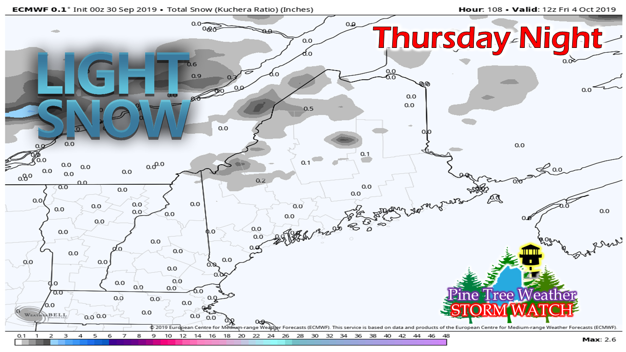
October starts off unsettledAfter a dry day Monday, a chance for precipitation exists in the forecast for parts of Maine through the remainder of the week. A warm front works into the region Monday night into Tuesday, followed by a cold front Tuesday night into Wednesday. High pressure on Thursday presents a bit of a respite before low pressure slides through the region on Friday. On that late week low, the higher elevations may see the first snow flakes of the season. Monday a dry, but cool dayAfter a chilly start, temperatures rebound fairly quickly and it appears to be a decent day overall. High pressure slides east, a southwest air flow develops, and clouds will be on the increase this afternoon. The high mark for temperatures of the day appear about 5° below normal on average statewide, with 50s to low 60s for the day. Showers arrive TuesdayI can't rule out the chance for some patchy frost in northern areas Tuesday morning, although that is cloud cover dependent. The more clouds, the more insulation to keep temperatures above freezing. With the arrival of the warm front, southern areas see the warmer temperatures of the day with 70s possible for interior York County. With the expectation of more clouds and shower activity to the north, Aroostook stays on the cool side with 50s, and 60s for Bangor and DownEast areas. With the frontal boundary, expect a breezy day with gusts in the 15-25 mph range possible through the day, higher gusts possible in the mountains. Scattered showers along the warm front break out over northern areas Monday night and move to the southeast during the day on Tuesday. A cold front drops into the region Tuesday night, and may bring a brief period of heavy shower activity Tuesday night into early Wednesday for northern areas. On general terms, not a whole lot of rain here. Most of the state can expect a couple of tenths of an inch, with a bit more possible for the higher terrain. Cold air late week brings snowliage potentialA cold front that works into the region Thursday night may bring some light amounts of wet snow to the higher elevations of the state. At this point it does not appear to be a lot, and I don't expect what falls to hang around for very long. For those looking to capture the beauty of fall foliage with some snow for that special beauty, the Katahdin region may bring you that Friday morning. For the rest of us, it's yet another reminder that we are getting closer to the winter that is on the way. It will be a cool, dry weekend ahead, but temperatures appear to warm up the following week. Please support Pine Tree Weather!A special thank you to those that have signed up to be monthly contributors on my Patreon page and to those who have mailed checks to me. This a labor of love here. I don't mind the 4 AM wake up calls (2 AM for snow days) to formulate a forecast, create graphics then write it all out for your consumption, so long as I have the financial support from you to continue to do so. There is no media or marketing influence here. No model forecast bias. No political or scientific agenda. It's just Maine weather, plain and simple. I would appreciate your support to continue this for 2020. Contributors are donation on average of $5 per month / $60 per year either through Patreon or by check. No amount is too small. This is Maine, most of us are on tight budgets, and having been there myself, I understand the struggle. All I ask is to do what you can. If you can't do anything financially right now, that is totally understandable. Please pass along what I do to others and help this site to grow!
Thank you for your support! ► ► For the latest official forecasts, bulletins and advisories, please check in with the National Weather Service in Gray for western and southern areas, or Caribou for northern and eastern parts of Maine. For more information from me, please check the Pine Tree Weather Facebook page as well as my Twitter feed. Always stay weather aware! - Mike |
Mike Haggett
|

