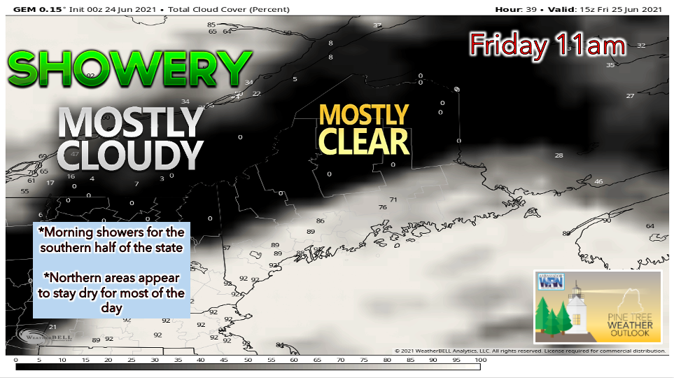
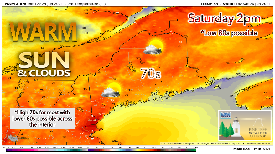
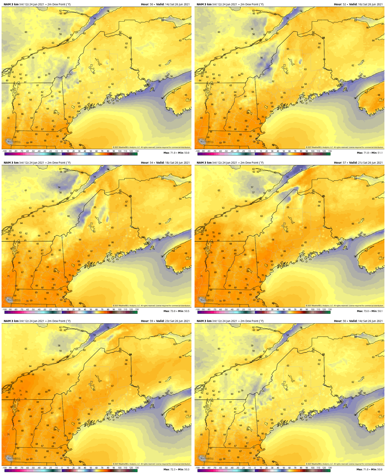
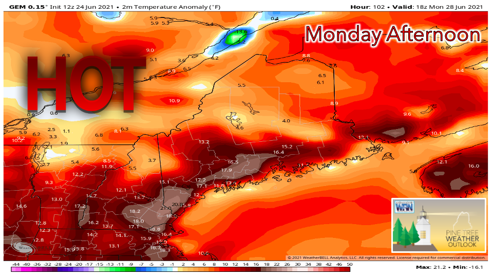
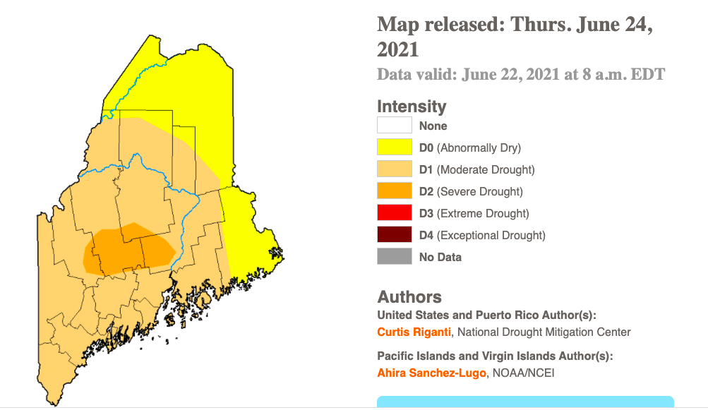
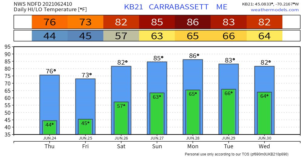
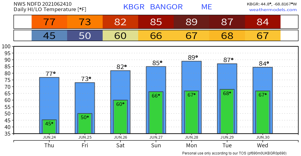
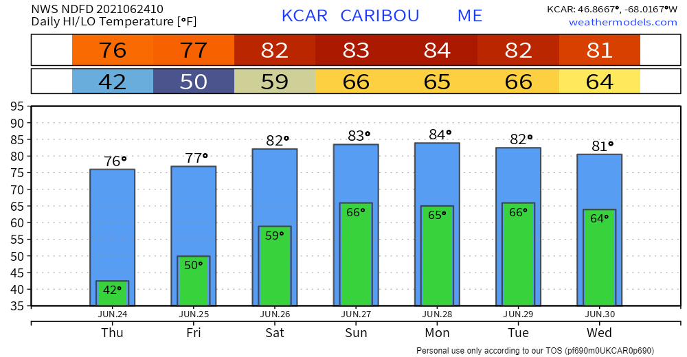
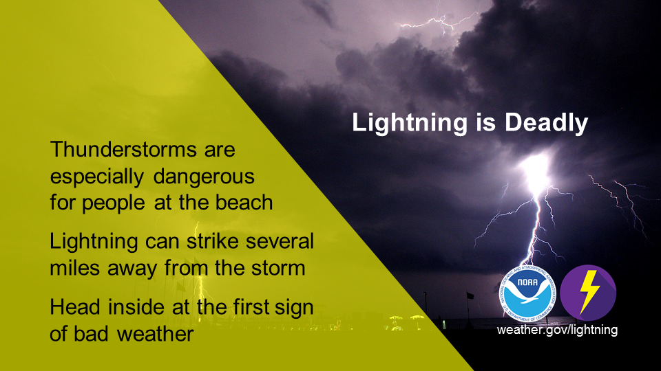
Showers possible Friday; Warming trend begins this weekend and lasts through early next week6/24/2021 One last day of comfortable temperatures before heat and humidity begin to creep up on SaturdayA weak low-pressure system is expected to track along the Mid Atlantic coast on Friday morning, bringing showery conditions to southern Maine. Much of the northern portion of the state appears to stay dry with sunshine likely for the early hours of the day. The precipitation appears to only last until about noon before the low exits east of Maine. Friday high temperatures likely reach the upper 70s in the north and mountains, while increased clouds and scattered showers keep the southern areas cooler in the low 70s. The sea breeze likely keeps areas Downeast in the 60s. A disturbance aloft brings the potential for another round of showers, this time for northern areas. This precipitation will likely occur during Friday afternoon and evening. The high-pressure system that dominated New England this week will begin to move toward our east, making way for a strong upper-level ridge to begin to take form on Friday night into Saturday. A southwesterly flow brings moisture and warmth to the region, driving temperatures a few degrees above normal. Saturday highs likely reach the upper 70s to lower 80s across much of the state. The exception is the coastal areas, especially Downeast, which should stay a bit cooler thanks to the sea breeze. Skies on Saturday appear partly sunny with a chance of showers for northern regions and along the Downeast coast. The dry, comfortable conditions that we enjoyed these past couple of days appear to end by Saturday. Dew points are expected to steadily rise into the mid to upper 60s, resulting in a humid feeling for most. This moist air will likely cause temperatures to feel warmer than they truly are. Temperatures continue to rise through Tuesday, drought concerns persistMonday and Tuesday are likely to be the hottest days in this upcoming stretch of warm weather. The above image shows the forecasted temperature anomaly on Monday afternoon. It appears that southern Maine will see temperatures deviate the furthest from normal, with some areas potentially seeing highs that are 15°-20° above average. Heat indices may reach the mid 90s on these days, so pay close attention for updates regarding heat-related advisories. Afternoon showers and thunderstorms are possible each day through the middle of next week; however, models do not suggest that any potential precipitation will put a dent in the ongoing dry conditions. As we near the end of June, drought remains a significant issue across the entire state. Portions of Franklin, Somerset, Piscataquis, and Penobscot counties have all reached severe drought conditions, as indicated by the darker orange spot on the above image. This area is currently experiencing the worst of the drought at level D2. Lighter orange areas are at level D1, which is moderate drought, while the rest of the state is considered "abnormally dry". Temperature outlook through WednesdayFriday appears very nice for most areas. A period of above-average temperatures begins on Saturday and likely lasts through mid-next week. Beach LightningJune 20th - 26th is Lightning Safety Awareness Week. Whether you’re spending the day at the beach or an afternoon at the pool, at the first sign of a storm, you should gather your things and seek shelter. By the time you hear thunder or see lightning, you’re already in danger. When Thunder Roars, Go Indoors! weather.gov/safety/lightning Be prepared to receive alerts and stay updated!
For more information in between posts, please follow Pine Tree Weather on Facebook and Twitter.
Thank you for supporting this community-based weather information source which operates by reader supported financial contributions. Stay updated, stay on alert, and stay safe! |
Mike Haggett
|

