
A "trick" of a Halloween evening appears likely for most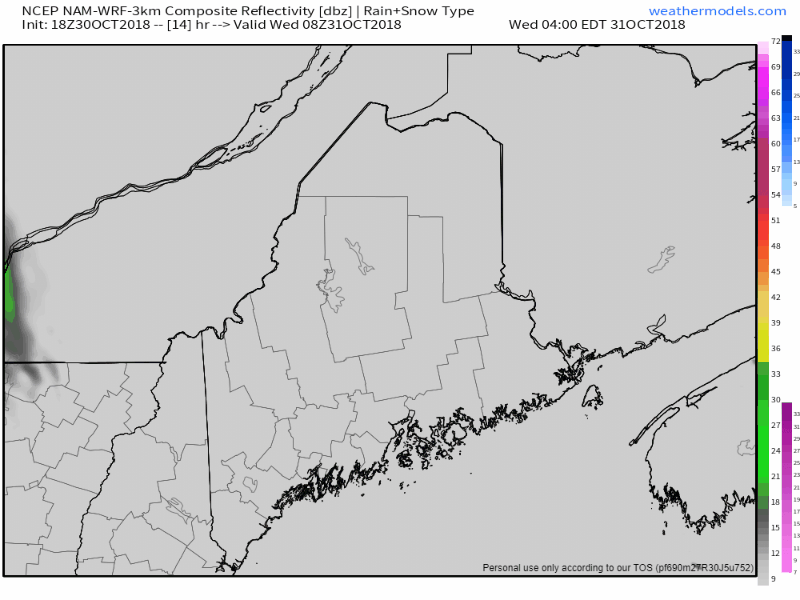 NAM model simulated radar idea from 4 AM Wednesday to 2 AM Thursday shows the first wave of shower activity over the state as a frontal boundary approaches the region. Most area appear to be wet with either rain or snow showers (far north) by the time evening comes. Only far southwestern areas may be lucky enough to engage in door-to-door activities with just a few raindrops, but I would suggest to keep the umbrella on hand and perhaps a rain coat just in case. I will update on Facebook Wednesday afternoon. 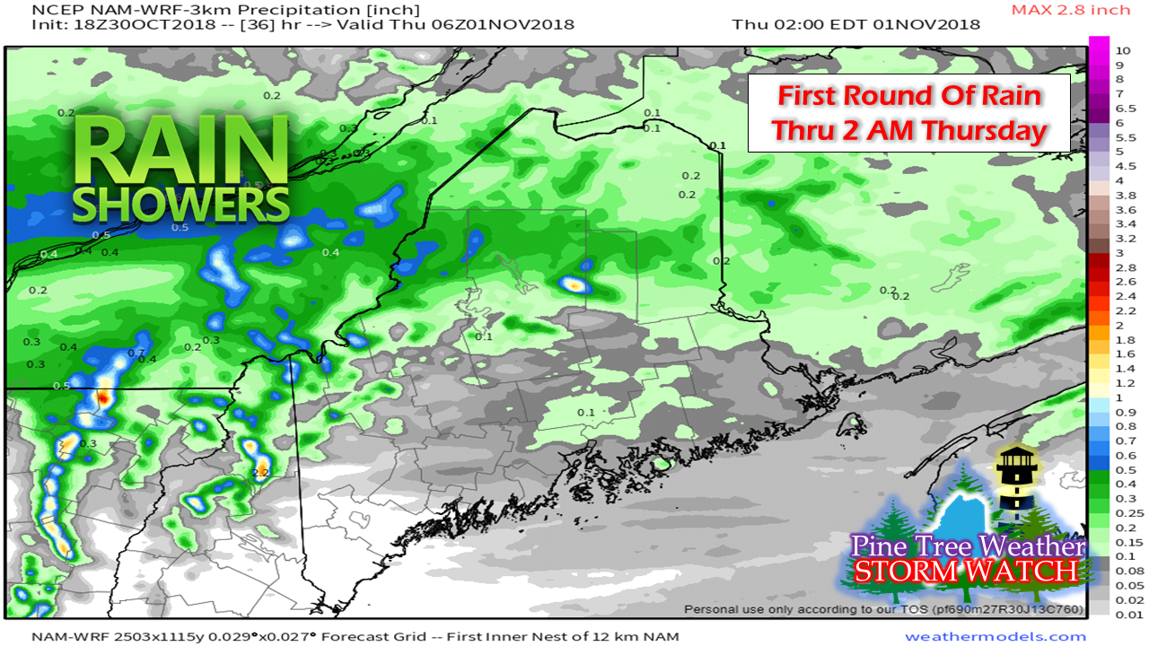 Most of the rainfall accumulation appears to be in northern areas. The Quebec border region and the rooftop may get a smattering of snow with up to an inch possible, but most areas appear to deal with liquid precipitation for this event, and others along the way through Saturday. Showers continue through Saturday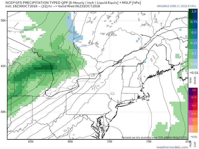 Loop here shows the duration of the event from 2 AM Wednesday to Sunday evening. Frontal boundary arrives Wednesday and stalls. Impulses ride along the frontal boundary off and on through Saturday. Friday and Saturday will feature steadier rain, and perhaps a few rumbles. Low pressure that rides up the front on Saturday is on track to pull the front away, bringing a dry, mainly sunny day for Sunday. Some areas could see and inch or two of rainfall, possibly higher as a grand total of the four day stretch. Winter Weather Preparedness Week - Day Two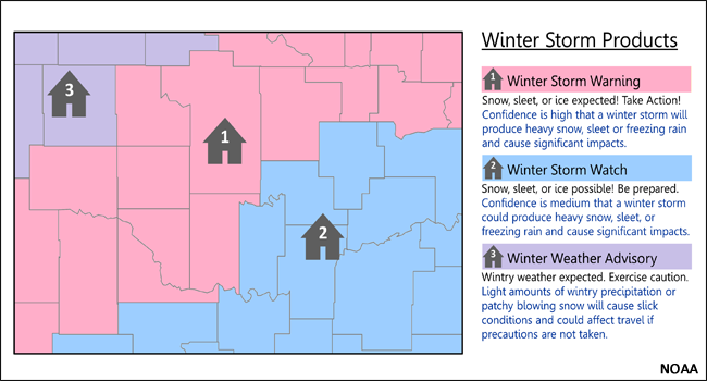 The National Weather Service offices that serve New England have declared October 29th through November 2nd, 2018, Winter Weather Preparedness Week. The National Weather Service in Caribou will feature a different educational topic each day during the preparedness week. Topic: Winter Weather Threats Heavy Snow: Heavy snow is the most frequent winter weather threat to Maine. Heavy snow can come in many forms and depending on the type, the threats can be different. Heavy "dry" snow can be easy to shovel and plow, but it can also blow around easily causing near zero visibilities and dangerous travel concerns. On the other end of the spectrum heavy "wet" snow doesn't blow and drift, but it sticks to trees causing limbs to break and power outages. In addition the fatigue of shoveling heavy snow can lead to heart attacks. Snow Squalls: Snow squalls, often associated with strong cold fronts, are a key weather hazard. They move in and out quickly, and typically last less than an hour. The sudden white-out conditions combined with falling temperatures produces icy roads in just a few minutes. Squalls can occur where there is no large-scale winter storm in progress and might only produce minor accumulations. Snow squalls can cause localized extreme impacts to the traveling public and to commerce for brief periods of time. Unfortunately, there is a long history of deadly traffic accidents associated with snow squalls. Although snow accumulations are typically an inch or less, the added combination of gusty winds, falling temperatures and quick reductions in visibility can cause extremely dangerous conditions for motorists. Blizzards: The blizzards of 2018 reminded everybody the dangers and impacts that a blizzard can cause. The combination of heavy snow and blowing snow can make traveling virtually impossible due to near-zero visibility and drifting of snow. In addition to the snow and blowing snow, the high winds can also cause power outages due to downed trees and limbs. This can be especially dangerous due to the very cold wind chills that accompany these storms. Ice Storms: Major ice storms are a real threat in Maine with the most significant storms over the last 20 years occurring in 1998, 2008, and 2013. These storms cause major disruptions to society due to prolonged power outages, downed trees and treacherous travel conditions. Fortunately major ice storms don't occur often, but freezing rain events are very common and although they may not cause major power outages they are extremely dangerous for traveling. Any amount of freezing rain on cold roadways can be a major travel issue. Coastal Flooding: Coastal flooding can precede or accompany major winter storms. Strong south, southeast, east, and northeast winds can cause water to pile up along the Maine coastline causing tide levels to rise above normal, leading to flooding. In addition to abnormally high tides, large waves associated with a storm can cause erosion along the coastline. Hypothermia/Frostbite: The human body loses heat during the winter due to the conduction and convection of heat from the skin to nearby air, due to evaporation of moisture from the skin's surface, and due to normal respiration. To compensate for this heat loss, the body burns energy to produce heat to keep the body temperature at a relatively constant level. However, if a body loses heat faster than it can produce heat, the body temperature will cool to below-normal levels. This is known as hypothermia. If the central core of the body continues to cool, uncontrollable shaking, memory loss, disorientation, incoherence, slurred speech, drowsiness, and apparent exhaustion may develop. Frostbite is a condition in which the body tissue actually freezes. Frostbite is often associated with hypothermia. In a hypothermic person, the brain greatly reduces the amount of blood that is circulated to the extremities of the body, causing them to cool. This increases the chances that the tissue at the end of the extremity may actually freeze. The most susceptible areas for frostbite include the fingers, toes, nose, and ear lobes. High Winds: High winds can occur before, during, and after major winter storms and can make driving difficult and dangerous, especially if you drive a high profile vehicle. Also, high winds bring increased danger from falling trees and branches, which can lead to widespread power outages. Please revisit our page www.weather.gov/car this week for useful winter weather information to get you and your family prepared for this upcoming season. In addition follow us on Facebook https://www.facebook.com/NWSCaribou and Twitter this week https://twitter.com/nwscaribou for additional information. Pine Tree Weather is a proud Weather Ready Nation Ambassador in coordination with the National Weather Service Caribou for the state of Maine. Regional outlook through the weekend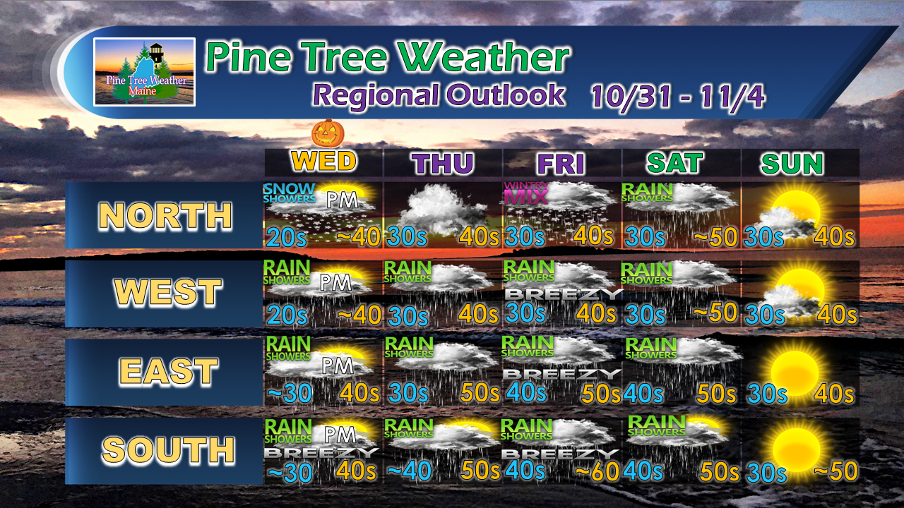 More updates to come.
For the latest official forecasts, bulletins and advisories, please check in with the National Weather Service in Gray for western and southern areas, or Caribou for northern and eastern parts of Maine. For more information from me, please follow the Pine Tree Weather Facebook page and my Twitter feed. Please consider making a donation to keep Pine Tree Weather going through the year ahead. My data cost is increasing! Check out the donate page on how to contribute. Always stay weather aware, and thank you for your support! - Mike |

Mike Haggett
|


