
One shot for rain this week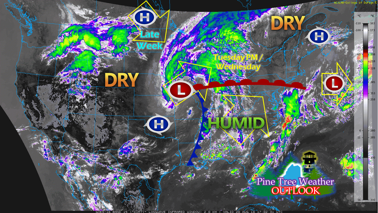 An area of low pressure over the midwest is on track to move northeast Tuesday. As a warm front attached to the low approaches, clouds will be on the increase and the humidity will begin to rise. A few remote light showers are possible late Tuesday, but the bulk of the rainfall is likely on Wednesday. Once this clears out Wednesday night into Thursday, a dry and comfortable period returns for the remainder of the week. Next chance for shower activity may come later in the weekend. A damp Wednesday, but not a washout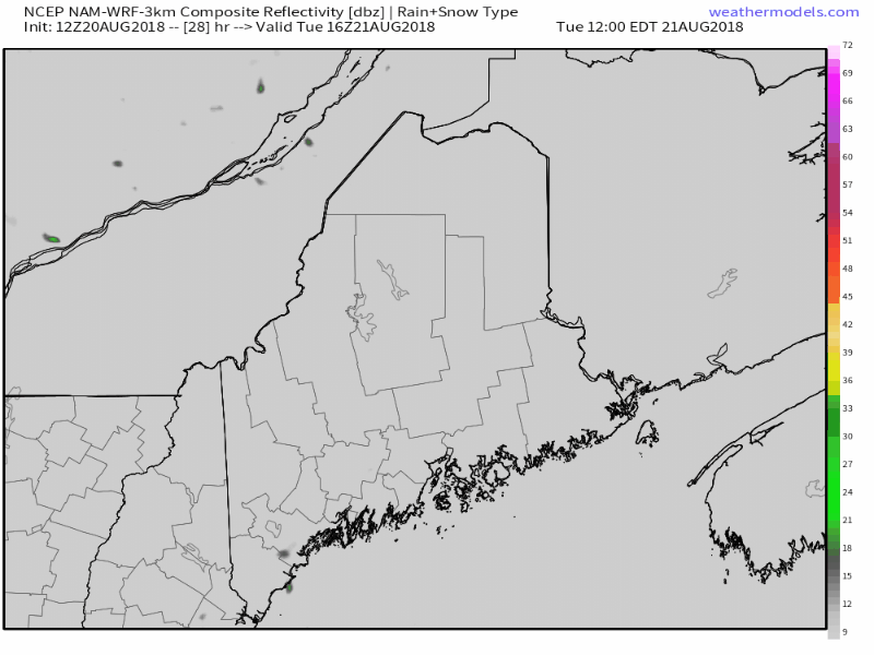 Forecast radar loop idea from the NAM model from noon Tuesday through Wednesday evening shows the timeline for rainfall. The more numerous showers and storms cross the state in the morning to early afternoon, with a few stray showers and storms possible after the cold front passes through. Storms may contain frequent lightning, gusty winds, hail, and heavy rain. The severe threat appears low, but cannot be completely ruled out. I will update on this Tuesday, either here or on Facebook. Tropics still quiet... for now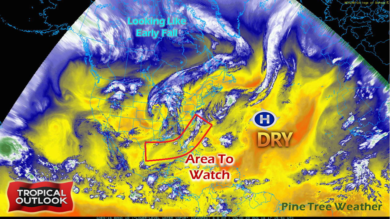 Not a whole lot going on the Atlantic basin. It's been a very quiet season thus far outside of some sub-tropical systems that have formed well away from the North American continent. Several factors to this being a large quantity of Saharan dust, wind shear and dry air. The wind shear factor and dust is showing signs of diminishing, which is typical for this time year. The amount of dry air over the Atlantic may take some time to erode. High pressure has been more or less camped out over the central part of the ocean for several weeks now. The arctic is showing signs of early fall with falling temperatures and storm pattern. The combination of all of this makes this forecaster think for the short term that if anything tropical in nature is going to mature, it will be fairly close to the southeast coastline, either the Gulf of Mexico or in the vicinity of the Bahamas. Given the close proximity to the shoreline, development could happen very quickly under the right scenario. Are you prepared for a potential storm? Now is the time to think about it to avoid the panic and the rush. Make sure you are Hurricane Strong and be prepared if a storm is on track to affect the region. Today (Monday, August 20th) is the 27th anniversary of Hurricane Bob making landfall in Rhode Island as a Category 2 hurricane. 'Tis the season. Pledge drive ongoing After the first week of pledge drive, supporters have been gracious enough to get my yearly funding off to a running start. As of Monday morning, Pine Tree Weather is just over 25% funded for the year. The beginning in October is when my yearly bills start rolling in for the website, forecast data, software, and graphics. For those who have already made a pledge, my heartfelt thanks to you for believing in what I am doing here. All I am looking for is $1 a month from followers. You can pledge on my Patreon page or you can message me on Facebook or on Twitter if you would prefer to mail a check. If you have any questions, please message me so I can answer them.
As always, please stay in touch with the National Weather Service in Caribou for eastern and northern areas, and Gray for western and southern parts of Maine for the latest forecasts, bulletins and advisories. Thank you as always for your support of the community supported and funded weather source! - Mike |

Mike Haggett
|


