
Summer briefly returns to a good portion of the state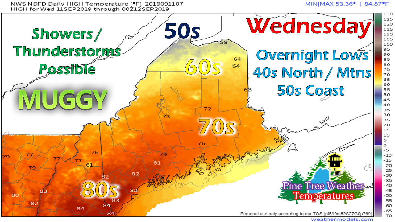 Far northern areas are likely to be the coolest and cloudiest of the state Wednesday as low pressure in eastern Canada tracks towards the Atlantic. For the rest of the state, summer appears to return for a day. This forecast is cloud dependent. Any areas where the overcast remains stubborn, temperatures are likely to be cooler. 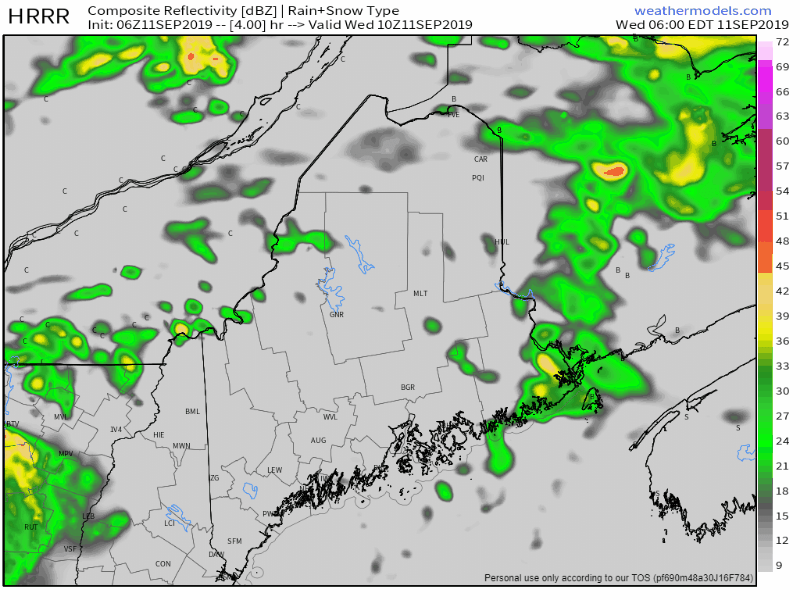 The warm front that moved through the region Tuesday night appears to linger over northern areas for the day. A cold front approaches the state Wednesday afternoon, and will bring the threat of showers and thunderstorms along with it. The severe threat is very low, but cannot be completely ruled out. Any storms that form are likely to have gusty winds and downpours. 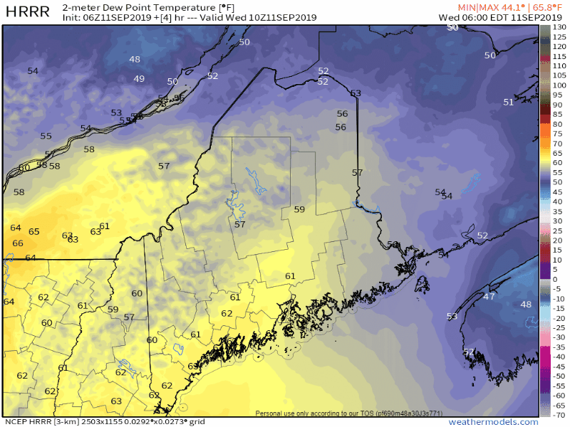 With the warm front is the return of muggy conditions to most of the state. The humidity will help fuel any shower and thunderstorm activity Wednesday afternoon. As the cold front passes through the state quickly, the region will return to more comfortable dew point levels as the afternoon and night progresses. Frost potential remains possible for far interior areas Friday morning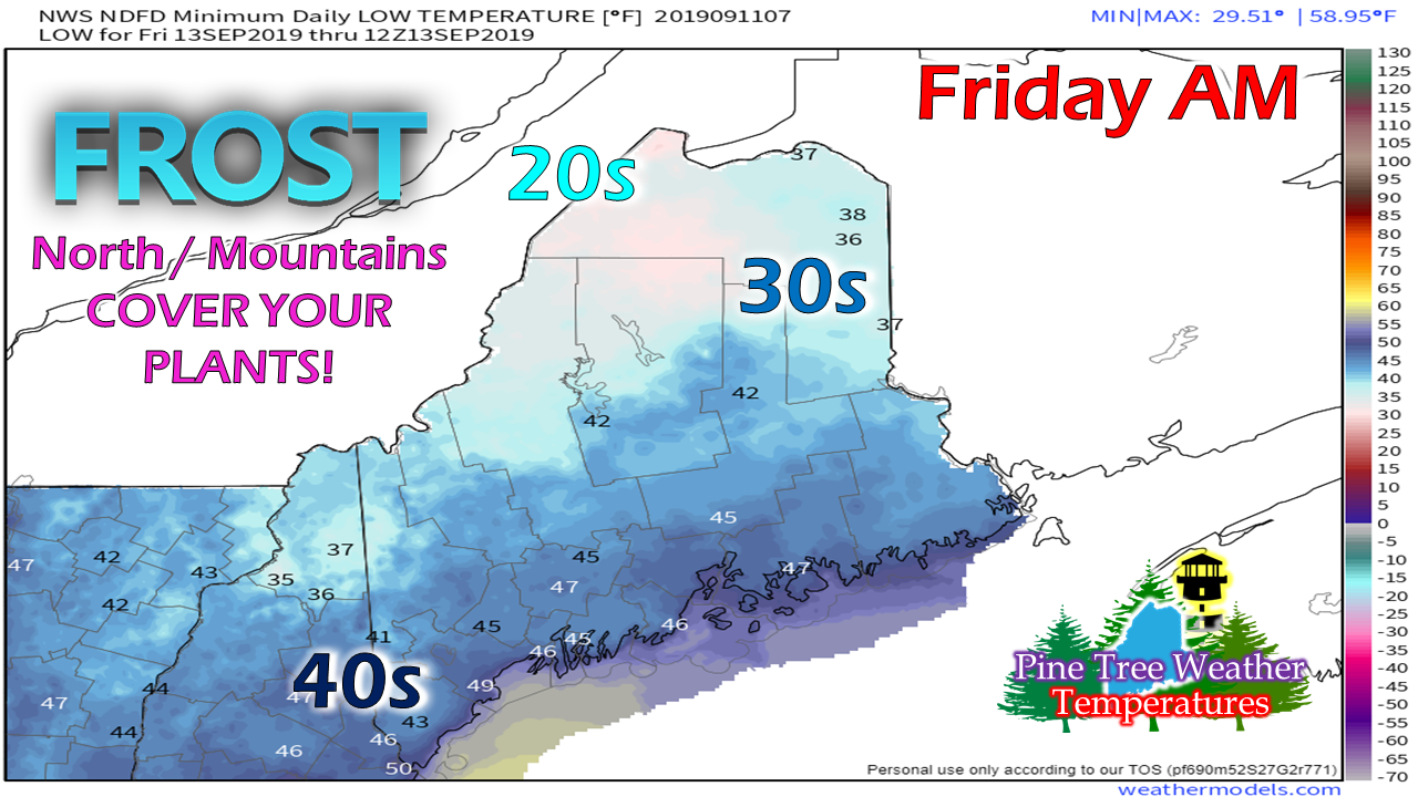 High pressure returns to the state on Thursday. As the dome settles over the region, it sets up a frost threat for Allagash region and protected valleys in the high country. Fog may form ahead of the cooler temperatures and as a result keep the mercury above freezing, but even so, temperatures could fall into the mid-30s, which for those growing may be a bit too close for comfort. The safe bet is to cover the plants just in case. After this, overnight temperatures stay above freezing for the foreseeable future. Weekend forecast improving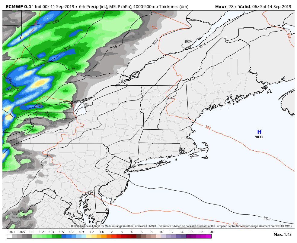 A cold front approaches the region Friday night into Saturday. Northern and western areas have the best chance for rain, with less to no rain for coastal areas. A weak area of high pressure keeps most of the region dry for Sunday. Temperatures will be a bit cool on Saturday with the passing front, with highs in the 60s for northern, western and eastern areas, and low 70s south. Sunday appears to be the warmer of the two days, with 70s for the coastal plain and mid to upper 60s for the north & mountains. Please support Pine Tree Weather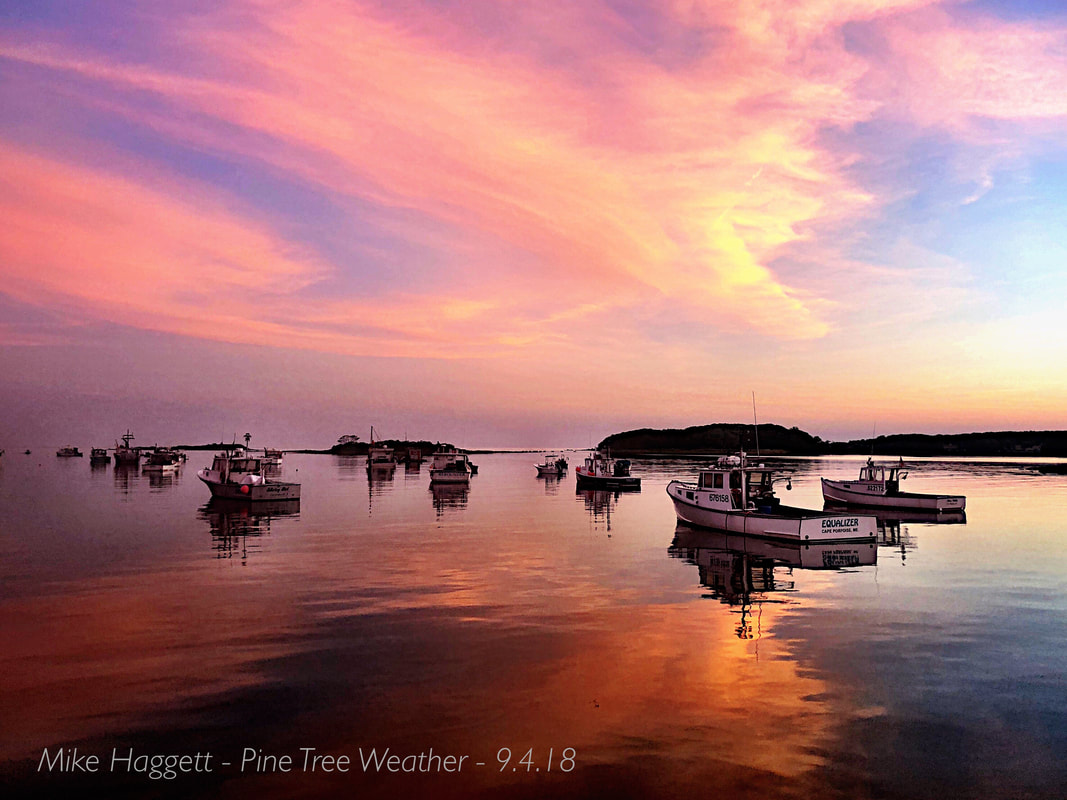 Pine Tree Weather is funded through the support of people like you. To this point, I do not accept outside advertising, and would like to keep it that way. Thanks to the Patreon monthly donors and those that have mailed checks, the site is roughly 40% funded for the year. In order to continue, a total of $3,000 is needed to pay the bills. October and January are when most of the bills come due. I have spent over $10,000 of my own funds over the years, and refuse to spend any more out of my own pocket to keep this going. If you find value in what I do, I will humbly ask you to support it. Without the financial support, this site will cease. No amount is too small. I would appreciate your support!
► ► For the latest official forecasts, bulletins and advisories, please check in with the National Weather Service in Gray for western and southern areas, or Caribou for northern and eastern parts of Maine. Please consider supporting Pine Tree Weather ► ► Your financial donations are much appreciated to keep this site funded and for further development. I sincerely appreciate your support not only financially, but also in sharing my efforts with others. For more information from me, please check the Pine Tree Weather Facebook page as well as my Twitter feed. Always stay weather aware! - Mike |

Mike Haggett
|


