Summer staff being assembledMuch of the activity in the past week has been on the Pine Tree Weather Facebook page with the return of 36-hour forecasts and introductions of the talented group of college seniors who will be working with me over the summer. Activity here will return as I get each of them trained, and that should begin no later than Monday. The plan is to have this site updated every afternoon by 4 PM daily through the summer until mid-August. Thanks for your understanding and patience. Humidity ticks up, showers and storms come with itWhile the region has enjoyed warm but dry conditions through much of the past week, that shifts as we head into the weekend. The ridge over the eastern half of the United States begins to relax and waves of energy over the top begin to chip away at it. 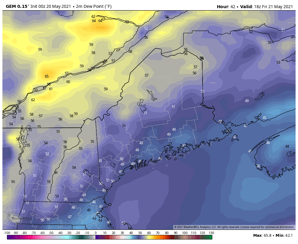 Moisture from the south creeps in ahead of those waves which will bring dew points up into the 60s for parts of the region Friday and Saturday, then statewide for a brief time on Sunday. A sharp cold front drops down from the north-northwest in a pseudo back door style which will bring dry air back in Sunday night. 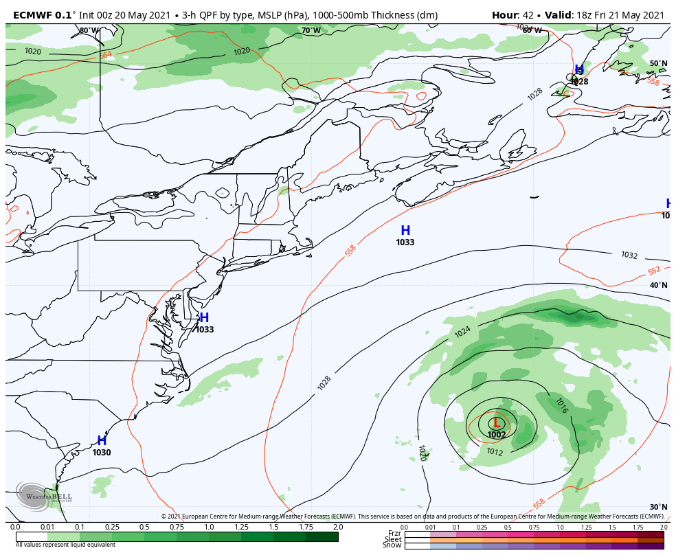 The National Hurricane Center is keeping watch on a subtropical low northeast of Bermuda which could be the first named storm of the season, but the effects of that system appear minimal with an increase for surf that mariners should watch for. Saturday's storms could be slow moving dumpers which may bring localized flash flooding where they flare up, with the western mountains and Great North Woods likely to get the best chance for those. Sunday brings another chance of isolated storms which could bring a downpour and gusty wind. With the strong cold front sweeping through, expect a breezy day on Monday with wind out of the northwest gusting in the 20-30 mph level. With the low relative humidity associated with the dry air, there is potential for wildfire concerns. Looking ahead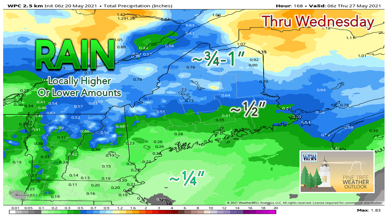 Most of the rain accumulation in this pattern is primarily over the northern half of the state in similar fashion as the clipper systems in winter. Areas of the coastal plain dealing with rainfall deficits from winter may not get much relief. 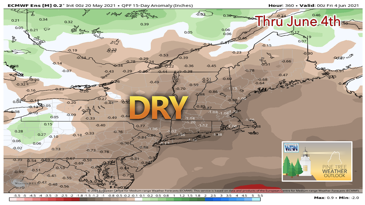 Looking longer term, the outlook appears dry as compared to seasonal averages through the end of May into early June. Expect drought concerns to elevate as potluck shower season has come early, much the way it did last spring. 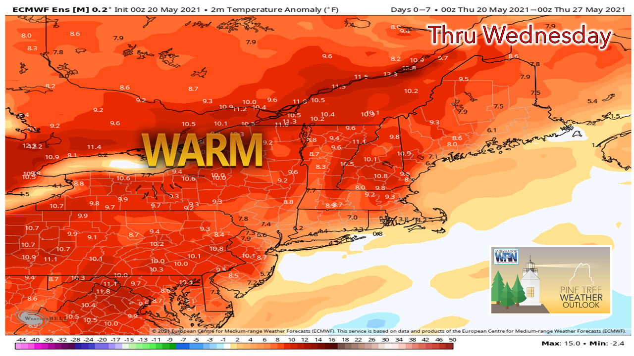 Temperatures appear well above normal in parts of the state overall through the middle part of next week. The outlook for the following week through Memorial Day weekend appears slightly above normal overall. Normal highs and lows anointed in the temperature graphs below for Portland and Caribou articulate the trend through Wednesday. Northern parts of The County and the Allagash should stay on alert for frost potential early next week. 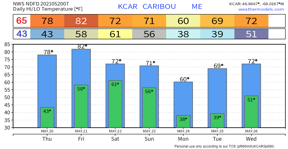 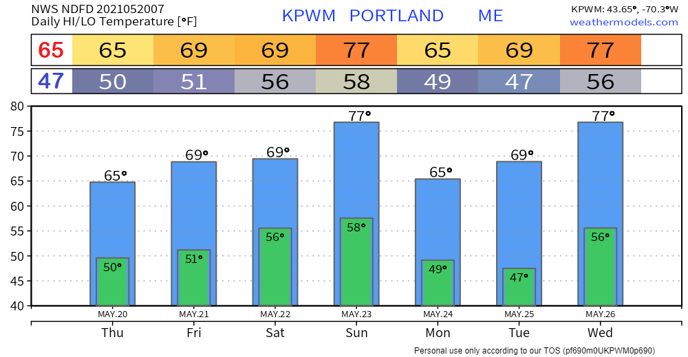 Join the weather community as a storm spotter!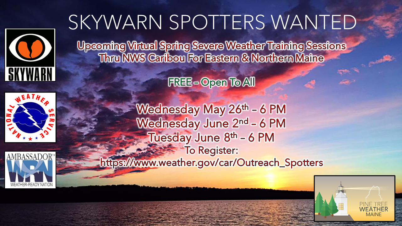 Here's a wonderful way to become active in the weather community and help the broadcast media and forecasters like myself with storm reports. This information is vital during and after an event for forecasting and alerting purposes. I can't tell you how many times I have seen the importance of these reports in the past 9+ years I have been involved. Pine Tree Weather followers have stepped up in the past and participated, and with the readership base continuing to grow, I know there are more out there. This is the spring/summer session which discusses severe weather, what to look for, and how to report it. These sessions run for about 90 minutes. They are fact filled, educational and interesting. You can get the whole family involved from the comfort and safety of home. Once completed, you will get your spotter ID, and will be ready for the season ahead. For those who trained for the winter session, this will complete your full year training. It's important to have both sessions done. The link to register is here ► https://www.weather.gov/car/Outreach_Spotters Be prepared to receive alerts and stay updated!
For more information in between posts, please follow Pine Tree Weather on Facebook and Twitter.
Thank you for supporting this community-based weather information source which operates by reader supported financial contributions. Stay updated, stay on alert, and stay safe! Thank you as always for your support! - Mike |

Mike Haggett
|