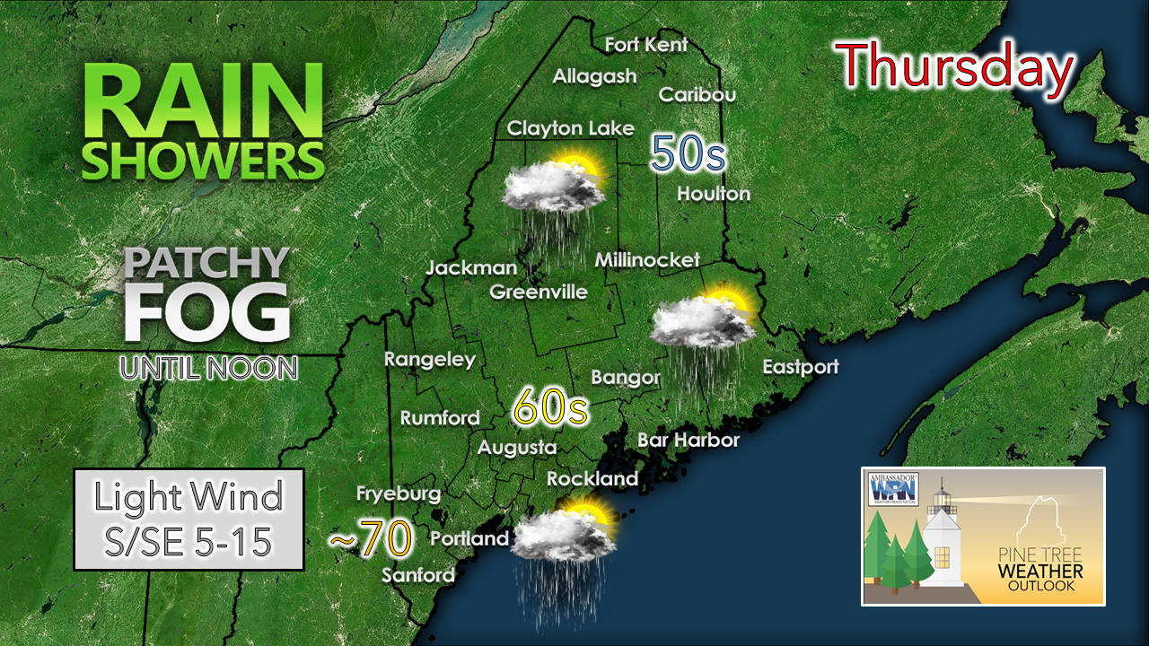
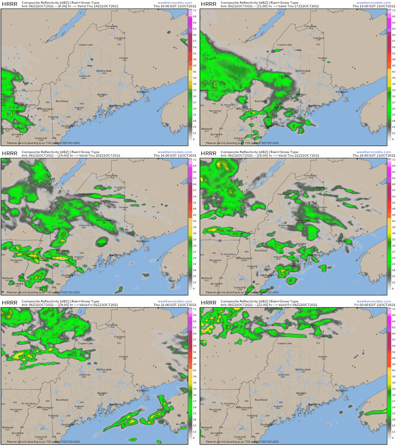
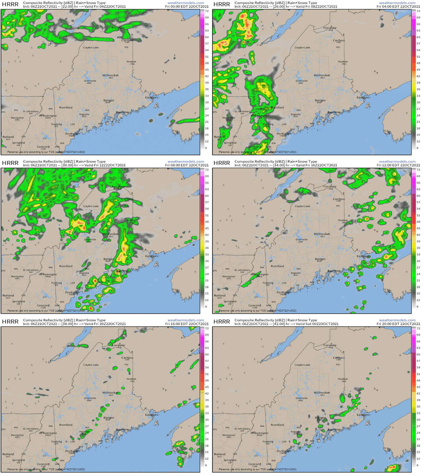
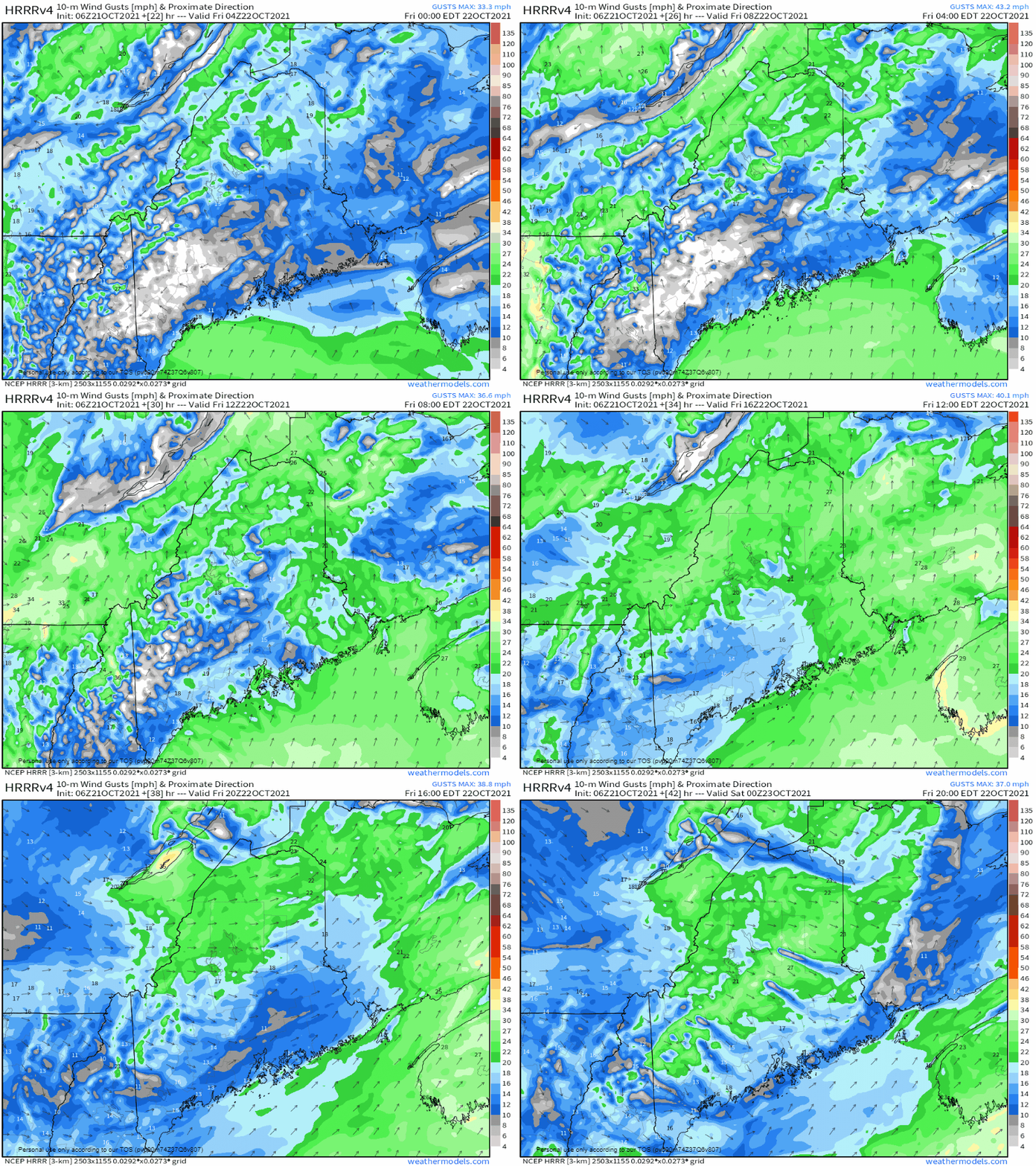
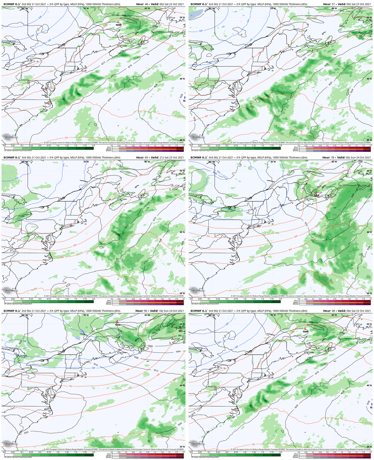
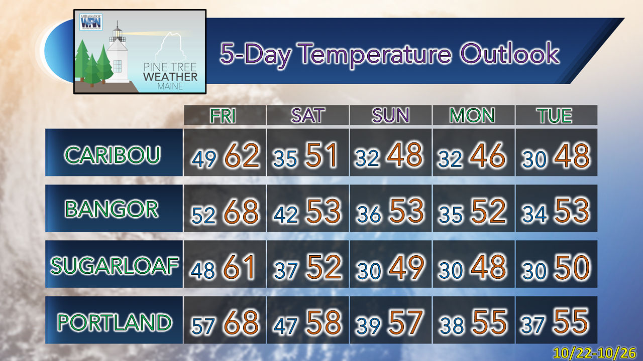
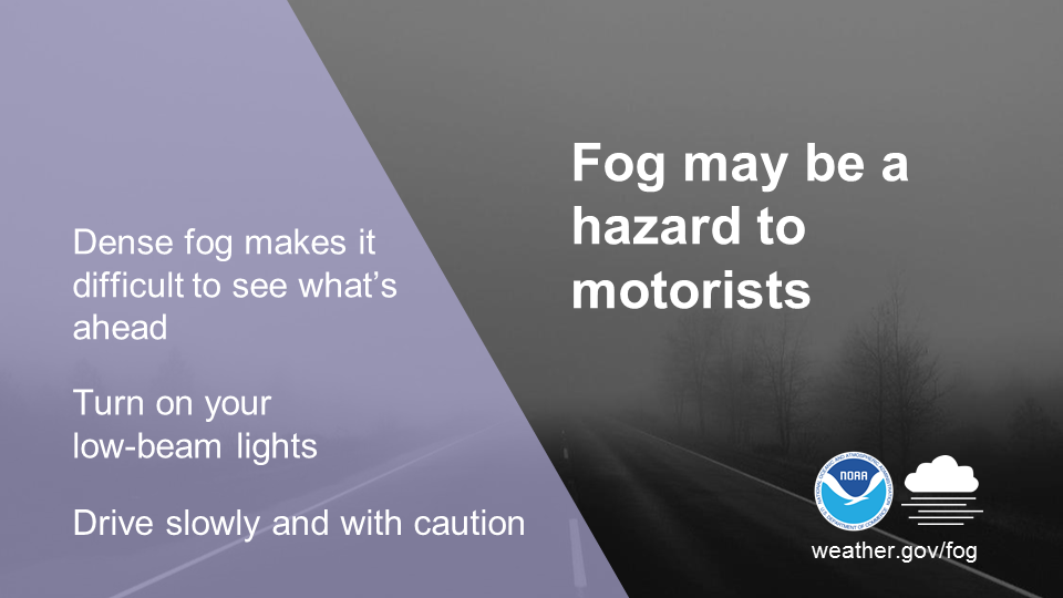
A bit warmer with a chance for showers ThursdayA warm front moves in from the southwest Thursday and brings above normal temperatures and a chance for rain showers across the region. With the rise in dew point temperatures comes the threat for areas of patchy fog around, which may be locally dense in spots until midday. Thursday 10 AM - Friday Midnight: The forecast remains on track for shower activity associated with the warm front to pass through the region. Accumulations of rain appear light for most, but I can't rule out a quick moderate to heavy shower in spots. Showers taper off as the warm front loses steam from daytime heating heading into the overnight. Expect areas of fog to pop up again. Showers and breezy conditions for FridayFriday Midnight to 8 PM: A cold front is on track to pass through the region. Most of the steady shower activity for western and southern areas appears over by mid-morning, and the rest of the state by around midday. An isolated shower is possible through the afternoon into the early evening. Wind - Friday Midnight to 8 PM: Wind gusts from the south pick up ahead of the front early on Friday ahead of the front and could be gusty at times in the 20-30 mph range. The wind shifts to the northwest in the wake of the frontal passage, bringing cooler, drier air into the region Friday night and into Saturday. Forecast on track for the weekendFriday 8 PM - Sunday 8 PM: With the frontal boundary just offshore to start the weekend, expect clouds for the coastal plain and an isolated shower for Saturday. High pressure from the northwest settles into the region by Sunday, ushering the coolest airmass of the fall season thus far. Expect the first widespread frost / freeze away from the shorelines by Monday. Driving in fogFog reduces visibility and contributes to numerous motorist accidents every year. Dense Fog Advisories are issued when visibility is expected to drop to one quarter mile or less. Take caution and check to see if there are any Dense Fog Advisories issued for your commute before driving. Learn more about fog safety by visiting weather.gov/safety/fog Be prepared to receive alerts and stay updated!
For more information in between posts, please follow Pine Tree Weather on Facebook and Twitter.
Thank you for supporting this community-based weather information source which operates by reader supported financial contributions. Stay updated, stay on alert, and stay safe! - Mike |
Mike Haggett
|

