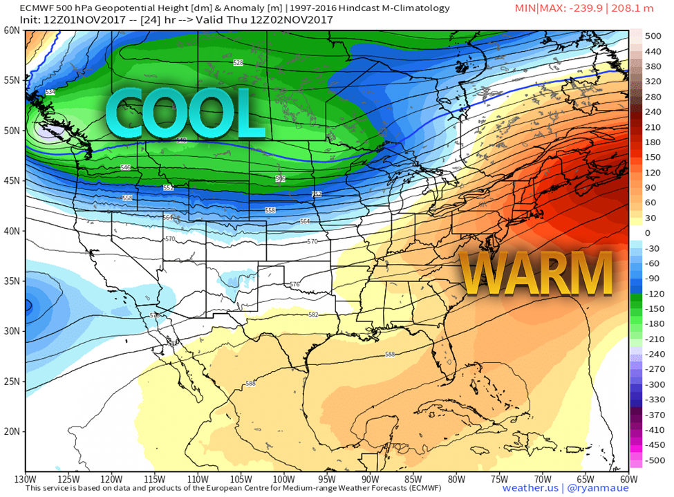
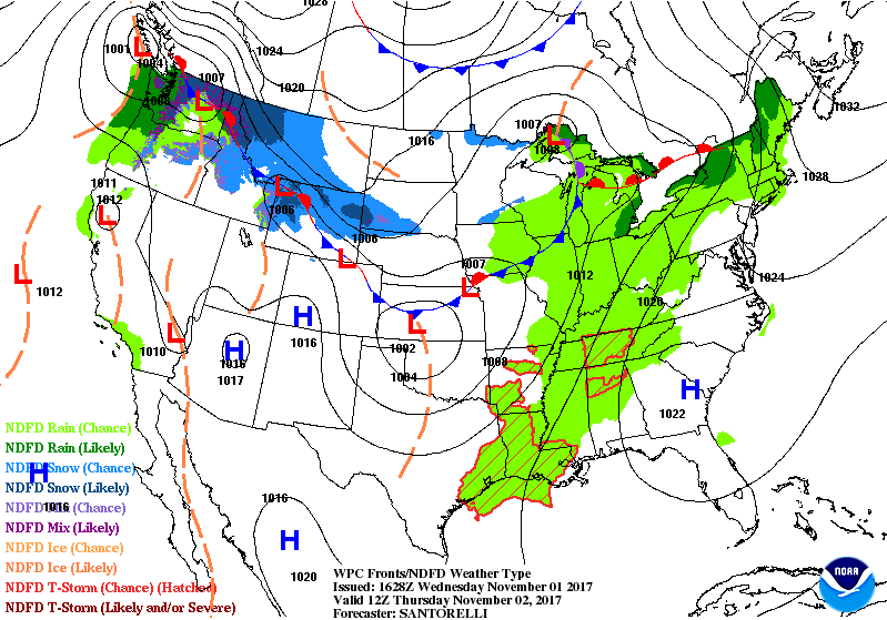
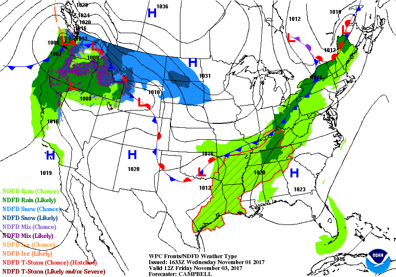
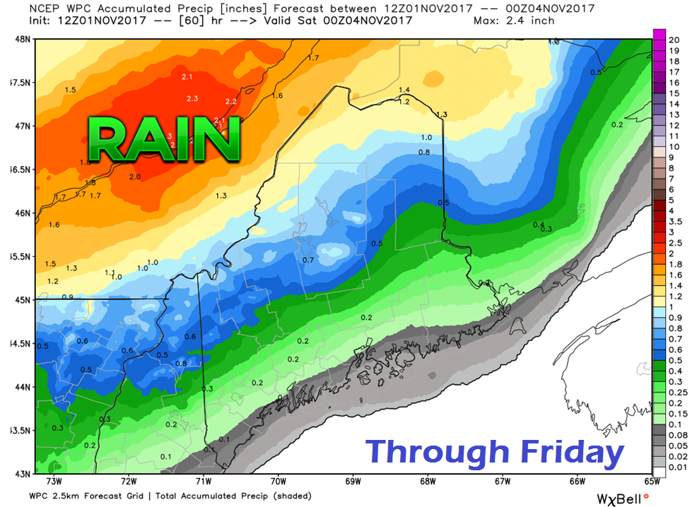
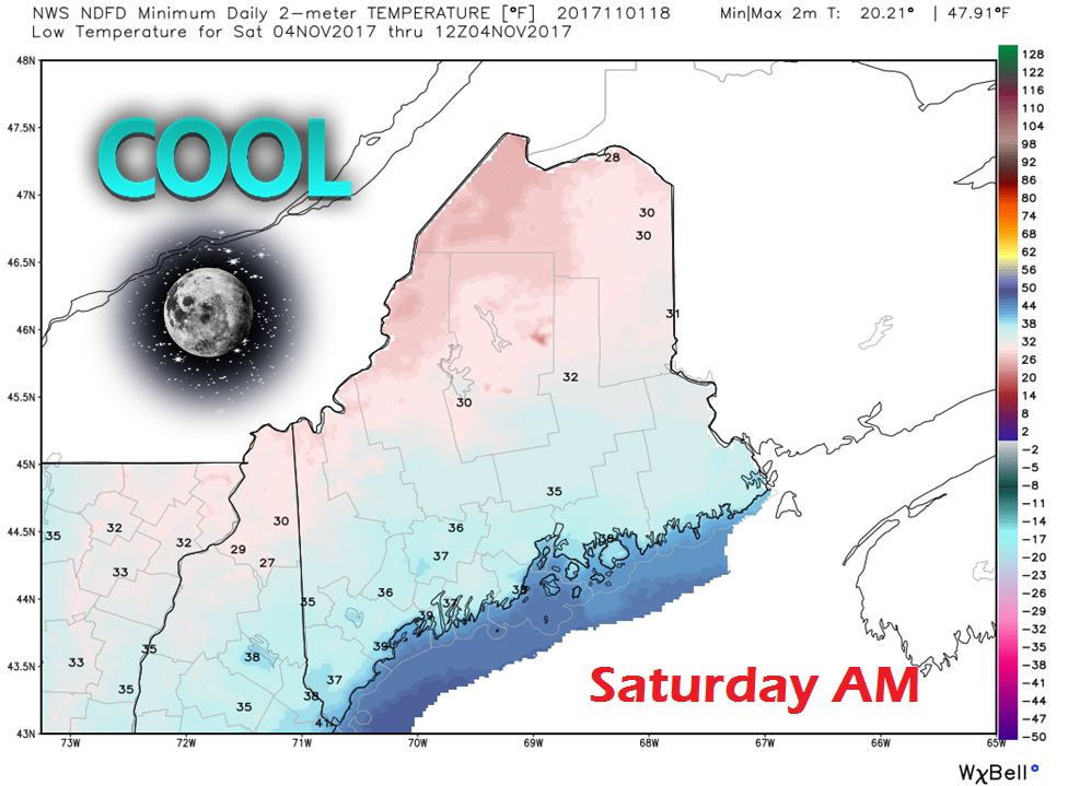
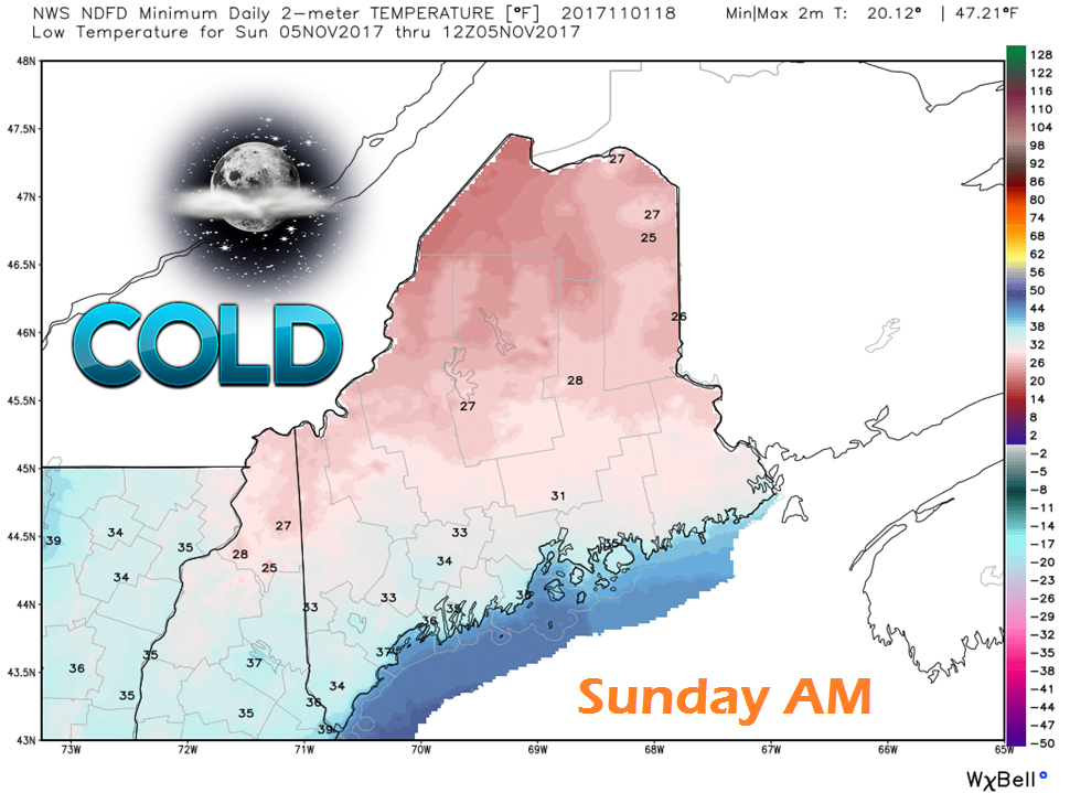
The Recovery Continues...At the time of this post Wednesday afternoon at 4:15 PM, Central Maine Power reported 195,693 customers offline, down from 219,561 at 8 AM this morning. Emera Maine was acknowledging 34,381 without power, down from 45,175 in the same time period. The total offline statewide 230,074, which is about half of the peak high number. Crews were fortunate to make some good progress, taking advantage of the dry weather and low wind speeds. There appears to be some hurdles to face for the remainder of the week, and again late weekend. Another anomalous warm ridge will affect the temperature pattern through the end of the week. Thursday and Friday appear to range 10-15° warmer than normal for this time of the year. Cooler air will be a concern this weekend for those still without power restoration. A warm front builds from the southwest Wednesday night as low pressure travels west of the St. Lawrence River Valley. Showers will form early Thursday and expand over most of the state in the morning. The mountains and north appear to see the steadier activity, with scattered showers for the south and east. Showers continue Thursday night into Friday morning. A cold front crosses the state during the day, shutting off the rainfall, but will bring back the breeze as high pressure works in from the west. It will remain breezy into Friday evening, diminishing overnight. Most of the rain falls in the mountains up through the crown of the state. As flood waters are gradually receding, this new rainfall is low enough that it does not appear to pose any additional problems. With the Canadian High working into the region Friday night, it will be cool start to the day on Saturday, with temps falling to around 30° for the high peaks and The County. Southern and eastern areas stay above freezing, but not by much. The day will be a dry one, which will continue to help with power restoration. For those still in the dark come Saturday night, the unfortunate news is it appears cooler to start Sunday. Temps start off in the 20s for the northern tier to a degree or two near freezing from southern and eastern areas.
The good news is another warm front will approach the region Saturday night into Sunday morning, bringing snow showers changing to rain for the mountains and north, and rain showers for the south and east. This will help bring temperatures back up. All areas appear to stay above freezing as showers continue Sunday night into Monday. Please click on the 7-Day Outlook tab for more details on what to expect through the middle part of next week. - Mike |
Mike Haggett
|

